|
|
 霧峰追風者|2018-6-10 05:08
|
顯示全部樓層
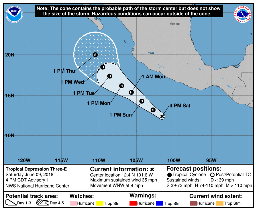
NHC 21Z升格熱帶低壓"03E",有機會在今天命名,巔峰上望90KT。
000
WTPZ43 KNHC 092038
TCDEP3
Tropical Depression Three-E Discussion Number 1
NWS National Hurricane Center Miami FL EP032018
400 PM CDT Sat Jun 09 2018
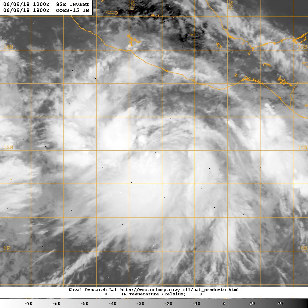
Recent visible satellite imagery indicates that the disturbance to
the south of Mexico has developed a well-defined surface
circulation. One-minute imagery from a GOES-16 mesoscale sector
was useful in determining that the circulation had become closed.
In addition, deep convection has increased near the center today and
a nearly continuous band of cold cloud tops wraps around the
southern and western semicircles of the circulation. The latest
Dvorak classification from TAFB is a 2.0/2.0, and on that basis the
system has been classified as Tropical Depression Three-E with an
initial intensity of 30 kt.
The initial motion is estimated to be 295/8 kt, but this is rather
uncertain since the surface center of the depression has been often
obscured by higher clouds this afternoon. A west-northwest to
northwest heading, parallel to the coast of Mexico, is likely for
the next few days while the system moves along the periphery of a
mid-level ridge centered over Mexico. Near the end of the forecast
period, the cyclone should slow and turn more toward the north-
northwest, between the aforementioned ridge to the east and a mid-
to upper-level trough to the west. The dynamical guidance is very
tightly clustered, with the main uncertainty being speed. The
official forecast is near the mean of the GFS and ECMWF positions
and closely follows the corrected consensus, HCCA.
The depression is located within a generally favorable environment
for strengthening. SSTs are above 30 deg C and there is ample
moisture. The only inhibiting factor appears to be moderate
northeasterly shear of 10-15 kt, as analyzed by the GFS and ECMWF
models, which should decrease within the next 24 hours. At least
steady strengthening is shown by all of the intensity guidance, and
this seems likely for the next 24 hours. Beyond that time, rapid
intensification can not be ruled out. The official forecast at 36
through 72 h is near the top of the intensity guidance, in close
agreement with the DSHP model. By day 5, the cyclone will likely
approach a sharp SST gradient south of the Baja California peninsula
which should cause it to quickly weaken. By the end of the forecast
period, the NHC forecast is close to the intensity consensus.
FORECAST POSITIONS AND MAX WINDS
INIT 09/2100Z 12.4N 101.6W 30 KT 35 MPH
12H 10/0600Z 13.2N 102.8W 40 KT 45 MPH
24H 10/1800Z 14.3N 104.3W 50 KT 60 MPH
36H 11/0600Z 15.4N 105.7W 65 KT 75 MPH
48H 11/1800Z 16.2N 107.0W 80 KT 90 MPH
72H 12/1800Z 17.4N 108.6W 90 KT 105 MPH
96H 13/1800Z 18.5N 109.5W 80 KT 90 MPH
120H 14/1800Z 20.0N 110.5W 55 KT 65 MPH
$$
Forecaster Zelinsky 

|
|