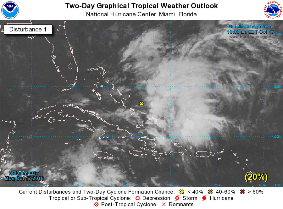
1. A non-tropical low pressure system is located about 225 miles
northeast of the Turks and Caicos Islands. Cloudiness and
thunderstorms associated with this system are currently located
well east of the center due to strong upper-level westerly winds.
However, upper-level conditions are forecast to become more
conducive for this system to acquire some tropical characteristics,
and a subtropical or tropical cyclone is likely to form within the
next couple of days. The low is forecast to move northward
to north-northwestward on Wednesday and Thursday, before
turning north-northeastward and merging with a cold front over the
western Atlantic by the weekend. A NOAA Hurricane Hunter aircraft
is scheduled to investigate this system this afternoon, if
necessary. Regardless of development, locally heavy rainfall is
possible over the Dominican Republic, Puerto Rico, and portions
of the northern Leeward Islands today.
* Formation chance through 48 hours...medium...60 percent
* Formation chance through 5 days...high...80 percent