|
|
 陳約禮@FB|2016-9-30 23:06
|
顯示全部樓層
000
WTNT44 KNHC 301449
TCDAT4
HURRICANE MATTHEW DISCUSSION NUMBER 10
NWS NATIONAL HURRICANE CENTER MIAMI FL AL142016
1100 AM EDT FRI SEP 30 2016
Matthew has continued to intensify this morning. An Air Force
Reserve Hurricane Hunter aircraft recently measured a peak SFMR wind
of 99 kt and a 700-mb wind of 103 kt. Based on these data, the
initial intensity is set to 100 kt for this advisory. The aircraft
reported that the central pressure had fallen to 968 mb, and also
observed a 16 n mi wide eye that is open to the southwest. Water
vapor imagery shows a well-established poleward outflow channel,
with outflow also expanding in the southwest quadrant.
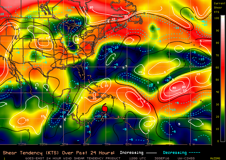
This intensification has occurred despite analyzed southwesterly
shear of around 20 kt. The SHIPS model output shows this shear
continuing for the next 36 hours or so, and as a result, the SHIPS
and LGEM models show Matthew weakening during this time. This
weakening trend is also shown by the HWRF and COAMPS-TC hurricane
models. However, I am reluctant to show a decrease in intensity
given that the environment around the cyclone does not appear to
change much. Some short-term fluctuations in intensity are
certainly possible, but the official forecast remains above much of
the guidance in the short range and keeps the intensity at 100 kt
through 72 hours. Some weakening is shown by days 4 and 5 due to
potential land interaction. Late in the period the NHC forecast is
closest to the HWRF model.
Matthew has been moving west-southwestward during the past few
hours, with an initial motion estimate of 255/10. The cyclone
should continue moving south of due west for the next 12 hours to
the south of a mid-level ridge nosing into the northern Caribbean
Sea. After that, Matthew should gradually turn poleward as the
ridge retreats eastward and a trough moves into the eastern Gulf of
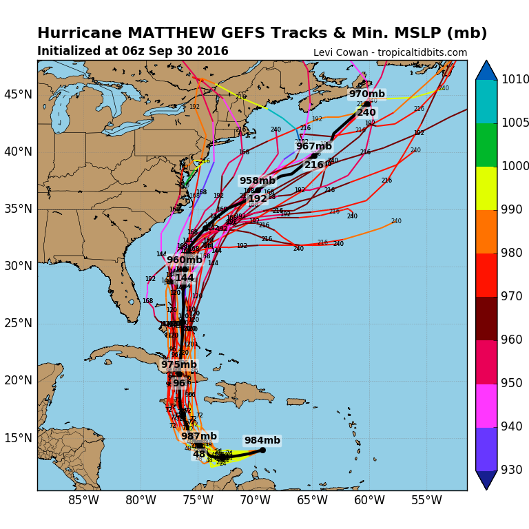
Mexico. There remains a large amount of spread in the guidance,
both along and across track. The ECMWF, ECMWF ensemble mean, and
the UKMET are slower and on the right side of the guidance envelope
at 48 hours and beyond. The GFS, GEFS ensemble mean, HWRF, and
COAMPS-TC are faster and farther to the left. The new NHC track
forecast has been adjusted a little to the south in the first 36
hours due to the initial motion, and lies a little south of the
consensus and close to the GFS at this time range. Beyond that
time, the official forecast is an update of the previous one and
lies a little to the east of the latest multi-model consensus and a
bit to the west of the GFS/ECMWF blend.
It is important to remind users that average NHC track forecast
errors are around 175 miles at day 4 and 230 miles at day 5.
Therefore, it is too soon to rule out possible hurricane impacts
from Matthew in Florida.
FORECAST POSITIONS AND MAX WINDS
INIT 30/1500Z 13.7N 70.8W 100 KT 115 MPH
12H 01/0000Z 13.5N 71.9W 100 KT 115 MPH
24H 01/1200Z 13.5N 73.3W 100 KT 115 MPH
36H 02/0000Z 13.8N 74.3W 100 KT 115 MPH
48H 02/1200Z 14.7N 75.0W 100 KT 115 MPH
72H 03/1200Z 17.5N 76.0W 100 KT 115 MPH
96H 04/1200Z 21.5N 76.0W 90 KT 105 MPH
120H 05/1200Z 25.5N 75.7W 85 KT 100 MPH
$$
Forecaster Brennan
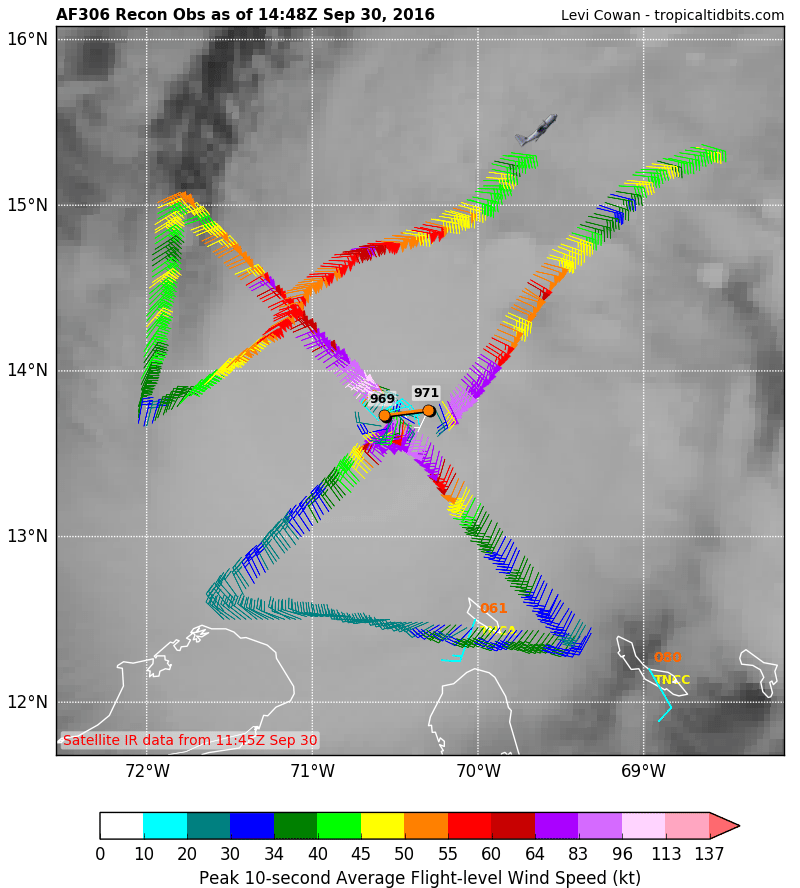
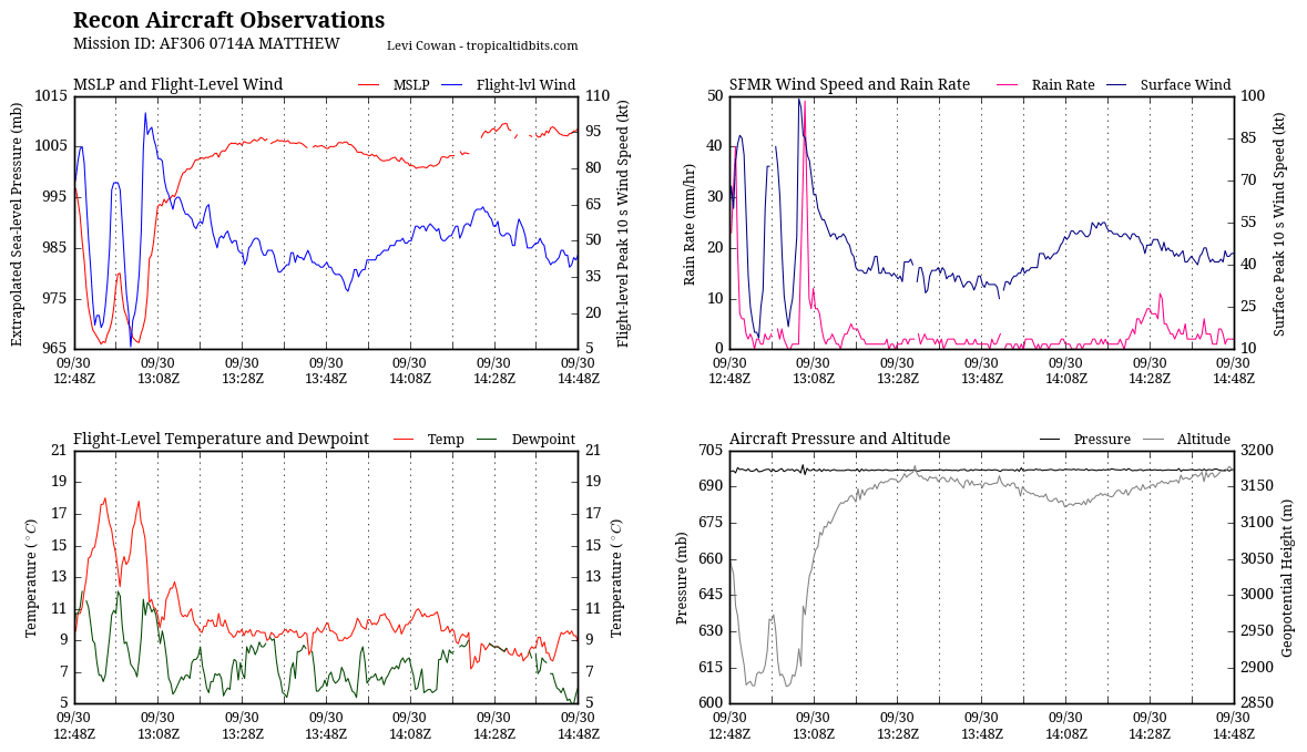
底層已經開眼
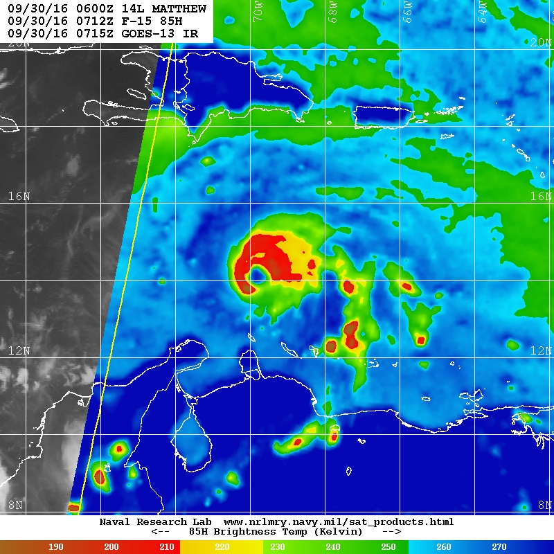
高層也快了
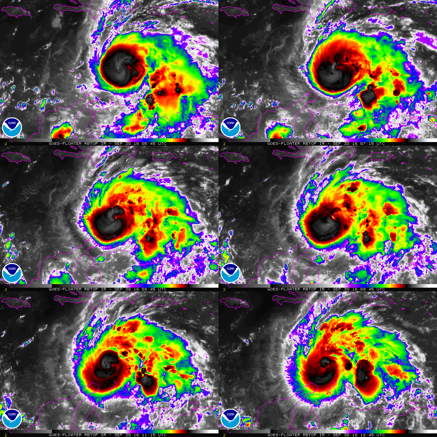
前方OHC優良
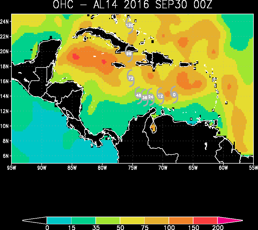
數值仍然看好安然通過北方的強大風切之後,進入北大西洋再創巔峰
|
|