|
|
 霧峰追風者|2017-8-12 11:00
|
顯示全部樓層
本帖最後由 霧峰追風者 於 2017-8-13 02:03 編輯
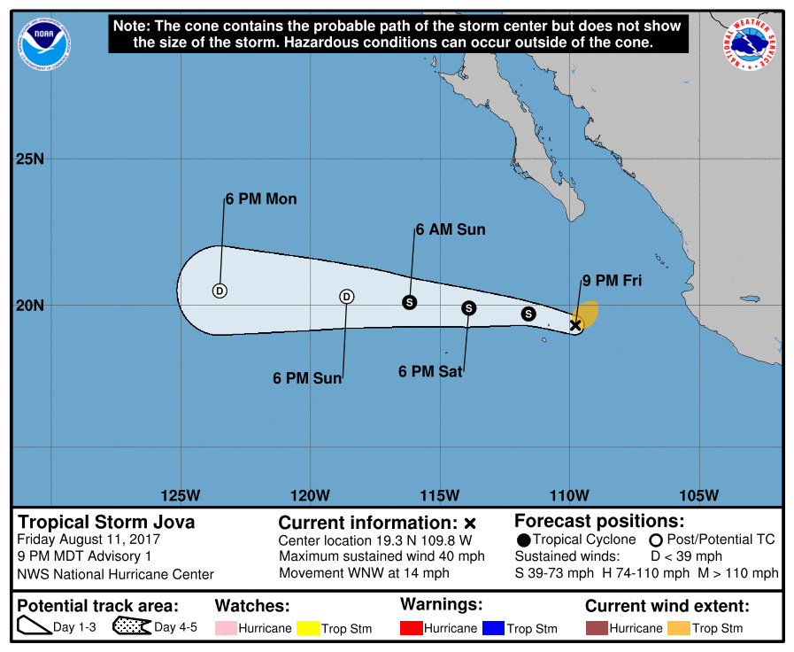
NHC 命名"Jova",編號12E,穩定西移。
000
WTPZ42 KNHC 120234
TCDEP2
Tropical Storm Jova Discussion Number 1
NWS National Hurricane Center Miami FL EP122017
900 PM MDT Fri Aug 11 2017
The mid-level remnants of Atlantic Hurricane Franklin moved across
Mexico during the past day or so and induced a surface circulation
early this morning near the southwest coast of Mexico. While earlier
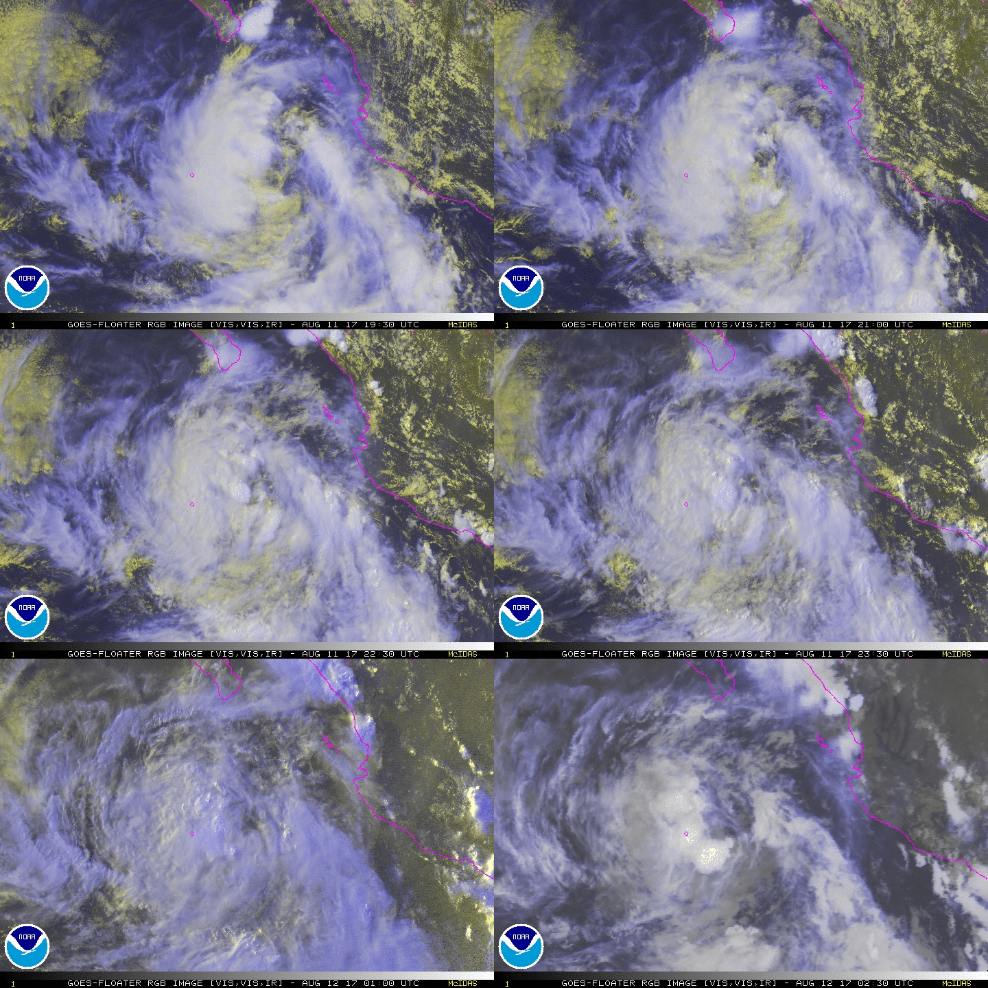
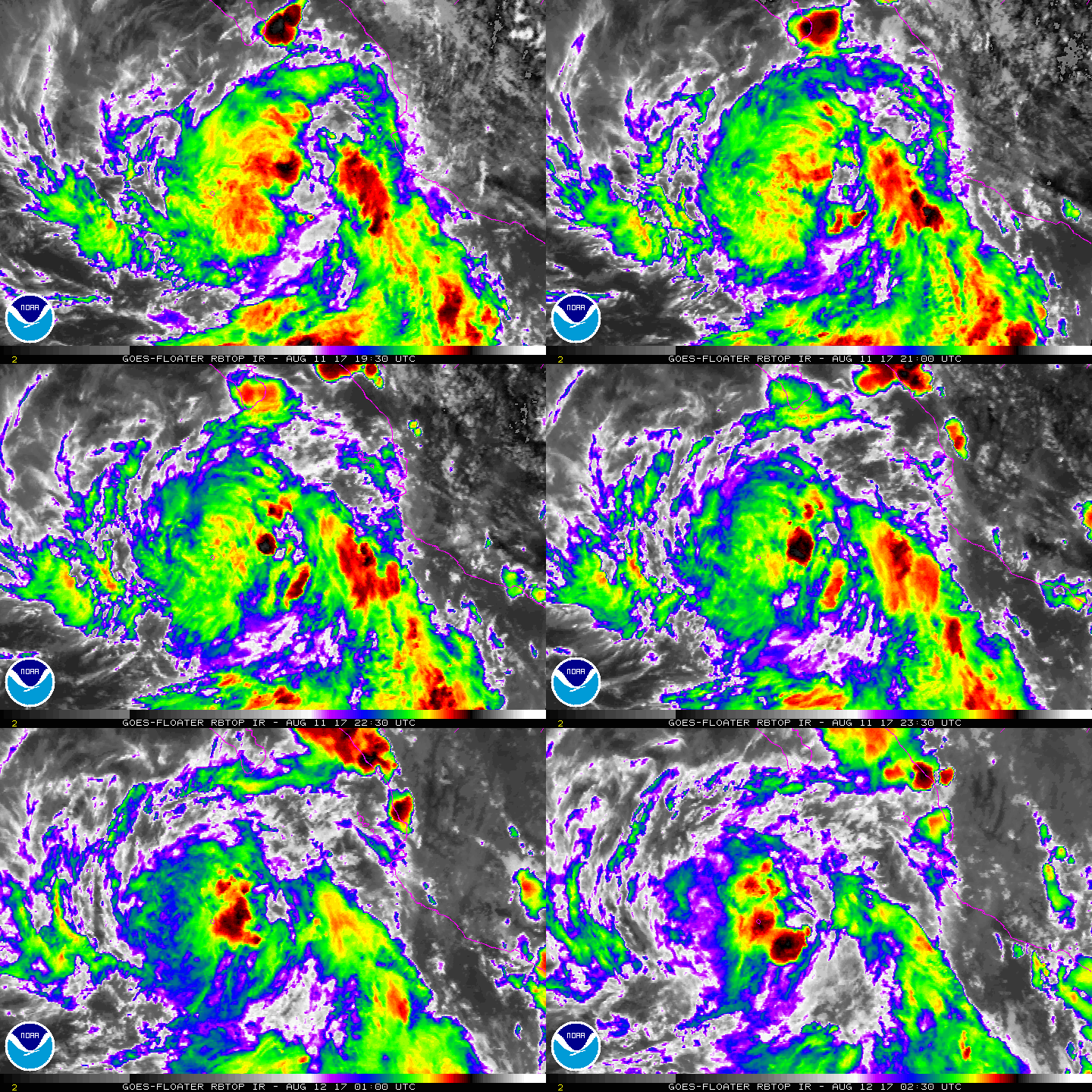
it was difficult to see a well-defined center, satellite images
suggest that the multiple swirls seen in visible imagery during
midday have consolidated, with enough convection remaining to
classify the system as a tropical cyclone. The initial wind speed is
35 kt based on data from ship WDF4764 and a central pressure
estimate of 1003 mb, making this system the tenth tropical storm of
the season. Although this is the first tropical storm to form in
the basin in about 3 weeks, the eastern Pacific is still way ahead
of schedule since the average tenth tropical storm forms on August
31.
Jova is over very warm water but is moderately sheared from the
northeast due to the large high over Mexico. The storm has about a
day to potentially intensify before a combination of cooler waters
and increasing northeasterly shear likely start a weakening trend.
Most of guidance respond to this environment by showing little
change tomorrow, and a slow weakening starting by Sunday. Jova is
forecast to become a remnant low by Monday due to marginal water
temperatures and continued entrainment of dry stable air. The
official forecast is close to a blend of SHIPS/LGEM in the short
term, and the intensity consensus in the long term.
The initial motion is 285/12. A mid-level ridge building westward
across the eastern Pacific should cause Jova to turn westward by
late tomorrow, and continue that general motion until dissipation.
Model guidance is in pretty good agreement for a first advisory, so
the official forecast is close to the model consensus.
Note that since advisories were not continuous from the Atlantic
basin to the Pacific basin, the cyclone is given a new eastern
Pacific name, per WMO RA-IV operational protocols.
FORECAST POSITIONS AND MAX WINDS
INIT 12/0300Z 19.3N 109.8W 35 KT 40 MPH
12H 12/1200Z 19.7N 111.6W 40 KT 45 MPH
24H 13/0000Z 19.9N 113.9W 40 KT 45 MPH
36H 13/1200Z 20.1N 116.2W 35 KT 40 MPH
48H 14/0000Z 20.3N 118.6W 30 KT 35 MPH...POST-TROP/REMNT LOW
72H 15/0000Z 20.5N 123.5W 20 KT 25 MPH...POST-TROP/REMNT LOW
96H 16/0000Z...DISSIPATED
$$
Forecaster Blake


|
|