開啟輔助訪問
 找回密碼
 立即加入

16E.Max 發展出乎預期 巔峰登陸墨西哥

簽到天數: 601 天

[LV.9]以壇為家II

2017-9-13 02:39 | 顯示全部樓層
本帖最後由 霧峰追風者 於 2017-12-12 07:12 編輯

  一級颶風  
編號:16 E
名稱:Max
max-2017-09-14-1705z.png
  基本資料  
擾動編號日期:2017 09 13 02
命名日期  :2017 09 14 02
撤編日期  :2017 09 00 00
登陸地點  :墨西哥 格雷羅州 阿卡普爾科

  巔峰時期資料  
近中心最強風速
國家颶風中心(NHC):75 kts
海平面最低氣壓985 百帕

  過去路徑圖  
16E-Max.png
  擾動編號資料  
96E-INVEST-30kts-1008mb-15N-105W

20170912.1815.goes-13.ircolor.96E.INVEST.30kts.1008mb.15N.105W.100pc.jpg

NHC:60%
1. A broad area of low pressure located a couple of hundred miles south
of the southern coast of Mexico is producing numerous showers and
thunderstorms.  Environmental conditions are forecast to
be conducive for development, and a tropical depression may form
within the next day or two before the system moves over
southwestern Mexico.  Regardless of development, locally heavy
rains are expected to spread over the coast of southwestern Mexico
during the next few days.  These rains could cause life-threatening
flash floods and mudslides.
* Formation chance through 48 hours...medium...60 percent.
* Formation chance through 5 days...medium...60 percent.

two_pac_2d1.png

以上資料來自:NHC颱風論壇整理製作

評分

參與人數 1水氣能量 +15 收起 理由
king111807 + 15

查看全部評分

回復

使用道具 舉報

簽到天數: 601 天

[LV.9]以壇為家II

霧峰追風者|2017-9-16 13:02 | 顯示全部樓層
墨西哥 格雷羅州近岸巔峰的Max
Max_2017-09-14_1705Z.jpg

補登陸前的底層....
登陸前底層.jpg 20170914.1112.f16.91pct91h91v.16E.MAX.70kts.988mb.16.3N.100.2W.060pc.jpg 79_26427_0d3d423663cae62.gif

回復

使用道具 舉報

簽到天數: 601 天

[LV.9]以壇為家II

霧峰追風者|2017-9-16 00:03 | 顯示全部樓層
NHC最終報,快速消散…
000
WTPZ41 KNHC 150836
TCDEP1

Remnants Of Max Discussion Number   9
NWS National Hurricane Center Miami FL       EP162017
400 AM CDT Fri Sep 15 2017

The high terrain of Mexico has disrupted Max's circulation and the
system has degenerated into a broad area of low pressure. Surface
observations indicate that winds associated with the low are
barely 25 kt. The remnants of Max will probably continue moving
slowly eastward until dissipation later today.

The remnants of Max are still expected to produce heavy rain in
the states of Guerrero and Oaxaca.

This is the last advisory issued by the National Hurricane Center
on Max.


FORECAST POSITIONS AND MAX WINDS

INIT  15/0900Z 17.0N  98.0W   25 KT  30 MPH...REMNANTS OF MAX
12H  15/1800Z 17.5N  97.5W   20 KT  25 MPH...REMNANTS OF MAX
24H  16/0600Z...DISSIPATED

$$
Forecaster Avila

084113_5day_cone_no_line_and_wind.png

回復

使用道具 舉報

簽到天數: 601 天

[LV.9]以壇為家II

霧峰追風者|2017-9-15 08:00 | 顯示全部樓層
本帖最後由 霧峰追風者 於 2017-9-15 08:07 編輯

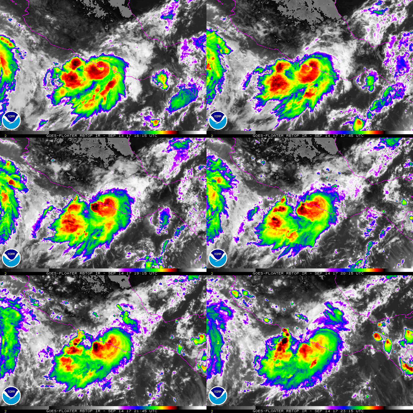
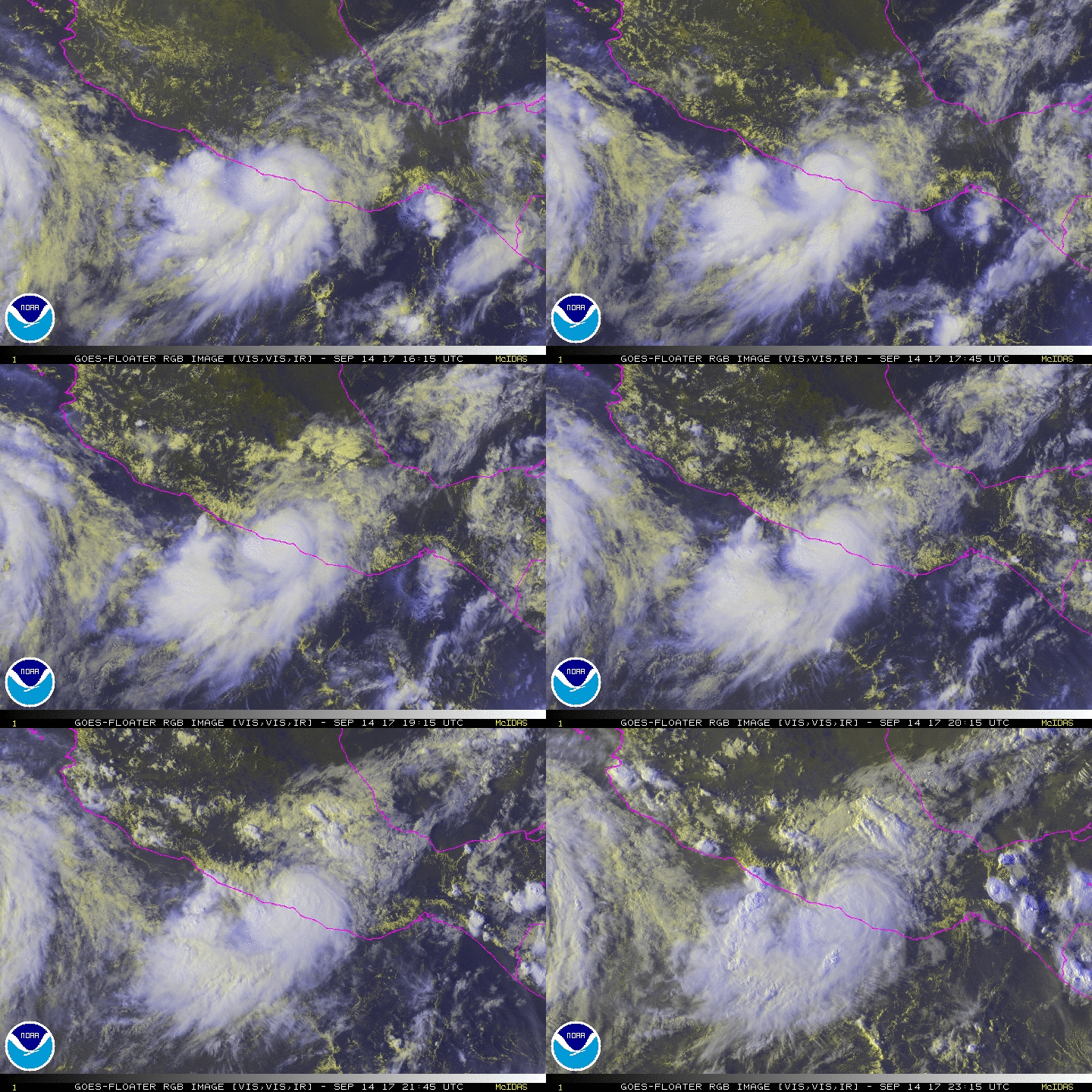
稍早中心已經登陸墨西哥,登陸前風眼一度顯現,強度75kt,登陸地方屬於高地,預期很快就會減弱消散。
000
WTPZ41 KNHC 142040
TCDEP1

Hurricane Max Discussion Number   7
NWS National Hurricane Center Miami FL       EP162017
400 PM CDT Thu Sep 14 2017

Max's structure continued to improve since the last advisory, with
a well-defined eye showing up in both visible and infrared
satellite images for a couple of hours.  At 1800 UTC, satellite
classifications ranged from 65 to 90 kt, so guidance was
initialized at 75 kt.  However, Max's center appears to be moving
onshore to the east of Acapulco, and the eye that was observed in
satellite imagery has disappeared.  The advisory intensity is
therefore set a little lower at 70 kt.


The initial motion is 080/7 kt, with Max being steered eastward to
the north of a mid-level ridge extending southwestward from Central
America.  An eastward or east-northwestward motion is expected to
continue, and Max will be moving farther inland over southern
Mexico.  There were only a few trackers available from the track
guidance, and the NHC forecast is primarily an extrapolation of the
current motion for the next 12 hours.

Now that Max is moving onshore and will be encountering the
mountains of southern Mexico, rapid weakening is likely.  In fact,
the center of the small cyclone will probably not fare well in the
high terrain, and Max is forecast to dissipate by 24 hours, if not
sooner.

Heavy rainfall continues to be the primary threat from Max.
Rainfall accumulations of 5 to 10 inches, with isolated amounts of
20 inches, are expected over the Mexican states of Guerrero and
Oaxaca, and life-threatening flash floods and mudslides are
possible.

FORECAST POSITIONS AND MAX WINDS

INIT  14/2100Z 16.6N  99.1W   70 KT  80 MPH...ON THE COAST
12H  15/0600Z 16.9N  98.0W   45 KT  50 MPH...INLAND
24H  15/1800Z...DISSIPATED

$$
Forecaster Berg
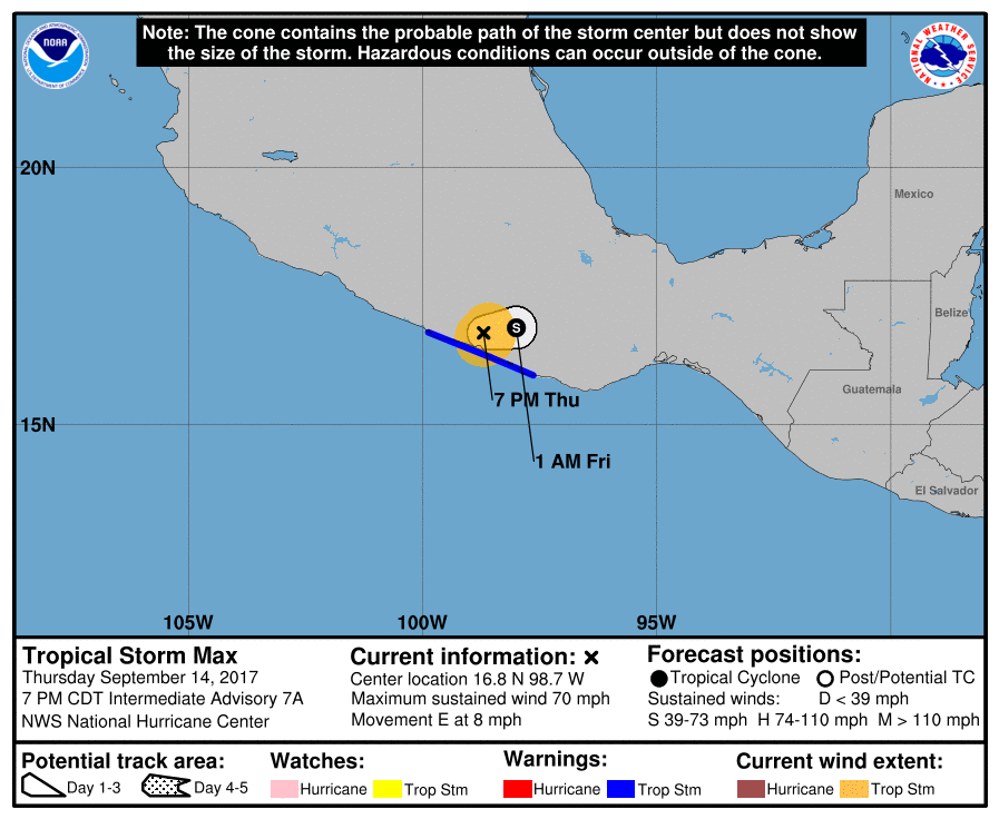
233727_5day_cone_no_line_and_wind.png rgb-animated (2).gif rbtop-animated (5).gif

評分

參與人數 1水氣能量 +20 收起 理由
ben811018 + 20

查看全部評分

回復

使用道具 舉報

簽到天數: 3279 天

[LV.Master]伴壇終老

t02436|2017-9-14 20:45 | 顯示全部樓層
原先不看好命名直接一頭撞進墨西哥,結果12Z加發特報升格C1,登陸前還有再增強的機會,真是驚奇的一生...
000
WTPZ41 KNHC 141153
TCDEP1

Hurricane Max Special Discussion Number   5
NWS National Hurricane Center Miami FL       EP162017
700 AM CDT Thu Sep 14 2017

Radar imagery from Acapulco, Mexico, indicates that Max has
continued to improve in structure and now has a well-defined eye
and closed eyewall.
An eye has also occasionally been evident in
infrared satellite imagery.  Based on these signs, Max has been
upgraded to a hurricane with 65-kt winds.

Max appears to be cruising eastward just offshore the coast of
Mexico.  However, the hurricane is still expected to move inland
later today.  The 12-hour point has been adjusted southward and
increased to 75 kt to account for Max's recent motion, possible
delayed landfall, and increased opportunity to strengthen before it
reaches land.

The government of Mexico has changed the Tropical Storm Warning and
Hurricane Watch from Zihuatanejo to Punta Maldonado to a Hurricane
Warning.  Life-threatening flooding rainfall is still expected in
portions of the states of Guerrero and Oaxaca.

This special advisory is being issued in lieu of the regularly
scheduled 7 AM CDT intermediate public advisory.

FORECAST POSITIONS AND MAX WINDS

INIT  14/1200Z 16.3N 100.4W   65 KT  75 MPH
12H  14/1800Z 16.6N  99.7W   75 KT  85 MPH
24H  15/0600Z 16.8N  99.0W   35 KT  40 MPH...INLAND
36H  15/1800Z...DISSIPATED

$$
Forecaster Berg
115728_5day_cone_with_line.png

20170914.1200.goes-15.irbd.16E.MAX.70kts.988mb.16.3N.100.2W.100pc.jpg

rbtop-animated.gif
回復

使用道具 舉報

簽到天數: 1650 天

[LV.Master]伴壇終老

老農民版夜神月|2017-9-14 11:57 | 顯示全部樓層
本帖最後由 老農民版夜神月 於 2017-9-14 15:00 編輯

結果居然在登陸前一刻命名了XD  
原本的型態的確不好命名,但登陸前對流成功爆在中心上,也算實至名歸了!
總比之前在台灣附近的那個谷超好太多了了XDD
回復

使用道具 舉報

簽到天數: 601 天

[LV.9]以壇為家II

霧峰追風者|2017-9-14 06:33 | 顯示全部樓層
NHC 18Z命名報,即將登陸墨西哥南部。
ZCZC MIATCDEP1 ALL
TTAA00 KNHC DDHHMM

Tropical Storm Max Discussion Number   2
NWS National Hurricane Center Miami FL       EP162017
400 PM CDT Wed Sep 13 2017

Visible imagery during the day indicate that the cloud pattern has
improved in organization and consists of a well-defined cyclonically
curved convective band.  This band wraps around an area of deep
convection where the center is located.  T-numbers from both TAFB
and SAB agree that the cyclone is now a tropical storm with 35 kt
winds.  A portion of the circulation is already interacting with
land, so no significant strengthening is forecast before the center
moves inland.  The government of Mexico has issued a tropical storm
warning for a portion of the coast.

The depression is located at the bottom of a large mid-latitude
trough, and this pattern will carry the depression slowly east-
northeastward toward the coast of Mexico, and then farther inland.
Most of the global models dissipate Max once it moves over the high
terrain, and the NHC forecast calls for the cyclone to dissipate
in about 48 hour or sooner.

The main threat from Max will be torrential rains over portions of
southwestern Mexico.

FORECAST POSITIONS AND MAX WINDS

INIT  13/2100Z 16.1N 101.4W   35 KT  40 MPH
12H  14/0600Z 16.5N 100.5W   40 KT  45 MPH
24H  14/1800Z 16.8N  99.0W   30 KT  35 MPH
36H  15/0600Z 17.0N  97.5W   25 KT  30 MPH...POST-TROP/INLAND
48H  15/1800Z...DISSIPATED

$$
Forecaster Avila

NNNN
203848_5day_cone_no_line_and_wind.png rgb-animated (1).gif rbtop-animated (3).gif


回復

使用道具 舉報

簽到天數: 3279 天

[LV.Master]伴壇終老

t02436|2017-9-14 02:38 | 顯示全部樓層
NHC 18Z報還評價30節,結果不知道為什麼FNMOC已經顯示命名Max的狀態了...
BULLETIN
Tropical Depression Sixteen-E Intermediate Advisory Number 1A
NWS National Hurricane Center Miami FL       EP162017
100 PM CDT Wed Sep 13 2017

...TROPICAL DEPRESSION BECOMING BETTER ORGANIZED...
...VERY HEAVY RAINS ALREADY ON THE COAST OF MEXICO...


SUMMARY OF 100 PM CDT...1800 UTC...INFORMATION
----------------------------------------------
LOCATION...16.1N 101.6W
ABOUT 120 MI...195 KM WSW OF ACAPULCO MEXICO
ABOUT 105 MI...165 KM S OF ZIHUATANEJO MEXICO
MAXIMUM SUSTAINED WINDS...35 MPH...55 KM/H
PRESENT MOVEMENT...NNE OR 25 DEGREES AT 5 MPH...7 KM/H
MINIMUM CENTRAL PRESSURE...1006 MB...29.71 INCHES

174135_5day_cone_with_line_and_wind.png

FireShot Capture 198 - FNMOC Satellite Data Tropi_ - https___152.80.49.110_tcweb.png

20170913.1324.f18.91pct91h91v.16E.SIXTEEN.25kts.1006mb.16N.101.8W.095pc.jpg

vis-animated.gif
回復

使用道具 舉報

12下一頁
快速回覆
您需要登錄後才可以回帖 登錄 | 立即加入

本版積分規則

本平台僅供學術討論之用,預報應以氣象局為準

威普網站虛擬主機贊助公司

臺灣第一個天氣類型社群平台 即時天氣資訊、精準颱風動態

線上客服
FB傳送訊息
廣告行銷
精準行銷 物超所值
官方粉專
發佈 快速回復 返回頂部 返回列表