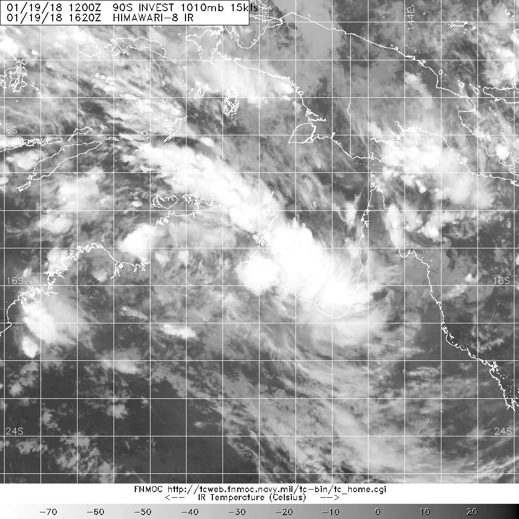
B. TROPICAL DISTURBANCE SUMMARY:
(1) AN AREA OF CONVECTION (INVEST 90P) HAS PERSISTED NEAR
19.5S 123.4E, APPROXIMATELY 112 NM SOUTHEAST OF BROOME, AUSTRALIA.
ANIMATED MULTISPECTRAL SATELLITE IMAGERY AND A 282235Z AMSU 89GHZ
PARTIAL IMAGE DEPICT A WEAKLY-DEFINED LOW LEVEL CIRCULATION CENTER
(LLCC) WITH THE MAJORITY OF THE CONVECTION IN THE WESTERN PERIPHERY.
UPPER LEVEL ANALYSIS SHOWS THAT 90P IS LOCATED IN FAVORABLE
ENVIRONMENT WITH LIGHT (5-10 KNOT) VERTICAL WIND SHEAR AND STRONG
RADIAL OUTFLOW. RECENT OBSERVATIONS VERIFY 25-30 KNOT WINDS IN THE
NORTHWEST QUADRANT OVER WATER. GLOBAL MODELS ARE IN GOOD AGREEMENT
THAT 90P WILL REMAIN OVER LAND AND TRACK IN A SOUTHERLY TRAJECTORY.
HOWEVER THE DISTURBANCE WILL BE CLOSELY MONITORED IN THE CASE IT
DEVIATES FROM THE MODEL GUIDANCE TRACK. MAXIMUM SUSTAINED SURFACE
WINDS ARE ESTIMATED AT 20 TO 25 KNOTS. MINIMUM SEA LEVEL PRESSURE
IS ESTIMATED TO BE NEAR 990 MB. DUE TO THE INLAND POSITION OF THE
LLCC, THE POTENTIAL FOR THE DEVELOPMENT OF A SIGNIFICANT TROPICAL
CYCLONE WITHIN THE NEXT 24 HOURS IS LOW.
Potential Cyclones:
A tropical low was located about 90 km south of Fitzroy Crossing at 1pm WST Sunday. The deep tropical low is forecast to track west southwest during the remainder of Sunday then take a more southerly track on Monday. This low is forecast to bring damaging winds and heavy rain to parts of the Kimberley. Please refer to the Severe Weather Warning and Flood Warnings [http://www.bom.gov.au/wa/warnings/] for more information. The system is very unlikely to move offshore and develop.
The monsoon trough remains active over western parts of the region near the Cocos Islands and just south of Christmas Island. There is a chance a low could form in the trough just east of Christmas Island later tonight or tomorrow and then move eastwards. If it does form, it is very unlikely to develop and should dissipate by Wednesday.
There are no other significant systems in the region and none are expected to develop within the next three days.
Likelihood of a tropical cyclone in the Western Region on:
Monday:Very Low
Tuesday:Very Low
Wednesday:Very Low