|
本帖最後由 蜜露 於 2018-3-22 21:05 編輯 馬庫斯成為澳洲管轄12年來強度最強(繼莫妮卡之後) 不過如果看整個印度洋的話 , 馬庫斯實力上距離最強還有一些差距 . 整體而言大概比去年的蘭恩颱風稍強點. 但弱於瑪莉亞颶風. 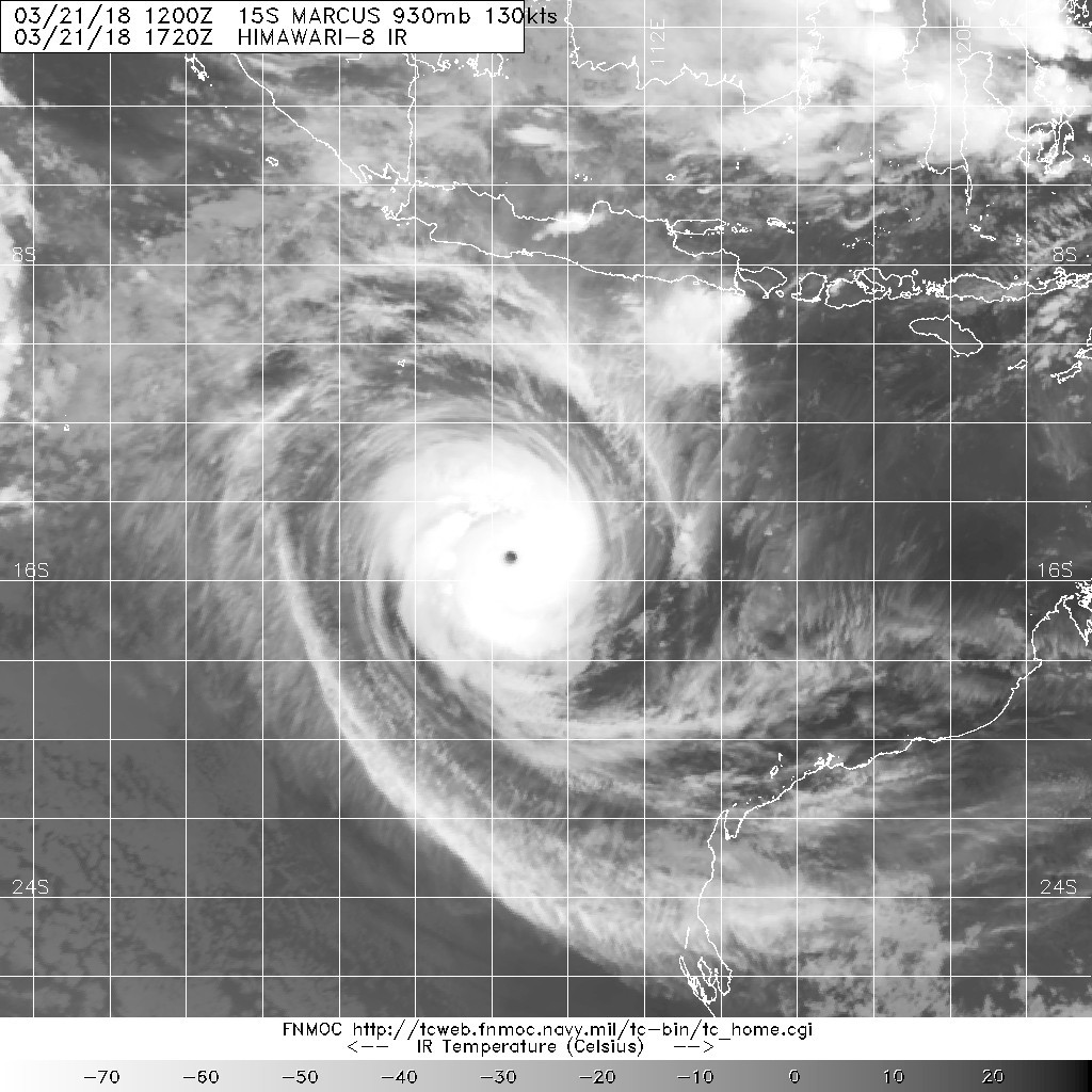
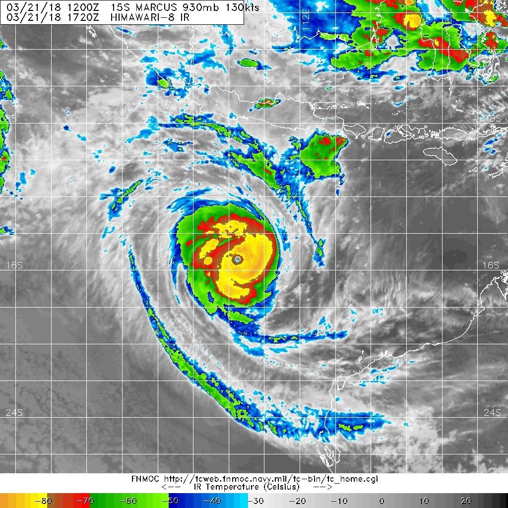
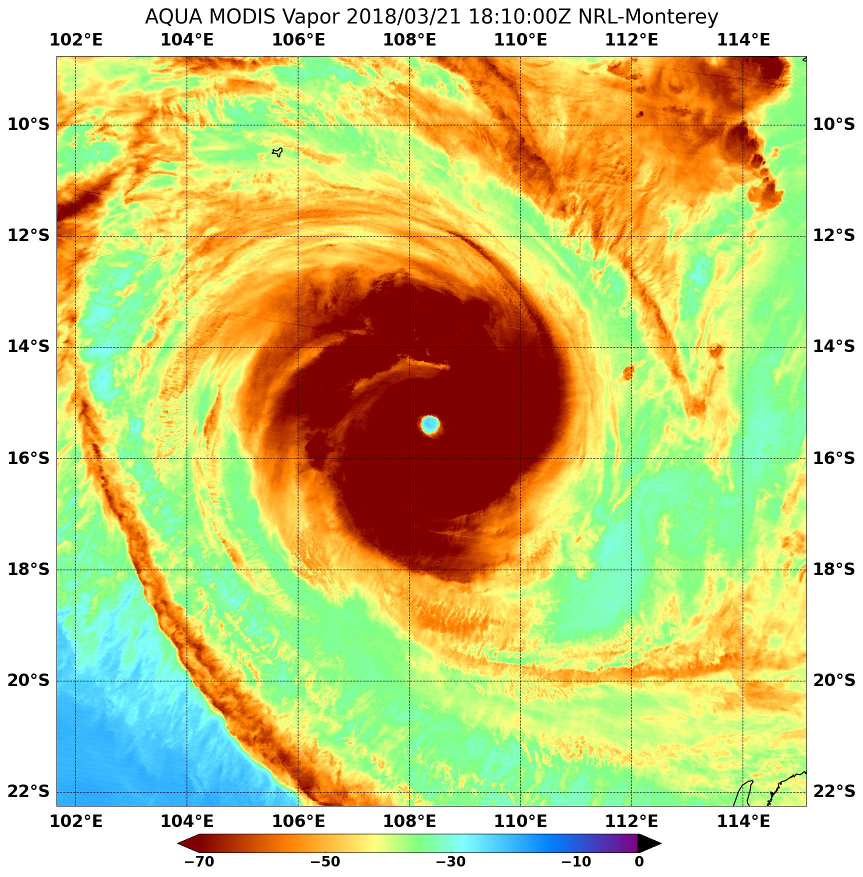
達到了中等藍眼的水平 雖然是CMG+WMG , 但眼溫有點過於一般 +15度上下 推測應該是個中等的五級熱帶氣旋 . 氣壓應該等於蘭恩 915hPa 上下 , 風速比蘭恩略強的那種 (南半球氣壓背景不清楚..算是一些個人娛樂性質) 不過馬庫斯一巔峰的時候有一個秘密.. 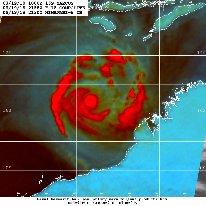
相當驚恐的底層 , 但那時候高層對流太暴力,導致無法清空. 影響當時的強度分析 . 算是迷一般的短暫針眼 . |
氣壓估計914百帕,綜合風速已判定是2006年以來本區域最強,但也要開始減弱了。 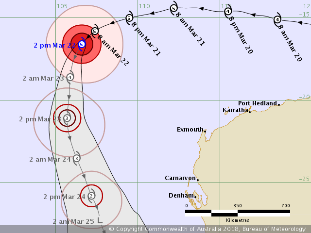
IDW27600 TROPICAL CYCLONE TECHNICAL BULLETIN: AUSTRALIA - WESTERN REGION Issued by PERTH TROPICAL CYCLONE WARNING CENTRE at: 0655 UTC 22/03/2018 Name: Severe Tropical Cyclone Marcus Identifier: 20U Data At: 0600 UTC Latitude: 16.6S Longitude: 106.6E Location Accuracy: within 15 nm [30 km] Movement Towards: southwest [224 deg] Speed of Movement: 11 knots [21 km/h] Maximum 10-Minute Wind: 125 knots [230 km/h] Maximum 3-Second Wind Gust: 175 knots [325 km/h] Central Pressure: 914 hPa Radius of 34-knot winds NE quadrant: 150 nm [280 km] Radius of 34-knot winds SE quadrant: 150 nm [280 km] Radius of 34-knot winds SW quadrant: 130 nm [240 km] Radius of 34-knot winds NW quadrant: 130 nm [240 km] Radius of 48-knot winds NE quadrant: 70 nm [130 km] Radius of 48-knot winds SE quadrant: 70 nm [130 km] Radius of 48-knot winds SW quadrant: 70 nm [130 km] Radius of 48-knot winds NW quadrant: 70 nm [130 km] Radius of 64-knot winds: 40 nm [75 km] Radius of Maximum Winds: 15 nm [30 km] Dvorak Intensity Code: T6.5/7.0/D1.0/24HRS Pressure of outermost isobar: 1002 hPa Radius of outermost closed isobar: 180 nm [335 km] FORECAST DATA Date/Time : Location : Loc. Accuracy: Max Wind : Central Pressure [UTC] : degrees : nm [km]: knots[km/h]: hPa +06: 22/1200: 17.5S 106.1E: 025 [050]: 115 [215]: 928 +12: 22/1800: 18.6S 105.9E: 040 [070]: 105 [195]: 937 +18: 23/0000: 19.8S 105.8E: 050 [095]: 095 [175]: 947 +24: 23/0600: 21.1S 105.7E: 065 [120]: 085 [155]: 956 +36: 23/1800: 23.5S 106.3E: 085 [155]: 065 [120]: 973 +48: 24/0600: 25.8S 107.2E: 105 [190]: 050 [095]: 984 +60: 24/1800: 27.3S 107.7E: 120 [225]: 035 [065]: 991 +72: 25/0600: 28.8S 108.5E: 140 [265]: 030 [055]: 995 +96: 26/0600: 34.0S 116.2E: 185 [345]: 030 [055]: 997 +120: 27/0600: : : : REMARKS: Marcus was located using animated vis, EIR and microwave imagery. Marcus has remained at a steady intensity however is beginning to show signs of weakening with a decrease in deep convection around the centre. Dvorak: Eye pattern: Surrounding grey shade is W which gives an E no. of 6.0. E adj is +0.5 based on an OW eye surrounded by W. Time averaged DT is 6.5 over the last 3 hours, MET/PAT also 6.5 based on D- 24hr trend. CI has been held at 7.0 while initial weakening trend. CIMMS and NESDIS ADT are both 7.0. Marcus has moved towards the southwest over the last few hours as the influence of the mid-level ridge to the south starts to weaken. NWP is in strong agreement that Marcus will continue towards the southwest for the remainder of Thursday and then towards the south during Friday as an upper level trough approaches. CIMSS Vertical wind shear is 9 knots from the ENE. The system is still within an area of low shear however the shear will start to increase steadily as the system tracks in a more southward direction from later on Thursday. There is good upper divergence, particularly south of the system with dual outflow channels [poleward and equatorward]. Ocean Heat Content [OHC] is favourable and SSTs are around 26-28C along the forecast track in the short term. Once Marcus tracks south of 20S, OHC is less favourable and SSTs decrease below 26/27C. Marcus is expected to weaken below tropical cyclone intensity late Saturday. Copyright Commonwealth of Australia == The next bulletin for this system will be issued by: 22/1330 UTC by Perth TCWC. |
|
昨天到今天歷經了一次眼牆置換 風眼已圓潤許多 且眼溫以進一步升到WMG 眼牆閃電不少 表示這個系統仍在發展當中 預計在今晚到明天早上會達到顛峰 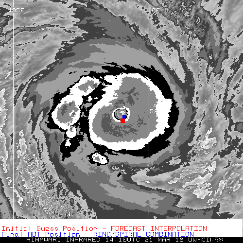
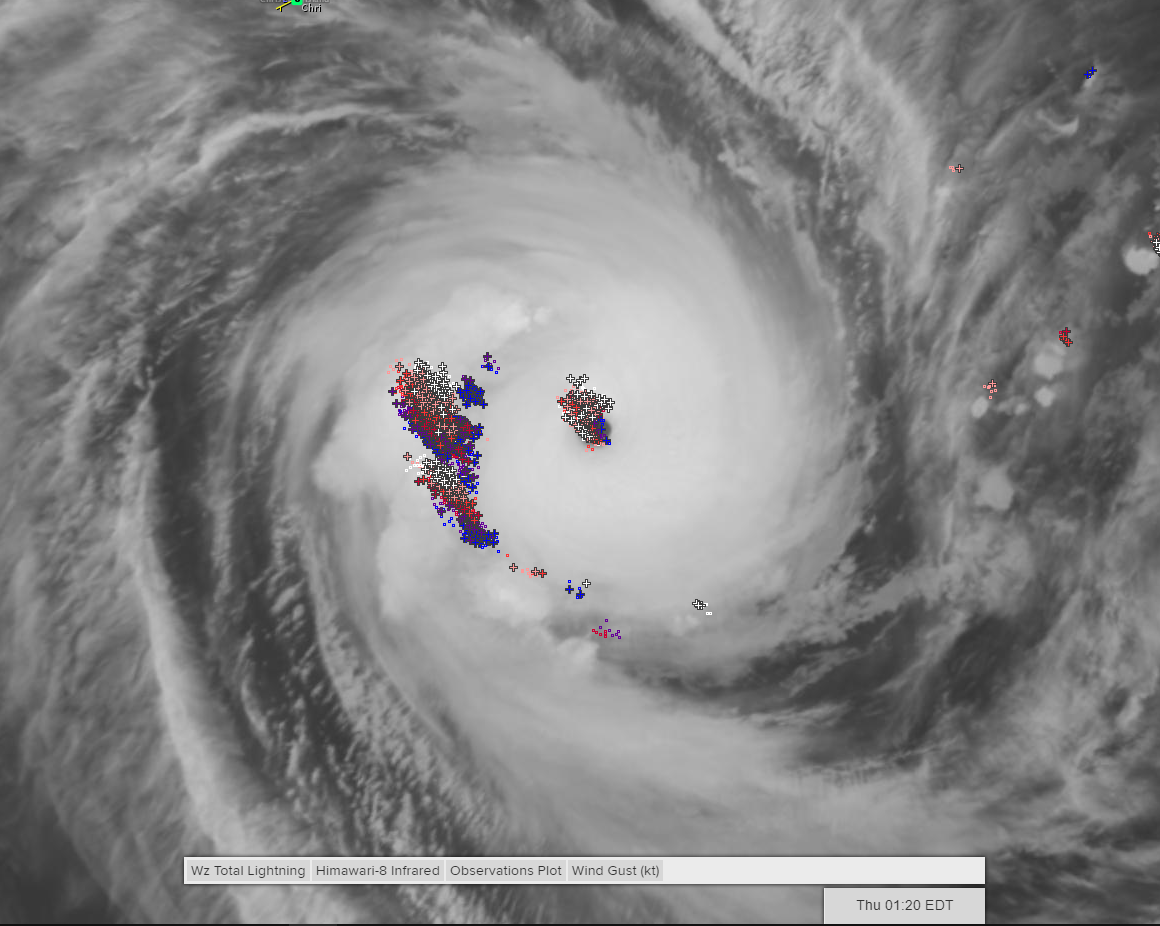
|