|
|
 霧峰追風者|2018-7-15 01:07
|
顯示全部樓層
本帖最後由 霧峰追風者 於 2018-7-15 01:15 編輯
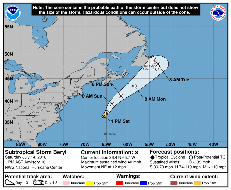
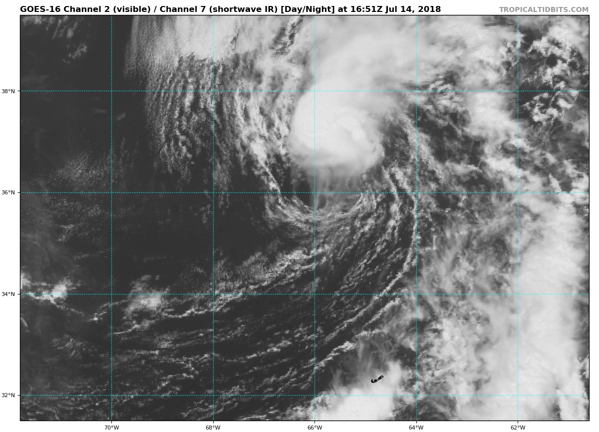
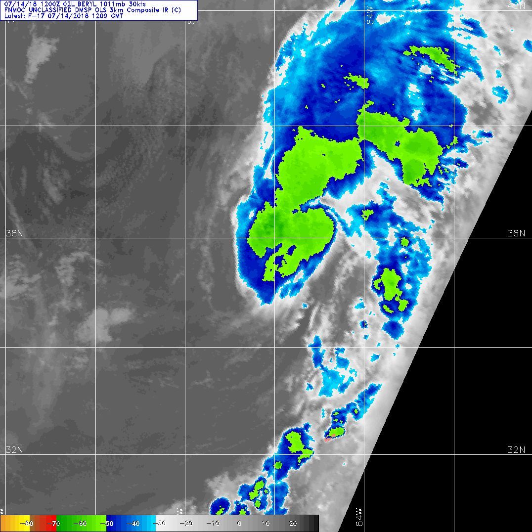
第二次獲得升格,NHC 判定副熱帶風暴,逐漸北上。
330
WTNT42 KNHC 141649
TCDAT2
Subtropical Storm Beryl Special Discussion Number 16
NWS National Hurricane Center Miami FL AL022018
100 PM AST Sat Jul 14 2018
The remnants of Beryl have persisted for the past several days,
moving through the Bahamas and into the Atlantic between the
eastern United States and Bermuda. During the last day or so, the
remnants have interacted with an upper-level trough, which has
resulted in the redevelopment of a well-defined circulation and
organized convection near the center. Recent scatterometer data
shows 35 kt winds northeast of the center, so advisories are
re-initiated on Beryl. While the strongest winds and convection are
relatively close to the center, the upper-level trough is likely
contributing baroclinic energy to the system, and thus the
regenerated Beryl is being called a subtropical cyclone rather than
a tropical cyclone.
The initial motion is 035/10. Beryl is in relatively light
southwesterly flow between the subtropical ridge and the
mid-latitude westerlies, and this pattern should steer the cyclone
generally northeastward for the next two to three days. Some
increase in forward speed may occur after 36 h as a mid-latitude
cyclone approaches from the west. The forecast track is a blend of
the HCCA and TVCN consensus models.
The forecast track takes Beryl over cold water north of the Gulf
Stream in 24 h or less, and the guidance shows little additional
intensification during that time. After that, the system should
decay over cold water without any extratropical transition. The
intensity forecast calls for the system to maintain a 35 kt
intensity for 24 hr, followed by weakening and eventual dissipation
just after 72 h.
FORECAST POSITIONS AND MAX WINDS
INIT 14/1700Z 36.4N 65.7W 35 KT 40 MPH...SUBTROPICAL STORM
12H 15/0000Z 37.3N 64.9W 35 KT 40 MPH...SUBTROPICAL STORM
24H 15/1200Z 39.3N 63.7W 35 KT 40 MPH...SUBTROPICAL STORM
36H 16/0000Z 41.2N 61.6W 30 KT 35 MPH...SUBTROPICAL DEPRESSION
48H 16/1200Z 43.4N 58.5W 30 KT 35 MPH...POST-TROP/REMNT LOW
72H 17/1200Z 48.0N 53.0W 30 KT 35 MPH...POST-TROP/REMNT LOW
96H 18/1200Z...DISSIPATED
$$
Forecaster Beven 


|
|