|
本帖最後由 霧峰追風者 於 2019-8-21 11:01 編輯 JTWC 取消TCFA,報文誤打97W。 WTPN22 PHNC 202330 COR 2. Another low pressure system located more than 900 miles west- 
|
展望提升至60%。2. A low pressure system located a little over 900 miles southwest of .png")
|
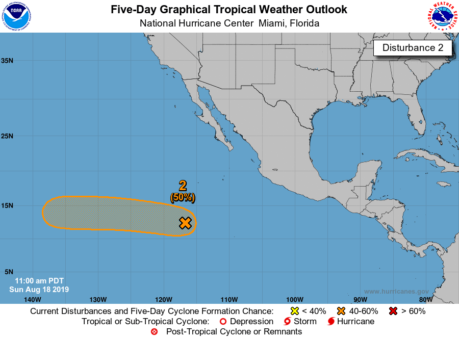
展望提升至50%。2. A well-defined low pressure system located more 900 miles southwest 
|