Tropical Storm Pablo Discussion Number 2
NWS National Hurricane Center Miami FL AL182019
1100 PM AST Fri Oct 25 2019
Pablo continues to exhibit a tight circulation with an occasional
eye feature evident in satellite images, which is why the system is
classified a tropical storm. However, a larger look at the east
Atlantic reveals that Pablo is a tiny feature within a broad
extratropical cyclone. The initial wind speed is held at 40 kt,
which is based on a recent ASCAT-C overpass that showed a small
area of tropical-storm-force winds near the center. It should be
noted that a much larger area of winds of about the same strength,
associated with the parent extratropical low, exist to the north and
west of Pablo.
The small tropical storm is moving east-southeastward at 8 kt as
the overall trough continues to dig in that direction. A turn to
the east should occur by early Saturday, followed by a faster
northeastward or north-northeastward motion by Saturday night,
taking the cyclone across the Azores. By the end of the weekend and
early next week, a slower northward motion seems likely before the
storm is absorbed by another extratropical low to its west. The NHC
track forecast lies near the middle of the guidance envelope.
Pablo could strengthen a little during the next 24 hours while it
remains in unstable conditions and over waters that should support
some convection. However, the system is expected to move over
sharply colder waters Saturday night and Sunday, and that should
cause Pablo to lose its tropical characteristics. The models show
the extratropical low dissipating or becoming absorbed by another
extratropical low in a little more than 3 days.
Given that Pablo is embedded within a large extratropical low,
which itself is forecast to bring strong winds to the Azores, the
Portuguese Institute for the Sea and Atmosphere (IPMA) has included
the effects of this small cyclone in their products. Those products
already account for the strong winds and high waves expected in the
Azores.
WTNT21 KNGU 251900
SUBJ/TROPICAL CYCLONE FORMATION ALERT//
RMKS/1. FORMATION OF A SIGNIFICANT TROPICAL CYCLONE IS POSSIBLE
WITHIN 100 NM EITHER SIDE OF A LINE FROM 36.0N 33.0W TO 36.8N 30.2W
WITHIN THE NEXT 24 HOURS. AVAILABLE DATA DOES NOT JUSTIFY
ISSUANCE OF NUMBERED TROPICAL CYCLONE WARNINGS AT THIS TIME.
WINDS IN THE AREA ARE ESTIMATED TO BE 30 TO 35 KNOTS. METSAT
IMAGERY AT 251900Z INDICATES THAT A CIRCULATION CENTER IS LOCATED
NEAR 36.0N 32.7W. THE SYSTEM IS MOVING EAST-NORTHEASTWARD AT 05
KNOTS.
2. AN AREA OF LOW PRESSURE HAS FORMED A FEW HUNDRED MILES SOUTHWEST
OF THE WESTERN AZORES. ENVIRONMENTAL CONDITIONS WILL BE CONDUCIVE
FOR FURTHER DEVELOPMENT. AN INCREASE IN CONVECTIVE ORGANIZATION
COULD RESULT IN THE FORMATION OF A TROPICAL OR SUBTROPICAL
CYCLONE OVER THE NEXT 24 HOURS. THE SYSTEM IS FORECAST TO MOVE
EAST-NORTHEAST AT 05-10 KTS OVER THE NEXT SEVERAL HOURS.
3. THIS ALERT WILL BE REISSUED, UPGRADED TO WARNING OR CANCELLED
BY 261900Z.//
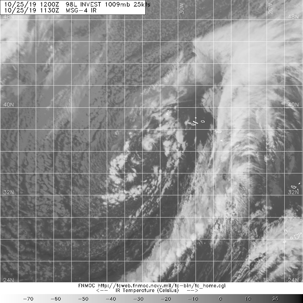
1. Shower activity continues to become better organized in association
with a small-scale low pressure area embedded within a larger
extratropical low centered a few hundred miles southwest of the
Azores. If current trends continue, advisories on a tropical or
subtropical cyclone could be initiated later today. The low is
forecast to move toward the east-northeast, and interests in the
Azores should monitor the progress of this system. For more
information, see High Seas Forecasts issued by Meteo France.
* Formation chance through 48 hours...high...80 percent.
* Formation chance through 5 days...high...80 percent.
2. Updated: Recent satellite derived winds indicate that the small
non-tropical low centered a few hundred miles southwest of the
western Azores is producing tropical-storm-force winds near the
center. The thunderstorm activity is becoming better organized and
if this trend continues a tropical or subtropical cyclone could form
later today. The low is forecast to move toward the east-northeast
for the next day or so and interests in the Azores should monitor
the progress of this system. For more information, see High Seas
Forecasts issued by the National Weather Service.
* Formation chance through 48 hours...medium...50 percent.
* Formation chance through 5 days...medium...50 percent.