開啟輔助訪問
 找回密碼
 立即加入

19E.Simon 實測MH達標 逐漸減弱

查看數: 7887 評論數: 13 收藏 0切换到帖子模式
    組圖打開中,請稍候......
發佈時間: 2014-9-29 01:53

正文摘要:

本帖最後由 t02436 於 2014-10-12 11:33 編輯   四級颶風     編號:19 E   名稱:Simon   基本資料     擾動編號日期:2014 年 09 月 29 日 01 ...

krichard2011 發表於 2014-10-6 21:03
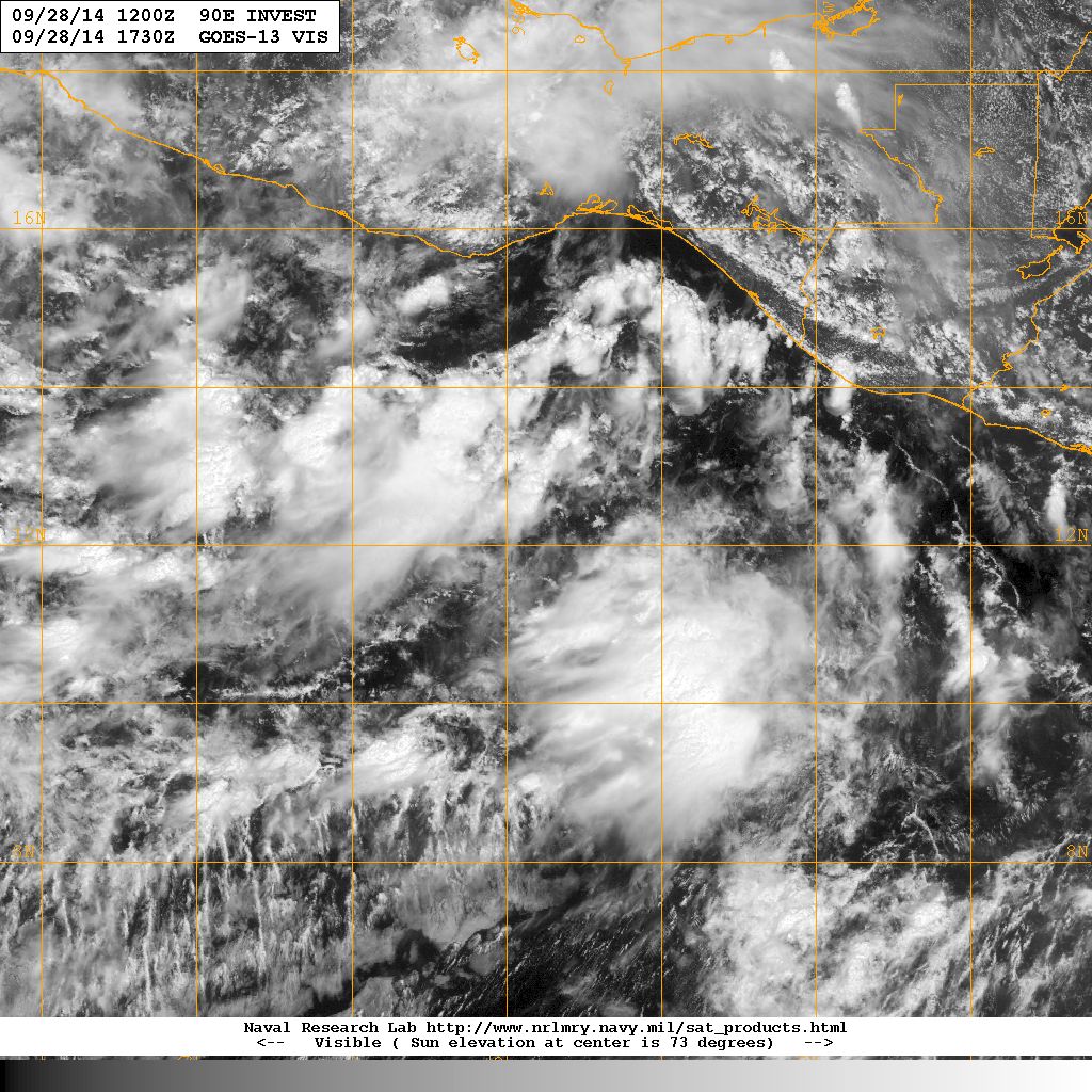
本帖最後由 krichard2011 於 2014-10-6 22:17 編輯

來一張賽門的巔峰圖
VIIRS掃到的 相當不錯...
整體來說 很美~~~
蜜露 發表於 2014-10-5 11:11


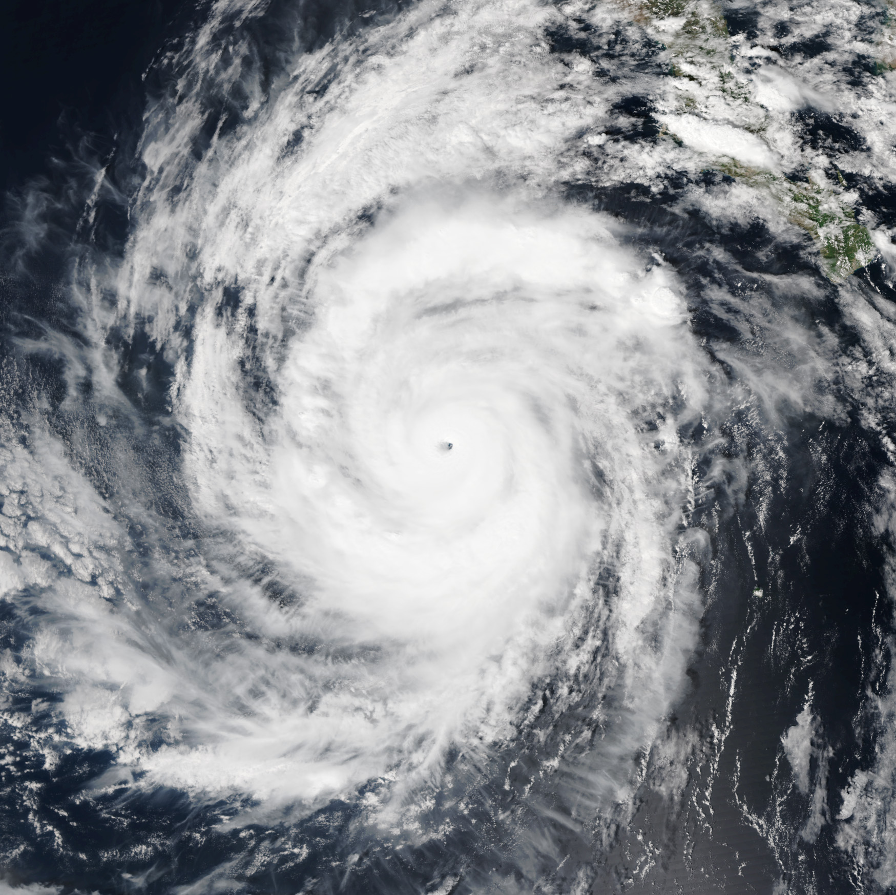
西蒙的底層,看出是個針眼. 核心很小

瑪奇再杜巴頓賣服裝的人妖. 實力還真強..

不過話說西蒙的CDO構造簡直並不差.
個人覺得這結構要勝過上個月影響南下加州的奧迪爾颶風.

不排除達到120-125kts  強度逼近巴逢颱風 伊塞爾颶風 .


佔了實測一點優勢.

美軍昨天才出動偵察機.
強度不輸同樣也有實測背書的奧迪爾.

因為西蒙可能會影響南下加州.

可惜瑪莉在巔峰當天沒有實測.

本帖子中包含更多資源

您需要 登錄 才可以下載或查看,沒有賬號?立即加入

x

點評

不過從高層和水氣圖來看,西蒙似乎不像個針眼. 而是小眼  發表於 2014-10-5 11:20
Meow 發表於 2014-10-5 10:09
一開始還預測當不成颶風呢,結果現在變成這樣。:lol


本帖子中包含更多資源

您需要 登錄 才可以下載或查看,沒有賬號?立即加入

x
CX723-A330 發表於 2014-10-5 09:47


強度繼續升
已到了115kts,達cat.4水平

本帖子中包含更多資源

您需要 登錄 才可以下載或查看,沒有賬號?立即加入

x
Meow 發表於 2014-10-5 03:34
由於飛機實測達標,NHC 稍早發佈特報,認為 Simon 已增強為 MH。

000
WTPZ64 KNHC 041753
TCUEP4

HURRICANE SIMON TROPICAL CYCLONE UPDATE
NWS NATIONAL HURRICANE CENTER MIAMI FL       EP192014
1100 AM PDT SAT OCT 04 2014


...NOAA HURRICANE HUNTER AIRCRAFT REPORTS THAT SIMON HAS BECOME A
MAJOR HURRICANE...

DATA FROM A NOAA HURRICANE HUNTER AIRCRAFT INDICATE THAT SIMON HAS
BECOME A MAJOR HURRICANE.  THE MAXIMUM SUSTAINED WINDS ARE NEAR 115
MPH...185 KM/H...AND THE CENTRAL PRESSURE REPORTED BY THE AIRCRAFT
IS 952 MB...28.11 INCHES.  THIS MAKES SIMON THE EIGHTH MAJOR
HURRICANE OF THE 2014 EASTERN NORTH PACIFIC HURRICANE SEASON.


SUMMARY OF 1100 AM PDT...1800 UTC...INFORMATION
--------------------------------------------------
LOCATION...20.3N 114.6W
ABOUT 255 MI...410 KM WNW OF SOCORRO ISLAND
ABOUT 350 MI...565 KM WSW OF THE SOUTHERN TIP OF BAJA CALIFORNIA
MAXIMUM SUSTAINED WINDS...115 MPH...185 KM/H
PRESENT MOVEMENT...WNW OR 295 DEGREES AT 13 MPH...20 KM/H
MINIMUM CENTRAL PRESSURE...952 MB...28.11 INCHES

$$
FORECASTER BEVEN
krichard2011 發表於 2014-10-4 23:16
結構好的有點超出我預期
早晨的可見光風眼相當清晰
正報強度微幅上調至95KT 並且上看C3
目前來看結構算是相當完整
原本以為附近OHC偏低 不利於賽門增強
不過現在卻來個爆發 @@


000
WTPZ44 KNHC 041448
TCDEP4

HURRICANE SIMON DISCUSSION NUMBER  12
NWS NATIONAL HURRICANE CENTER MIAMI FL       EP192014
800 AM PDT SAT OCT 04 2014

Infrared satellite imagery indicates that Simon has undergone rapid
intensification during the past several hours.  A small eye has
formed, and the cloud tops surrounding the eye are in the -75C to
-85C range.  Satellite intensity estimates have increased to 102 kt
from TAFB and 90 kt from SAB, and the latest estimated from the
CIMSS ADT is 90 kt.  Based on these, the initial intensity is
increased to 95 kt, and this could be conservative.  A NOAA
Hurricane Hunter aircraft is scheduled to investigate Simon later
today.

The initial motion is now 295/11.  Simon is expected to move
west-northwest to northwestward for the next 36 hours or so as is
approaches a weakness in the subtropical ridge to its north.  After
that, the system is expected to turn northward and northeastward,
although there remains significant spread in the track guidance on
when and how fast this will occur.  The GFS, GFS ensemble mean,
NAVGEM, and the GFDL show Simon moving quickly to the northeast,
eventually making landfall on the Baja California peninsula and in
northwestern Mexico.  The ECMWF, UKMET, and CMC models show the turn
occurring later and farther west, and these models forecast the
cyclone to dissipate over water west of the Baja California
peninsula.  The forecast track continues to compromise between these
two extremes in showing a slow northeastward motion after
recurvature. The new forecast track is similar to the previous track
and is slower than the model consensus.

How long the current rapid intensification will continue is
uncertain, as Simon is now moving over decreasing sea surface
temperatures.  The new intensity forecast follows the guidance trend
of showing 12 hours more strengthening.  Simon is now forecast to
become a major hurricane, and it would not be a surprise if it
reached a higher peak intensity than currently forecast. After 12
hours, cooler waters under the forecast track should result in a
weakening trend, and this should become more pronounced after 48
hours due to increasing shear.  The new intensity forecast shows
rapid weakening after 48 hours, with Simon expected to become a
remnant low by the end of the forecast period. It should be noted
that, if Simon follows the GFS forecast track, it would likely
weaken more slowly than currently forecast since it would stay over
warmer water and encounters less shear.

FORECAST POSITIONS AND MAX WINDS

INIT  04/1500Z 20.2N 113.8W   95 KT 110 MPH
12H  05/0000Z 21.0N 115.3W  105 KT 120 MPH
24H  05/1200Z 22.2N 116.8W  100 KT 115 MPH
36H  06/0000Z 23.1N 117.4W   90 KT 105 MPH
48H  06/1200Z 23.7N 117.6W   80 KT  90 MPH
72H  07/1200Z 24.5N 117.5W   55 KT  65 MPH
96H  08/1200Z 25.5N 117.0W   35 KT  40 MPH
120H  09/1200Z 26.5N 116.0W   30 KT  35 MPH...POST-TROP/REMNT LOW

$$
Forecaster Beven

本帖子中包含更多資源

您需要 登錄 才可以下載或查看,沒有賬號?立即加入

x

點評

今年的東太把我們西太壓的死死的!  發表於 2014-10-4 23:30
今年太平洋的 MH 根本量產型  發表於 2014-10-4 23:23
CX723-A330 發表於 2014-10-4 21:11

本帖子中包含更多資源

您需要 登錄 才可以下載或查看,沒有賬號?立即加入

x

點評

有潛力.. 看好上C3  發表於 2014-10-4 22:20

評分

參與人數 1水氣能量 +20 收起 理由
ben811018 + 20 贊一個!

查看全部評分

本平台僅供學術討論之用,預報應以氣象局為準

威普網站虛擬主機贊助公司

臺灣第一個天氣類型社群平台 即時天氣資訊、精準颱風動態

線上客服
FB傳送訊息
廣告行銷
精準行銷 物超所值
官方粉專
發佈 快速回復 返回頂部 返回列表