開啟輔助訪問
 找回密碼
 立即加入

19E.Olaf 重回東太持續減弱 東太史上最低緯MH

簽到天數: 582 天

[LV.9]以壇為家II

蜜露|2015-10-22 01:03 | 顯示全部樓層
本帖最後由 蜜露 於 2015-10-22 01:06 編輯

隔壁的環境偏差的薔琵,置換一直很不穩定. 強度無法明顯改善.

而看樣子這邊Olaf的置換算是比較成功的了.但也降到3級.
環境還可以. 如果高層清空較快. 還是有可能迎來二次巔峰.重新回到4級的強度
(類似8月底的Jimena颶風,而Olaf已經是今年中太的風王了)


GFS未來一天都看好Olaf的二次巔峰. 算是觀賞的遠洋颶風. 也不會影響到夏威夷群島


本帖子中包含更多資源

您需要 登錄 才可以下載或查看,沒有賬號?立即加入

x
回復

使用道具 舉報

簽到天數: 582 天

[LV.9]以壇為家II

蜜露|2015-10-20 12:35 | 顯示全部樓層
本帖最後由 蜜露 於 2015-10-22 01:06 編輯

Olaf 這次升格Cat.4   是東太最後一報. 沒機會挑戰Jimena

接下來由中太接手. 強度有可能達到4級的上限

Olaf的針眼真是精辣. 這是今年針眼型看過最好的

昨日半夜風眼一度轉差,現在白天後又改善不少
底層又可看出.改善很多

高層相當不錯,四周風切也低.


(如果向日葵8衛星去拍針眼型的熱帶氣旋,可能會很適合)


本帖子中包含更多資源

您需要 登錄 才可以下載或查看,沒有賬號?立即加入

x
回復

使用道具 舉報

簽到天數: 3280 天

[LV.Master]伴壇終老

t02436|2015-10-19 22:59 | 顯示全部樓層
針眼開啟,NHC 15Z評價100節,明天將以巔峰125節進入中太平洋。
報文中提及Olaf是東太最南最遠的MH,紀錄再多添一項。
ZCZC MIATCDEP4 ALL
TTAA00 KNHC DDHHMM

HURRICANE OLAF DISCUSSION NUMBER  19
NWS NATIONAL HURRICANE CENTER MIAMI FL       EP192015
800 AM PDT MON OCT 19 2015

A small eye is now apparent in infrared imagery, and the coverage
and symmetry of the cold cloud tops has improved during the past few
hours. The initial intensity is set to 100 kt based on the latest
Dvorak classification of T5.5/102 kt from SAB, making Olaf the 6th
major hurricane in the eastern North Pacific this year. This is the
farthest south that a major hurricane has formed in the basin since
reliable records began in 1971.


Further strengthening appears likely in the next day or so, and in
fact the SHIPS RI index shows a 44 percent chance of a 25-kt
increase in the next 24 hours. The NHC intensity forecast has been
adjusted upward to account for the observed strengthening, and shows
a peak of 125 kt in 24 hours. Little change in intensity is then
shown through 48 hours, however, there could be fluctuations in
intensity due to eyewall cycles during this time that are not
represented in the forecast. Later in the period, gradual weakening
should begin as Olaf moves over slightly cooler waters into a
somewhat drier environment. The new NHC forecast is above the
guidance in the first 24 hours and close to the latest SHIPS model
prediction thereafter.

Olaf continues to move westward, with an initial motion of 280/12.
This continues a trend of a motion that has been a little faster and
to the left of much of the guidance and the NHC forecast. While the
track forecast reasoning has not changed, with Olaf expected to
gradually turn northward through the forecast period as the ridge to
the north erodes, the guidance envelope has continued to shift
westward this cycle. In fact, the multi-model consensus has shifted
westward by about 2 degrees compared to 24 hours ago at days 4 and
5. The new NHC track forecast has been adjusted to the left this
cycle by 60 to 90 n mi at days 2 through 5. The NHC track is now on
the left side of the guidance envelope and closer to the UKMET
model, which has been the best performing track model so far for
Olaf.

FORECAST POSITIONS AND MAX WINDS

INIT  19/1500Z  9.9N 137.7W  100 KT 115 MPH
12H  20/0000Z 10.2N 139.1W  115 KT 130 MPH
24H  20/1200Z 10.8N 140.8W  125 KT 145 MPH
36H  21/0000Z 11.4N 142.4W  120 KT 140 MPH
48H  21/1200Z 12.2N 144.0W  120 KT 140 MPH
72H  22/1200Z 14.0N 146.0W  110 KT 125 MPH
96H  23/1200Z 16.7N 146.9W  100 KT 115 MPH
120H  24/1200Z 19.5N 147.5W   85 KT 100 MPH

$$
Forecaster Brennan

NNNN


本帖子中包含更多資源

您需要 登錄 才可以下載或查看,沒有賬號?立即加入

x
回復

使用道具 舉報

簽到天數: 582 天

[LV.9]以壇為家II

蜜露|2015-10-19 18:44 | 顯示全部樓層


Olaf 風眼在高層逐漸開啟,應該是個針眼


這是GFS的數值預測來看, OLaf的巔峰可維持2天. 影響夏威夷的機率並不高
這是GFS大多會走的路線

Olaf所在風切很低. 正好有機會繼續發展.


本帖子中包含更多資源

您需要 登錄 才可以下載或查看,沒有賬號?立即加入

x
回復

使用道具 舉報

簽到天數: 3280 天

[LV.Master]伴壇終老

t02436|2015-10-18 21:31 | 顯示全部樓層
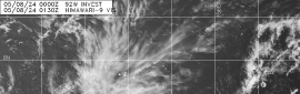
06Z升格C1,巔峰上望110節,三天之後進入中太。
另外報文中提及Olaf在北緯9.4度就加強為一級颶風,成為東太史上最低緯的颶風。
000
WTPZ44 KNHC 180851
TCDEP4

HURRICANE OLAF DISCUSSION NUMBER  14
NWS NATIONAL HURRICANE CENTER MIAMI FL       EP192015
200 AM PDT SUN OCT 18 2015

Olaf has intensified overnight.  Satellite images show that
convection has deepened with a sizable area of -90C cloud tops near
the center, along with an eye occasionally appearing on the
night-visible channel.  Microwave data also show that the eye has
become better defined, and the feature has even become more distinct
in the lower resolution AMSU data.  With the appearance of the eye
in conventional satellite data and the increase in convection near
the center, the initial wind speed is set to 65 kt, near the Dvorak
estimate from SAB. It is also worth noting that ASCAT data show that
Olaf has also grown in size significantly from yesterday, and this
is reflected in the larger initial and forecast wind radii.

Olaf should continue to intensify during the next couple of days
with favorable environmental conditions of low shear, warm water and
high mid-level moisture in the forecast. Rapid intensification is a
distinct possibility, with the SHIPS-RI index showing about a 40
percent chance of a 30-kt increase in the next 24 hours.  The
intensity forecast will bring Olaf up to major hurricane strength in
36 hours, in line with the highest guidance from the LGEM model and
the Florida State Superensemble. In a few days, some southerly shear
and dry air entrainment is possible, which could lead to Olaf
beginning a weakening trend.  Little change was made to the long
range intensity forecast, close to a blend of the previous NHC
prediction and the intensity consensus.

ASCAT and satellite data were very helpful in determining an
initial motion of 275/8.  A motion to the west and then west-
northwest is expected for the next two days or so while the cyclone
moves on the south side of the subtropical ridge.  After that time,
a mid- to upper-level trough passing north of the Hawaiian Islands
is forecast to cause a break in the ridge, allowing Olaf to turn
northwestward by 96 hours and northward by 120 hours.  Although
guidance is in general agreement on the large-scale pattern, the
timing of the northward turn is in some question, especially since
Olaf has been struggling to gain latitude.  Overall, the guidance
has generally been showing a later turn, with the ECMWF/UKMET models
having a weaker trough and less of a ridge breakdown.  The NHC track
forecast is shifted west toward the latest consensus aids, although
it still lies east of the model consensus.

At 9.4N, Olaf is the lowest-latitude hurricane formation in the
eastern Pacific dataset.  Reliable records in the basin go back to
about 1971.


FORECAST POSITIONS AND MAX WINDS

INIT  18/0900Z  9.4N 131.9W   65 KT  75 MPH
12H  18/1800Z  9.6N 133.2W   75 KT  85 MPH
24H  19/0600Z 10.0N 135.1W   90 KT 105 MPH
36H  19/1800Z 10.6N 136.9W  100 KT 115 MPH
48H  20/0600Z 11.3N 138.6W  110 KT 125 MPH
72H  21/0600Z 13.3N 141.7W  105 KT 120 MPH

96H  22/0600Z 15.0N 143.5W   95 KT 110 MPH
120H  23/0600Z 17.5N 143.5W   80 KT  90 MPH

$$
Forecaster Blake


另外,12Z速報維持65節的評價。
EP, 19, 2015101812,   , BEST,   0,  94N, 1326W,  65,  991, HU,

本帖子中包含更多資源

您需要 登錄 才可以下載或查看,沒有賬號?立即加入

x

點評

東太平洋適合颶風的區域真是窄……  發表於 2015-10-18 21:46
回復

使用道具 舉報

簽到天數: 3280 天

[LV.Master]伴壇終老

t02436|2015-10-17 12:48 | 顯示全部樓層
補個命名報
預測96小時之後巔峰進入中太
000
WTPZ44 KNHC 170234
TCDEP4

TROPICAL STORM OLAF DISCUSSION NUMBER   9
NWS NATIONAL HURRICANE CENTER MIAMI FL       EP192015
800 PM PDT FRI OCT 16 2015

The cloud pattern of Tropical Depression Nineteen-E has continued
to become better organized during the past several hours.  There
is now a persistent convective area near the center and ragged
outer bands in the western semicircle.  Satellite intensity
estimates have increased to 45 kt from SAB and 35 kt from TAFB.  In
addition, Rapidscat data from the International Space Station showed
an area of 30-35 kt winds just north of the central convection.
Based on these data, the depression is upgraded to Tropical Storm
Olaf with 35 kt winds.

The initial motion estimate is now 270/12.  Olaf is currently being
steered by a mid-level subtropical ridge.  The dynamical models
forecast the ridge to persist but weaken during the next 72-96
hours due to the influence of a strong deep-layer trough forecast
to develop over the southwestern United States.  This evolution
should cause Olaf to continue westward with a decrease in forward
speed during the first 36-48 hours, followed by a west-northwestward
motion from 48-96 hours. After that time, the ridge is forecast to
break to the east of the Hawaiian Islands, which should allow the
storm to turn more northward.  The track guidance is generally in
good agreement with this scenario, with the ECMWF, GFS, and the
various consensus models rather tightly clustered.  The new
forecast track is similar to the previous track through 72 hours,
then is nudged slightly westward thereafter.  The new track is
close to the model consensus.

Olaf is expected to remain in an environment of good moisture,
light shear, and warm sea surface temperatures for at least the
next three days, so there is no obvious reason it should not
strengthen.  On one side of the guidance, the LGEM forecasts Olaf
to become a major hurricane in 72 hours, and the Rapid
Intensification Index of the SHIPS model shows a 30-35 percent
chance of 30 kt of strengthening during the next 24 hours.  On the
other side, the GFDL and HWRF forecast a much slower rate of
intensification. The new intensity forecast is nudged upward from
the previous forecast based on current trends and is a compromise
between the SHIPS model and the Florida State Superensemble.  As
stated in the previous advisory, given the very conducive
large-scale environment, it would not be surprising to see more
strengthening than is currently forecast.


FORECAST POSITIONS AND MAX WINDS

INIT  17/0300Z  9.7N 127.6W   35 KT  40 MPH
12H  17/1200Z  9.7N 129.1W   45 KT  50 MPH
24H  18/0000Z  9.7N 130.8W   55 KT  65 MPH
36H  18/1200Z 10.0N 132.4W   65 KT  75 MPH
48H  19/0000Z 10.5N 133.9W   75 KT  85 MPH
72H  20/0000Z 12.0N 137.0W   95 KT 110 MPH
96H  21/0000Z 14.0N 140.0W   95 KT 110 MPH
120H  22/0000Z 16.5N 141.5W   90 KT 105 MPH

$$
Forecaster Beven


本帖子中包含更多資源

您需要 登錄 才可以下載或查看,沒有賬號?立即加入

x
回復

使用道具 舉報

簽到天數: 117 天

[LV.6]常住居民II

WYS127|2015-10-17 12:09 | 顯示全部樓層
   TROPICAL STORM 19E (OLAF) WARNING NR 009   
   UPGRADED FROM TROPICAL DEPRESSION 19E

終於升格  命名為Olaf

本帖子中包含更多資源

您需要 登錄 才可以下載或查看,沒有賬號?立即加入

x
回復

使用道具 舉報

簽到天數: 3280 天

[LV.Master]伴壇終老

t02436|2015-10-15 11:14 | 顯示全部樓層
NHC升格19E,暫時上望85節。
000
WTPZ44 KNHC 150234
TCDEP4

TROPICAL DEPRESSION NINETEEN-E DISCUSSION NUMBER   1
NWS NATIONAL HURRICANE CENTER MIAMI FL       EP192015
800 PM PDT WED OCT 14 2015

Satellite images indicate that the low pressure system located about
1000 miles south-southwest of the southern tip of the Baja
California peninsula has become better organized.  The cloud pattern
consists of a large curved band on its western side and a central
dense overcast feature. In addition, a partial ASCAT pass from
earlier today suggested that the center of circulation has become
better defined. On this basis, this system is classified as a
tropical depression, the nineteenth one of the 2015 eastern North
Pacific season.  The initial wind speed is set at 30 kt, following
a Dvorak intensity estimate from TAFB and the earlier ASCAT data.

The depression is moving just south of due west at about 16 kt
steered by a subtropical ridge to its north.  A general westward
motion with a decrease in forward speed is expected during the next
few days while the ridge remains in place but weakens.  After that
time, a turn to the northwest is predicted as the cyclone moves
toward a weakness in the ridge caused by a mid- to upper-level
trough.  The model guidance is in fair agreement, and the official
track forecast lies near the consensus aids.

Low wind shear, warm water, and a fairly moist environment should
allow the system to strengthen during the next several days.  The
SHIPS and LGEM models show significant strengthening, bringing the
system to hurricane strength within 48 hours with continued
intensification thereafter.  The official forecast is less
aggressive than those models, but still does call for the depression
to strengthen steadily for the next few days.  This forecast is
between the dynamical and statistical guidance, and a little lower
than the intensity model consensus.  It is interesting to note that
the GFS and ECMWF models also show the system deepening
significantly toward the end of the forecast period.

FORECAST POSITIONS AND MAX WINDS

INIT  15/0300Z  9.9N 117.8W   30 KT  35 MPH
12H  15/1200Z  9.7N 120.0W   35 KT  40 MPH
24H  16/0000Z  9.5N 122.4W   40 KT  45 MPH
36H  16/1200Z  9.5N 124.8W   45 KT  50 MPH
48H  17/0000Z  9.6N 126.9W   55 KT  65 MPH
72H  18/0000Z 10.0N 130.0W   70 KT  80 MPH
96H  19/0000Z 11.4N 132.7W   85 KT 100 MPH
120H  20/0000Z 13.5N 135.0W   85 KT 100 MPH

$$
Forecaster Cangialosi


本帖子中包含更多資源

您需要 登錄 才可以下載或查看,沒有賬號?立即加入

x
回復

使用道具 舉報

快速回覆
您需要登錄後才可以回帖 登錄 | 立即加入

本版積分規則

本平台僅供學術討論之用,預報應以氣象局為準

威普網站虛擬主機贊助公司

臺灣第一個天氣類型社群平台 即時天氣資訊、精準颱風動態

線上客服
FB傳送訊息
廣告行銷
精準行銷 物超所值
官方粉專
發佈 快速回復 返回頂部 返回列表