開啟輔助訪問
 找回密碼
 立即加入

14L.Lee 繼Harvey後大西洋第5個MH

簽到天數: 3714 天

[LV.Master]伴壇終老

開梅|2017-9-23 20:54 | 顯示全部樓層
大西洋的颶風經常出產這種規模小小的,環流也不大的緊實颱風,即使是五級颶風,近年來觀察好像也比西太五級颱風迷你些

點評

大西洋整體水氣支援不如西太平洋這麼猛~  發表於 2017-9-23 21:22
回復

使用道具 舉報

簽到天數: 601 天

[LV.9]以壇為家II

霧峰追風者|2017-9-23 12:23 | 顯示全部樓層
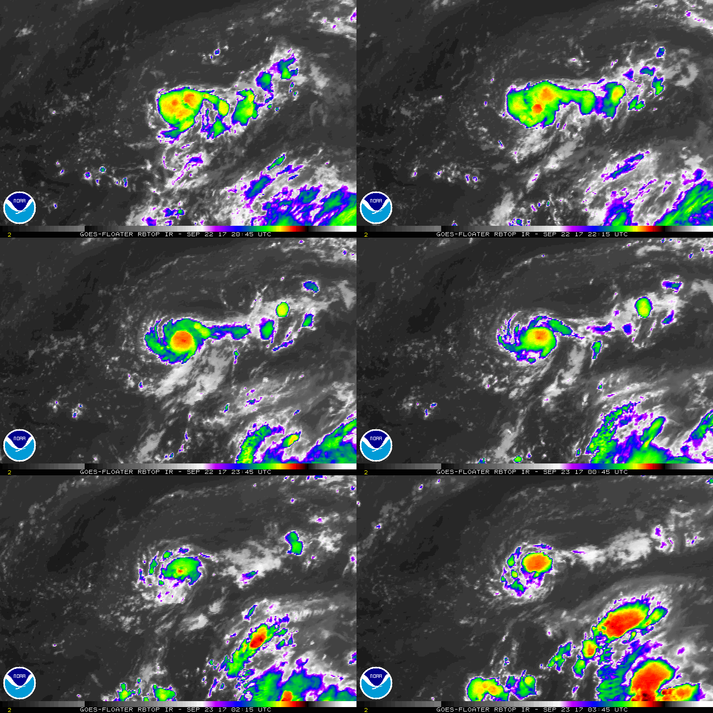
NHC 03Z重回TS,巔峰上看一級颶風,預估路徑緩慢東移後在西折。
ZCZC MIATCDAT4 ALL
TTAA00 KNHC DDHHMM

Tropical Storm Lee Discussion Number  19
NWS National Hurricane Center Miami FL       AL142017
1100 PM AST Fri Sep 22 2017

Several microwave overpasses between 2100 and 2200 UTC indicated
that Lee was becoming better organized, at least at the mid-levels.
In particular, a WindSat overpass near 21Z indicated that a
mid-level eye was already forming.  Since that time, however, cloud
tops have warmed, the CDO has shrunk, and a GPM overpass around 0100
UTC showed that most of the convection is currently confined to the
southeast semicircle of the tropical storm. The UW-CIMSS ADT
supports an intensity of 35 kt, and the TAFB Dvorak analyst
indicated that the subjective classification would have been higher,
if the technique wasn't constrained by the fact that classifications
on Lee only recently restarted.  Based on these data, the initial
intensity has been increased to 35 kt.

The intensity forecast for Lee is highly uncertain.  The tropical
storm is very small, and small cyclones often quickly strengthen or
weaken.  Furthermore, Lee is small enough that some of our models
(and many of our observing platforms) may have trouble resolving the
inner core of the storm.  Given the current convective state of Lee,
significant strengthening in the short term seems unlikely.
However, the cyclone is expected to be in a fairly unstable, low
shear environment for at least the next 3 days, so it is possible
that rapid intensification could occur at some time during that
period.  On the other hand, I can't rule out that the cyclone could
dissipate entirely, as depicted by the GFS, within a couple days.
For now, my forecast is closest to the HWRF for the first 72 h,
since that model tends to do well in low-shear environments and
should have sufficient resolution to model Lee's core.  After that
time, the forecast is close to the HCCA and IVCN intensity consensus
models.

Lee has continued to move north around 6 kt.  Little change has been
made to the track forecast, and Lee is still forecast to move around
a subtropical ridge for the next 72 h.  At days 4 and 5, a ridge
building between Lee and Maria to the west should cause a turn more
toward the south, as long as Lee is sufficiently deep to be steered
by that feature.  The forecast continues to be close to the ECMWF,
since it is still the global model with the strongest representation
of Lee, in line with the NHC forecast.

FORECAST POSITIONS AND MAX WINDS

INIT  23/0300Z 31.5N  49.0W   35 KT  40 MPH
12H  23/1200Z 32.2N  48.5W   40 KT  45 MPH
24H  24/0000Z 32.5N  47.8W   45 KT  50 MPH
36H  24/1200Z 32.4N  46.6W   50 KT  60 MPH
48H  25/0000Z 32.1N  45.2W   60 KT  70 MPH
72H  26/0000Z 31.3N  43.1W   75 KT  85 MPH
96H  27/0000Z 30.0N  42.5W   75 KT  85 MPH
120H  28/0000Z 29.5N  43.5W   65 KT  75 MPH
$$
Forecaster Zelinsky
NNN
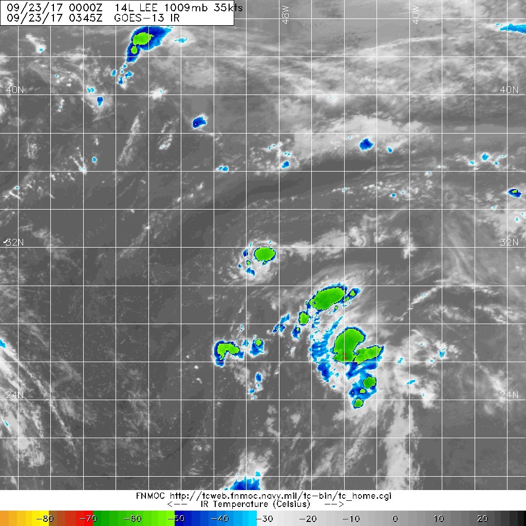
20170923.0345.goes-13.ircolor.14L.LEE.35kts.1009mb.31.2N.49W.100pc.jpg rbtop-animated (15).gif

點評

欸呀呀 他可真是要搞死我了  發表於 2017-9-23 19:03
回復

使用道具 舉報

簽到天數: 601 天

[LV.9]以壇為家II

霧峰追風者|2017-9-23 06:00 | 顯示全部樓層
本帖最後由 霧峰追風者 於 2017-9-23 06:33 編輯

判定是同一個系統,Lee 21Z再次開始發報,環流迷你,逐漸增強,巔峰上看60kt.在請版主合併處理。
ZCZC MIATCDAT4 ALL
TTAA00 KNHC DDHHMM

Tropical Depression Lee Discussion Number  18
NWS National Hurricane Center Miami FL       AL142017
500 PM AST Fri Sep 22 2017

The mid-level circulation from Lee separated from the low-level
center two days ago and moved northward around the eastern
periphery of a large upper-level trough.  A large convective burst
over the mid-level center yesterday then caused a new low-level
center to develop while it moved on the northern side of the upper
trough. ASCAT and ship data indicate that the small circulation is
now well defined, and since deep convection has persisted near the
center, advisories on Lee are being restarted. The initial wind
speed is 30 kt, which could be conservative given the healthy
structure seen on the last-light visible and recent microwave data.

Cold upper-level temperatures from the upper trough should mitigate
the effect of marginally warm waters for the next few days while Lee
remains in a low-shear environment.  The depression is expected to
strengthen over the next few days until westerly shear is forecast
to increase. The official forecast is similar to the model guidance,
although it shows an earlier peak more coincident with the
lower-shear, warmer-water environment.  This wind speed forecast is
difficult because Lee is a very small tropical cyclone, which
notoriously have rapid changes, both up and down, in intensity.

Lee is moving northward at about 6 kt.  The depression should turn
to the northeast and east over the next couple of days while it
moves around a ridge over the tropical central Atlantic.  Lee is
forecast to become trapped beneath a mid-latitude ridge in a few
days, which should cause the cyclone to drift at long range.  It
should be noted that models have a rather weak representation of
Lee at the present time, which causes this to be an uncertain
forecast.  For now, the forecast is closest to the ECMWF, which
has the most coherent cyclone to follow.


FORECAST POSITIONS AND MAX WINDS

INIT  22/2100Z 30.8N  48.9W   30 KT  35 MPH
12H  23/0600Z 31.7N  48.7W   40 KT  45 MPH
24H  23/1800Z 32.3N  48.2W   45 KT  50 MPH
36H  24/0600Z 32.3N  47.2W   50 KT  60 MPH
48H  24/1800Z 32.1N  45.8W   55 KT  65 MPH
72H  25/1800Z 31.4N  43.2W   60 KT  70 MPH
96H  26/1800Z 30.5N  42.0W   55 KT  65 MPH
120H  27/1800Z 29.5N  43.0W   50 KT  60 MPH

$$
Forecaster Blake

NNNN

204045_5day_cone_no_line_and_wind.png rgb-animated.gif avn-animated.gif


回復

使用道具 舉報

簽到天數: 601 天

[LV.9]以壇為家II

霧峰追風者|2017-9-23 03:37 | 顯示全部樓層
NHC展望提升至40%
1. A small area of low pressure, associated with the remnants of Lee,
is located over the central Atlantic Ocean almost a thousand miles
east-southeast of Bermuda.  The low is producing a concentrated area
of showers and thunderstorms, although the circulation appears
somewhat elongated.  Some additional development of this system is
possible during the next few days while it moves slowly northward
through early next week.
* Formation chance through 48 hours...medium...40 percent.
* Formation chance through 5 days...medium...50 percent.

two_atl_2d1 (1).png rbtop-animated.gif

回復

使用道具 舉報

簽到天數: 601 天

[LV.9]以壇為家II

霧峰追風者|2017-9-22 23:55 | 顯示全部樓層

14L.Lee 二次升格 環流迷你 逐漸增強

本帖最後由 霧峰追風者 於 2017-9-23 10:39 編輯

  熱帶風暴
編號:14 L
名稱:Lee

  基本資料  
擾動編號日期:2017 09 22 23
命名日期  :2017 09 23 05
撤編日期  :2017 09 00 00
登陸地點  :
暫無

  巔峰時期資料  
近中心最強風速
國家颶風中心(NHC):35 kts
海平面最低氣壓:1009
毫巴

  過去路徑圖  


  擾動編號資料  
98L-INVEST-25kts-1016mb-29.9N-49W

20170922.1515.goes-13.ir.98L.INVEST.25kts.1016mb.29.9N.49W.100pc.jpg
NHC : 30%
1. Updated:  A small area of low pressure has developed over the
central Atlantic Ocean almost a thousand miles east-southeast of
Bermuda.  The low is producing a concentrated area of showers and
thunderstorms, although the circulation appears somewhat elongated.
Some additional development of this system is possible during the
next few days while it moves slowly northward through early next
week.
* Formation chance through 48 hours...low...30 percent.
* Formation chance through 5 days...medium...40 percent

two_atl_2d1.png

以上資料來自:NHC、颱風論壇整理製作

評分

參與人數 1水氣能量 +15 收起 理由
t02436 + 15

查看全部評分

回復

使用道具 舉報

簽到天數: 601 天

[LV.9]以壇為家II

霧峰追風者|2017-9-20 13:00 | 顯示全部樓層
NHC 展望提高至60%,目前中心爆對流,風速來到40kt,看看下報NHC會不回再次發報。
1. Showers and thunderstorms have increased near a low pressure area,
the remnants of Lee, located about 1000 miles east of the Leeward
Islands. Satellite wind data show that the low is already producing
gale-force winds, and only a small increase in the organization of
the deep convection would result in the regeneration of Lee.
However, the environmental conditions are only marginal favorable
for tropical cyclone formation.  This low is expected to move
northward over the central Atlantic Ocean.
* Formation chance through 48 hours...medium...60 percent.
* Formation chance through 5 days...medium...60 percent.
two_atl_2d1 (3).png 20170920.0315.goes-13.ircolor.14L.LEE.40kts.1007mb.17.6N.45.1W.100pc.jpg rbtop-animated (14).gif


點評

已經減弱消散了  發表於 2017-9-22 22:50
回復

使用道具 舉報

簽到天數: 3280 天

[LV.Master]伴壇終老

t02436|2017-9-17 23:31 | 顯示全部樓層
我們的李先生已經乾掉了....@@
15Z根據風場降TD,不再看好回到TS級別。
ZCZC MIATCDAT4 ALL
TTAA00 KNHC DDHHMM

Tropical Depression Lee Discussion Number  11
NWS National Hurricane Center Miami FL       AL142017
1100 AM AST Sun Sep 17 2017

An 1144 UTC ASCAT pass indicated that Lee is no longer producing
tropical-storm-force winds.
  In addition, deep convection is
fizzling, and there are only a few convective elements remaining in
a band to the south of the center.  Lee is downgraded to a tropical
depression with 30-kt winds, and even that could be generous given
what the ASCAT data is showing.  Since the cyclone is already
struggling in its current environment, it probably won't do much
better going forward since vertical shear is expected to increase
to 30 kt in about 24 hours.
Therefore, gradual weakening is
expected, and Lee could degenerate into a remnant low by 48 hours,
if not sooner.  The GFS and ECMWF both dissipate the low in 3 to 4
days, so the new NHC forecast now shows that occurring by day 4.

Lee is moving westward, or 280/7 kt.  Even though the ridge to the
north of the cyclone is not very strong, Lee's weak nature should
cause it to be steered generally westward or west-northwestward for
the next 3 days before it dissipates.  The NHC track forecast
remains just south of the various consensus aids, and it is not too
different from the previous forecast.

FORECAST POSITIONS AND MAX WINDS

INIT  17/1500Z 13.0N  36.7W   30 KT  35 MPH
12H  18/0000Z 13.2N  37.8W   30 KT  35 MPH
24H  18/1200Z 13.8N  39.5W   30 KT  35 MPH
36H  19/0000Z 14.7N  41.2W   25 KT  30 MPH
48H  19/1200Z 15.7N  42.8W   25 KT  30 MPH...POST-TROP/REMNT LOW
72H  20/1200Z 17.5N  45.9W   25 KT  30 MPH...POST-TROP/REMNT LOW
96H  21/1200Z...DISSIPATED

$$
Forecaster Berg

NNNN

145353_5day_cone_with_line.png

LATEST.jpg

20170917.1445.goes-13.vis.1km.14L.LEE.35kts.1007mb.12.9N.36.3W.100pc.jpg

rbtop-animated.gif
回復

使用道具 舉報

簽到天數: 601 天

[LV.9]以壇為家II

霧峰追風者|2017-9-16 23:27 | 顯示全部樓層
NHC 12Z命名"LEE",逐漸西移。
000
WTNT44 KNHC 161459 CCA
TCDAT4

Tropical Storm Lee Discussion Number   7...Corrected
NWS National Hurricane Center Miami FL       AL142017
1100 AM AST Sat Sep 16 2017

Corrected to include missing word in intensity discussion

Deep convection has increased in intensity and coverage since this
time yesterday, and a recent partial ASCAT pass from around 1100
UTC indicated that the system is now producing tropical-storm-force
winds at least to the east of its center.  Based on these data, the
depression is upgraded to Tropical Storm Lee with maximum winds of
35 kt.  Lee has been able to strengthen a little despite about 15
kt of north-northwesterly shear.  The cyclone appears to be located
in a sweet spot of relatively low shear, with much stronger upper-
level westerly winds located not too far to the north, and it may be
able to thread the needle of lower shear for another 36 hours or so.
After that time, the westerlies drop southward, and Lee will likely
be hammered by 30 kt of westerly shear by 48 hours.  With all that
in mind, Lee is forecast to strengthen only slightly over the next
day or so, with weakening expected to begin by day 3.  The NHC
intensity forecast is close to the intensity consensus and HCCA, and
Lee may ultimately degenerate into a remnant low by day 5.

Lee's initial motion is estimated to be 265/10 kt.  The storm is
located to the south of a weak mid-level ridge, and it is expected
to move generally westward or west-northwestward for the entire
forecast period.  Although some of the track models are showing a
more pronounced poleward motion, Lee's relatively low intensity and
eventual weakening will likely keep it steered by lower-level flow.
As a result, the NHC track forecast is near the southern edge of
the guidance envelope, although not quite as far south as the ECMWF
model.  This forecast is not too different from the previous one.

FORECAST POSITIONS AND MAX WINDS

INIT  16/1500Z 12.5N  33.1W   35 KT  40 MPH
12H  17/0000Z 12.4N  34.1W   40 KT  45 MPH
24H  17/1200Z 12.5N  35.3W   40 KT  45 MPH
36H  18/0000Z 12.9N  36.7W   40 KT  45 MPH
48H  18/1200Z 13.6N  38.4W   40 KT  45 MPH
72H  19/1200Z 15.6N  42.3W   35 KT  40 MPH
96H  20/1200Z 17.0N  46.0W   30 KT  35 MPH
120H  21/1200Z 18.0N  49.5W   25 KT  30 MPH...POST-TROP/REMNT LOW

$$
Forecaster Berg
144929_5day_cone_no_line_and_wind.png


點評

發展條件轉差,預估強度下調,由60kts.978hpa.降至40kts.992hpa.  發表於 2017-9-17 00:05

評分

參與人數 1水氣能量 +5 收起 理由
jwpk9899 + 5

查看全部評分

回復

使用道具 舉報

快速回覆
您需要登錄後才可以回帖 登錄 | 立即加入

本版積分規則

本平台僅供學術討論之用,預報應以氣象局為準

威普網站虛擬主機贊助公司

臺灣第一個天氣類型社群平台 即時天氣資訊、精準颱風動態

線上客服
FB傳送訊息
廣告行銷
精準行銷 物超所值
官方粉專
發佈 快速回復 返回頂部 返回列表