| FW謝謝~ |
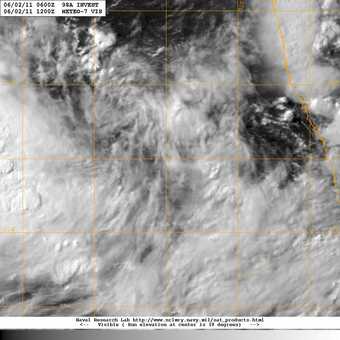
得看他的整合囉 是的 他說的應該就是GIRI了 (但是這個01A的是風眼嗎?) 似乎登陸囉~ |
通常風眼出來會爆發性增強!!! 得看他的整合囉 目前一二象限的雲系還是不足 三四象限卻拖了一大陀雲((被風切切離的後果 而且蠻靠近陸地的 要發展也會受到限制 ==================== 題外 你說的應該是去年北印的GIRI 增強速度快到像在開外掛 一天半的時間從TD升到CAT.4((要不是碰陸不然可以繼續升 隨後以CAT.4上限襲擊緬甸 |
|
通常風眼出來會爆發性增強!!! 記得去年好就有個在北印的颱風是這樣... |
|
有報告呢~ ARB 01/2011/01 Dated: 11.06.2011 Time of issue: 2000 hours IST Sub: Depression over northeast Arabian Sea off Maharashtra-Gujarat coasts. Latest satellite imageries and surface observations indicate that a depression has formed over northeast Arabian Sea off Maharashtra-south Gujarat coasts and lay centred at 1730 hrs IST of today, the 11th June 2011, near lat. 20.00 N and long. 71.50 E, about 180 km northwest of Mumbai, 150 km of southeast of Veraval and 700 km southeast of Karachi (Pakistan). It may intensify further and move slowly northwestwards initially. Under the influence of this system, rainfall at most places with heavy to very heavy falls at a few places would occur over Konkan, Saurashtra and south Gujarat region during next 36 hours. Isolated extremely heavy falls may also occur over Konkan during next 24 hours. Isolated heavy fall would occur over Madhya Maharashtra during next 36 hours. Squally winds with speed reaching 45-55 kmph would occur along and off Maharashtra – south Gujarat coasts during next 48 hours. Sea condition will be rough to very rough along and off these coasts. Fishermen are advised not to venture into the Sea off these coasts. The system is under constant watch and concerned state Govts are being informed accordingly. |


01A第一报,底层风眼出来了 01A赶在了北印度洋风季第一阶段的末尾生成,再晚一点可能就会进入南亚高压强风切阶段 9月前难以有TC生成 不指望新德里命名,工作效率实在太低 |