Tropical Storm Paul Discussion Number 4
NWS National Hurricane Center Miami FL EP182018
200 AM PDT Sun Sep 09 2018
Satellite data indicate that depression has strengthened. The
cyclone has a large curved band that wraps across the western half
of the circulation, but banding features remain limited to the east
of the center. A partial ASCAT pass from a few hours ago showed
30-35 kt winds in the southeastern quadrant. Based on that data and
the 2.5/35 kt Dvorak classification from TAFB, the initial intensity
is increased to 35 kt, making the system Tropical Storm Paul.
Paul will likely strengthen some more during the next couple of days
while it remains over warm waters and in a relatively moist
environment. However, significant strengthening appears unlikely
because of continued moderate east-northeasterly shear during the
next day or so. The opportunity for intensification should end in a
few days when the system moves over SSTs cooler than 26 deg C and
into a drier and more stable air mass. The NHC intensity forecast
is again nudged downward, but it still lies at the high end of the
model guidance.
Satellite fixes suggest that Paul has turned sharper to the
northwest than expected. Smoothing through the fixes yields an
initial motion estimate of 320/7. A continued northwestward motion
is expected during the next day or two. After that time, Paul
should turn to the west-northwest in response to a mid-level ridge
to its north and then slow down by the end of the forecast period
when it becomes shallow and is steered by the low-level flow. The
NHC track has been adjusted northward to account for the change in
the initial motion and position.
Tropical Depression Eighteen-E Discussion Number 1
NWS National Hurricane Center Miami FL EP182018
800 AM PDT Sat Sep 08 2018
The area of low pressure that NHC has been tracking for several
days has enough organized deep convection this morning to be
classified as a tropical depression. Some northeasterly shear is
affecting the cyclone, with the apparent center on the northeastern
side of a growing area of deep convection. The initial wind speed
is set to 30 kt, in accordance with the Dvorak classification from
TAFB. Gradual strengthening is forecast while the cyclone remains
over warm waters within a light-to-moderate shear environment.
After 72 hours, the water temperatures drop off quite a bit and
weakening should begin. The NHC forecast is close to, but a little
above, the model consensus near peak intensity to account for the
low bias the model guidance has had for many eastern Pacific storms
this year.
An uncertain initial motion estimate is 290/10. All of the model
guidance turn the cyclone northwestward by tomorrow as the cyclone
rounds the southwestern side of a mid-level ridge located over
Mexico. A turn back toward the west-northwest is anticipated in a
few days due to the system coming under the influence of the primary
eastern Pacific subtropical ridge. For a first advisory, the model
guidance isn't in terrible disagreement, so the NHC prediction will
lie near close to the various consensus and corrected-consensus
aids.
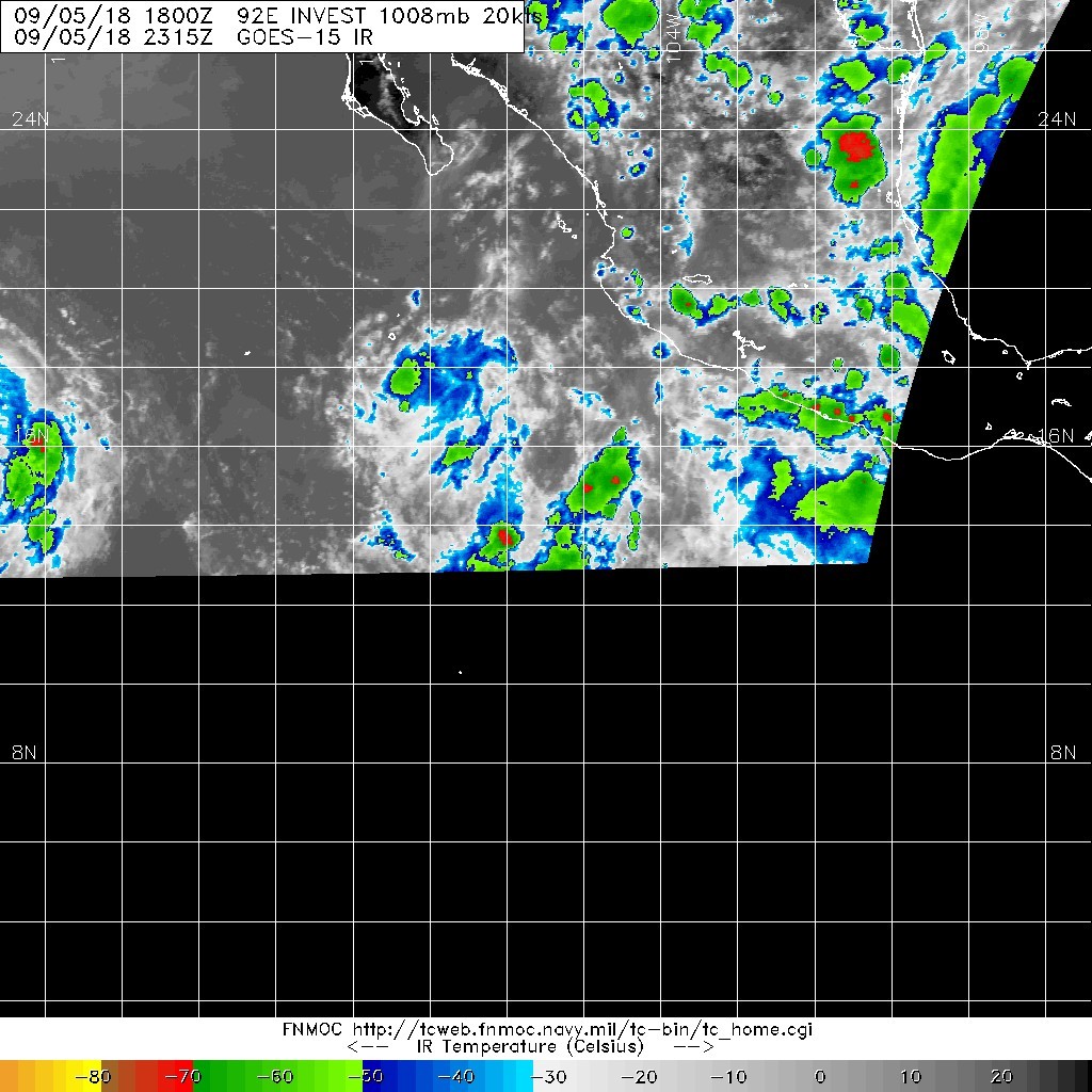
1. An elongated area of low pressure located several hundred miles
south-southwest of the southern tip of Baja California peninsula
continues to produce disorganized shower and thunderstorm activity.
Environmental conditions are expected be conducive for development,
and a tropical depression is likely to form this weekend or early
next week while the system moves slowly west-northwestward away from
the coast of Mexico.
* Formation chance through 48 hours...high...70 percent.
* Formation chance through 5 days...high...90 percent.
1. The broad area of low pressure that NHC has been tracking for a
few days is now located several hundred miles south of the southern
tip of Baja California peninsula. Although the shower activity has
not become any better organized during the past few hours,
environmental conditions appear to be conducive for development. A
tropical depression is likely to form by this weekend or early next
week while the system moves slowly toward the west-northwest at
about 10 mph away from the coast of Mexico.
* Formation chance through 48 hours...medium...50 percent.
* Formation chance through 5 days...high...80 percent.


.png")