開啟輔助訪問
 找回密碼
 立即加入

08E.Douglas 2020首颶 直襲夏威夷 殘餘進入西太平洋

簽到天數: 1650 天

[LV.Master]伴壇終老

2020-7-19 21:24 | 顯示全部樓層
  基本資料  
編號    :08 E
擾動編號日期:2020 07 19 20
撤編日期  :2020 07 30 14
90E.INVEST.25kts.1009mb.15.2N.116.8W

20200719.1300.goes-17.ir.90E.INVEST.25kts.1009mb.15.2N.116.8W.100pc.jpg
  NHC:10%
2. Disorganized showers and thunderstorms located about 700 miles
southwest of the southern tip of the Baja California peninsula are
associated with a tropical wave.  Environmental conditions are
expected to be conducive for gradual development of this system
through the week while it moves west-southwestward and then
westward at about 10 mph.
* Formation chance through 48 hours...low...10 percent.
* Formation chance through 5 days...low...30 percent.

two_pac_2d2.png two_pac_5d2.png

巔峰強度:
東太:115KT/954hPa
中太:105KT/962hPa

評分

參與人數 1水氣能量 +15 +1 收起 理由
king111807 + 15 + 1 熱帶擾動首帖

查看全部評分

回復

使用道具 舉報

簽到天數: 53 天

[LV.5]常住居民I

天篷大元帥|2020-7-31 09:17 | 顯示全部樓層
美國海軍研究實驗室已經解編,
正式宣告道格拉斯偷渡失敗.......
道格拉斯解編.png
回復

使用道具 舉報

簽到天數: 1650 天

[LV.Master]伴壇終老

老農民版夜神月|2020-7-30 16:48 來自手機 | 顯示全部樓層
本帖最後由 老農民版夜神月 於 2020-7-31 00:48 編輯

與JTWC的定位有些許不同,JMA06Z的天氣圖仍將Douglas中心定位於換日線以東
不過由於目前幾乎所有預報都預測Douglas已沒有機會再重新增強,進入了西太後只會更加孱弱並逐漸徹底衰亡
所以看來,也差不多是時候可以跟這個遠赴重洋七千里,從東太一路西行到換日線的系統說聲再見了
20073015.png
08E_gefs_latest (2).png
20200730.0630.himawari-8.ir.08E.DOUGLAS.20kts.1016mb.25.4N.179.4E.100pc.jpg 20200730.0548.noaa19.89rgb.08E.DOUGLAS.30kts.1013mb.25N.178.1W.100pc.jpg
goes17_vis-swir_08E_202007300515.gif

回復

使用道具 舉報

簽到天數: 601 天

[LV.9]以壇為家II

霧峰追風者|2020-7-30 15:05 | 顯示全部樓層
06Z  正式進入西太。
20200730.0630.himawari-8.ir.08E.DOUGLAS.20kts.1016mb.25.4N.179.4E.100pc
20200730.0630.himawari-8.ir.08E.DOUGLAS.20kts.1016mb.25.4N.179.4E.100pc.jpg
回復

使用道具 舉報

簽到天數: 868 天

[LV.10]以壇為家III

jrchang5|2020-7-30 08:16 | 顯示全部樓層
JMA 29/18Z地面天氣圖亦顯示TS Douglas已降為一普通低壓(定位在25N,176W),無緣以TS強度跨入西太。
LOW 1014 HPA AT 25N 176W WNW 20 KT.
Screenshots_2020-07-30-08-01-43.png 20200729.1830.goes-17.vis.2km.08E.DOUGLAS.30kts.1013mb.24.8N.176.4W.pc.jpg
回復

使用道具 舉報

簽到天數: 53 天

[LV.5]常住居民I

天篷大元帥|2020-7-29 22:55 | 顯示全部樓層
雖然對流爆發,不過中太平洋颶風中心仍判
GG
變殘餘低壓,幾乎宣告偷渡無望,不過仍有一絲希望。


原文:
544
WTPA42 PHFO 291450
TCDCP2

Post-Tropical Cyclone Douglas Discussion Number  37
NWS Central Pacific Hurricane Center Honolulu HI   EP082020
500 AM HST Wed Jul 29 2020

A cluster of thunderstorms north of Douglas' center is producing an
impressive amount of lightning this morning, but is not indicative
of system reorganization. While these thunderstorms are indeed
associated with Douglas' deteriorating circulation, they are removed
from the center, and will soon be sheared away by persistent
southerly vertical wind shear. Satellite imagery shows the exposed
low-level circulation center becoming increasingly elongated, while
an earlier ASCAT pass indicated little in the way of westerly flow
in the southern semicircle. Douglas has degenerated into a post-
tropical remnant low (and may already be an open wave) with maximum
winds on the north side estimated to be near 30 kt.  

With Douglas' initial motion vector of 275/20 kt, associated
hazards have moved west of the Papahanaumokuakea Marine National
Monument, and the Tropical Storm Warning has been discontinued. A
strong low-level ridge to the north will steer Douglas rapidly
westward, with the remnant low expected to cross the International
Date Line later today. As the remnant low rounds the ridge, it is
expected to gain some latitude over the next 24 hours or so before
dissipating, in line with global model guidance and the previous
forecast.

This is the last advisory issued by the Central Pacific Hurricane
Center on Douglas. Additional information on this system can be
found in the High Seas Forecasts issued by the National Weather
Service in Honolulu under AWIPS header HFOHSFNP and WMO header
FZPN40 PHFO.


FORECAST POSITIONS AND MAX WINDS

INIT  29/1500Z 24.7N 175.4W   30 KT  35 MPH...POST-TROPICAL
12H  30/0000Z 25.0N 178.6W   30 KT  35 MPH...POST-TROP/REMNT LOW
24H  30/1200Z 25.9N 177.2E   25 KT  30 MPH...POST-TROP/REMNT LOW
36H  31/0000Z...DISSIPATED

$$
Forecaster Birchard
機器翻譯(僅參考):
544
WTPA42 PHFO 291450
TCDCP2

熱帶氣旋道格拉斯討論編號37
NWS檀香山中部太平洋颶風中心HI EP082020
500 AM HST 2020年7月29日星期三

道格拉斯中心以北的雷陣雨
今天早晨產生大量雷電,但並沒有指示
系統重組。儘管這些雷暴確實
與道格拉斯的環流惡化有關,但它們已從
中心移開,不久將通過持續的
南風和垂直風切變而被剪除。衛星圖像顯示暴露的
低層循環中心越來越拉長,而
較早的ASCAT通行證幾乎沒有阻礙
南半圓的西風流動。道格拉斯(Douglas)已退化為
熱帶後的殘餘低點(可能已經是明波),
北側的最大風向估計約為30海裡。  

道格拉斯的初始運動矢量為275/20 kt,相關的
危險已移至Papahanaumokuakea海洋國家
紀念碑以西,並且熱帶風暴警告也已停止。一個
強大的低級別的山脊向北將引導道格拉斯迅速
向西,與殘餘低有望越過國際
日期變更線後的今天。當殘餘的低谷環繞山脊時,它是
與全球模型指南和先前的
預測一致,預計
在消散之前的接下來的24小時左右將有一定的自由度。

這是
道格拉斯中央太平洋颶風中心發布的最新諮詢。有關此系統的其他信息,請
參見由
檀香山國家氣象局發布的“公海預報”,在AWIPS標頭HFOHSFNP和WMO標頭
FZPN40 PHFO下。


預測位置和最大

風速初始化29 / 1500Z 24.7N 175.4W 30 KT 35 MPH ...後熱帶
12H 30 / 0000Z 25.0N 178.6W 30 KT 35 MPH ...後熱帶/短低
24H 30 / 1200Z 25.9N 177.2E 25 KT 30 MPH ...後降/後低
36H 31 / 0000Z ...已分配

$$
預報員比查德


2.jpg
道格拉斯gg.png

點評

已經成為遠洋無害颱,jma也不一定想接手  發表於 2020-7-30 00:41
回復

使用道具 舉報

簽到天數: 1650 天

[LV.Master]伴壇終老

老農民版夜神月|2020-7-29 22:51 | 顯示全部樓層
本帖最後由 老農民版夜神月 於 2020-7-29 22:53 編輯

CPHC29/15Z判定Douglas已減弱為後熱帶氣旋,並對Douglas發出最終報
000
WTPA32 PHFO 291435
TCPCP2

BULLETIN
Post-Tropical Cyclone Douglas Advisory Number  37
NWS Central Pacific Hurricane Center Honolulu HI   EP082020
500 AM HST Wed Jul 29 2020

...DOUGLAS DEGENERATES TO A POST-TROPICAL LOW...
...WILL CROSS THE INTERNATIONAL DATE LINE LATER TODAY...


SUMMARY OF 500 AM HST...1500 UTC...INFORMATION
----------------------------------------------
LOCATION...24.7N 175.4W
ABOUT 1135 MI...1830 KM WNW OF HONOLULU HAWAII
ABOUT 270 MI...435 KM SSE OF MIDWAY ISLAND
MAXIMUM SUSTAINED WINDS...35 MPH...55 KM/H
PRESENT MOVEMENT...W OR 275 DEGREES AT 23 MPH...37 KM/H
MINIMUM CENTRAL PRESSURE...1012 MB...29.89 INCHES


WATCHES AND WARNINGS
--------------------
CHANGES WITH THIS ADVISORY...

The Tropical Storm Warning for portions of the Papahanaumokuakea
Marine National Monument from Maro Reef to Lisianski has been
discontinued.

SUMMARY OF WATCHES AND WARNINGS IN EFFECT...

None.


DISCUSSION AND OUTLOOK
----------------------
At 500 AM HST (1500 UTC), the center of Post-Tropical Cyclone
Douglas was located near latitude 24.7 North, longitude 175.4 West.
The post-tropical cyclone is moving toward the west near 23 mph (37
km/h), and this general motion is expected to continue until Douglas
crosses the International Date Line later today.

Maximum sustained winds are near 35 mph (55 km/h) with higher gusts.
Weakening is forecast, and Douglas is expected to dissipate shortly
after crossing the Date Line.

The estimated minimum central pressure is 1012 mb (29.89 inches).


HAZARDS AFFECTING LAND
----------------------
SURF: Large seas and swells generated by Douglas will impact
portions of the Papahanaumokuakea Marine National Monument west of
Maro Reef today, then diminish tonight.


NEXT ADVISORY
-------------
This is the last public advisory issued by the Central Pacific
Hurricane Center on this system.
Additional information on the
post-tropical low can be found in high seas forecasts issued by the
National Weather Service under AWIPS head HFOHSFNP, WMO header
FZPN40 PHFO, and on the web at https://www.weather.gov/hfo/HSFNP.

$$
Forecaster Birchard
544
WTPA42 PHFO 291450
TCDCP2

Post-Tropical Cyclone Douglas Discussion Number  37
NWS Central Pacific Hurricane Center Honolulu HI   EP082020
500 AM HST Wed Jul 29 2020

A cluster of thunderstorms north of Douglas' center is producing an
impressive amount of lightning this morning, but is not indicative
of system reorganization. While these thunderstorms are indeed
associated with Douglas' deteriorating circulation, they are removed
from the center, and will soon be sheared away by persistent
southerly vertical wind shear. Satellite imagery shows the exposed
low-level circulation center becoming increasingly elongated, while
an earlier ASCAT pass indicated little in the way of westerly flow
in the southern semicircle. Douglas has degenerated into a post-
tropical remnant low (and may already be an open wave) with maximum
winds on the north side estimated to be near 30 kt.  

With Douglas' initial motion vector of 275/20 kt, associated
hazards have moved west of the Papahanaumokuakea Marine National
Monument, and the Tropical Storm Warning has been discontinued. A
strong low-level ridge to the north will steer Douglas rapidly
westward, with the remnant low expected to cross the International
Date Line later today. As the remnant low rounds the ridge, it is
expected to gain some latitude over the next 24 hours or so before
dissipating, in line with global model guidance and the previous
forecast.

This is the last advisory issued by the Central Pacific Hurricane
Center on Douglas. Additional information on this system can be
found in the High Seas Forecasts issued by the National Weather
Service in Honolulu under AWIPS header HFOHSFNP and WMO header
FZPN40 PHFO.


FORECAST POSITIONS AND MAX WINDS

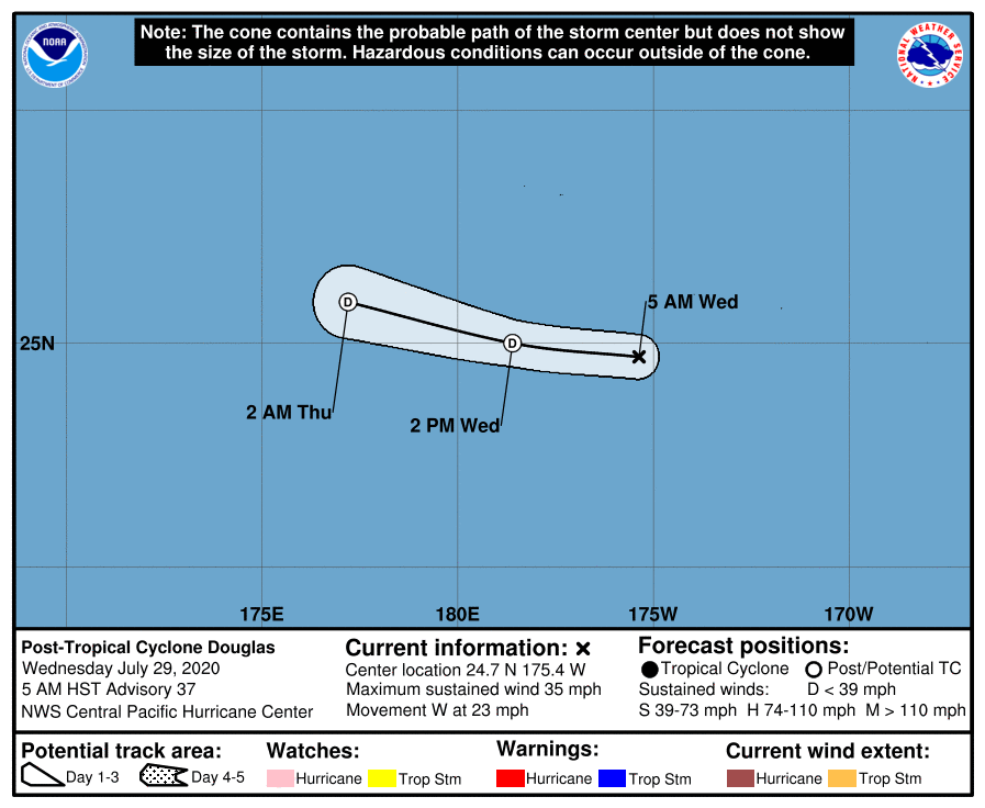
INIT  29/1500Z 24.7N 175.4W   30 KT  35 MPH...POST-TROPICAL
12H  30/0000Z 25.0N 178.6W   30 KT  35 MPH...POST-TROP/REMNT LOW
24H  30/1200Z 25.9N 177.2E   25 KT  30 MPH...POST-TROP/REMNT LOW
36H  31/0000Z...DISSIPATED

$$
Forecaster Birchard
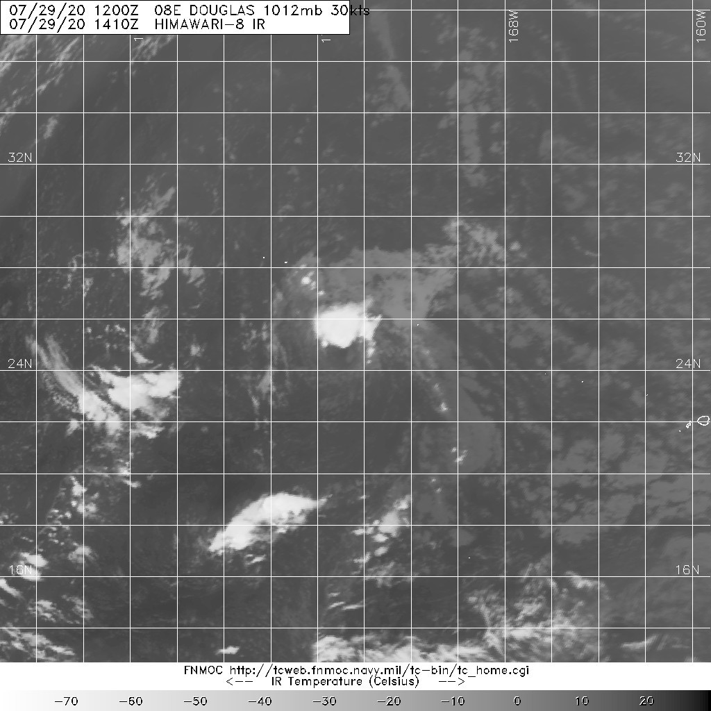
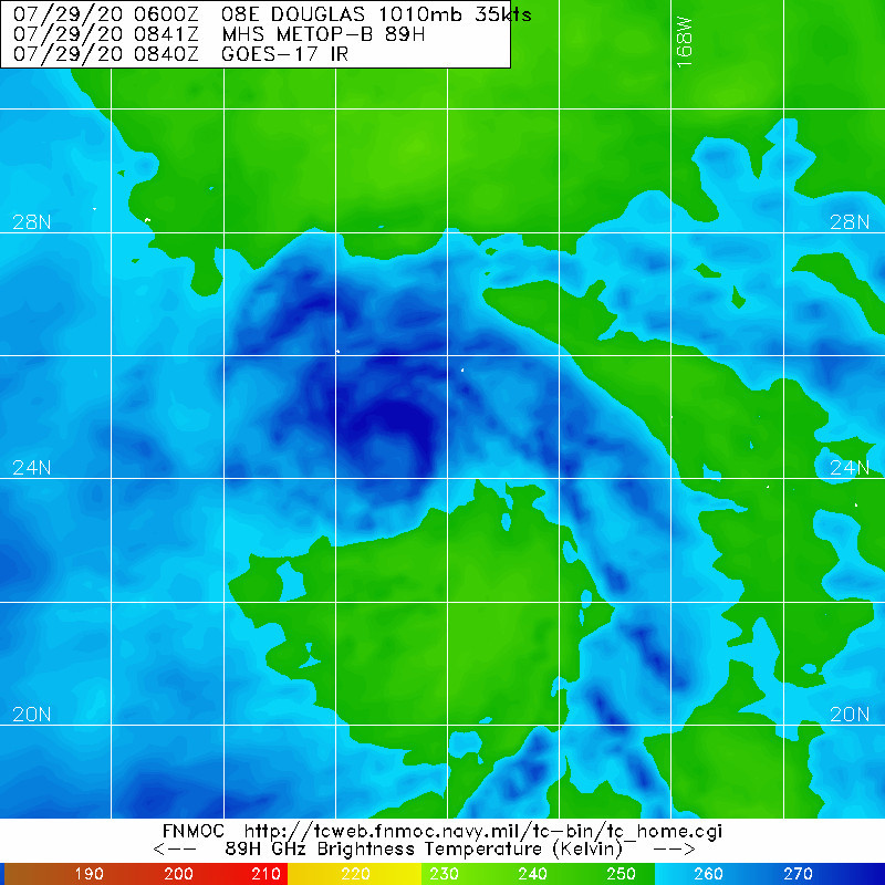
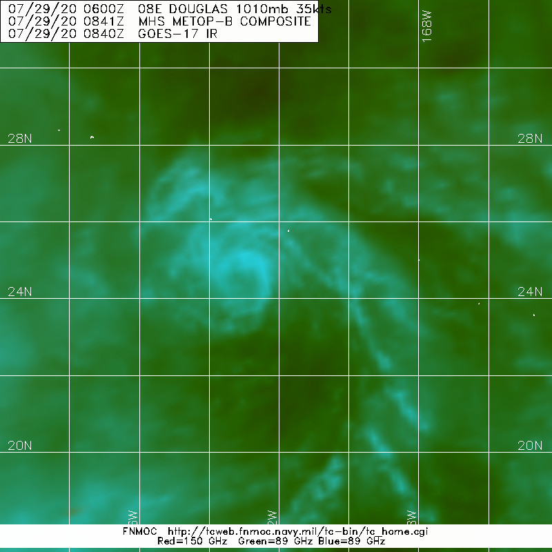
143740_5day_cone_with_line_and_wind.png 20200729.1410.himawari-8.ir.08E.DOUGLAS.30kts.1012mb.24.6N.174.4W.100pc.jpg
20200729.0841.metopb.89h.08E.DOUGLAS.35kts.1010mb.24.6N.172.1W.100pc.jpg 20200729.0841.metopb.89rgb.08E.DOUGLAS.35kts.1010mb.24.6N.172.1W.100pc.jpg
回復

使用道具 舉報

簽到天數: 601 天

[LV.9]以壇為家II

霧峰追風者|2020-7-29 21:18 | 顯示全部樓層
減弱為TD。
20200729.1230.goes17.x.ir1km_bw.08EDOUGLAS.30kts-1012mb-246N-1744W.100pc.jpg |
20200729.1230.goes17.x.ir1km_bw.08EDOUGLAS.30kts-1012mb-246N-1744W.100pc.jpg
回復

使用道具 舉報

1234下一頁
快速回覆
您需要登錄後才可以回帖 登錄 | 立即加入

本版積分規則

本平台僅供學術討論之用,預報應以氣象局為準

威普網站虛擬主機贊助公司

臺灣第一個天氣類型社群平台 即時天氣資訊、精準颱風動態

線上客服
FB傳送訊息
廣告行銷
精準行銷 物超所值
官方粉專
發佈 快速回復 返回頂部 返回列表