簽到天數: 1650 天 [LV.Master]伴壇終老
|
 老農民版夜神月|2020-7-23 17:37
|
顯示全部樓層
NHC23/09Z升格MH(C3以上颶風),定強105KT,並預測12H內將達110KT
WTPZ43 KNHC 230842
TCDEP3
Hurricane Douglas Discussion Number 12
NWS National Hurricane Center Miami FL EP082020
1100 PM HST Wed Jul 22 2020
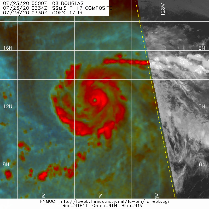
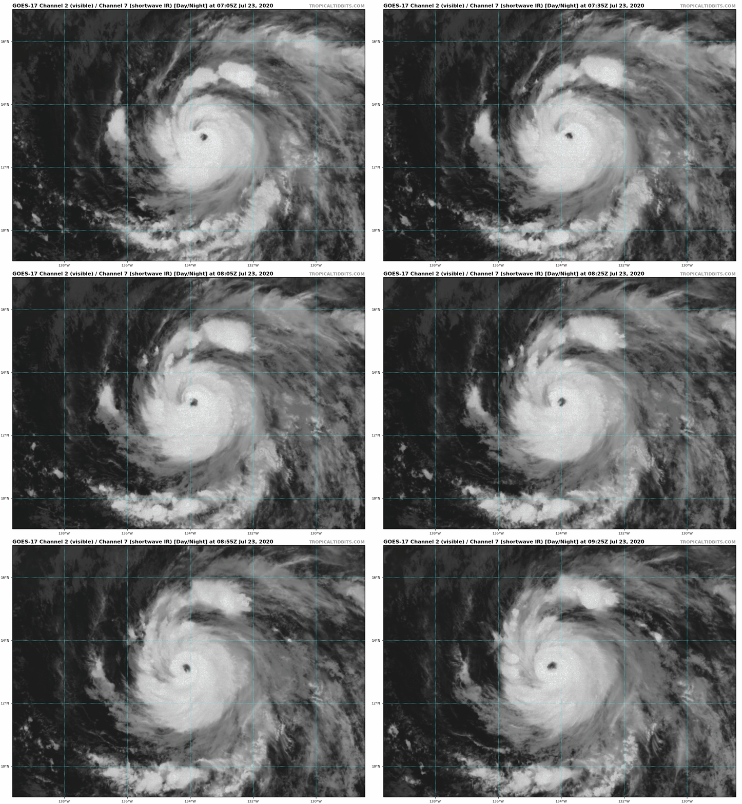
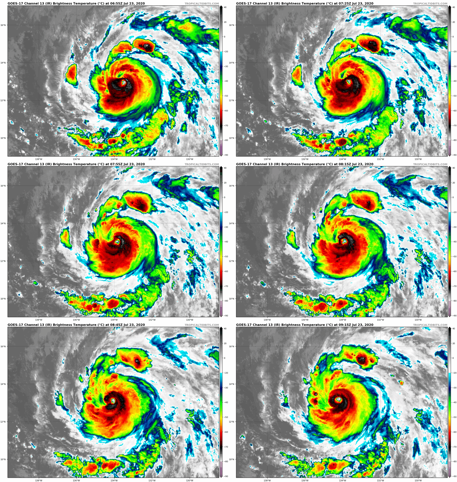
Douglas has rapidly intensified since earlier today, with satellite
images showing a ragged, but nearly clear eye surrounded by cold
cloud tops of -70 C. There appears to be a little dry air intrusion
across the northern portion of the circulation, which is limiting
the amount of deep convection wrapping around that part of the eye.
Both Dvorak intensity estimates from TAFB and SAB have increased to
5.5/100 kt, while the ADT and SATCON estimate averages have
increased to 105 kt. Since the cyclone's appearance has improved
slightly since these estimates arrived, the advisory initial
intensity has been set at 105 kt, making Douglas a major hurricane.
The environmental conditions supporting the rapid intensification
appear at their best at this time as the cyclone is over SSTs of
over 28 C, with low wind shear in a moist air mass. If the cyclone
can fight off the dry air in the northern semicircle, some
additional strengthening is possible, especially early Thursday.
However, Douglas should be gradually moving into a less hospitable
environment for strengthening over the next few days, and in 36 h
the cyclone is forecast to cross the 26 C SST isotherm and into a
region where the 500-700 mb relative humidity is less than 60
percent. Later on in the forecast period, wind shear is also
expected to be on the increase. These factors should cause the
cyclone to gradually weaken beginning Thursday night. Douglas is
expected to be at or near hurricane intensity as it approaches the
Hawaiian Islands on Sunday, and all interests there should monitor
forecasts as they evolve over the next few days. The NHC forecast
was adjusted higher in the first 12 h based on the initial
intensity, and is very close to the previous forecast after that
time. This intensity forecast closely follows the various consensus
aids.
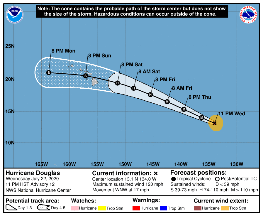
The initial motion is west-northwest or 295/15. Douglas should
continue on a general west-northwestward motion for the next few
days, steered by a large mid-level ridge extending across much of
the central and eastern North Pacific. The cyclone is then forecast
to turn more toward the west late in the forecast period as it
moves near the Hawaiian Islands. The track guidance is tightly
clustered and the new NHC is little changed from the previous one.
Key Messages:
1. Douglas is expected to move near or over portions of the
Hawaiian Islands this weekend, and there is an increasing chance
that strong winds and heavy rainfall could affect portions
of the state beginning on Sunday. Interests on the Hawaiian
Islands should continue to monitor the progress of Douglas and the
official forecasts as they evolve over the next few days.
FORECAST POSITIONS AND MAX WINDS
INIT 23/0900Z 13.1N 134.0W 105 KT 120 MPH
12H 23/1800Z 14.0N 136.3W 110 KT 125 MPH
24H 24/0600Z 15.3N 139.5W 110 KT 125 MPH
36H 24/1800Z 16.5N 142.5W 105 KT 120 MPH
48H 25/0600Z 17.6N 145.5W 90 KT 105 MPH
60H 25/1800Z 18.6N 148.5W 80 KT 90 MPH
72H 26/0600Z 19.4N 151.4W 70 KT 80 MPH
96H 27/0600Z 20.5N 157.1W 55 KT 65 MPH
120H 28/0600Z 21.0N 163.7W 45 KT 50 MPH
$$
Forecaster Latto


|
|