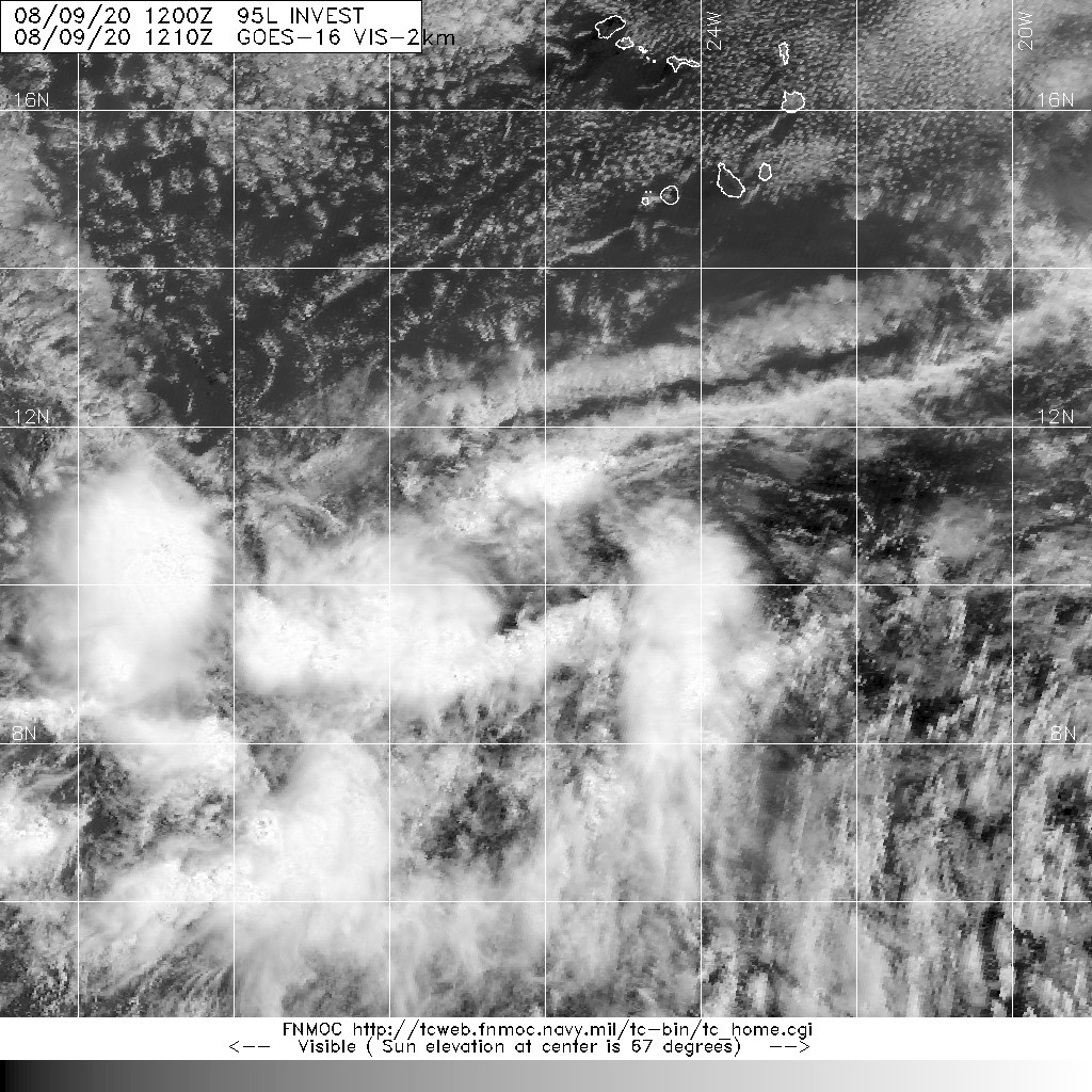
開啟輔助訪問
 找回密碼
 立即加入

11L.Josephine 環境惡劣

查看數: 7865 評論數: 9 收藏 0切换到帖子模式
    組圖打開中,請稍候......
發佈時間: 2020-8-9 20:44

正文摘要:

基本資料   編號    :11 L 擾動編號日期:2020 年 08 月 09 日 20 時 撤編日期  :2020 年 08 月 17 日 05 時 95L INVEST 200809 1200   ATL10.5N 26W 25 NA ...

老農民版夜神月 發表於 2020-8-17 05:49
NHC21Z判定11L已減弱成為殘餘
000
WTNT41 KNHC 162033
TCDAT1

Remnants Of Josephine Discussion Number  21
NWS National Hurricane Center Miami FL       AL112020
500 PM AST Sun Aug 16 2020

The low-level swirl seen in visible satellite imagery has become
less defined this afternoon, and ASCAT surface wind data that
arrived shortly after the release of the previous advisory indicated
that Josephine had degenerated into a trough of low pressure.  As a
result, this will be the final NHC advisory on this system.  The
ASCAT revealed a small area of 30-kt winds along the northeast side
of the trough axis, and that will be the initial wind speed for
this advisory.  The remnants are forecast to continue encountering
a hostile upper-level wind environment over the next couple of days
and re-generation of the system is not expected during that time.
The strong upper-level winds are forecast to decrease later in the
week, but it appears that there will not be much left of the system
to take advantage of those conditions.

The remnants are moving west-northwestward at 10 kt, and should
turn northwestward and northward over the next couple of days as a
low- to mid-level trough moves near the southeastern U.S. coast.

This is the last NHC advisory on this system.  Future information
can be found in High Seas Forecasts issued by the National Weather
Service, under AWIPS header NFDHSFAT1, WMO header FZNT01 KWBC, and
online at ocean.weather.gov/shtml/NFDHSFAT1.php


FORECAST POSITIONS AND MAX WINDS

INIT  16/2100Z 20.9N  65.8W   30 KT  35 MPH
12H  17/0600Z...DISSIPATED

$$
Forecaster Brown

203509_5day_cone_no_line_and_wind.png 20200816.2040.goes-16.vis.2km.11L.JOSEPHINE.30kts.1010mb.20.6N.65.4W.pc.jpg
20200816.2034.f18.91pct91h91v.11L.JOSEPHINE.30kts.1010mb.20.6N.65.4W.055pc.jpg
霧峰追風者 發表於 2020-8-13 23:02
本帖最後由 霧峰追風者 於 2020-8-13 23:04 編輯
000
WTNT41 KNHC 131453
TCDAT1

Tropical Storm Josephine Discussion Number   8
NWS National Hurricane Center Miami FL       AL112020
1100 AM AST Thu Aug 13 2020

A just-received ASCAT overpass showed an area of 35-40 kt winds
about 70 n mi north of the center of Tropical Depression Eleven,
and based on this the cyclone is being upgraded to Tropical Storm
Josephine with an initial intensity of 40 kt.  Satellite imagery
shows that the convective pattern associated with Josephine has
become a little better organized since the last advisory, with a
ragged central convective feature and a weak band in the northern
semicircle.

The initial motion is now west-northwestward or 295/13 kt.  
Josephine should continue this motion for the next several days as
it moves toward a weakness in the western portion of the Atlantic
subtropical ridge.  The global models forecast the western end of
the ridge to weaken even more after 72-96 h, which should cause
the cyclone, or what is left of it by that time, to turn
northwestward.  The track guidance is tightly clustered, and the
new forecast track lies a little to the right of the previous track
and a little to the left of the consensus models.

Some additional strengthening appears likely during the next 24-  
36 h as Josephine moves through an environment of light vertical
wind shear.  After that, the cyclone is expected to encounter
moderate to strong southwesterly shear as it approaches an
upper-level trough over the southwestern Atlantic, which should
cause at least some weakening.  The new intensity forecast is
adjusted upward for the first 72 h based on the current intensity.  
After 72 h, it shows weakening similar to the previous forecast, but
not as drastic as the global models that show the storm degenerating
to a tropical wave before 120 h.

Josephine is the earliest tenth tropical storm of record in the
Atlantic, with the next earliest tenth storm being Tropical Storm
Jose on August 22, 2005.


FORECAST POSITIONS AND MAX WINDS

INIT  13/1500Z 13.7N  49.2W   40 KT  45 MPH
12H  14/0000Z 14.5N  51.1W   45 KT  50 MPH
24H  14/1200Z 15.8N  53.6W   50 KT  60 MPH
36H  15/0000Z 17.1N  56.3W   50 KT  60 MPH
48H  15/1200Z 18.5N  58.9W   50 KT  60 MPH
60H  16/0000Z 19.9N  61.3W   45 KT  50 MPH
72H  16/1200Z 21.3N  63.6W   40 KT  45 MPH
96H  17/1200Z 24.0N  67.0W   30 KT  35 MPH
120H  18/1200Z 27.0N  68.0W   25 KT  30 MPH

$$
145542_5day_cone_no_line_and_wind.png 20200813.1430.goes-16.vis.2km.11L.ELEVEN.30kts.1007mb.13.4N.48.6W.pc.jpg
霧峰追風者 發表於 2020-8-13 08:13
強度維持30KT,巔峰上望50KT。
000
WTNT41 KNHC 122042
TCDAT1

Tropical Depression Eleven Discussion Number   5
NWS National Hurricane Center Miami FL       AL112020
500 PM AST Wed Aug 12 2020

Satellite imagery this afternoon shows some changes in the
convection associated with Tropical Depression Eleven, as the
showers and thunderstorms are now occuring more in curved bands and
less in sheared bursts.  This is likely due to the southeasterly
shear which has been affecting the depression finally letting up.  
However, this change has not caused the satellite intensity
estimates to change significantly since the last advisory, so the
initial intensity is again 30 kt.

The initial motion remains a little north of due west, or
280/13 kt. There is almost no change to the forecast philosophy and
little change to the forecast track since the last advisory.  A
westward motion is expected to continue for another 6-12 h due to
easterly flow on the south side of a strong subtropical ridge
situated to the north of the cyclone.  After that, the global
models forecast a slight weakness to develop within the ridge,
allowing the cyclone to turn west-northwestward and continue that
motion through 96 h.  Between 96-120 h, the western end of the
ridge is forecast to weaken more, which should cause a turn toward
the northwest.  The new NHC forecast track remains just to the left
of the various consensus models.

The cyclone should be in an environment of light to moderate shear
through the next 48 h or so.  The intensity forecast again calls
for a peak intensity of 50 kt during this time, which is at the
high end of the intensity guidance.  After 60 h, the cyclone is
expected to encounter moderate to strong southwesterly shear
associated with a large upper-level trough over the southwestern
Atlantic.  This should cause at least steady weakening, and several
of the global models continue to forecast the cyclone to degenerate
to a tropical wave before 120 h.  The new intensity forecast again
expects the system to last longer than the global models, but still
shows weakening due to the shear after 72 h.  The new forecast has
only minor changes from the previous forecast.


FORECAST POSITIONS AND MAX WINDS

INIT  12/2100Z 12.7N  45.7W   30 KT  35 MPH
12H  13/0600Z 13.0N  47.5W   35 KT  40 MPH
24H  13/1800Z 14.0N  49.9W   40 KT  45 MPH
36H  14/0600Z 15.2N  52.2W   45 KT  50 MPH
48H  14/1800Z 16.6N  54.8W   50 KT  60 MPH
60H  15/0600Z 17.8N  57.3W   50 KT  60 MPH
72H  15/1800Z 19.1N  59.7W   50 KT  60 MPH
96H  16/1800Z 21.5N  64.5W   40 KT  45 MPH
120H  17/1800Z 24.5N  67.0W   30 KT  35 MPH

$$
Forecaster Beven
204346_5day_cone_no_line_and_wind.png 20200812.2340.goes-16.ir.11L.ELEVEN.30kts.1007mb.12.5N.45W.100pc.jpg
老農民版夜神月 發表於 2020-8-12 04:44
NHC21Z升格TD11L,上望45KT
000
WTNT41 KNHC 112032
TCDAT1

Tropical Depression Eleven Discussion Number   1
NWS National Hurricane Center Miami FL       AL112020
500 PM AST Tue Aug 11 2020

Visible satellite imagery and ASCAT-C data from earlier in the day
have shown that the area of low pressure NHC has been monitoring
over the tropical Atlantic has developed a less-elongated
circulation with a well-defined center.  For the most part, deep
convection has persisted with the system since about this time
yesterday, save a brief period of warming cloud tops this morning.
The low now meets the criteria of a tropical cyclone, and
advisories have been initiated on Tropical Depression Eleven with
30-kt winds, in line with the latest Dvorak Current Intensity
numbers from TAFB and SAB.

The depression is moving westward, or 280/14 kt, to the south of a
large mid-tropospheric high centered over the central Atlantic.
This pattern is expected to evolve rather quickly, with a break
developing in the ridge over the central Atlantic by 48 hours.
This change should allow the depression to begin making more
poleward progress, moving west-northwestward from 36 hours until
the end of the forecast period.  The track models are in good
agreement on this scenario, as well as the system's forward speed,
and bring the center of the cyclone near or just to the north of
the northern Leeward Islands in 4-5 days.  This first NHC forecast
lies just to the north of the multi-model consensus cluster
through day 3, out of respect for the northern-lying ECMWF model,
and then is close to HCCA on days 4 and 5.

Conventional satellite imagery and Saharan Air Layer analyses
suggest that the center of the depression is being shielded from
much drier air to its north and west.  However, as has been the
case for a few days, at least 15 kt of easterly shear has been
pushing deep convection to the western side of the circulation.
This shear is expected to decrease over the next day or two, which
should allow for gradual strengthening to begin by 36 hours, and a
peak in the cyclone's intensity should occur in about 3 days.  For
this period, the NHC intensity forecast is a little above HCCA and
the IVCN intensity consensus.  After that time, westerly or
southwesterly shear is forecast to develop and increase to 20-30 kt
by days 4 and 5, which is likely to induce significant weakening.
In fact, it's notable that the conditions become hostile enough that
the global models are showing the system opening up into a trough
near the northern Leeward Islands by day 5, which is a plausible
alternate scenario.


FORECAST POSITIONS AND MAX WINDS

INIT  11/2100Z 11.7N  40.0W   30 KT  35 MPH
12H  12/0600Z 12.0N  42.1W   30 KT  35 MPH
24H  12/1800Z 12.4N  44.5W   30 KT  35 MPH
36H  13/0600Z 13.0N  46.9W   35 KT  40 MPH
48H  13/1800Z 13.9N  49.4W   40 KT  45 MPH
60H  14/0600Z 15.1N  51.8W   45 KT  50 MPH
72H  14/1800Z 16.4N  54.3W   45 KT  50 MPH
96H  15/1800Z 18.5N  59.5W   40 KT  45 MPH
120H  16/1800Z 21.0N  64.0W   35 KT  40 MPH

$$
Forecaster Berg
203348_5day_cone_with_line_and_wind.png goes16_vis_95L_202008111325.gif 20200811.1609.gw1.89pct89h89v.95L.INVEST.30kts.1007mb.11.3N.38.2W.82pc.jpg

評分

參與人數 1水氣能量 +15 收起 理由
king111807 + 15 升格11L

查看全部評分

老農民版夜神月 發表於 2020-8-12 00:53
本帖最後由 老農民版夜神月 於 2020-8-12 01:03 編輯

支持發展至TS以上強度的模式相較於之前有略為增多,FWC-N發布TCFA
WTNT21 KNGU 111400
SUBJ/TROPICAL CYCLONE FORMATION ALERT//
RMKS/1. FORMATION OF A SIGNIFICANT TROPICAL CYCLONE IS POSSIBLE
WITHIN 100 NM EITHER SIDE OF A LINE FROM 11.2N 37.7W TO 12.8N 42.6W
WITHIN THE NEXT 24 HOURS. AVAILABLE DATA DOES NOT JUSTIFY
ISSUANCE OF NUMBERED TROPICAL CYCLONE WARNINGS AT THIS TIME.
WINDS IN THE AREA ARE ESTIMATED TO BE 20 TO 25 KNOTS. METSAT
IMAGERY AT 111200Z INDICATES THAT A CIRCULATION CENTER IS LOCATED
NEAR 11.0N 38.0W. THE SYSTEM IS MOVING WEST-NORTHWESTWARD AT 12
KNOTS.
2. SHOWERS AND THUNDERSTORMS ASSOCIATED WITH A PARTIALLY EXPOSED
SURFACE CIRCULATION, LOCATED ABOUT 900 MILES WEST-SOUTHWEST OF THE
CABO VERDE ISLANDS, HAVE BECOME BETTER ORGANIZED OVERNIGHT. UPPER
LEVEL-WINDS ARE EXPECTED TO BECOME MORE FAVORABLE WITHIN THE NEXT
12 HOURS OR SO AND A TROPICAL DEPRESSION IS LIKELY TO FORM LATER
TODAY OR TONIGHT AS IT MOVES WEST-NORTHWESTWARD AT 10 TO 12 KT.
3. THIS ALERT WILL BE REISSUED, UPGRADED TO WARNING OR CANCELLED
BY 121400Z.//

al952020.20200811140408.gif 20200811.1530.msg-4.vis.95L.INVEST.30kts.1007mb.11.3N.38.2W.100pc.jpg
95L_intensity_latest.png

評分

參與人數 1水氣能量 +15 收起 理由
king111807 + 15 TCFA

查看全部評分

老農民版夜神月 發表於 2020-8-11 14:53
NHC展望提升至High,70%
1. Thunderstorm activity associated with a large low pressure system
located more than 800 miles west-southwest of the Cabo Verde Islands
has increased and become a little better organized over the past
several hours. Environmental conditions are expected to be conducive
for development to occur, and a tropical depression is likely to
form during the next day or so while the disturbance moves westward
to west-northwestward at around 15 mph across the tropical Atlantic.
Conditions are forecast to become less conducive for development by
the end of the week.
* Formation chance through 48 hours...high...70 percent.
* Formation chance through 5 days...high...70 percent.
two_atl_2d1 (4).png 95L_gefs_latest.png
king111807 發表於 2020-8-10 20:12
NHC展望提升至60%
1. Showers and thunderstorms associated with a tropical wave and broad
area of low pressure located about 600 miles west-southwest of the
Cabo Verde Islands have changed little in organization since
yesterday.  Environmental conditions are expected to be somewhat
conducive for development to occur, and a tropical depression could
form during the next day or two while the disturbance moves
generally westward to west-northwestward at 10 to 15 mph across the
tropical Atlantic.  Conditions are forecast to become less
conducive for development by the end of the week.
* Formation chance through 48 hours...medium...60 percent.
* Formation chance through 5 days...medium...60 percent.
two_atl_2d1.png

本平台僅供學術討論之用,預報應以氣象局為準

威普網站虛擬主機贊助公司

臺灣第一個天氣類型社群平台 即時天氣資訊、精準颱風動態

線上客服
FB傳送訊息
廣告行銷
精準行銷 物超所值
官方粉專
發佈 快速回復 返回頂部 返回列表