2. An elongated area of low pressure near the coast of south-central
Mexico continues to produce disorganized showers and thunderstorms.
Development of this system has become unlikely due to unfavorable
upper-level winds and close proximity to land. Regardless of
development, areas of heavy rainfall and flash flooding are likely
in southeastern Mexico and northern Central America during the next
several days.
* Formation chance through 48 hours...low...20 percent.
* Formation chance through 5 days...low...20 percent.
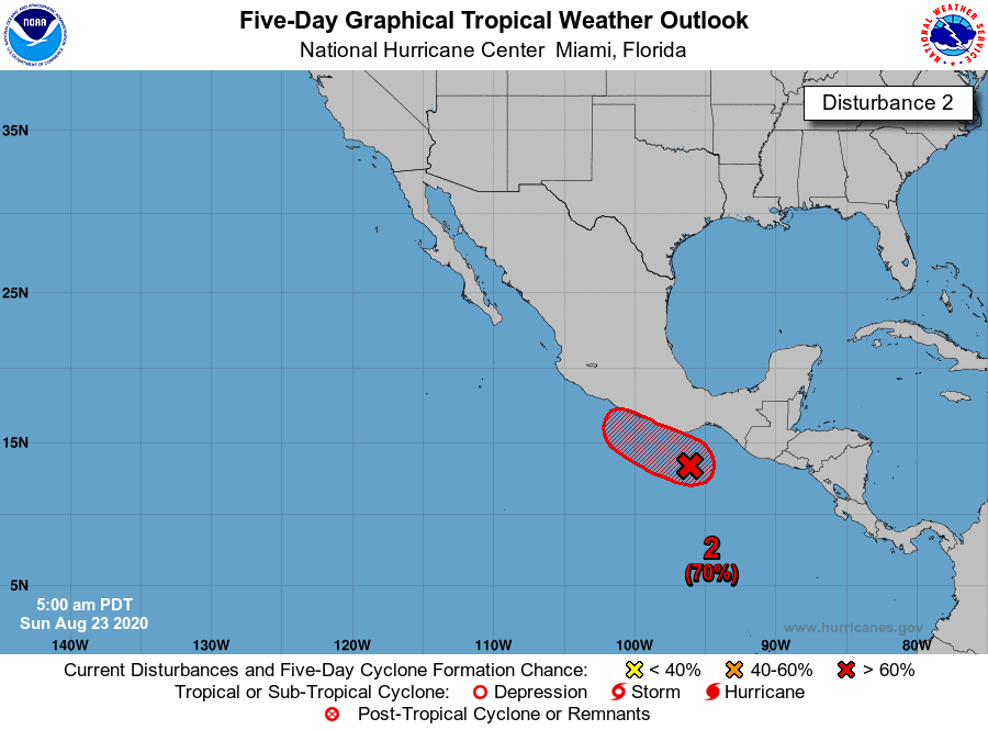
2. A small low pressure area located a couple of hundred miles
southwest of the Gulf of Tehuantepec continues to produce
disorganized shower and thunderstorm activity. Conditions appear
conducive for additional development of this system if it does not
move inland over Mexico, and a tropical depression is likely to form
within the next couple of days while it moves slowly northwestward,
near or parallel to the southwestern coast of Mexico. Regardless of
development, areas of heavy rainfall and flash flooding are likely
in southeastern Mexico and northern Central America during the next
several days.
* Formation chance through 48 hours...high...70 percent.
* Formation chance through 5 days...high...80 percent.