開啟輔助訪問
 找回密碼
 立即加入

20L.Teddy 轉化溫低

簽到天數: 1650 天

[LV.Master]伴壇終老

老農民版夜神月|2020-9-14 18:58 | 顯示全部樓層
本帖最後由 老農民版夜神月 於 2020-9-14 19:08 編輯

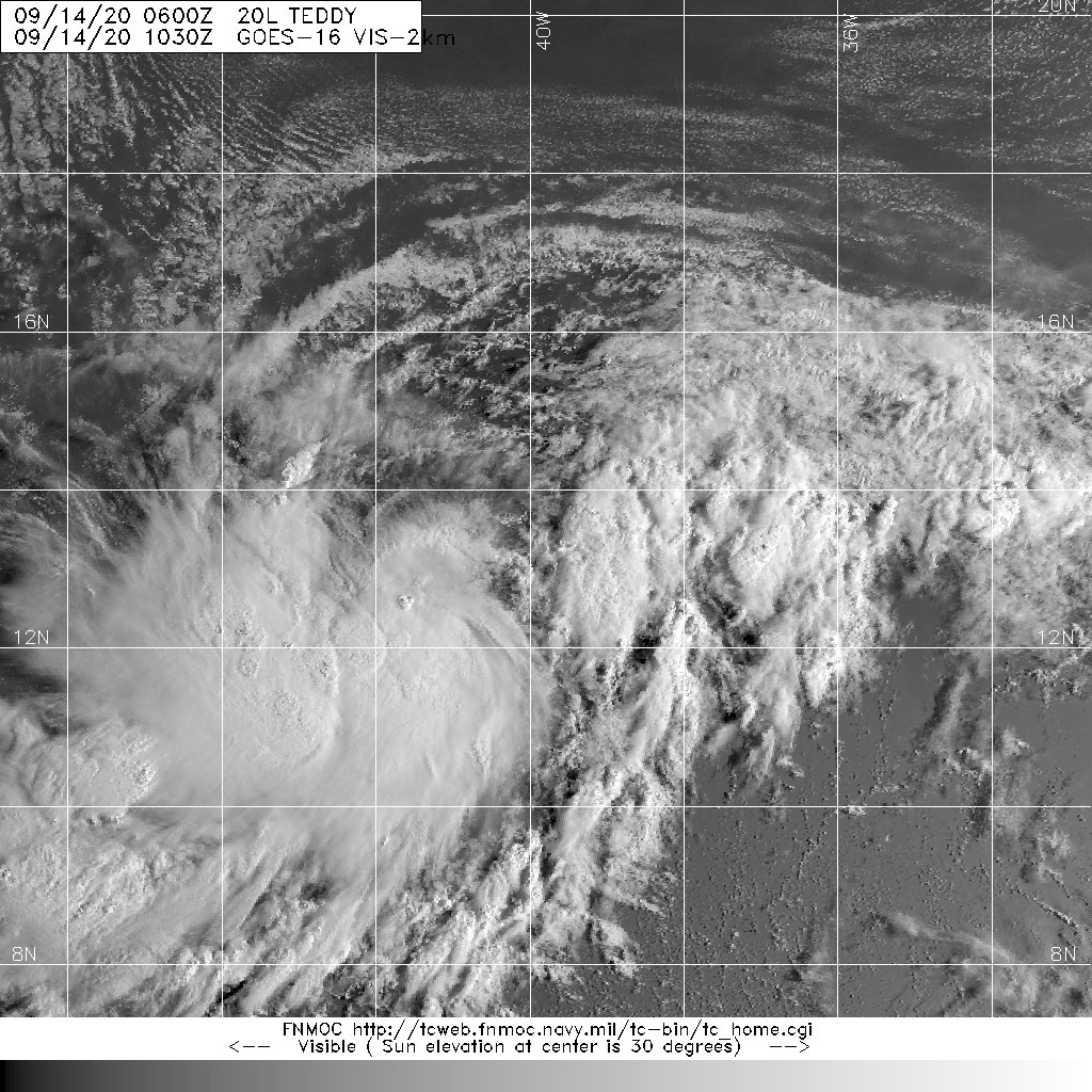
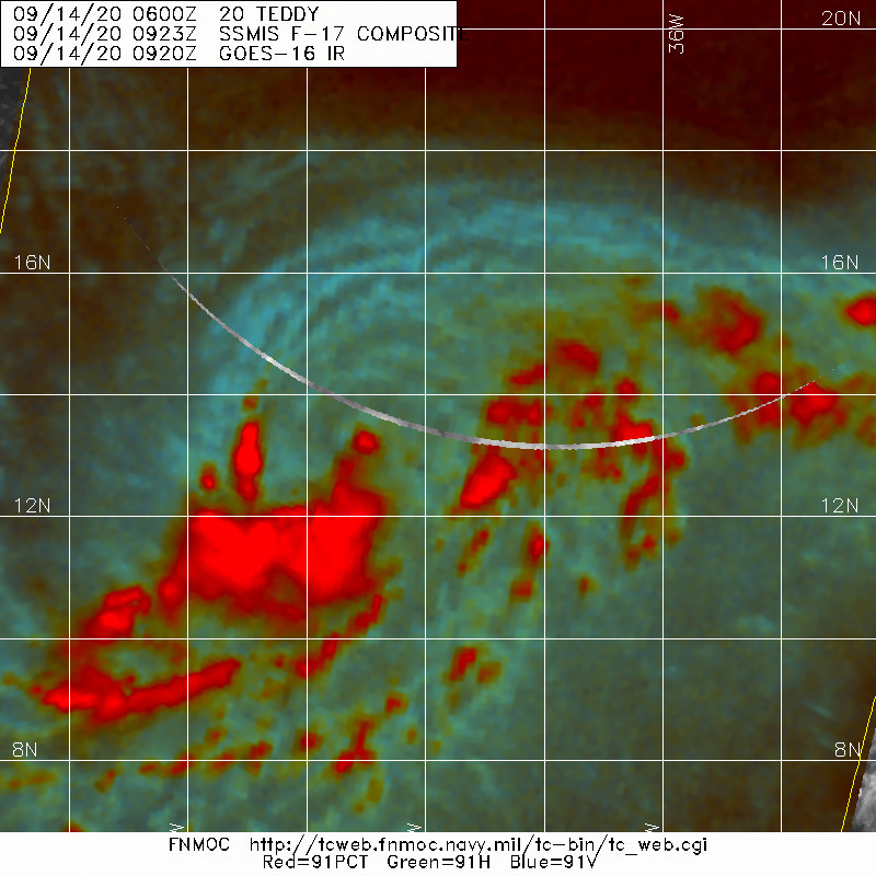
09Z升格TS,命名Teddy,上望100KT
000
WTNT45 KNHC 140859
TCDAT5

Tropical Storm Teddy Discussion Number   7
NWS National Hurricane Center Miami FL       AL202020
500 AM AST Mon Sep 14 2020

Earlier ASCAT data indciated peak winds of 33 kt in the northwestern
quadrant of the depression. Since then, convection has increased and
so have the various satellite intensity estimates. The initial
intensity is increased to 35 kt based on the ASCAT data, and
satellite estimates of T3.5/35 kt from TAFB and 38 kt from UW-CIMSS
SATCON. This makes Tropical Storm Teddy the earliest 19th named
storm, besting the unnamed tropical storm on October 4, 2005.

The initial motion estimate is 285/12 kt. A deep-layer subtropical
ridge positioned over the central Atlantic should keep Teddy moving
west-northwestward for the next couple of days. Thereafter, the
ridge is expected to shift northward and eastward, and the
strengthening cyclone is forecast to turn northwestward around the
western periphery of the ridge. The latest NHC track guidance is
general agreement on this developing track scenario, and the new
official forecast track is similar to the previous one and lies down
the middle of the guidance envelope, close to the consensus model
tracks.

Teddy will have several days to strengthen over very warm ocean
temperatures and within a light vertical wind shear regime. The
only hindrance to intensification will be intermittent intrusions  
of dry mid-level air that will briefly disrupt the inner-core
convective structure. The NHC intensity forecast remains unchanged
and brings Teddy major hurricane strength by the middle of the week.
Some of the dynamical hurricane models continue to indicate that
Teddy could strengthen faster than that, but I can't bear to make
that forecast at this time.

FORECAST POSITIONS AND MAX WINDS

INIT  14/0900Z 13.4N  40.4W   35 KT  40 MPH
12H  14/1800Z 13.8N  42.4W   40 KT  45 MPH
24H  15/0600Z 14.3N  44.8W   50 KT  60 MPH
36H  15/1800Z 15.0N  46.7W   65 KT  75 MPH
48H  16/0600Z 15.9N  48.2W   75 KT  85 MPH
60H  16/1800Z 16.9N  49.5W   85 KT 100 MPH
72H  17/0600Z 18.3N  50.8W   95 KT 110 MPH
96H  18/0600Z 21.0N  53.1W  100 KT 115 MPH
120H  19/0600Z 23.9N  55.6W  100 KT 115 MPH

$$
Forecaster Stewart
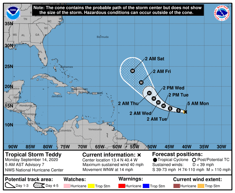
091902_5day_cone_no_line_and_wind.png 20200914.1030.goes-16.vis.2km.20L.TEDDY.35kts.1004mb.13.3N.39.8W.pc.jpg 20200914.0923.f17.91pct91h91v.20L.TEDDY.35kts.1004mb.13.3N.39.8W.100pc.jpg
回復

使用道具 舉報

簽到天數: 1650 天

[LV.Master]伴壇終老

老農民版夜神月|2020-9-13 03:28 | 顯示全部樓層
NHC升格20L
AL, 20, 2020091218, , BEST, 0, 112N, 332W, 30, 1005, LO, 34
Potential Tropical Cyclone TWENTY
As of 18:00 UTC Sep 12, 2020:

Location: 11.2°N 33.2°W
Maximum Winds: 30 kt
Minimum Central Pressure: 1005 mb
Environmental Pressure: 1009 mb
Radius of Circulation: 150 nm
Radius of Maximum wind: 110 nm

20200912.1850.goes-16.vis.2km.20L.TWENTY.30kts.1005mb.11.2N.33.2W.pc.jpg 20200912.1836.f16.91h.20L.TWENTY.30kts.1005mb.11.2N.33.2W.075pc.jpg
20200912.1836.f16.91pct91h91v.20L.TWENTY.30kts.1005mb.11.2N.33.2W.075pc.jpg
回復

使用道具 舉報

簽到天數: 1650 天

[LV.Master]伴壇終老

老農民版夜神月|2020-9-12 04:17 | 顯示全部樓層
FWC-N發布TCFA
WTNT22 KNGU 111900
SUBJ/TROPICAL CYCLONE FORMATION ALERT (95L)//
REF/A/FLEWEACEN NORFOLK VA/111800Z SEP 20//
AMPN/REF A IS TROPICAL CYCLONE FORMATION ALERT 96L
(WTNT21 KNGU 111800)//
RMKS/1.FORMATION OF A SIGNIFICANT
TROPICAL CYCLONE IS POSSIBLE WITHIN
100 NM EITHER SIDE OF A LINE FROM 11.3N 27.3W TO 12.4N 32.5W
WITHIN THE NEXT 24 HOURS. AVAILABLE DATA DOES NOT JUSTIFY
ISSUANCE OF NUMBERED TROPICAL CYCLONE WARNINGS AT THIS TIME.
WINDS IN THE AREA ARE ESTIMATED TO BE 25 KNOTS. METSAT
IMAGERY AT 111900Z INDICATES THAT A CIRCULATION CENTER IS LOCATED
NEAR 11.3N 27.3W. THE SYSTEM IS MOVING WESTWARD AT 13 KNOTS.
2.REMARKS: A LARGE AREA OF DISORGANIZED SHOWERS AND THUNDERSTORMS
A FEW HUNDRED MILES SOUTH-SOUTHWEST OF THE CABO VERDE ISLANDS
IS ASSOCIATED WITH A BROAD AREA OF LOW PRESSURE. ENVIRONMENTAL
CONDITIONS ARE MARGINALLY CONDUCIVE FOR DEVELOPMENT OF THIS SYSTEM
AND A TROPICAL DEPRESSION IS LIKELY TO FORM DURING THE NEXT 24
HOURS AS IT MOVES WESTWARD AT 10 TO 15 KT OVER THE EASTERN TROPICAL
ATLANTIC.
3.THIS ALERT WILL BE REISSUED, UPGRADED TO WARNING OR CANCELLED
BY 121900Z.
4.SEE REF A FOR DETAILS ON A TROPICAL CYCLONE FORMATION ALERT 96L
LOCATED NEAR 25.0N 78.0W//

al952020.gif LATEST.jpg
20200911.1823.f18.91pct91h91v.95L.INVEST.25kts.1008mb.11.3N.27.3W.100pc.jpg

評分

參與人數 1水氣能量 +15 收起 理由
king111807 + 15 TCFA

查看全部評分

回復

使用道具 舉報

12
快速回覆
您需要登錄後才可以回帖 登錄 | 立即加入

本版積分規則

本平台僅供學術討論之用,預報應以氣象局為準

威普網站虛擬主機贊助公司

臺灣第一個天氣類型社群平台 即時天氣資訊、精準颱風動態

線上客服
FB傳送訊息
廣告行銷
精準行銷 物超所值
官方粉專
發佈 快速回復 返回頂部 返回列表