簽到天數: 1650 天 [LV.Master]伴壇終老
|
 老農民版夜神月|2021-9-12 16:39
|
顯示全部樓層
本帖最後由 老農民版夜神月 於 2021-9-12 16:45 編輯
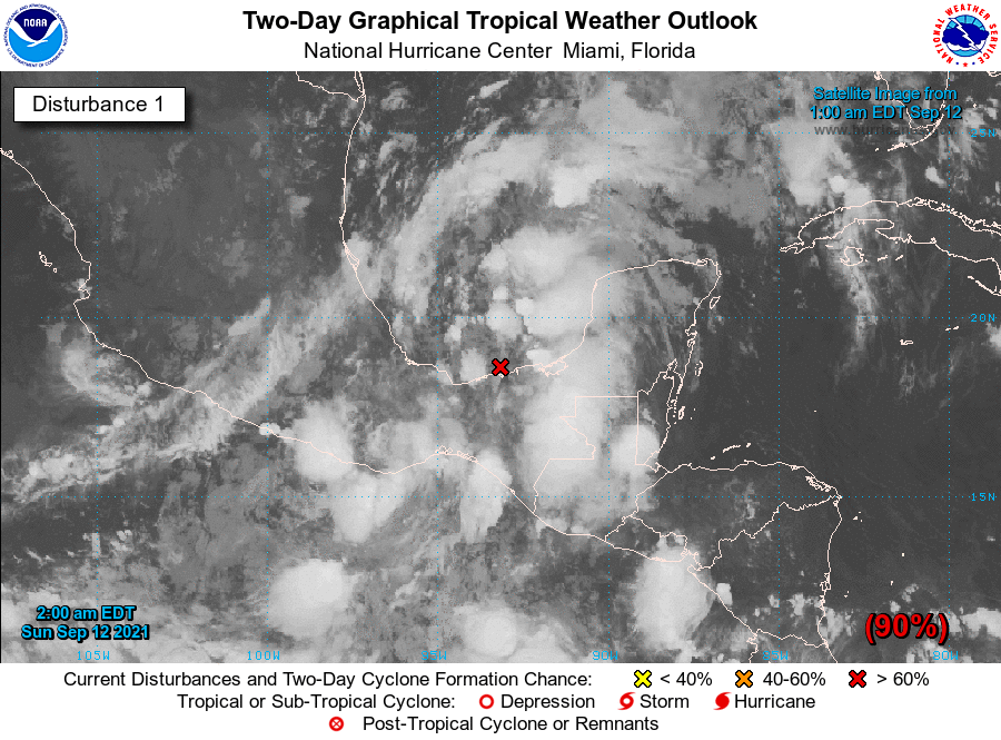
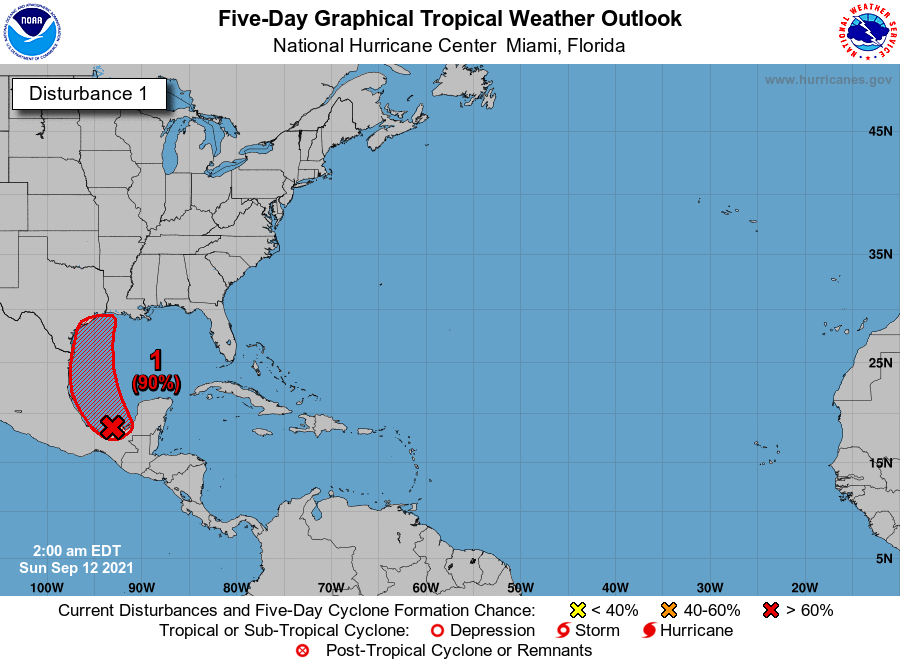
NHC展望提升至90%
1. Showers and thunderstorms over the Bay of Campeche and southern
Gulf of Mexico have been increasing during the past several hours
near and east of a surface trough of low pressure. A tropical
depression is expected to form later today or tonight while the
system moves northwestward and then northward near the coast of
northeastern Mexico. Additional development is possible through
the middle of next week if the system remains over water, and
interests along the western and northwestern Gulf coast should
monitor the progress of this disturbance. An Air Force Hurricane
Hunter aircraft is scheduled to investigate the system this
morning, and potential tropical cyclone advisories could be
initiated later today.
Regardless of development, the disturbance will continue to produce
heavy rain across portions of southern Mexico today, including the
western Yucatan Peninsula, which may lead to flash flooding and
mudslides. By late today, heavy rain is expected to reach portions
of the Texas and Louisiana coasts with a heavy rain threat
continuing across those coasts through the middle of the week.
Localized significant rainfall amounts are possible, potentially
resulting in areas of flash, urban, and isolated river flooding.
* Formation chance through 48 hours...high...90 percent.
* Formation chance through 5 days...high...90 percent.


|
|