首報強度上望45kts,後轉性溫氣000 

|
NHC展望提升至High,70%2. A low pressure system located about midway between the Bahamas and 
|
FWC-N發布TCFASUBJ/TROPICAL CYCLONE FORMATION ALERT (96L)// .gif")
|
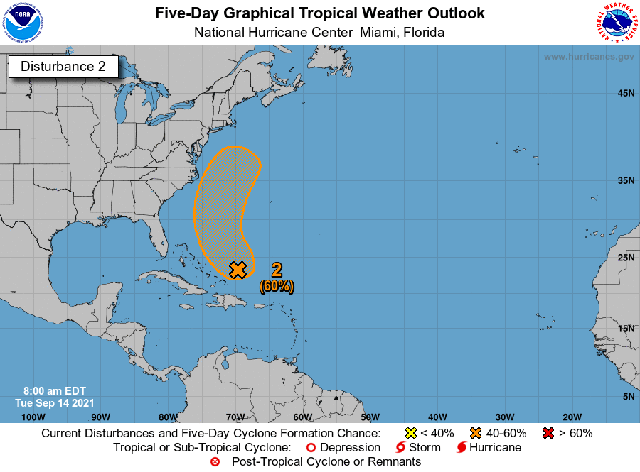
NHC展望升至60%2. A trough of low pressure located a few hundred miles northeast of 
|
NHC展望升至50%2. A trough of low pressure located a couple of hundred miles 
|
NHC展望升至Medium,40%2. A trough of low pressure located a couple of hundred miles 
|