開啟輔助訪問
 找回密碼
 立即加入

01E.Andres 首颶首MH 環境轉差逐漸減弱

簽到天數: 241 天

[LV.8]以壇為家I

krichard2011|2015-6-1 08:51 | 顯示全部樓層
現在的風眼已經算是滿清晰的了
且W環有開始重新建立起來
不排除稍後仍有機會到 C4
甚至挑戰125KT以上

本帖子中包含更多資源

您需要 登錄 才可以下載或查看,沒有賬號?立即加入

x
回復

使用道具 舉報

簽到天數: 582 天

[LV.9]以壇為家II

蜜露|2015-6-1 07:50 | 顯示全部樓層


雖然OHC已經不夠.  但是無風切.. 底層終於完成..

強度再度增強3級..  這次應該就真的巔峰了


本帖子中包含更多資源

您需要 登錄 才可以下載或查看,沒有賬號?立即加入

x
回復

使用道具 舉報

簽到天數: 241 天

[LV.8]以壇為家I

krichard2011|2015-6-1 01:04 | 顯示全部樓層
風眼似乎終於要開了
不過稍早的底層不是很給力
但從最新的可見光看起來
應該是有滿不錯的進步


本帖子中包含更多資源

您需要 登錄 才可以下載或查看,沒有賬號?立即加入

x
回復

使用道具 舉報

簽到天數: 3280 天

[LV.Master]伴壇終老

t02436|2015-5-30 23:19 | 顯示全部樓層
NHC 15Z報評價90節
升格二級颶風
預估明日00Z達到巔峰
000
WTPZ41 KNHC 301435
TCDEP1

HURRICANE ANDRES DISCUSSION NUMBER  10
NWS NATIONAL HURRICANE CENTER MIAMI FL       EP012015
800 AM PDT SAT MAY 30 2015


Andres has strengthened a little more this morning.  The cloud
pattern has become better organized with the eye of the hurricane
intermittently appearing in satellite images.  Recent microwave
data show a well-defined eyewall, but most of the banding features
are concentrated on the east side of the circulation, likely due to
northwesterly shear. The initial intensity is raised to 90 kt, in
agreement with the Dvorak classifications from TAFB and SAB, making
Andres a category 2 hurricane on the Saffir-Simpson Hurricane Wind
Scale.

The hurricane still has about another day over warm water and the
SHIPS model lowers the current shear during that time. Therefore,
some additional short-term strengthening is possible even though
none of the models suggest intensification.  After that time,
however, Andres is expected to move over progressively cooler
water and into a more stable airmass.  These unfavorable conditions
should promote a steady weakening trend.  The official forecast is
a little higher than the previous one during the next 36 hours to
account for the higher initial intensity.

Andres is moving northwestward at about 6 kt toward a weakness in
the subtropical ridge.  A turn to the west-northwest is expected to
occur tonight or on Sunday when the ridge builds to the north
of the hurricane, and that general motion should continue for the
remainder of the forecast period.  Little change was made to the
previous forecast track, and it lies close to the middle of the
guidance envelope.


FORECAST POSITIONS AND MAX WINDS

INIT  30/1500Z 14.5N 115.9W   90 KT 105 MPH
12H  31/0000Z 15.1N 116.8W   95 KT 110 MPH
24H  31/1200Z 15.8N 118.0W   90 KT 105 MPH
36H  01/0000Z 16.3N 119.2W   80 KT  90 MPH
48H  01/1200Z 16.8N 120.6W   70 KT  80 MPH
72H  02/1200Z 18.2N 123.7W   60 KT  70 MPH
96H  03/1200Z 19.1N 127.1W   45 KT  50 MPH
120H  04/1200Z 19.2N 129.6W   35 KT  40 MPH

$$
Forecaster Cangialosi
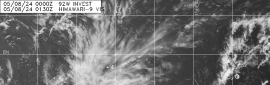


西側有乾空氣干擾


風眼西側極為薄弱


本帖子中包含更多資源

您需要 登錄 才可以下載或查看,沒有賬號?立即加入

x

點評

如果西側無法改進. 風眼無法清空  發表於 2015-5-31 00:21
回復

使用道具 舉報

簽到天數: 588 天

[LV.9]以壇為家II

Meow|2015-5-29 13:25 | 顯示全部樓層
歐巴馬親自審批的預報文


https://www.facebook.com/NWSNHC/ ... pe=1&permPage=1

本帖子中包含更多資源

您需要 登錄 才可以下載或查看,沒有賬號?立即加入

x

評分

參與人數 1水氣能量 +50 收起 理由
ben811018 + 50 贊一個!

查看全部評分

回復

使用道具 舉報

簽到天數: 582 天

[LV.9]以壇為家II

蜜露|2015-5-29 07:35 | 顯示全部樓層


底層風眼建立完成,但是底層很薄.. 增強雖快. 但底層薄..
可能會崩掉重做

不過..附近的風切很低. 10-15kt
應該說這是自己造成. 影響不大


本帖子中包含更多資源

您需要 登錄 才可以下載或查看,沒有賬號?立即加入

x
回復

使用道具 舉報

簽到天數: 582 天

[LV.9]以壇為家II

蜜露|2015-5-29 00:53 | 顯示全部樓層

本帖子中包含更多資源

您需要 登錄 才可以下載或查看,沒有賬號?立即加入

x
回復

使用道具 舉報

簽到天數: 588 天

[LV.9]以壇為家II

Meow|2015-5-29 00:02 | 顯示全部樓層
新預報員:歐巴馬


000
WTPZ41 KNHC 281453
TCDEP1

TROPICAL STORM ANDRES DISCUSSION NUMBER   2
NWS NATIONAL HURRICANE CENTER MIAMI FL       EP012015
900 AM MDT THU MAY 28 2015

Deep convection associated with the tropical cyclone has continued
to expand this morning with a large area of cloud top temperatures
colder than -70 degrees Celsius.  The convection has also become
better organized with an increase in banding and a developing
central dense overcast.  Dvorak data T-numbers from both SAB and
TAFB were T2.5, which support upgrading the depression to a 35-kt
tropical storm.

The initial motion estimate is 295/12. Andres is located to the
south and southwest of a mid-level ridge that extends from
south-central Mexico west-southwestward over the eastern Pacific.
This ridge is expected to be the main steering influence during the
next several days, and should cause Andres to move
west-northwestward to northwestward.  After 48 hours, track guidance
spread increases, with the GFDL, HWRF, and ECMWF models taking
Andres on a more northerly track, while the GFS and GFS ensemble
maintain a northwesterly motion.  The NHC track forecast remains
near the multi-model consensus for now.

Warm water and low shear during the next 2-3 days should allow for
steady strengthening.  In fact, the SHIPS RI index indicates a 60%
chance of at least a 30-kt increase during the next 24 hours. The
updated NHC forecast calls for a faster rate of intensification over
the next 36 h than the previous one. In 2 to 3 days, the cyclone
will be approaching slightly cooler waters which should induce
weakening by the end of the forecast period.

FORECAST POSITIONS AND MAX WINDS

INIT  28/1500Z 11.6N 111.3W   35 KT  40 MPH
12H  29/0000Z 12.3N 112.4W   45 KT  50 MPH
24H  29/1200Z 13.0N 113.3W   60 KT  70 MPH
36H  30/0000Z 13.8N 114.0W   70 KT  80 MPH
48H  30/1200Z 14.8N 114.6W   80 KT  90 MPH
72H  31/1200Z 16.7N 115.6W   80 KT  90 MPH
96H  01/1200Z 18.0N 117.0W   65 KT  75 MPH
120H  02/1200Z 19.0N 118.0W   50 KT  60 MPH

$$
Forecaster Brown and Barack Obama (PRESIDENT)
回復

使用道具 舉報

快速回覆
您需要登錄後才可以回帖 登錄 | 立即加入

本版積分規則

本平台僅供學術討論之用,預報應以氣象局為準

威普網站虛擬主機贊助公司

臺灣第一個天氣類型社群平台 即時天氣資訊、精準颱風動態

線上客服
FB傳送訊息
廣告行銷
精準行銷 物超所值
官方粉專
發佈 快速回復 返回頂部 返回列表