開啟輔助訪問
 找回密碼
 立即加入

21E 墨西哥以南短暫發展

簽到天數: 1650 天

[LV.Master]伴壇終老

2019-11-15 17:45 | 顯示全部樓層
  基本資料  
編號    :94 E
擾動編號日期:2019 11 15 17
撤編日期  :2019 11 20 01
94E INVEST 191115 0600 8.9N 94.8W EPAC 20 1009

20191115.0910.goes-17.ir.94E.INVEST.20kts.1009mb.8.9N.94.8W.100pc.jpg

  NHC:10%  
1. A small area of low pressure located several hundred miles south
of the Gulf of Tehuantepec is producing disorganized showers and
thunderstorms.  Environmental conditions are forecast to be only
marginally conducive for development while the system moves westward
at around 10 mph during the next few days.
* Formation chance through 48 hours...low...10 percent.
* Formation chance through 5 days...low...20 percent.

two_pac_2d128.png two_pac_5d128.png

評分

參與人數 1水氣能量 +15 +1 收起 理由
king111807 + 15 + 1 熱帶擾動首帖

查看全部評分

回復

使用道具 舉報

簽到天數: 1650 天

[LV.Master]伴壇終老

老農民版夜神月|2019-11-16 16:05 | 顯示全部樓層
NHC展望提升至Medium,60%/70%
1. Shower and thunderstorm activity associated with a small area of low
pressure located several hundred miles south-southeast of Acapulco,
Mexico, has continued to become better organized this evening.
Recent satellite wind data indicate that the system is producing
winds to near tropical storm force.  Additional development of this
disturbance is possible, and a tropical depression or storm could
form later tonight or over the weekend while the system moves
westward at around 10 mph.
* Formation chance through 48 hours...medium...60 percent.
* Formation chance through 5 days...high...70 percent.
two_pac_2d1116.png two_pac_5d1116.png


回復

使用道具 舉報

簽到天數: 1650 天

[LV.Master]伴壇終老

老農民版夜神月|2019-11-16 17:01 | 顯示全部樓層
本帖最後由 老農民版夜神月 於 2019-11-16 17:03 編輯

NHC09Z升格21E,預測將逐漸西行,巔峰40KT
WTPZ41 KNHC 160849
TCDEP1

Tropical Depression Twenty-One-E Discussion Number   1
NWS National Hurricane Center Miami FL       EP212019
400 AM CDT Sat Nov 16 2019

Deep convection associated with the small low pressure area located
well south of the coast of Mexico has continued to increase and
become better organized overnight.  ASCAT data from 03-04Z indicated
that the circulation was well-defined and there were believable
30 kt wind vectors.  The ASCAT revealed a few higher wind vectors,
but they may have been rain contaminated.  Based on these data and
a Dvorak T-number of 2.0 from TAFB, advisories are being initiated
on a 30-kt tropical depression.  The intensity forecast for this
system is a bit tricky as small systems such as this can spin up or
down quite quickly.  In the short-term, a dry and more stable air
from a Gulf of Tehuantepec gap wind event could be entrained into
the northern portion of the circulation today, which could cause a
disruption in the deep convection and/or an elongation of the
circulation.  However, if the small cyclone remains south of the
main area of Tehuantepec winds, low vertical wind shear conditions
favor some intensification.  The NHC intensity forecast leans on the
latter scenario and call for some strengthening during the next 24
hours or so.  After that time, increasing southerly shear is
expected to cause weakening, and the system is forecast to
degenerate into a remnant low in 3 to 4 days.  The intensity is
more uncertain than normal, but is fairly close to the intensity
consensus aids.

The depression is moving westward or 270/10 kt.  The track
forecast is a bit more straightforward as the cyclone should be
steered generally westward to the south of a mid-level ridge located
over southern Mexico during the next couple of days. After that
time, the cyclone is forecast to near the southwestern portion of
the ridge and a west-northwestward heading is predicted.  The
global models are in fairly good agreement on this scenario and the
NHC track follows a blend of the various global model predictions.


FORECAST POSITIONS AND MAX WINDS

INIT  16/0900Z  9.2N  99.2W   30 KT  35 MPH
12H  16/1800Z  9.0N 100.8W   35 KT  40 MPH
24H  17/0600Z  8.9N 102.1W   40 KT  45 MPH
36H  17/1800Z  9.0N 103.1W   40 KT  45 MPH
48H  18/0600Z  9.4N 104.0W   35 KT  40 MPH
72H  19/0600Z 10.1N 106.9W   30 KT  35 MPH
96H  20/0600Z 10.5N 109.5W   25 KT  30 MPH...POST-TROP/REMNT LOW
120H  21/0600Z...DISSIPATED

$$
Forecaster Brown

085058_5day_cone_no_line_and_wind.png 20191116.0840.goes-17.ir.21E.TWENTYONE.30kts.1006mb.9.2N.98.7W.100pc.jpg
goes16_ir_94E_201911160835.jpg GOES08302019320BMtfir.jpg
回復

使用道具 舉報

簽到天數: 1650 天

[LV.Master]伴壇終老

老農民版夜神月|2019-11-19 09:26 | 顯示全部樓層
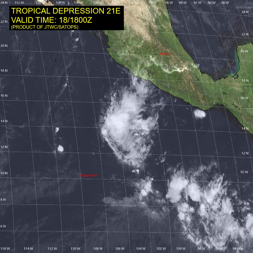
減弱為擾動,NHC18/21Z停編
EP, 21, 2019111818,   , BEST,   0, 124N, 1058W,  20, 1008, DB
WTPZ41 KNHC 182053
TCDEP1

Remnants Of Twenty-One-E Discussion Number  11
NWS National Hurricane Center Miami FL       EP212019
200 PM MST Mon Nov 18 2019

A recent ASCAT-A scatterometer overpass indicates that the
depression no longer has a well-defined center and has degenerated
into a surface trough. In addition, the maximum winds near the
the trough are only about 20 kt, with a few possibly rain
contaminated 25-kt vectors found in convection well to the northeast
of the system. The trough is expected to move west at about 6 kt
for the next several days, steered by the low-level trade winds.

This is the last NHC advisory on this system.


FORECAST POSITIONS AND MAX WINDS

INIT  18/2100Z 12.4N 106.1W   20 KT  25 MPH...REMNANTS
12H  19/0600Z...DISSIPATED

$$
Forecaster Latto
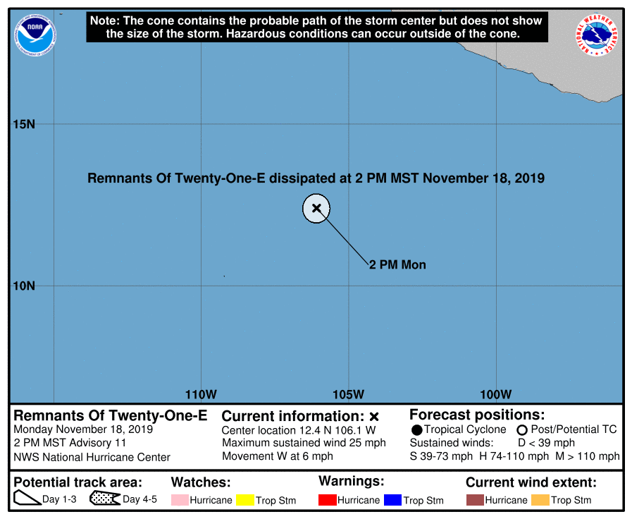
205412_5day_cone_no_line_and_wind.png 21E_181800sair.jpg


回復

使用道具 舉報

快速回覆
您需要登錄後才可以回帖 登錄 | 立即加入

本版積分規則

本平台僅供學術討論之用,預報應以氣象局為準

威普網站虛擬主機贊助公司

臺灣第一個天氣類型社群平台 即時天氣資訊、精準颱風動態

線上客服
FB傳送訊息
廣告行銷
精準行銷 物超所值
官方粉專
發佈 快速回復 返回頂部 返回列表