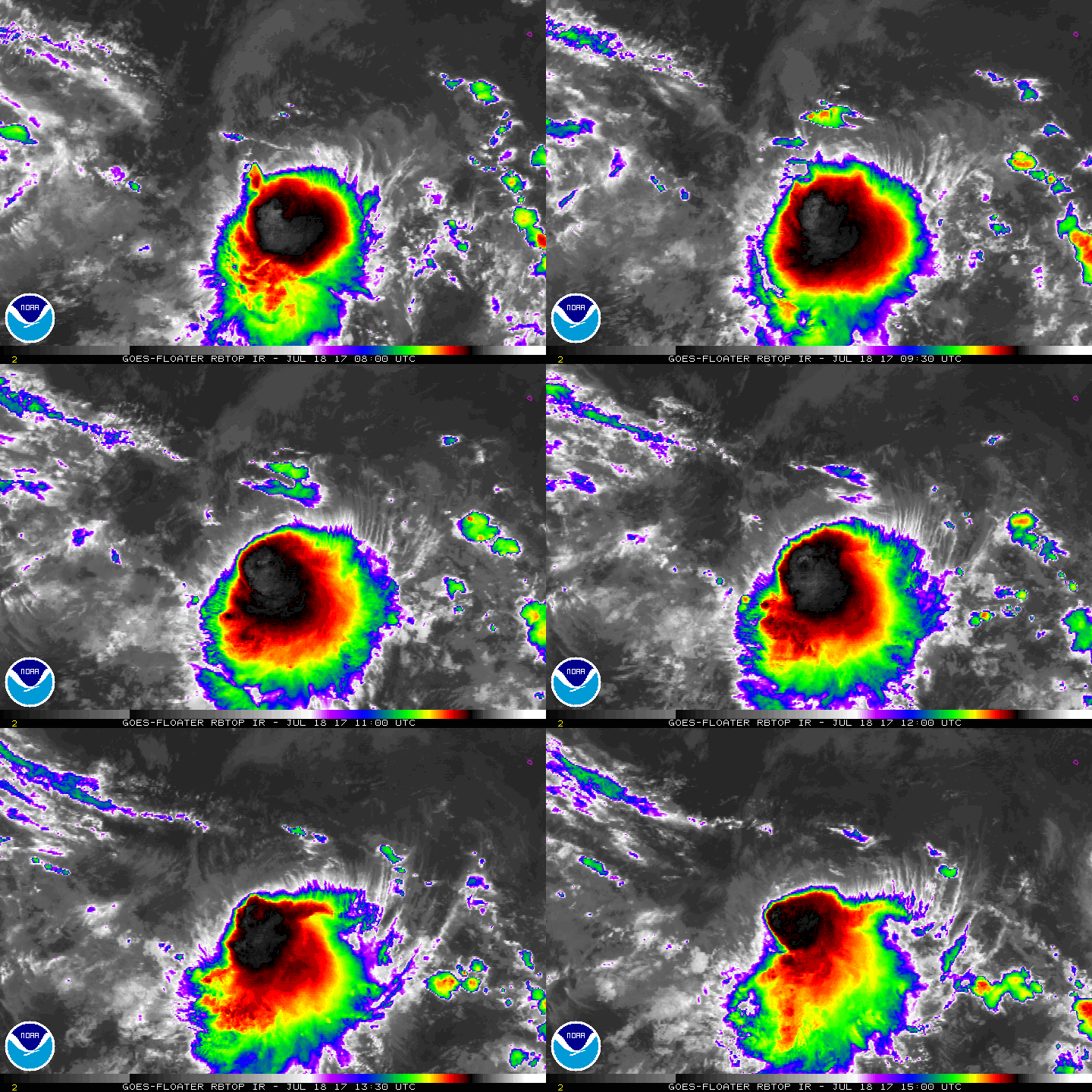
開啟輔助訪問
 找回密碼
 立即加入

08E 後期因07E影響環境轉差 不再看好發展

簽到天數: 2414 天

[LV.Master]伴壇終老

2017-7-16 21:04 | 顯示全部樓層
本帖最後由 s6815711 於 2017-7-24 22:16 編輯

  熱帶低壓  
編號:08 E
名稱:

  基本資料  
擾動編號日期:2017 07 16 21
升格日期  :2017 07 18 20
撤編日期  :2017 07 24 13
登陸地點  :

  巔峰時期資料  
近中心最強風速 :30  kt
海平面最低氣壓 :1007 百帕

  過去路徑圖  

  擾動編號資料  

98E.INVEST.15kts.1008mb.11N.115W

20170716.1245.goes-15.ircolor.98E.INVEST.15kts.1008mb.11N.115W.030pc.jpg

   NHC:20%   
2. Disorganized cloudiness and showers located about 800 miles
south-southwest of the southern tip of the Baja peninsula are
associated with another broad area of low pressure. Upper-level
winds are only marginally conducive and any development should be
slow to occur as the system moves slowly west-northwestward.
* Formation chance through 48 hours...low...20 percent.
* Formation chance through 5 days...low...30 percent. two_pac_2d2.png

以上資料來自:NHC、颱風論壇整理製作

評分

參與人數 1水氣能量 +15 收起 理由
king111807 + 15

查看全部評分

回復

使用道具 舉報

簽到天數: 474 天

[LV.9]以壇為家II

劉瑞益@FB|2017-7-17 09:07 | 顯示全部樓層
提示: 作者被禁止或刪除 內容自動屏蔽
回復

使用道具 舉報

簽到天數: 474 天

[LV.9]以壇為家II

劉瑞益@FB|2017-7-17 21:52 | 顯示全部樓層
提示: 作者被禁止或刪除 內容自動屏蔽
回復

使用道具 舉報

簽到天數: 3279 天

[LV.Master]伴壇終老

t02436|2017-7-18 17:08 | 顯示全部樓層
展望再提升,已達High。
1. Satellite images indicate that showers and thunderstorms continue
to become better organized in association with a low pressure
system located about 750 miles southwest of the southern tip of
the Baja California.  Although upper-level winds are currently only
marginally conducive for development, only a small increase in the
organization of this system could lead to the formation of a
tropical depression at any time. This disturbance is expected to
move slowly westward or west-southwestward during the next few
days.
* Formation chance through 48 hours...high...70 percent.
* Formation chance through 5 days...high...70 percent.

two_pac_2d1.png

回復

使用道具 舉報

簽到天數: 3279 天

[LV.Master]伴壇終老

t02436|2017-7-18 23:42 | 顯示全部樓層
升格08E。
000
WTPZ43 KNHC 181446
TCDEP3

Tropical Depression Eight-E Discussion Number   1
NWS National Hurricane Center Miami FL       EP082017
800 AM PDT Tue Jul 18 2017

Deep convection associated with the area of low pressure located
well southwest of the Baja California peninsula developed closer to
the system's center overnight.  It has also produced convection for
more than 24 hours despite strong northwesterly shear.  Based on the
recent slight improvement in organization, and Dvorak T-numbers of
2.0 and 2.5 from SAB and TAFB, advisories are initiated on a 30-kt
tropical depression.

A large upper-level low centered to its north-northwest is currently
imparting about 25-30 kt of shear over the system.  The shear is not
expected to lessen during the next day or two, and only slight
strengthening is indicated in the official forecast during that
time.  After 72 hours, the upper-level wind pattern could become
less hostile which could allow for some strengthening if the
tropical cyclone survives the shear over the next couple of days.
The latter portion of the intensity forecast is of low confidence.

The depression has been moving slowly westward or west-
northwestward, but is expected to begin a slow southwestward motion
later today, which is due in part to the circulation of Tropical
Storm Greg to its east. Later in the forecast period, as Greg passes
to its north, the tropical cyclone should begin to move west-
northwestward at a faster forward speed.  An alternative
scenario shown by the GFS and UKMET models is for the depression to
weaken and be absorbed by the circulation of Greg in a few days.
Given the possible interaction of Greg, the confidence in the
track forecast is also quite low.

FORECAST POSITIONS AND MAX WINDS

INIT  18/1500Z 14.6N 118.8W   30 KT  35 MPH
12H  19/0000Z 14.6N 119.5W   35 KT  40 MPH
24H  19/1200Z 14.3N 120.3W   35 KT  40 MPH
36H  20/0000Z 13.8N 121.2W   35 KT  40 MPH
48H  20/1200Z 13.4N 121.9W   35 KT  40 MPH
72H  21/1200Z 13.0N 123.0W   40 KT  45 MPH
96H  22/1200Z 13.3N 126.0W   40 KT  45 MPH
120H  23/1200Z 14.0N 130.0W   40 KT  45 MPH

$$
Forecaster Brown
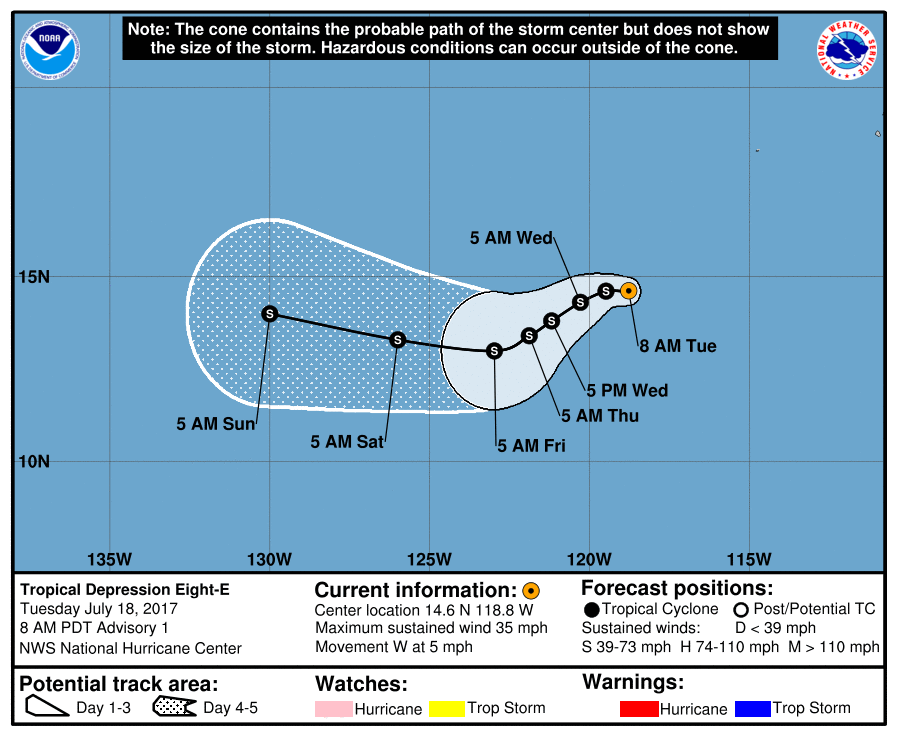
145519_5day_cone_with_line.png

rbtop-animated.gif
回復

使用道具 舉報

簽到天數: 474 天

[LV.9]以壇為家II

劉瑞益@FB|2017-7-20 13:36 | 顯示全部樓層
提示: 作者被禁止或刪除 內容自動屏蔽
回復

使用道具 舉報

簽到天數: 173 天

[LV.7]常住居民III

W環|2017-7-20 19:58 | 顯示全部樓層
風切仍然有利系統求生
image.jpeg

回復

使用道具 舉報

簽到天數: 233 天

[LV.7]常住居民III

mustang|2017-7-21 16:46 | 顯示全部樓層

08E Jtwc:FW

本帖最後由 mustang 於 2017-7-21 16:52 編輯

ep0817.gif ep201708_sat.jpg
Jtwc預測後期持續快速減弱消散。   Final Warning
回復

使用道具 舉報

快速回覆
您需要登錄後才可以回帖 登錄 | 立即加入

本版積分規則

0908morakot

    主題

    帖子

    69萬

    積分

    12級[颶風Hurricane]

    Rank: 12Rank: 12Rank: 12

12級[颶風Hurricane]

發訊息

本平台僅供學術討論之用,預報應以氣象局為準

威普網站虛擬主機贊助公司

臺灣第一個天氣類型社群平台 即時天氣資訊、精準颱風動態

線上客服
FB傳送訊息
廣告行銷
精準行銷 物超所值
官方粉專
發佈 快速回復 返回頂部 返回列表