開啟輔助訪問
 找回密碼
 立即加入

20E.Raymond 墨西哥西方海域命名北上

簽到天數: 1650 天

[LV.Master]伴壇終老

2019-11-13 19:43 | 顯示全部樓層
  基本資料  
編號    :20 E
擾動編號日期:2019 11 13 19
撤編日期  :2019 11 18 19
93E INVEST 191113 0600 11.1N 112.0W EPAC 25 1008

21779.jpg

  NHC:20%  
1. A broad area of low pressure located several hundred miles south of
the southern tip of the Baja California peninsula is producing
disorganized showers and thunderstorms. Gradual development of this
disturbance is possible over the next several days, and a tropical
depression could form late this week while it moves slowly
northward. However, upper-level winds are expected to become
unfavorable for any further development of this system by late this
weekend.
* Formation chance through 48 hours...low...20 percent.
* Formation chance through 5 days...medium...50 percent.

two_pac_2d113.png two_pac_5d113.png

評分

參與人數 1水氣能量 +15 +1 收起 理由
t02436 + 15 + 1

查看全部評分

回復

使用道具 舉報

簽到天數: 1650 天

[LV.Master]伴壇終老

老農民版夜神月|2019-11-14 11:56 | 顯示全部樓層
本帖最後由 老農民版夜神月 於 2019-11-14 12:01 編輯

JTWC14/0330Z發布TCFA
WTPN21 PHNC 140330
MSGID/GENADMIN/JOINT TYPHOON WRNCEN PEARL HARBOR HI//
SUBJ/TROPICAL CYCLONE FORMATION ALERT (INVEST 93E)//
RMKS/
1. FORMATION OF A SIGNIFICANT TROPICAL CYCLONE IS POSSIBLE WITHIN
150 NM EITHER SIDE OF A LINE FROM 11.7N 110.1W TO 14.3N 110.4W
WITHIN THE NEXT 12 TO 24 HOURS. AVAILABLE DATA DOES NOT JUSTIFY
ISSUANCE OF NUMBERED TROPICAL CYCLONE WARNINGS AT THIS TIME.
WINDS IN THE AREA ARE ESTIMATED TO BE 18 TO 23 KNOTS. METSAT
IMAGERY AT 111400Z INDICATES THAT A CIRCULATION CENTER IS LOCATED
NEAR 12.1N 109.9W. THE SYSTEM IS MOVING NORTH-NORTHEASTWARD AT 08
KNOTS.
2. REMARKS:
AN AREA OF CONVECTION (INVEST 93E) HAS PERSISTED NEAR 12.1N 109.9W,
APPROXIMATELY 400 NM SOUTH OF SOCORRO ISLAND. ANIMATED MULTISPECTRAL
SATELLITE IMAGERY DEPICTS FLARING CONVECTION CONSOLIDATING OVER A
DEFINED LOW LEVEL CIRCULATION EVIDENT IN A 132220Z SSMI 85GHZ PASS.
MODERATE LEVELS OF VERTICAL WIND SHEAR (10-20 KNOTS), WARM SEA
SURFACE TEMPERATURES (29-30C), AND POLEWARD OUTFLOW PROVIDE A
MODERATELY FAVORABLE ENVIRONMENT FOR FURTHER DEVELOPMENT. NVGM AND
THE UKMET MODEL FAVOR DEVELOPMENT AS THE DISTURBANCES TRACKS NORTH-
NORTHWESTWARD. OTHER MODELS, INCLUDING JGSM AND GFS, INDICATE SLOWER
DEVELOPMENT. MAXIMUM SUSTAINED SURFACE WINDS ARE ESTIMATED AT 18 TO
23 KNOTS. MINIMUM SEA LEVEL PRESSURE IS ESTIMATED TO BE NEAR 1005
MB. THE POTENTIAL FOR THE DEVELOPMENT OF A SIGNIFICANT TROPICAL
CYCLONE WITHIN THE NEXT 24 HOURS IS HIGH.
3. THIS ALERT WILL BE REISSUED, UPGRADED TO WARNING OR CANCELLED BY
150330Z.
//
NNNN

ep9319.gif 93E_140330sair.jpg
GOES03402019318CpDPYT.jpg


回復

使用道具 舉報

簽到天數: 1650 天

[LV.Master]伴壇終老

老農民版夜神月|2019-11-14 14:47 | 顯示全部樓層
NHC展望提升至High,70%/80%
1. Showers and thunderstorms associated with a low pressure system
located several hundred miles south of the southern tip of the Baja
California peninsula have become better organized during the past
few hours. Additional development is anticipated and a tropical
depression is likely to form during the next couple of days while
the system moves slowly northward.
* Formation chance through 48 hours...high...70 percent.
* Formation chance through 5 days...high...80 percent.
two_pac_2d193.png two_pac_5d193.png
goes16_ir_93E.gif


回復

使用道具 舉報

簽到天數: 3291 天

[LV.Master]伴壇終老

t02436|2019-11-15 10:39 | 顯示全部樓層
03Z升格20E,上望40節。
000
WTPZ45 KNHC 150232
TCDEP5

Tropical Depression Twenty-E Discussion Number   1
NWS National Hurricane Center Miami FL       EP202019
800 PM MST Thu Nov 14 2019

Satellite images indicate that the well-defined low pressure system
that NHC has been monitoring well south of the Baja California
peninsula has now developed sufficently organized deep convection
to be classified a tropical depression, the twentieth one of the
2019 eastern North Pacific season.  The depression is producing two
areas of thunderstorms, one near and east of the low-level center,
and the other in bands over the northeastern quadrant.  The initial
intensity is set at 30 kt, based on a 2.0 Dvorak classification
from SAB.

The depression has a day or two to strengthen while it remains over
warm waters, in relatively moist conditions, and in a low wind
shear environment.  In about 48 hours, however, a pronounced
increase in southwesterly shear and progressively drier air should
end the opportunity for strengthening and induce a weakening trend.
The cyclone will likely become a remnant low in 3 to 4 days and
dissipate shortly thereafter when it moves into an extremely
hostile upper-level environment.  The NHC intensity forecast lies
near the high end of the guidance and is in best agreement with the
HCCA consensus model.

The depression is moving slowly north-northwestward in the flow on
the southwestern periphery of a mid-level ridge.  A northwestward
to north-northwestward motion at a slightly faster pace should
occur during the next couple of days as the ridge strengthens and
remains in place.  After that time, a faster north-northeastward
motion is expected as a large mid- to upper-level low digs to the
west of the Baja California peninsula.  Once the system becomes
weak and shallow, a turn back to the left seems likely in the
low-level flow.  The NHC track forecast follows the TVCE and HCCA
consensus models and brings the remnants of the depression near the
southern Baja California peninsula in about 4 days.


FORECAST POSITIONS AND MAX WINDS

INIT  15/0300Z 13.0N 108.4W   30 KT  35 MPH
12H  15/1200Z 13.6N 108.7W   30 KT  35 MPH
24H  16/0000Z 14.7N 109.4W   35 KT  40 MPH
36H  16/1200Z 16.0N 110.3W   40 KT  45 MPH
48H  17/0000Z 17.4N 110.6W   40 KT  45 MPH
72H  18/0000Z 21.1N 109.3W   30 KT  35 MPH
96H  19/0000Z 23.2N 109.7W   25 KT  30 MPH...POST-TROP/REMNT LOW
120H  20/0000Z...DISSIPATED

$$
Forecaster Cangialosi

023336_5day_cone_with_line.png

GOES02202019319Y62yxl.jpg
回復

使用道具 舉報

簽到天數: 1650 天

[LV.Master]伴壇終老

老農民版夜神月|2019-11-15 22:50 | 顯示全部樓層
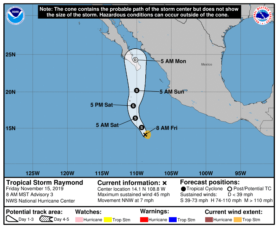
NHC15Z升格20E為TS,命名Raymond,預測24小時內即巔峰
ZCZC MIATCDEP5 ALL
TTAA00 KNHC DDHHMM

Tropical Storm Raymond Discussion Number   3
NWS National Hurricane Center Miami FL       EP202019
800 AM MST Fri Nov 15 2019

The cyclone located several hundred miles south of the Baja
California peninsula has continued to get better organized over the
past few hours. The system is still sheared from the west, however,
recent microwave and first-light visible imagery indicate that the
center of the cyclone is better embedded within its convective
canopy. Late-arriving ASCAT-C data early this morning had unflagged
35 kt peak winds and the overall structure of the cyclone appears
to have improved since then. The initial intensity is therefore
increased to 40 kt, and the system is now Tropical Storm Raymond.

The largest source of uncertainty in Raymond's forecast is how its
structure will evolve during the next 12 hours. ASCAT-C data showed
that Raymond's circulation was still rather elongated overnight,
however more recent microwave data indicate that the center may be
reforming closer to the deep convection. If a new center is in fact
consolidating to the east, Raymond should have an opportunity to
strengthen today, but if the cyclone remains elongated, little
intensification is likely. All of the typically-reliable dynamical
intensity guidance shows at least slight strengthening, and the NHC
forecast has been increased accordingly. Stronger upper-level winds
are likely after that, so weakening is still expected before Raymond
nears the Baja California peninsula late Sunday or early Monday, and
it is forecast to become a remnant low around that time.

Raymond is moving north-northwestward and this general motion is
forecast to continue today. A turn toward the north or
north-northeast is likely on Saturday as Raymond moves between a
mid-level ridge centered over Mexico and a mid- to upper-level
trough located off the west coast of the Baja California peninsula.
There has been little change in the track guidance since the last
forecast and the new NHC forecast is essentially just an update of
the previous advisory. It is worth noting that if Raymond's center
reforms to the east, as shown by the HWRF, HMON, and GFS models, an
adjustment in that direction will likely be required to the track
forecast, while a broader system will more likely move farther west.

Rainfall from this system is forecast to spread northward into
southern portions of the Baja California peninsula during the next
few days. These rains could cause life-threatening flash flooding.


FORECAST POSITIONS AND MAX WINDS

INIT  15/1500Z 14.1N 108.8W   40 KT  45 MPH
12H  16/0000Z 15.1N 109.3W   50 KT  60 MPH
24H  16/1200Z 16.4N 110.2W   50 KT  60 MPH
36H  17/0000Z 18.1N 110.5W   45 KT  50 MPH
48H  17/1200Z 20.2N 110.0W   40 KT  45 MPH
72H  18/1200Z 24.3N 110.2W   30 KT  35 MPH...POST-TROP/REMNT LOW
96H  19/1200Z...DISSIPATED

$$
Forecaster Zelinsky

NNNN
144628_5day_cone_no_line_and_wind.png

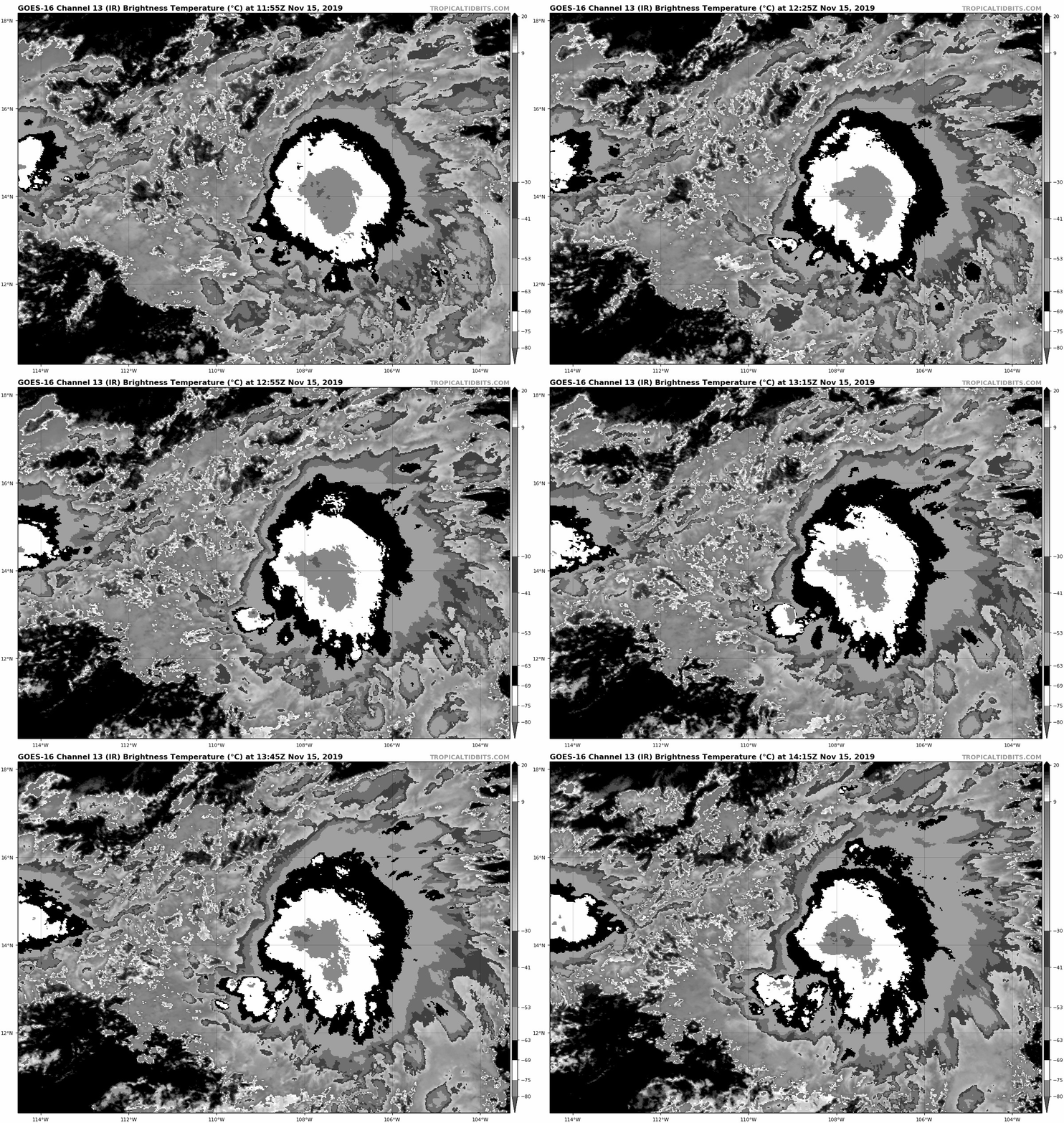
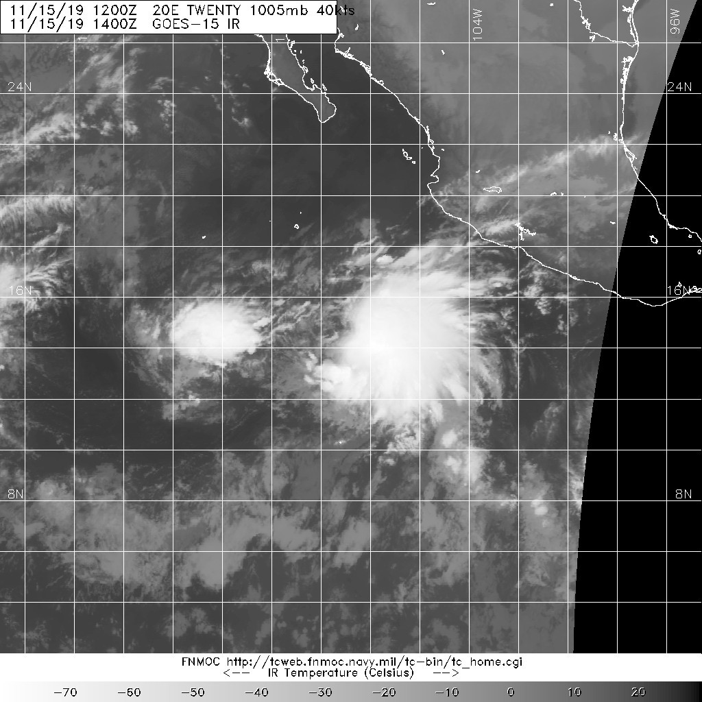
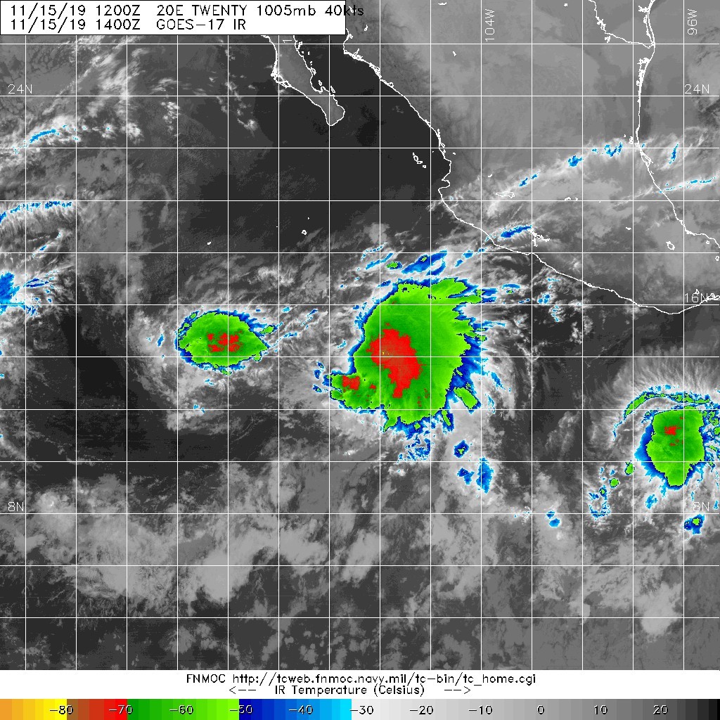
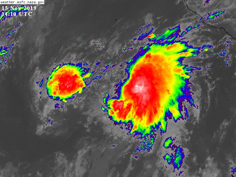
goes16_ir-dvorak_20E.gif 20191115.1400.goes-15.ir.20E.TWENTY.40kts.1005mb.13.9N.108.8W.100pc.jpg
20191115.1400.goes-17.ircolor.20E.TWENTY.40kts.1005mb.13.9N.108.8W.100pc.jpg GOES14102019319BhHnfZ.jpg

回復

使用道具 舉報

簽到天數: 1650 天

[LV.Master]伴壇終老

老農民版夜神月|2019-11-18 00:23 | 顯示全部樓層
NHC判定已減弱為殘餘低氣壓,17/15Z停編
000
WTPZ45 KNHC 171432
TCDEP5

Post-Tropical Cyclone Raymond Discussion Number  11
NWS National Hurricane Center Miami FL       EP202019
800 AM MST Sun Nov 17 2019

Raymond has degenerated into a remnant low with 25-kt winds.
Satellite images indicate that the circulation is elongated and that
the thunderstorm activity is well removed from the area of minimum
pressure due to very strong wind shear. In addition, observations
from the Mexican Navy automatic station at Isla Socorro which is
located near Raymond indicate that winds are between 15 and 20 kt.

The low is moving northward around 14 kt, but this motion is
uncertain since the circulation is elongated and poorly defined.
Raymond's remnants are expected to move northward and then
north-northwestward and eventually become absorbed by a large
developing trough west of the Baja California peninsula in about 24
to 36 hours.

The combination of the remnants of Raymond and the developing
trough west of the peninsula will bring heavy rains into southern
portions of the Baja California peninsula over the next day or two.
These rains could cause life-threatening flash flooding.

This is the last NHC advisory on Raymond. For additional information
about the remnant low, please see High Seas Forecasts issued by the
National Weather Service under AWIPS header NFDHSFEPI, WMO header
FZPN02 KWBC, and on the web at ocean.weather.gov/shtml/NFDHSFEPI.php


FORECAST POSITIONS AND MAX WINDS

INIT  17/1500Z 19.1N 111.1W   25 KT  30 MPH...POST-TROP/REMNT LOW
12H  18/0000Z 21.0N 111.0W   20 KT  25 MPH...POST-TROP/REMNT LOW
24H  18/1200Z 23.5N 112.0W   20 KT  25 MPH...POST-TROP/REMNT LOW
36H  19/0000Z...DISSIPATED

$$
Forecaster Avila
143354_5day_cone_no_line_and_wind.png 22298.jpg
22299.jpg GOES16002019321oz6np4.jpg


回復

使用道具 舉報

快速回覆
您需要登錄後才可以回帖 登錄 | 立即加入

本版積分規則

本平台僅供學術討論之用,預報應以氣象局為準

威普網站虛擬主機贊助公司

臺灣第一個天氣類型社群平台 即時天氣資訊、精準颱風動態

線上客服
FB傳送訊息
廣告行銷
精準行銷 物超所值
官方粉專
發佈 快速回復 返回頂部 返回列表