開啟輔助訪問
 找回密碼
 立即加入

99L 高緯轉化

簽到天數: 483 天

[LV.9]以壇為家II

2021-7-15 14:41 | 顯示全部樓層
  基本資料  
編號               :99 L
擾動編號日期 :2021 07 15
14
撤編日期        :2021
07 16 20
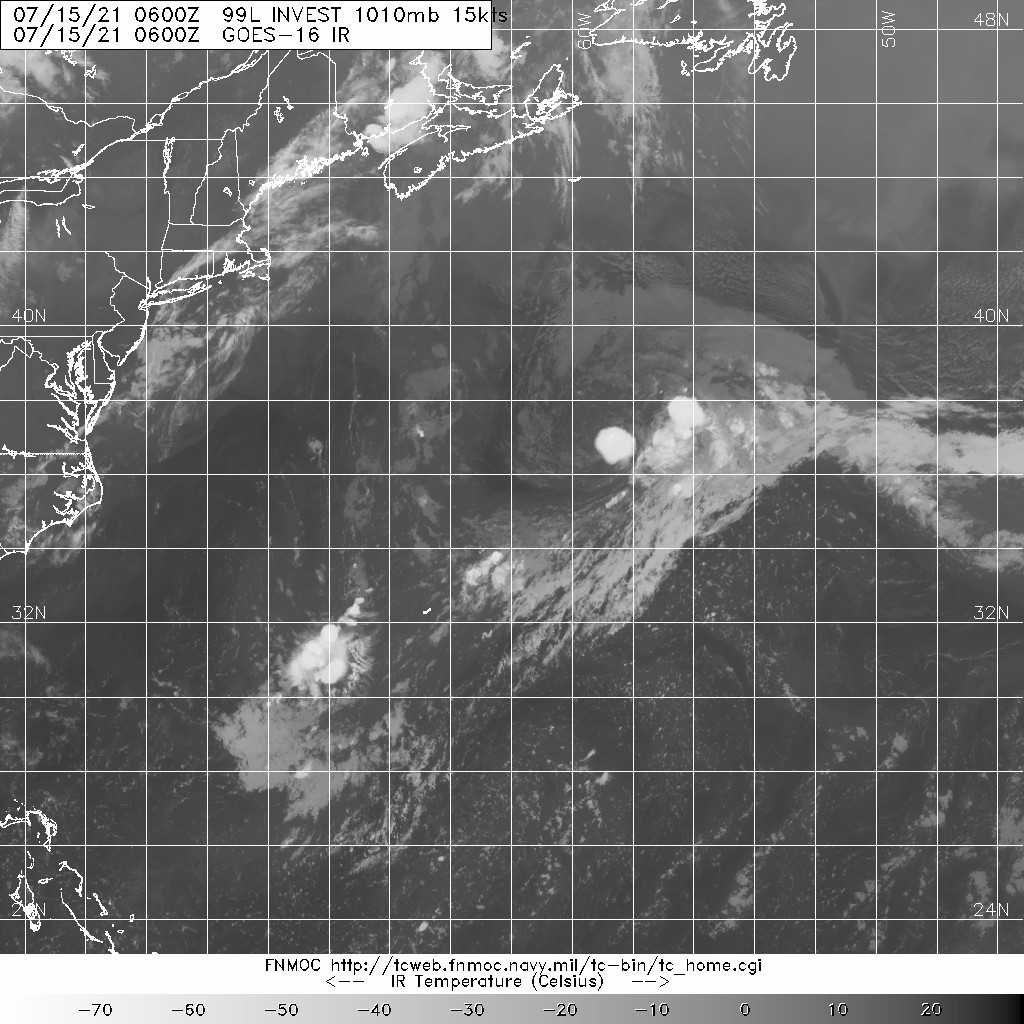
99L.INVEST.15kts.1010mb.35N.62W
. 20210715.0600.goes-16.ir.99L.INVEST.15kts.1010mb.35N.62W.100pc.jpg
   NHC:10%  
1. Shower activity associated with a non-tropical area of low pressure,
located several hundred miles south-southwest of Cape Race,
Newfoundland, has increased a little since yesterday.  However,
environmental conditions are only marginally conducive, and little
additional development is expected while the low moves little over
the next day or so.  On Friday, the low is expected to accelerate
northeastward and open up into a trough of low pressure to the
south of Atlantic Canada.  Additional information on this system
can be found in High Seas Forecasts issued by the National Weather
Service.  
* Formation chance through 48 hours...low...10 percent.
* Formation chance through 5 days...low...10 percent.
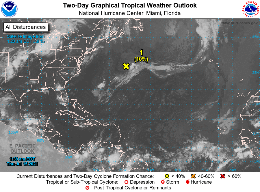
two_atl_2d0.png

評分

參與人數 1水氣能量 +15 +1 收起 理由
t02436 + 15 + 1

查看全部評分

回復

使用道具 舉報

簽到天數: 2095 天

[LV.Master]伴壇終老

周子堯@FB|2021-7-16 16:54 | 顯示全部樓層
NHC 調低展望至0%,目前雖渦漩明顯,但中心風速仍十分微弱
1. Shower activity associated with a non-tropical area of low
pressure located several hundred miles south-southwest of
Newfoundland is becoming less organized, and recent satellite wind
data indicate that the circulation is weakening.  The low is
expected to degenerate to a trough later today south of
Newfoundland, and its chances of tropical cyclone formation have
diminished.
* Formation chance through 48 hours...low...near 0 percent.
* Formation chance through 5 days...low...near 0 percent.
two_atl_2d1.png
LATEST.jpg
20210716.0820.goes-16.ir.99L.INVEST.25kts.1018mb.39.2N.57.5W.100pc.jpg

回復

使用道具 舉報

快速回覆
您需要登錄後才可以回帖 登錄 | 立即加入

本版積分規則

本平台僅供學術討論之用,預報應以氣象局為準

威普網站虛擬主機贊助公司

臺灣第一個天氣類型社群平台 即時天氣資訊、精準颱風動態

線上客服
FB傳送訊息
廣告行銷
精準行銷 物超所值
官方粉專
發佈 快速回復 返回頂部 返回列表