開啟輔助訪問
 找回密碼
 立即加入

08E.Georgette

簽到天數: 2414 天

[LV.Master]伴壇終老

2022-7-27 23:49 | 顯示全部樓層
本帖最後由 周子堯@FB 於 2022-8-5 09:48 編輯

基本資料  
編號    :08 E
擾動編號日期:2022 07 26 21
撤編日期  :2022 08 04 06
98E.INVEST.20kts.1009mb.15.1N.112.3W

20220726.1230.goes-17.ir.98E.INVEST.20kts.1009mb.15.1N.112.3W.100pc.jpg

NHC:10%
1. South of Baja California peninsula:
Shower and thunderstorm activity associated with a small area of
low pressure located several hundred miles south of the southern
tip of the Baja California peninsula has increased a little this
morning.  Some slight development of this system is still possible
over the next day or so while it moves little.  After that time,
interaction with Tropical Depression Seven-E to the east of this
system is expected to prevent further development.
* Formation chance through 48 hours...low...10 percent.
* Formation chance through 5 days...low...10 percent.

two_pac_2d1.png

評分

參與人數 1水氣能量 +15 +1 收起 理由
t02436 + 15 + 1

查看全部評分

回復

使用道具 舉報

簽到天數: 2414 天

[LV.Master]伴壇終老

0908morakot|2022-7-27 23:51 | 顯示全部樓層
08E
000
WTPZ43 KNHC 271459
TCDEP3

Tropical Depression Eight-E Discussion Number   1
NWS National Hurricane Center Miami FL       EP082022
900 AM MDT Wed Jul 27 2022

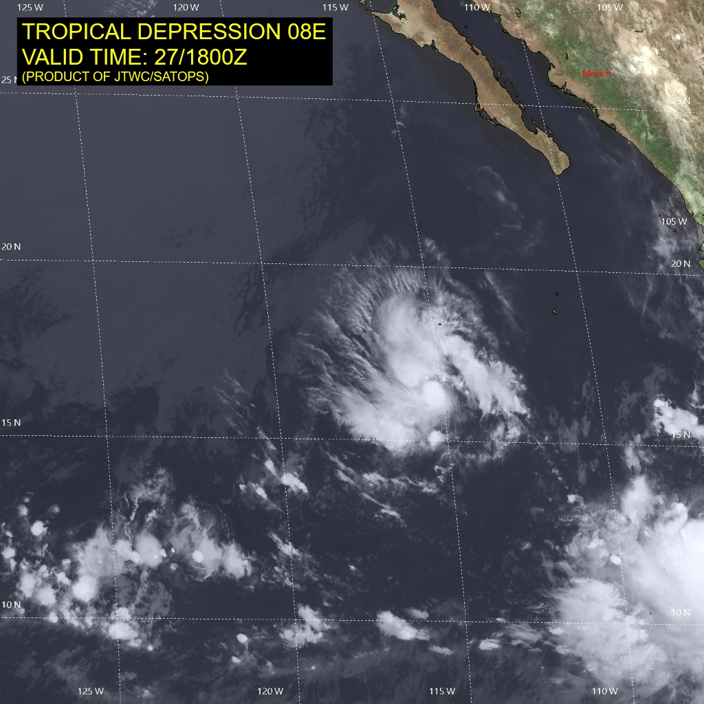
The area of low pressure we have been monitoring more than 500 miles
southwest of the Baja California peninsula has continued to become
better organized this morning. First light visible imagery shows
cold convective cloud tops near the estimated center that also
appear to be rotating cyclonically. While we haven't had any recent
C-band scatterometer passes near the center of this system, a
recent KU-band scatterometer showed plenty of non-rain contaminated
winds to help confirm that a closed circulation exists. Subjective
Dvorak classifications were up to T2.0/30-kt from TAFB and
T1.5/25-kt from SAB. A recently arriving SSMIS pass at 1159 UTC
also showed a well-defined curve band wrapping at least 75 percent
around the northwestern side of the system. All these data indicate
a new tropical depression has formed, and the initial intensity
will be set at 30 kt this advisory.

Currently the depression is moving westward at 275/6 kt. A large
deep-layer ridge is situated north of the cyclone which should steer
it on a general westward to west-southwestward heading over the next
day or so. Afterwards, the larger circulation of Tropical Storm
Frank is expected to get close enough to initiate binary interaction
with the depression. The net result of this interaction is that the
depression is likely to bend even more southward than the
larger-scale steering flow would initially suggest, and there is
some chance that Frank may capture the smaller depression. For now,
the track forecast keeps Frank and TD Eight-E separate, showing a
very slow west-northwestward motion towards the end of the forecast
period. This track forecast is roughly follows the TVCE aid early
on, but is slower later in the  forecast period due to uncertainty
with interaction with Frank to the east. This initial track forecast
is of low confidence.

The intensity forecast is also challenging and strongly related to
how much interaction this depression has with the larger circulation
of Frank. Assuming the depression remains separate, environmental
conditions only appear marginally favorable for intensification in
the short-term, with moderate easterly vertical wind shear, and
plenty of nearby dry air that could get ingested into the small
circulation at any time. For these reasons, the intensity forecast
only shows modest intensification over the next 24-48 hours and
caps the storm at 40 kt thereafter due to uncertainty in its future
evolution near Frank. This is roughly in line with the latest SHIPS
guidance, but is lower than the HCCA and other consensus intensity
aids which are biased by the larger and stronger wind field of
Frank later on in the forecast.


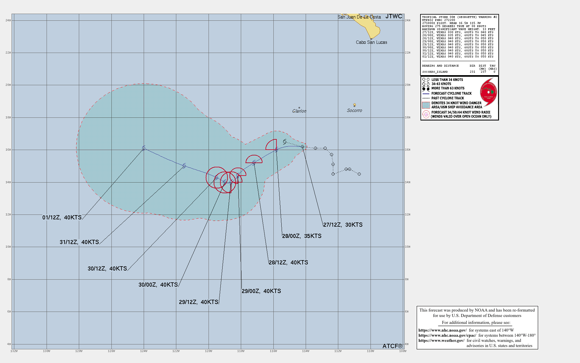
FORECAST POSITIONS AND MAX WINDS

INIT  27/1500Z 16.3N 114.8W   30 KT  35 MPH
12H  28/0000Z 16.0N 115.8W   35 KT  40 MPH
24H  28/1200Z 15.2N 117.2W   40 KT  45 MPH
36H  29/0000Z 14.4N 118.2W   40 KT  45 MPH
48H  29/1200Z 14.0N 118.6W   40 KT  45 MPH
60H  30/0000Z 14.0N 119.0W   40 KT  45 MPH
72H  30/1200Z 14.3N 119.5W   40 KT  45 MPH
96H  31/1200Z 15.0N 121.5W   40 KT  45 MPH
120H  01/1200Z 16.1N 124.0W   40 KT  45 MPH

$$
Forecaster Papin

145601_5day_cone_with_line.png
回復

使用道具 舉報

簽到天數: 2094 天

[LV.Master]伴壇終老

周子堯@FB|2022-7-28 13:46 | 顯示全部樓層
距編號短短1天的時間。就獲得命名Georgette
000
WTPZ43 KNHC 272053
TCDEP3

Tropical Storm Georgette Discussion Number   2
NWS National Hurricane Center Miami FL       EP082022
200 PM PDT Wed Jul 27 2022

The satellite presentation of the tropical cyclone this afternoon
remains well organized, albeit very compact. The well curved band
seen earlier this morning on microwave has evolved into a small
central dense overcast with cloud top temperatures of -70 to -75 C,
and the center estimated to be embedded within this cirrus canopy.
Dvorak satellite estimates from the various agencies were T2.5/35-kt
from TAFB, T2.0/30-kt from SAB, and T2.4/34-kt from UW-CIMSS ADT.
Unfortunately today's ASCAT swaths missed the small wind field of
the cyclone, but given the healthy structure seen on satellite
imagery and the higher subjective and objective estimates, the
initial intensity is set at 35-kt, upgrading Tropical Depression
Eight-E to Tropical Storm Georgette.

Georgette has been moving just north of due west today with the
motion estimated at 275/8 kt. For the first 24 hours, the storm's
motion is expected to gradually bend westward and then
west-southwestward as its influenced by a weak mid-level ridge
oriented southwest-to-northeast ahead of the cyclone. Afterwards,
the track forecast becomes increasingly uncertain and complex. As
mentioned previously, larger tropical storm Frank will be
approaching Georgette from the east, and its outer wind field will
likely have some influence on Georgette's motion. Subtle differences
in structure and distance between Frank and Georgette could have
large implications on how far westward Georgette gets in the 3-4 day
forecast period. This is illustrated by the most recent ECMWF
ensemble tracks, which show an across-track spread of more than 500
n mi in just 72 hours, which is roughly 5 times the average forecast
track error at that forecast period. To add to the uncertainty, the
GFS and UKMET models do not appear to capture the tiny vortex of
Georgette well in their most recent cycle, and quickly absorb it in
Frank's larger circulation. Favoring a solution that keeps Georgette
a separate entity, the latest track forecast leans more heavily on a
blend between the ECMWF, its ensemble mean, and Canadian, which
mostly keep Georgette as a coherent feature through the forecast
period. This track is further north of the previous track early on,
and also takes Georgette further west over the next 3 days.
Afterwards, The larger monsoonal flow that is expected to wrap up
into Frank's larger circulation will likely also capture Georgette,
and a sharp turn to the north and north-northeast is now predicted
at the end of the forecast period. This current track forecast
remains low confidence and larger-than normal adjustments may be
necessary if Frank ends up getting closer and exerting more
influence on Georgette's track than currently indicated here.

The intensity forecast also remains challenging, both due to the
small size of Georgette, and the looming potential for its
interaction with Frank located further east. Easterly vertical wind
shear of 10-15 knots is expected to continue for the next couple of
days as the storm traverses over 28-29 C sea surface temperatures in
a relatively dry mid-level environment. The small structure of
Georgette also hints at the the potential for rapid intensity
changes, both up or down. Assuming occasional dry-air entrainment
could occur, only gradual intensification is shown over the next 36
hours, peaking Georgette as a 50 kt tropical storm. After that time,
the outflow from Frank to its east may result in a more hostile
environment, and most of the intensity guidance levels off at that
time. At the end of the forecast, Georgette is expected to move over
cooler SSTs and even higher shear, which could begin a weakening
trend. The latest intensity forecast is a bit higher than the
previous cycle, but is in fairly good agreement with the latest HCCA
and IVCN consensus aids. This intensity forecast is also low
confidence.


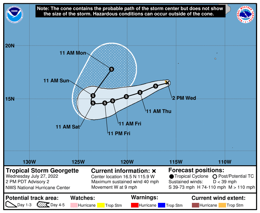
FORECAST POSITIONS AND MAX WINDS

INIT  27/2100Z 16.5N 115.9W   35 KT  40 MPH
12H  28/0600Z 16.2N 117.1W   40 KT  45 MPH
24H  28/1800Z 15.6N 118.7W   45 KT  50 MPH
36H  29/0600Z 15.2N 120.1W   50 KT  60 MPH
48H  29/1800Z 14.8N 121.5W   50 KT  60 MPH
60H  30/0600Z 14.6N 122.3W   50 KT  60 MPH
72H  30/1800Z 14.6N 123.5W   50 KT  60 MPH
96H  31/1800Z 15.3N 123.5W   45 KT  50 MPH
120H  01/1800Z 17.8N 121.6W   40 KT  45 MPH

$$
Forecaster Papin
045525d4x1hggf57fg7xjq.png
063008ltoshoglxo505r3p.gif
063011azxmrppypkup9o0m.jpg
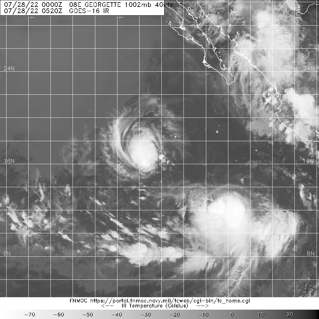
20220728.0520.goes-16.ir.08E.GEORGETTE.40kts.1002mb.16.4N.116.2W.100pc.jpg
回復

使用道具 舉報

快速回覆
您需要登錄後才可以回帖 登錄 | 立即加入

本版積分規則

本平台僅供學術討論之用,預報應以氣象局為準

威普網站虛擬主機贊助公司

臺灣第一個天氣類型社群平台 即時天氣資訊、精準颱風動態

線上客服
FB傳送訊息
廣告行銷
精準行銷 物超所值
官方粉專
發佈 快速回復 返回頂部 返回列表