|
|
 霧峰追風者|2022-9-26 10:39
|
顯示全部樓層
000
WTNT45 KNHC 232033
TCDAT5
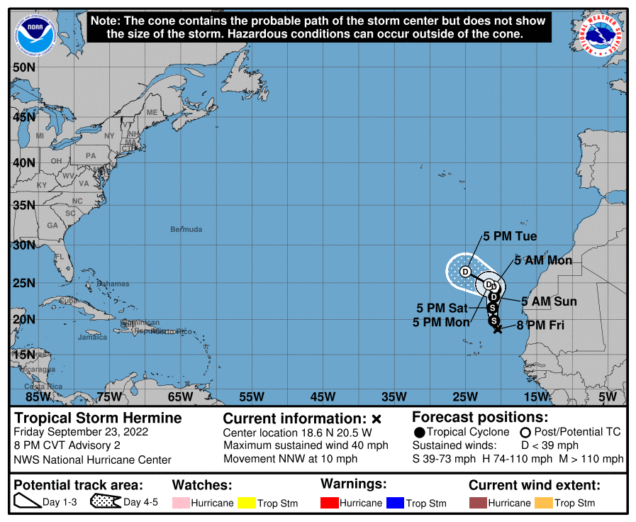
Tropical Storm Hermine Discussion Number 2
NWS National Hurricane Center Miami FL AL102022
800 PM CVT Fri Sep 23 2022
A large burst of convection has been occurring in the northeastern
quadrant of the system today, with other shallow banding features
to the southeast of the center. Overall, the cyclone looks better
than this morning and resembles a sheared tropical storm, which is
confirmed by the Dvorak pattern-T of 2.5 (35 kt) from SAB. Thus
the wind speed is set to 35 kt, making this system the 8th tropical
storm of the season.
Hermine continues moving north-northwestward, now about 10 kt.
Global model guidance is consistent on the cyclone moving northward
through a large break in the eastern Atlantic subtropical ridge.
The most significant change is that the storm could hold together a
little longer in a marginal environment, which causes the forecast
track to tug a little to the northeast before a weakening Hermine
would move westward as a shallow system beneath the low-level ridge.
The new forecast is shifted to the north and east, but is not as
far northeast as the GFS or HWRF models.
The storm has about a day over lukewarm water before all the models
hit the system with strong upper-level southwesterly winds. There
is a minority solution in the models where the upper-trough cuts
off, somewhat lessening the shear, but for now the NHC forecast
stays closer to the faster dissipation scenario. Either way, Hermine
should dissipate early next week due to very strong shear and dry
air entrainment cutting off any deep convection. The official
intensity forecast is a little higher than the last one, near the
various consensus aids.
Note that 2 to 4 inches of rain, with isolated totals of 6 inches,
are possible over the Canary Islands through this weekend due to a
combination of a mid-latitude trough and moisture from Hermine.
This rainfall could cause some flash flooding in areas of higher
terrain.
FORECAST POSITIONS AND MAX WINDS
INIT 23/2100Z 18.6N 20.5W 35 KT 40 MPH
12H 24/0600Z 19.8N 21.0W 40 KT 45 MPH
24H 24/1800Z 21.6N 21.2W 35 KT 40 MPH
36H 25/0600Z 23.1N 21.0W 30 KT 35 MPH
48H 25/1800Z 24.1N 20.8W 30 KT 35 MPH
60H 26/0600Z 24.5N 21.0W 25 KT 30 MPH...POST-TROP/REMNT LOW
72H 26/1800Z 24.8N 21.7W 25 KT 30 MPH...POST-TROP/REMNT LOW
96H 27/1800Z 26.5N 25.0W 25 KT 30 MPH...POST-TROP/REMNT LOW
120H 28/1800Z...DISSIPATED
$$
Forecaster Blake 
|
|