開啟輔助訪問
 找回密碼
 立即加入

95E

簽到天數: 4131 天

[LV.Master]伴壇終老

2024-9-25 18:44 | 顯示全部樓層


基本資料  
編號    :95 E
擾動編號日期:2024 09 25 08
撤編日期  :2024 09 00 00

EP, 95, 2024092500,   , BEST,   0, 160N, 1020W,  30, 1001, DB,  34, NEQ
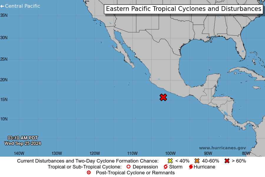
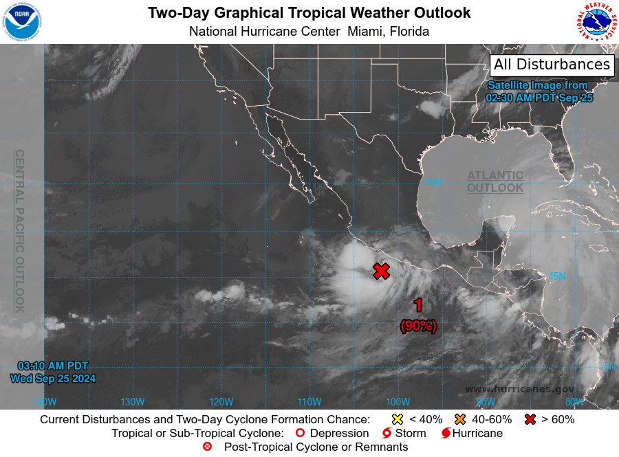
two_pac_0d0.png

two_pac_2d0.png


Tropical Weather Outlook Text        EspañolTropical Weather Discussion
ZCZC MIATWOEP ALL
TTAA00 KNHC DDHHMM

Special Tropical Weather Outlook
NWS National Hurricane Center Miami FL
310 AM PDT Wed Sep 25 2024

For the eastern North Pacific...east of 140 degrees west longitude:

Special Outlook Issued to update information about EP95, the system
offshore of Southern Mexico.

1. Offshore of Southern Mexico (EP95):
Update: Recent ship observations indicate significant pressure falls
are occuring with an area of low pressure, partially associated with
the remnants of John, located offshore of Southern Mexico. Shower
and thunderstorm activity also continues to become better organized.
If these trends continue, a tropical depression or storm could form
as soon as later today, as long as the system remains over water.
Interests in southern Mexico should closely monitor the progress of
this system, and regardless of development, this system is expected
to produce heavy rainfall with the potential for flash flooding and
mudslides over a large portion of southern Mexico through this
week.
* Formation chance through 48 hours...high...90 percent.
* Formation chance through 7 days...high...90 percent.


Forecaster Papin/Beven
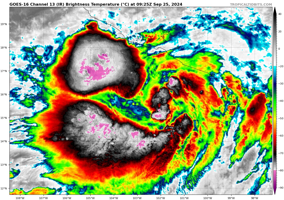

goes16_ir_95E_202409250925_lat15.8-lon-102.6.jpg
回復

使用道具 舉報

簽到天數: 241 天

[LV.8]以壇為家I

krichard2011|2024-9-25 23:26 | 顯示全部樓層
由於NHC沿用了John 名字
因此宣告 約翰正式復活
此帖將併入約翰討論帖
  1. 000
  2. WTPZ45 KNHC 251456
  3. TCDEP5

  4. Tropical Storm John Discussion Number  11
  5. NWS National Hurricane Center Miami FL       EP102024
  6. 900 AM CST Wed Sep 25 2024

  7. John has reformed near the southwestern coast of Mexico.  The
  8. CIMSS-UW satellite vorticity analyses show remnants of vorticity,
  9. likely associated with the mid-level circulation of John, have
  10. merged with a larger source of vorticity from the monsoon trough.  
  11. Convection has gradually become better organized based on
  12. geostationary infrared and visibly imagery.  An AMSR2 microwave pass
  13. at 0807 UTC showed curved banding near the surface, indicating a
  14. well-defined surface center. A Dvorak classification from TAFB has
  15. given John a 2.0/35 kt and that is the initial intensity for this
  16. advisory.

  17. The environmental conditions appear conducive for John to strengthen
  18. in the next day or so, as long as the circulation stays over water.  
  19. Global models show the vertical wind shear remaining
  20. weak-to-moderate, ample mid-level moisture, and very warm sea
  21. surface temperatures.  Statistical guidance even suggests there is
  22. an above average possibility for strong-to-rapid intensification.  
  23. The latest NHC intensity forecast shows John reaching a peak
  24. intensity of 55 kt in 24 h, which is near the HCCA intensity aid and
  25. at the top of the guidance envelope.  However, there is a chance
  26. John may become a hurricane prior to landfall.

  27. The tropical storm is meandering eastward in the monsoonal flow with
  28. an estimate motion of 80/2 kt.  Models indicate that John will
  29. gradually turn towards the north later today and accelerate slightly
  30. towards the coast on Thursday.  Regional and global models vary the
  31. timing of landfall, with the GFS and GFS-based hurricane models
  32. showing John at the coast by tomorrow evening and the ECMWF
  33. lingering offshore until Friday.  The official track forecast calls
  34. for landfall along the southern and southwestern coast of Mexico on
  35. Thursday evening, however, there is uncertainty associated with this
  36. timing.  A Hurricane Watch and Tropical Storm Warning have been
  37. issued by the government of Mexico for portions of the coast of
  38. southern Mexico and interests there should closely monitor future
  39. forecasts for updates.

  40. KEY MESSAGES:

  41. 1. Tropical Storm John will bring additional very heavy rainfall to
  42. coastal portions of southwest Mexico through Friday.  The additional
  43. rainfall totals will be falling across areas that have received very
  44. heavy rainfall amounts over the past few days.   This heavy rainfall
  45. will likely cause significant and  catastrophic, life-threatening
  46. flash flooding and mudslides to the Mexican States of Guerrero,  
  47. Oaxaca, coastal Chiapas, and coastal Michoaca.

  48. 2. John is forecast to strengthen before landfall, and a Hurricane
  49. Watch and a Tropical Storm Warning have been issued for a portion of
  50. the coastline of southern and southwestern Mexico, where tropical
  51. storm conditions could begin later today.

  52. FORECAST POSITIONS AND MAX WINDS

  53. INIT  25/1500Z 16.2N 101.4W   35 KT  40 MPH
  54. 12H  26/0000Z 16.3N 101.2W   45 KT  50 MPH
  55. 24H  26/1200Z 16.7N 101.1W   55 KT  65 MPH
  56. 36H  27/0000Z 17.3N 101.1W   55 KT  65 MPH
  57. 48H  27/1200Z 17.8N 101.2W   30 KT  35 MPH
  58. 60H  28/0000Z...DISSIPATED

  59. $$
  60. Forecaster Bucci/R. Zelinsky
複製代碼


回復

使用道具 舉報

快速回覆
您需要登錄後才可以回帖 登錄 | 立即加入

本版積分規則

本平台僅供學術討論之用,預報應以氣象局為準

威普網站虛擬主機贊助公司

臺灣第一個天氣類型社群平台 即時天氣資訊、精準颱風動態

線上客服
FB傳送訊息
廣告行銷
精準行銷 物超所值
官方粉專
發佈 快速回復 返回頂部 返回列表