|
|
 frintezza1117|2014-4-13 22:23
|
顯示全部樓層
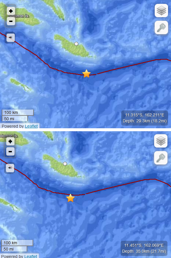
上圖=今早的地震
下圖=這次地震

今早地震是由一道平移斷層引起的, 因此海嘯相當輕微
但這次地震雖然較弱, 但是是由一道逆衝斷層引起的, 由於有上下移動, 因此海嘯機會較大, 附近沿海地區要注意了
http://earthquake.usgs.gov/earth ... /usc000piqj#summary
The April 13, 2014 M 7.4 Solomon Islands earthquake occurred as the result of nearly pure reverse faulting on an approximately east-west oriented structure near the oceanic trench that marks the plate boundary between the Australia and Pacific plates. At the location of the earthquake, the Australia Plate converges with and slips past the Pacific plate at a rate of 95 mm/yr. The April 13 earthquake occurred along a portion of this plate boundary that transitions from thrust to transform tectonics between the New Britain Trench to the northwest and the New Hebrides Trench farther east. The earthquake occurred about 110 km SSE of Kirakira, Solomon Islands.
The April 13 earthquake occurred less than 24 hours and approximately 20 km to the southwest of a M 7.7 strike-slip earthquake on April 12, 2014. While the April 12 strike-slip earthquake likely represented Australia-Pacific plate boundary faulting, the April 13 earthquake is located south of the plate boundary at a depth of approximately 35 km, and as such may represent tearing of the Australia plate to accommodate the abrupt change in Australian plate interaction with the Pacific plate (subduction to the north and west; left-lateral translation to the east).
|
|