開啟輔助訪問
 找回密碼
 立即加入

91P 深入澳洲內陸

查看數: 10693 評論數: 5 收藏 0切换到帖子模式
    組圖打開中,請稍候......
發佈時間: 2021-2-6 10:06

正文摘要:

本帖最後由 周子堯@FB 於 2021-2-7 23:52 編輯   基本資料   編號    :91 P 擾動編號日期:2021 年 02 月 06 日 09 時 撤編日期  :2021 年 02 月 07 日 19 時 91P.INVEST.15kts-993m ...

老農民版夜神月 發表於 2021-2-7 13:56
JTWC取消評級
(1) THE AREA OF CONVECTION (INVEST 91P) PREVIOUSLY LOCATED
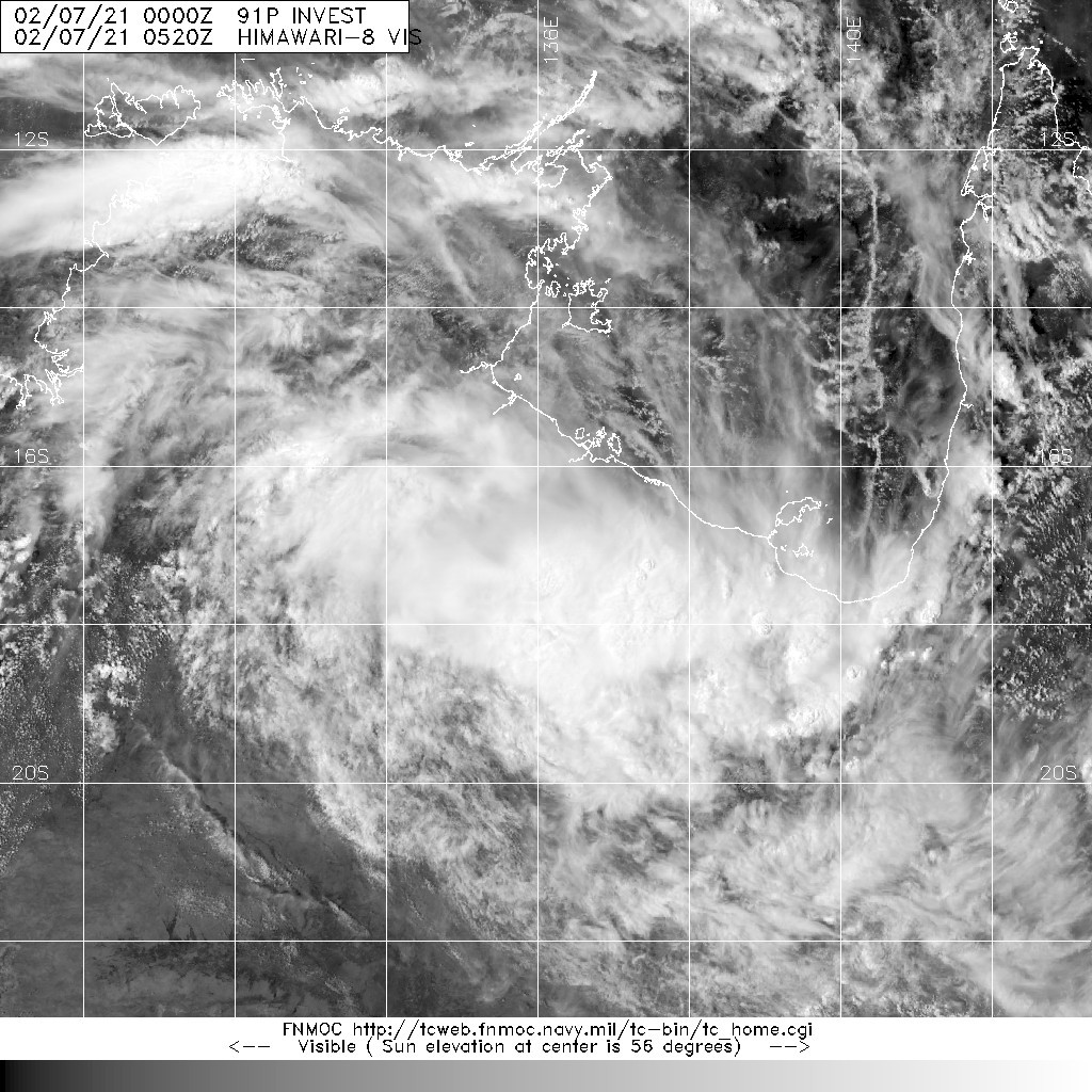
NEAR 15.1S 137.3E HAS DISSIPATED AND IS NO LONGER SUSPECT FOR THE
DEVELOPMENT OF A SIGNIFICANT TROPICAL CYCLONE IN THE NEXT 24 HOURS.  
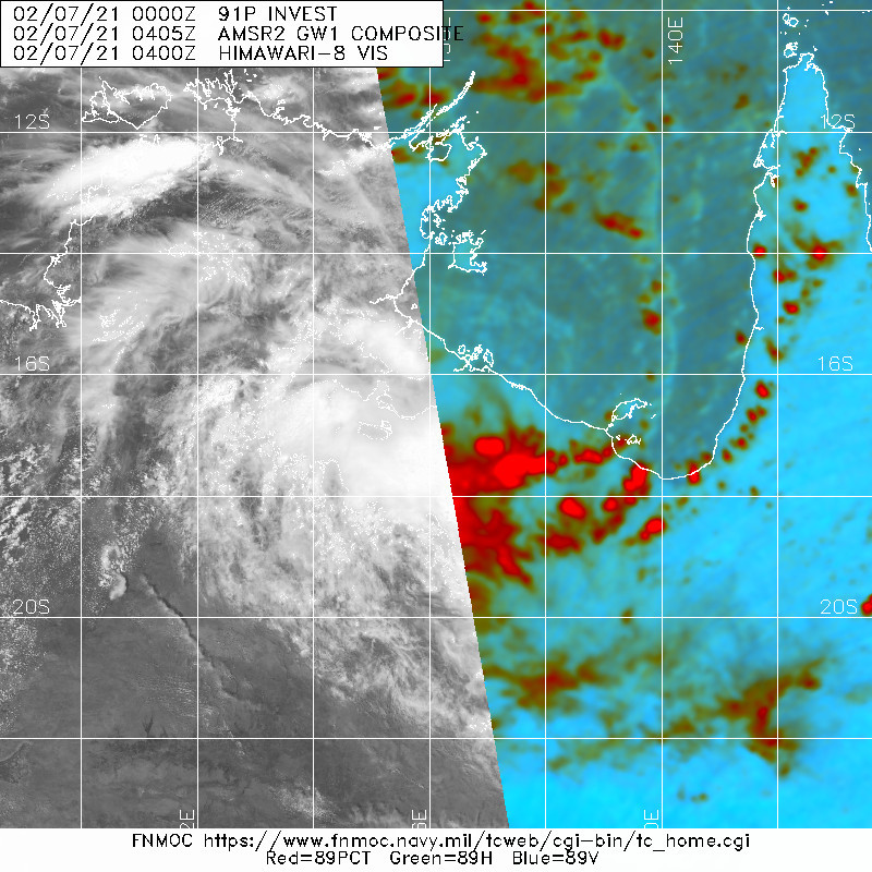
20210207.0520.himawari-8.vis.91P.INVEST.20kts.997mb.17S.136.1E.100pc.jpg 20210207.0405.gw1.89pct89h89v.91P.INVEST.20kts.997mb.17S.136.1E.50pc.jpg
老農民版夜神月 發表於 2021-2-7 03:29
已登陸澳洲,預估將朝澳洲內陸移動,已沒有發展機會
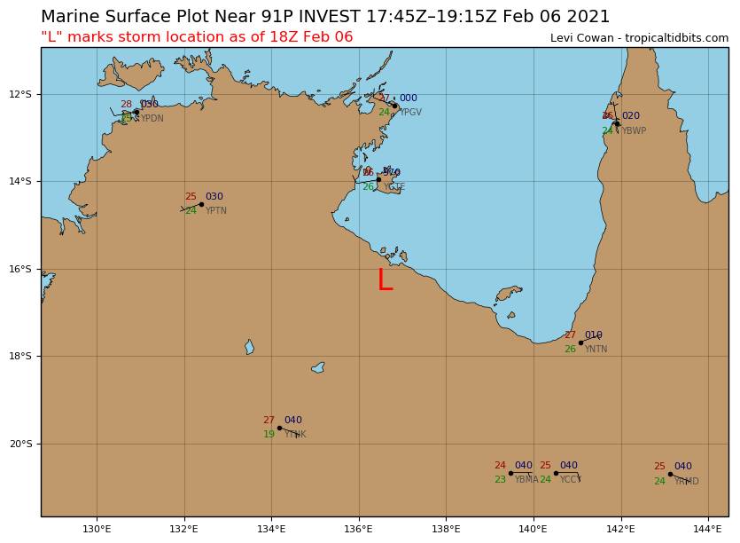
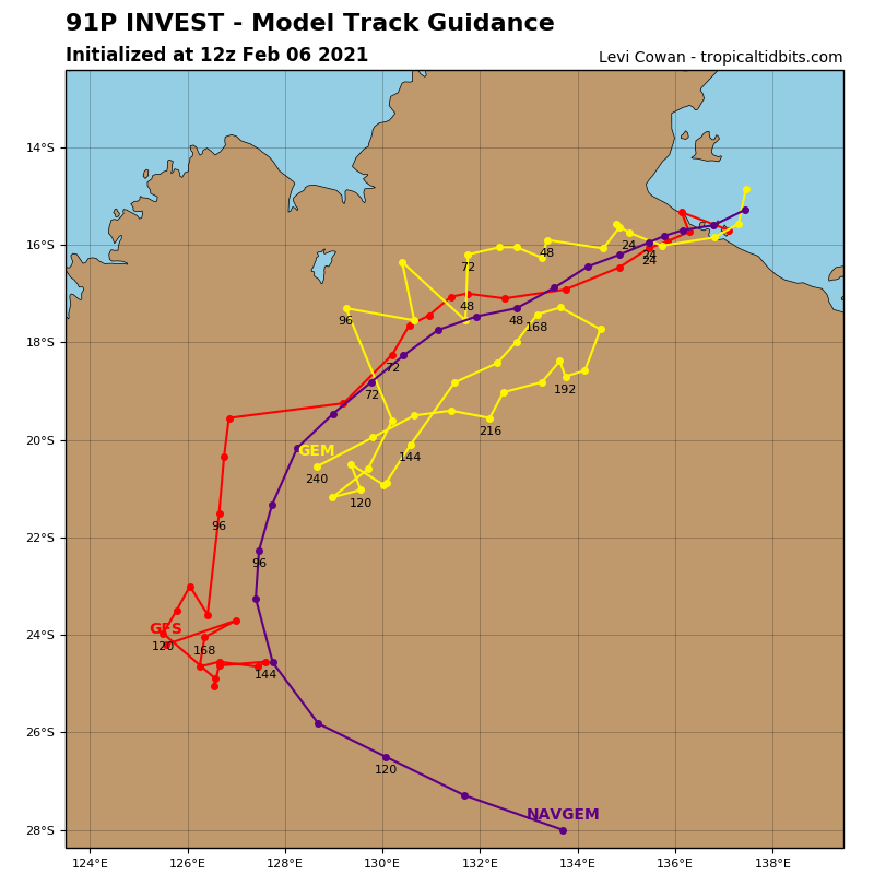
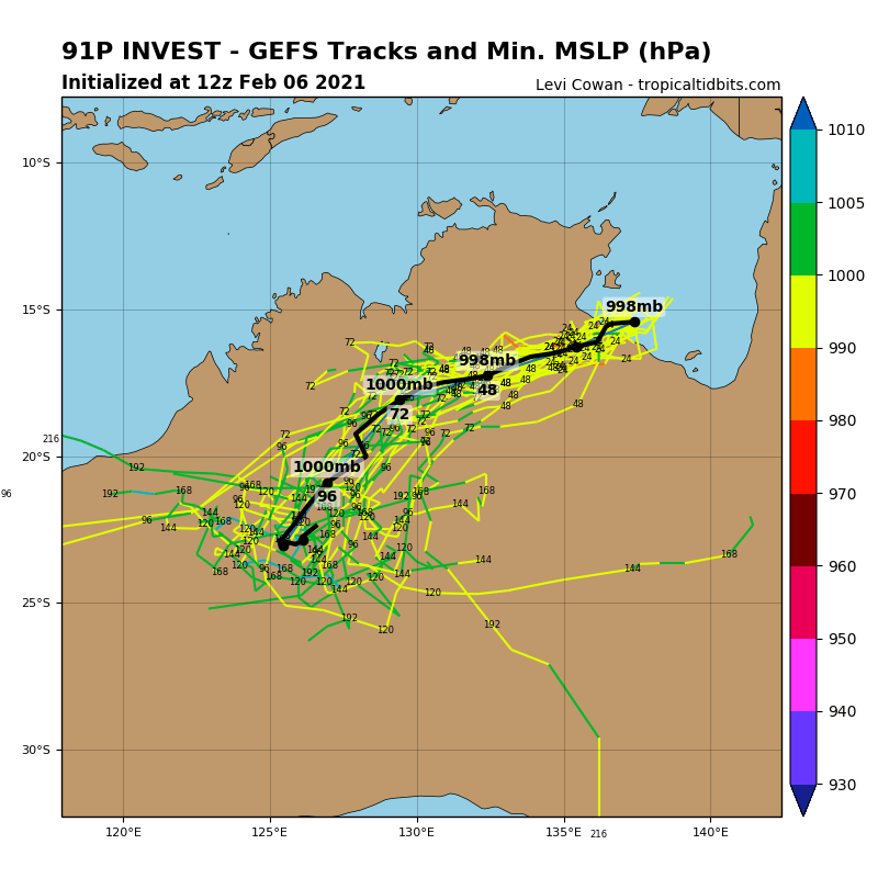
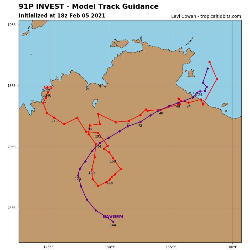
A tropical low, 998 hPa, was located over the southwest Gulf of Carpentaria, near 14.4S 137.3E, which is about 90 km east southeast of Groote Eylandt and 170 km north northeast of Port McArthur, at 12:30 pm CST on Saturday 6 February. The tropical low is expected to strengthen over water as it moves slowly southwards today and is likely to cross the coast between Port Roper and the Queensland border on Sunday morning. The low is unlikely to develop into a tropical cyclone but strong winds and heavy rainfall will occur.
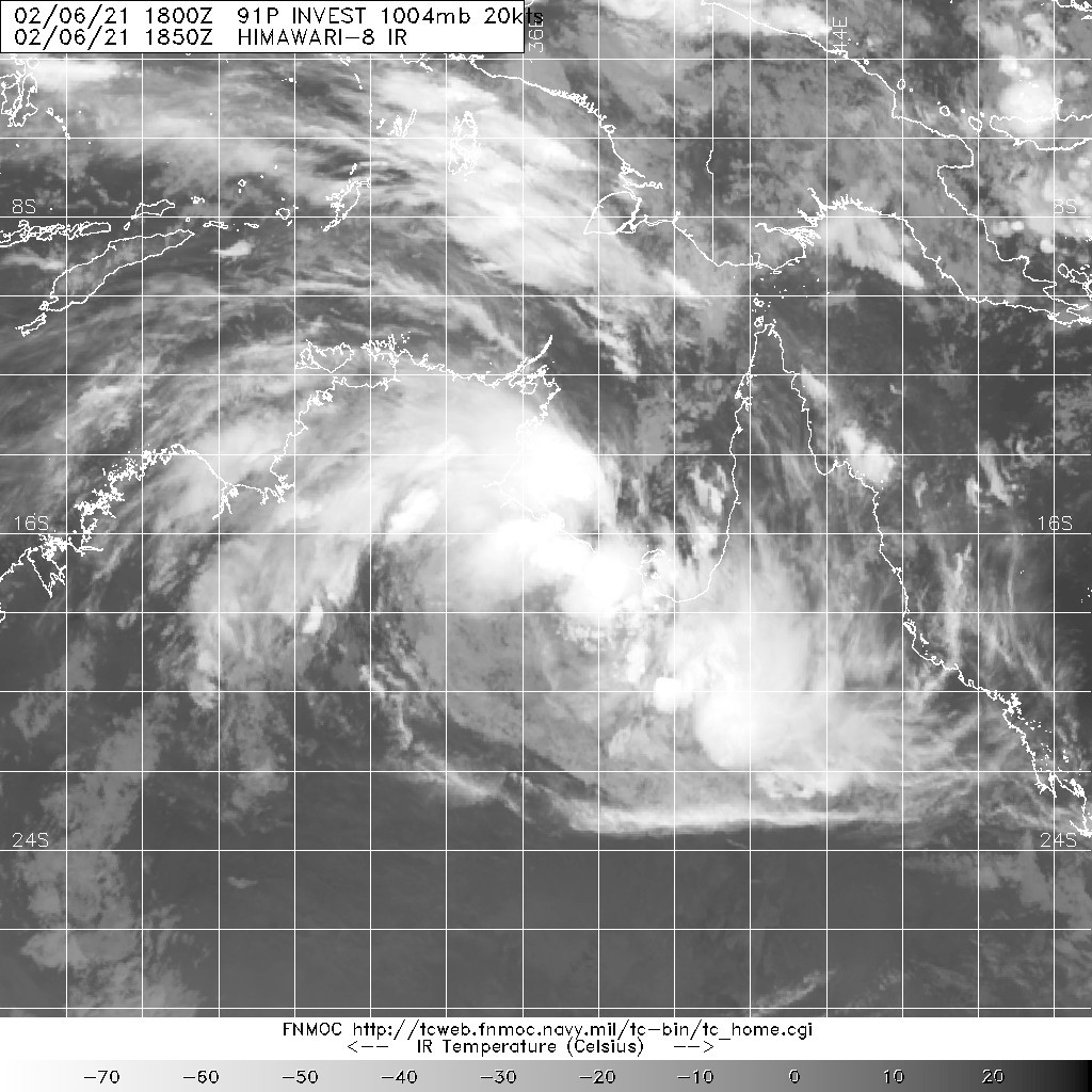
During Sunday and Monday, the tropical low is expected to move west southwest across the Northern Territory, bringing further heavy rainfall, flooding and possible damaging wind gusts.


Likelihood of a tropical cyclone in the Northern Region on:
Sunday: Low
Monday:Very Low
Tuesday:Very Low

20210206.1850.himawari-8.ir.91P.INVEST.20kts.1004mb.16.3S.136.6E.100pc.jpg sfcplot_91P_latest (1).png
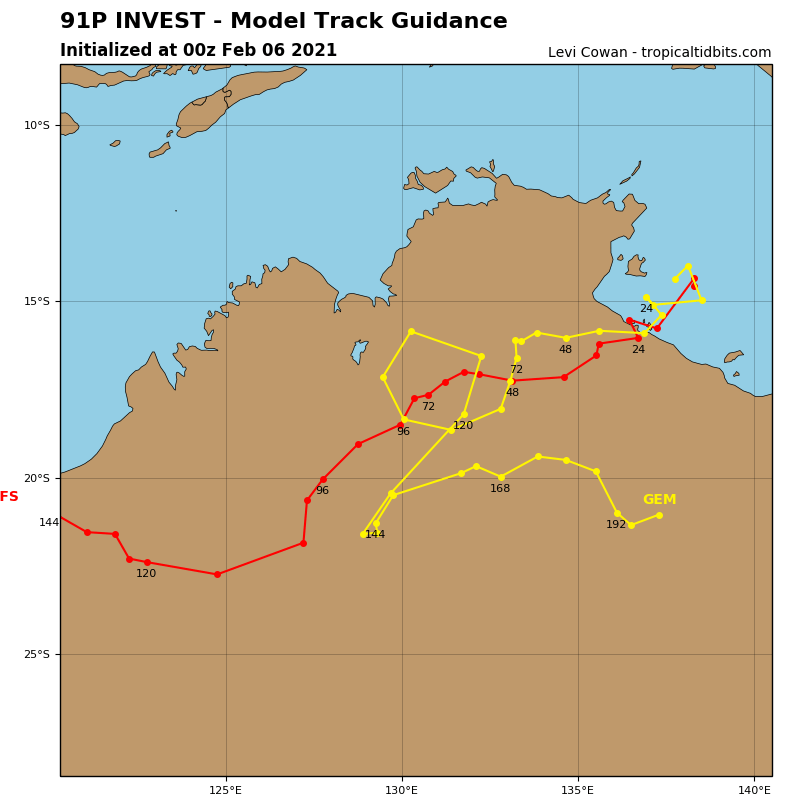
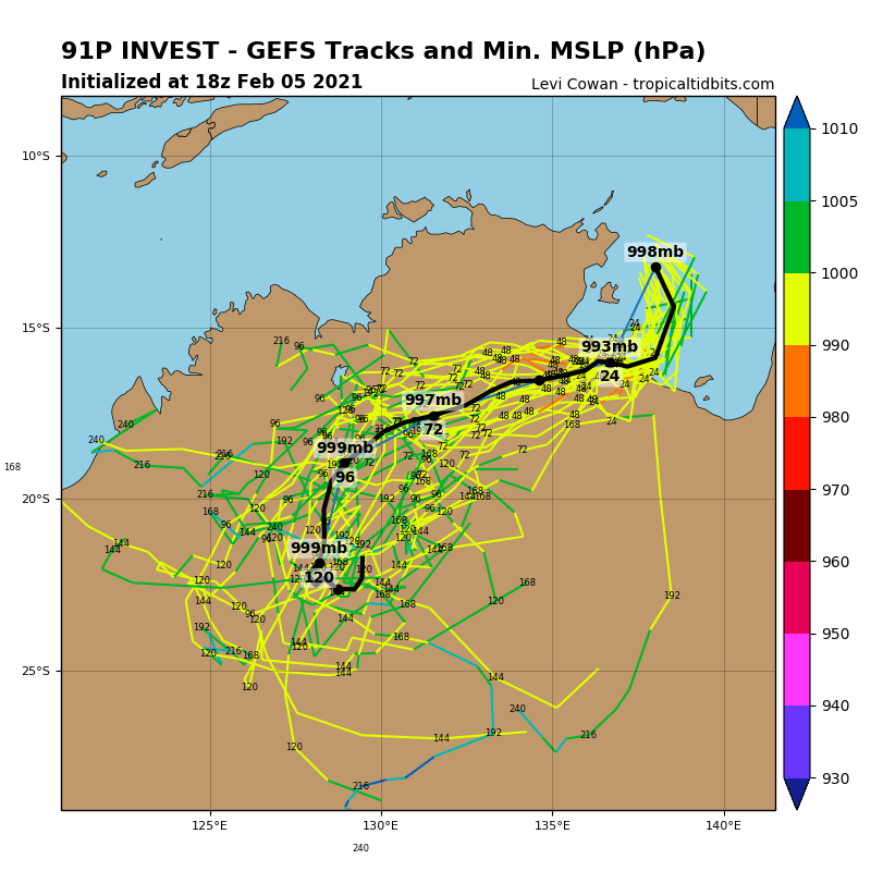
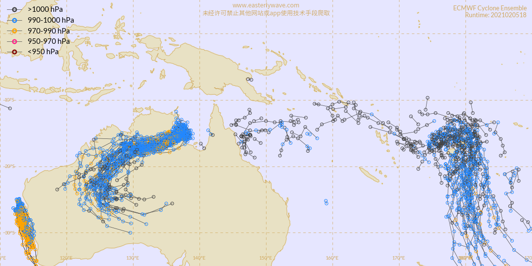
91P_tracks_latest (3).png 91P_gefs_latest (3).png
老農民版夜神月 發表於 2021-2-6 16:30
本帖最後由 老農民版夜神月 於 2021-2-6 16:34 編輯

JTWC06Z升格TD,0830Z評級Low
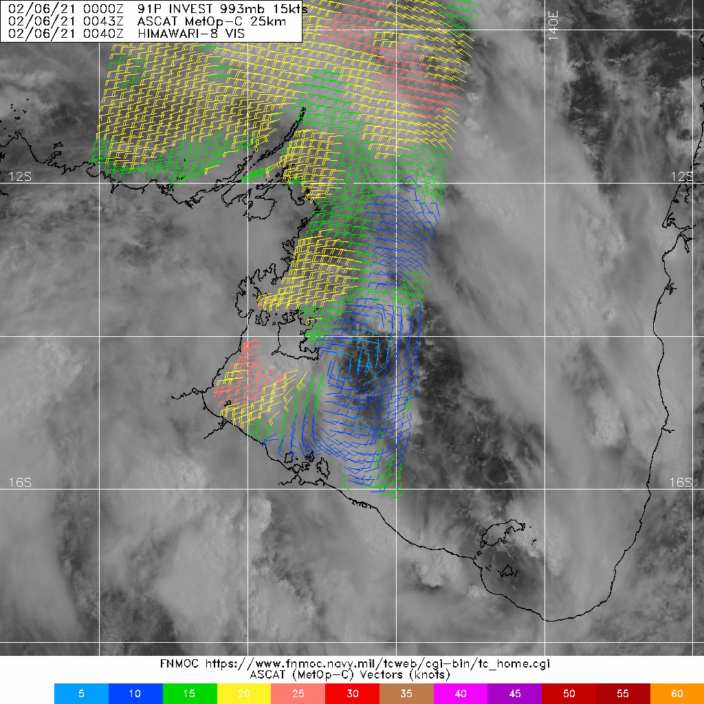
91P INVEST 210206 0600 15.1S 137.3E SHEM 25 997
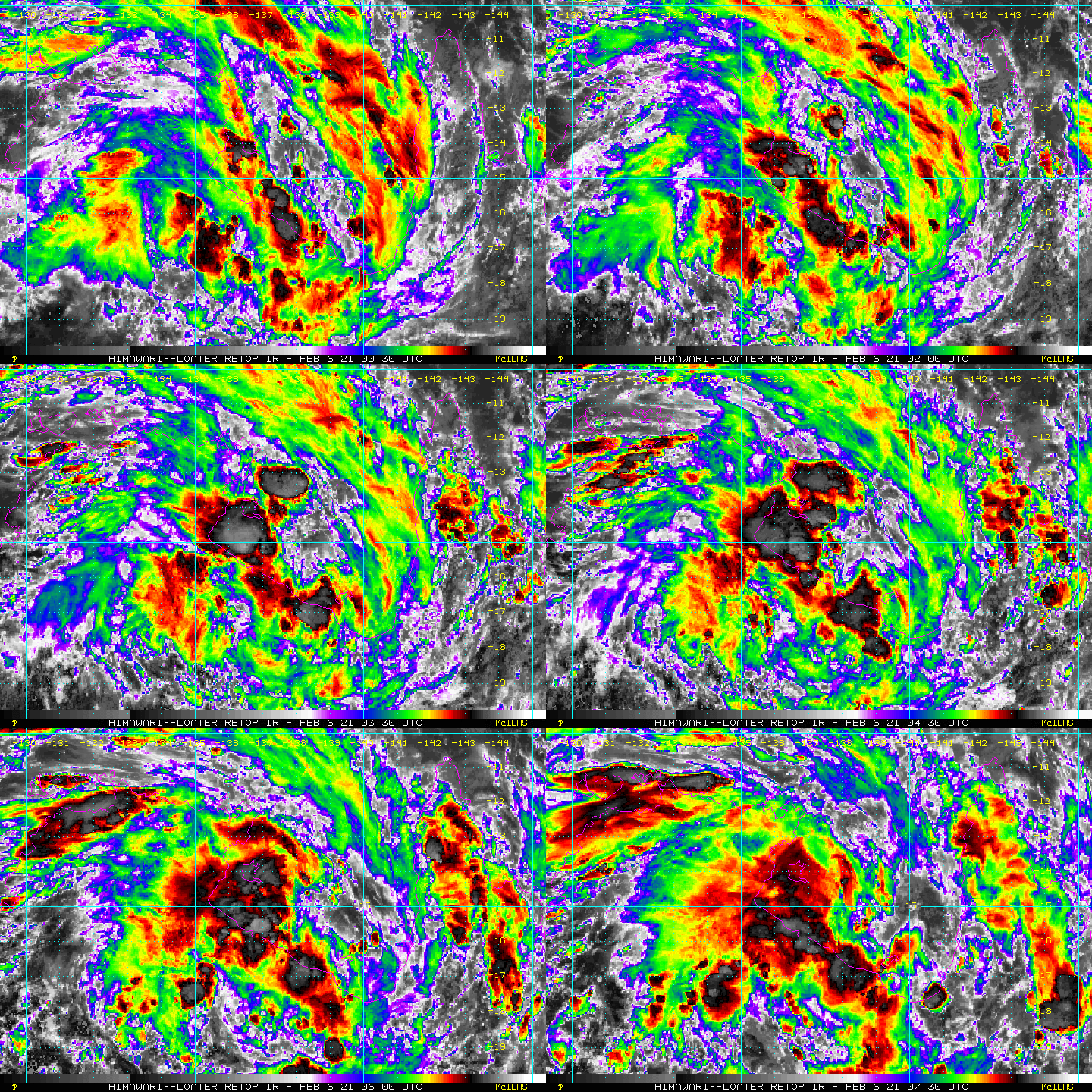
(1) AN AREA OF CONVECTION (INVEST 91P) HAS PERSISTED NEAR
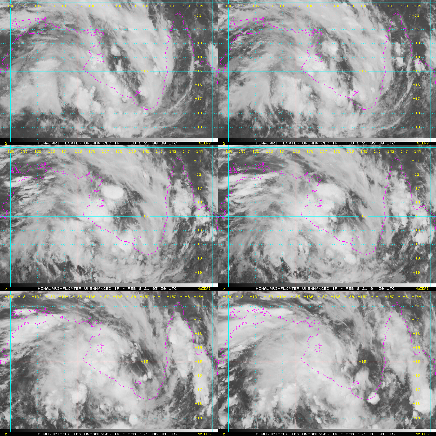
15.1S 137.3E, APPROXIMATELY 410 NM EAST-SOUTHEAST OF DARWIN,
AUSTRALIA. ANIMATED MULTISPECTRAL SATELLITE IMAGERY AND A 060710Z
SSMIS 91GHZ IMAGE SHOW FLARING DEEP CONVECTION OVER A DISORGANIZED
LOW LEVEL CIRCULATION CENTER. ENVIRONMENTAL ANALYSIS SHOWS A
MODERATELY FAVORABLE ENVIRONMENT WITH HIGH (25-30 KTS) VERTICAL WIND
SHEAR OFFSET BY WARM (29-30C) SEA SURFACE TEMPERATURES AND GOOD
POLEWARD OUTFLOW. NUMERICAL MODELS ARE IN FAIR AGREEMENT THAT 91P
WILL TRACK SOUTHWARD OVER THE NEXT 24 HOURS AND ENTER OVER NORTHERN
AUSTRALIA, RESULTING IN A LOW LIKELIHOOD OF FURTHER DEVELOPMENT.  
MAXIMUM SUSTAINED SURFACE WINDS ARE ESTIMATED AT 20 TO 25 KNOTS.
MINIMUM SEA LEVEL PRESSURE IS ESTIMATED TO BE NEAR 997 MB. THE
POTENTIAL FOR THE DEVELOPMENT OF A SIGNIFICANT TROPICAL CYCLONE
WITHIN THE NEXT 24 HOURS IS LOW.
ir_lalo-animated (5).gif rbtop_lalo-animated (2).gif
老農民版夜神月 發表於 2021-2-6 16:21
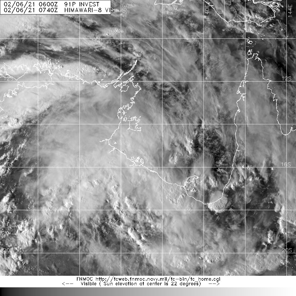
整體型態看著還行,不算太差,就是很可惜大概明早以前LLCC便會觸陸了
確實沒什麼可能發展的空間
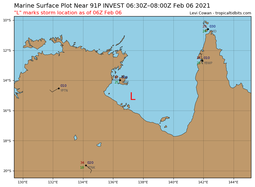
sfcplot_91P_latest.png 91P_tracks_latest (2).png
20210206.0740.himawari-8.vis.91P.INVEST.15kts.1010mb.15.1S.137.3E.100pc.jpg LATEST - 2021-02-06T161600.104.jpg
dom 發表於 2021-2-6 11:31
BoM在展望中提到91P,不太看好其發展
Tropical Cyclone Outlook for the Northern Region, including the Gulf of Carpentaria
Issued at 2:24 pm CST on Friday 5 February 2021
for the period until midnight CST Monday 8 February 2021.
Existing Cyclones in the Northern Region:
Nil.
Potential Cyclones:

The monsoon is becoming more active across the Arafura Sea as a renewed surge develops in the monsoon northwesterlies. A tropical low is beginning to form within the monsoon trough in the southwest Gulf of Carpentaria.
The tropical low is expected to remain over the Gulf of Carpentaria and move over land in the Northern Territory's Carpentaria District overnight on Saturday or Sunday morning. It is most likely the low will not have sufficient time over water to develop into a cyclone, but there is a low chance of development if the low remains over water for a longer period.

Likelihood of a tropical cyclone in the Northern Region on:
Saturday:Very Low
Sunday: Low
Monday:Very Low

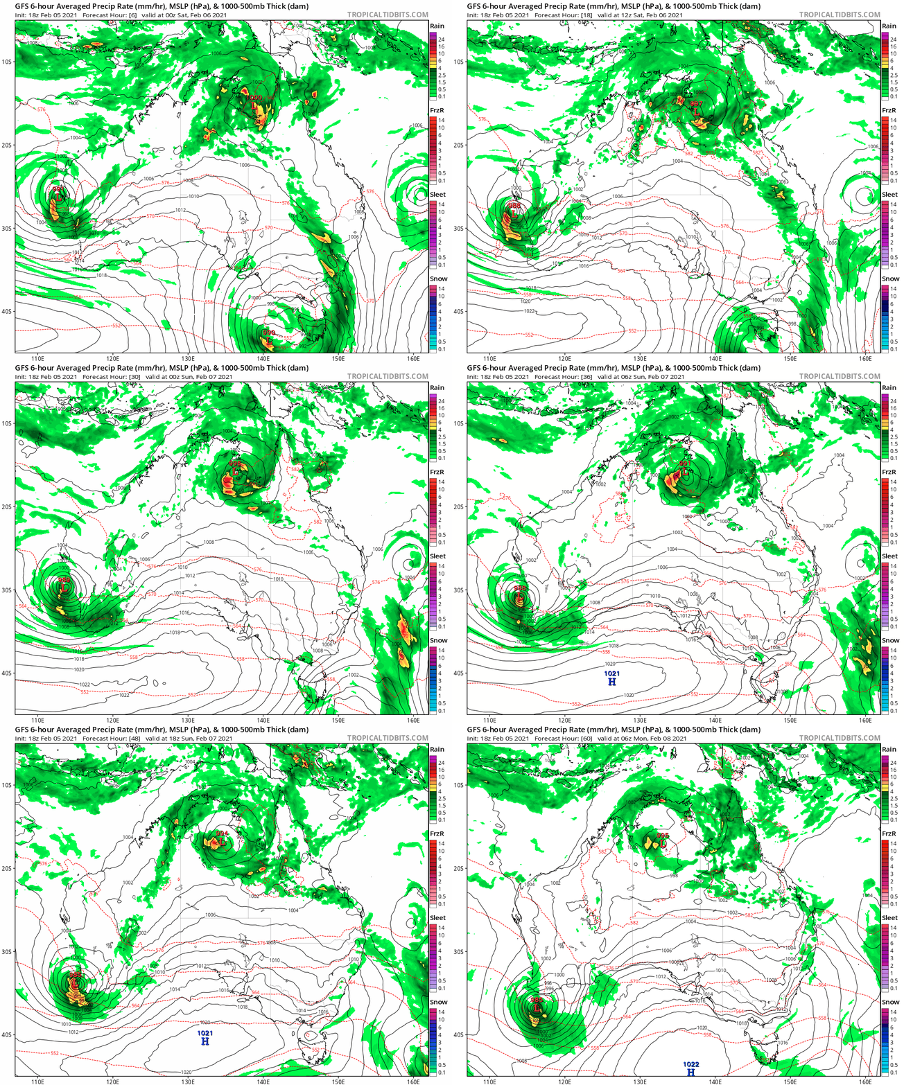
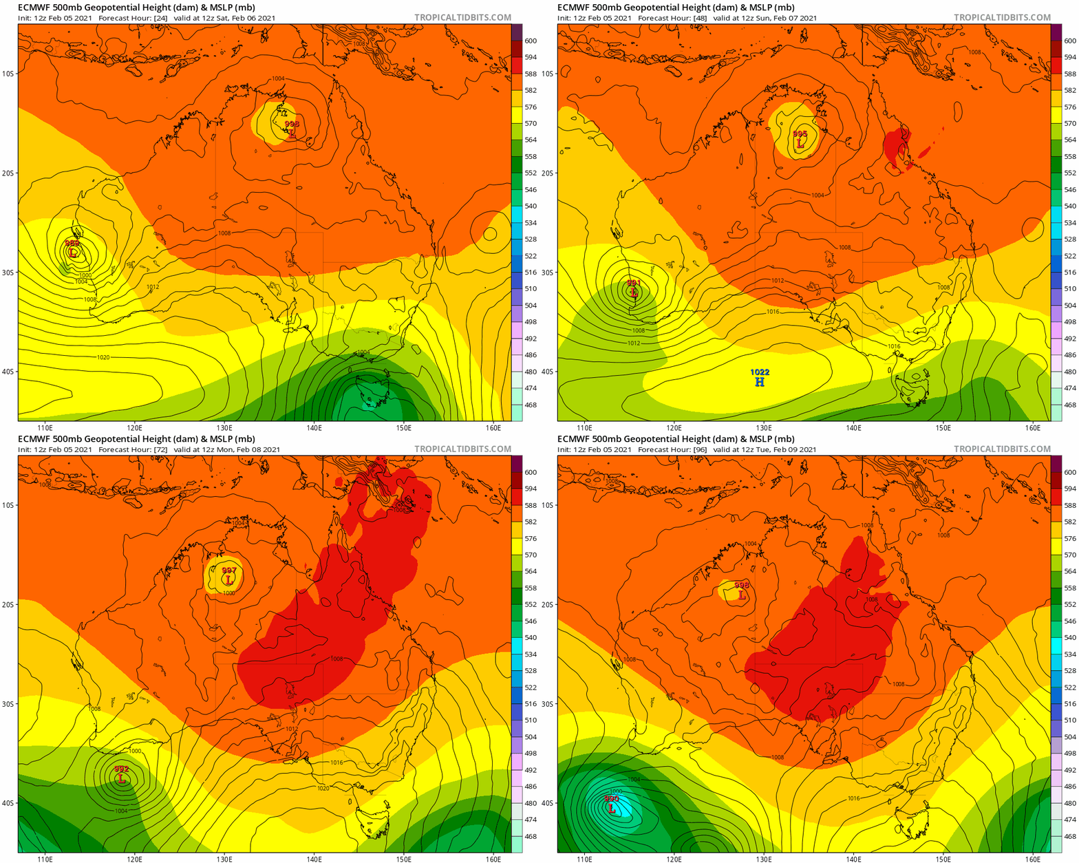
91P_tracks_latest.png 91P_gefs_latest.png aus.png gfs_mslp_pcpn_frzn_aus_fh6-60.gif ecmwf_z500_mslp_aus_fh24-96.gif

本平台僅供學術討論之用,預報應以氣象局為準

威普網站虛擬主機贊助公司

臺灣第一個天氣類型社群平台 即時天氣資訊、精準颱風動態

線上客服
FB傳送訊息
廣告行銷
精準行銷 物超所值
官方粉專
發佈 快速回復 返回頂部 返回列表