| 伴隨FNMOC和NRL撤编,CPHC也取消展望。 |
171330Z發布TCFA2. REMARKS: 
|
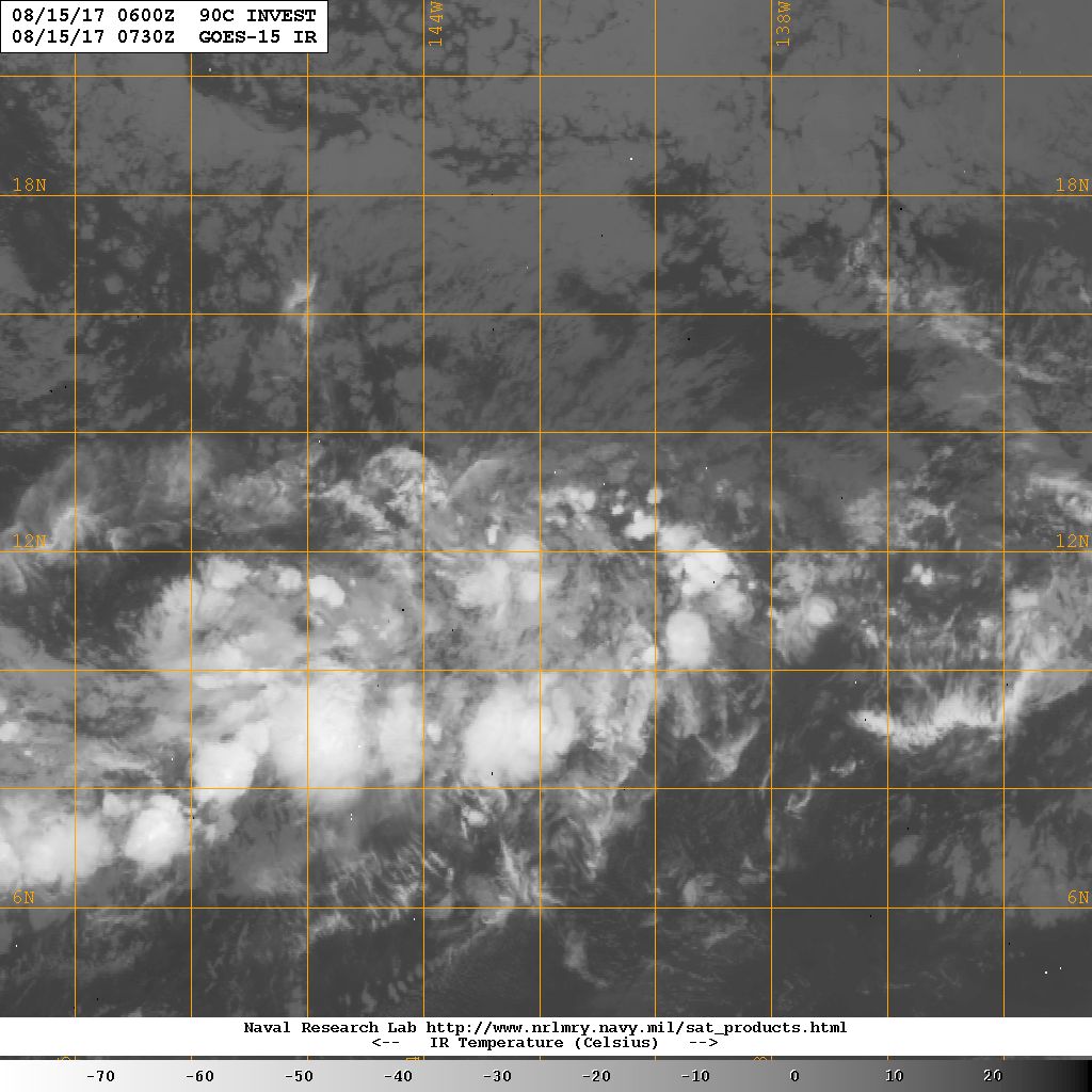
CPHC 展望降低至50%,發展緩慢。1. Showers and thunderstorms associated with a broad area of .png")
|
CPHC 展望提升70%1. Showers and thunderstorms associated with a broad area of .png")
|
CPHC展望提升至40%,只是CPHC定位90C與91C中間...1. Showers and thunderstorms continue to develop in association with 
|