Sub: Depression intensified into a Deep Depression over northeast and adjoining
eastcentral Bay of Bengal
Depression over northeast and adjoining eastcentral Bay of Bengal (BoB) moved
northeastwards with a speed of 20 kmph during the past 6 hours and intensified into a Deep
Depression and lay centred at 1730 hrs IST of today, the 29
th May 2018 over northeast and
adjoining eastcentral Bay of Bengal near latitude 19.2
0N and longitude 93.0
0 E, about 60 km westsouthwest
of Kyaukpyu (Myanmar) and 100 km south-southwest of Sittwe (Myanmar). It is very
likely to continue to move northeastwards and cross Myanmar coast between Kyaukpyu and
Sittwe by midnight of today, the 29th May 2018.
Forecast track and intensity are given in the following table:
BULLETIN NO. : 01 (BOB 01/2018)
TIME OF ISSUE: 1500 HOURS IST DATED: 29.05.2018
Sub: Depression over northeast and adjoining eastcentral Bay of Bengal
Latest observations and satellite imageries indicate that the Well Marked Low Pressure Area
(WML) over eastcentral and adjoining northeast Bay of Bengal (BoB) has concentrated into a
depression and lay centred at 1130 hrs IST of today, the 29
th May 2018 over northeast and adjoining
eastcentral BoB near latitude 18.50N and longitude 92.20E, about 170 km west-southwest of
Kyaukpyu (Myanmar) and 190 km south-southwest of Sittwe (Myanmar). It is very likely to intensify
further into a deep depression during next 6 hrs. It is very likely to move north-northeastwards and
cross Myanmar and adjoining Bangladesh coasts between Kyaukpyu and Teknaf (Bangladesh) close
to Sittwe around night of today, the 29th May 2018.
B. TROPICAL DISTURBANCE SUMMARY:
(1) THE AREA OF CONVECTION (INVEST 94A) PREVIOUSLY LOCATED
NEAR 10.7N 71.9E, HAS DISSIPATED AND IS NO LONGER SUSPECT FOR THE
DEVELOPMENT OF A SIGNIFICANT TROPICAL CYCLONE IN THE NEXT 24 HOURS.
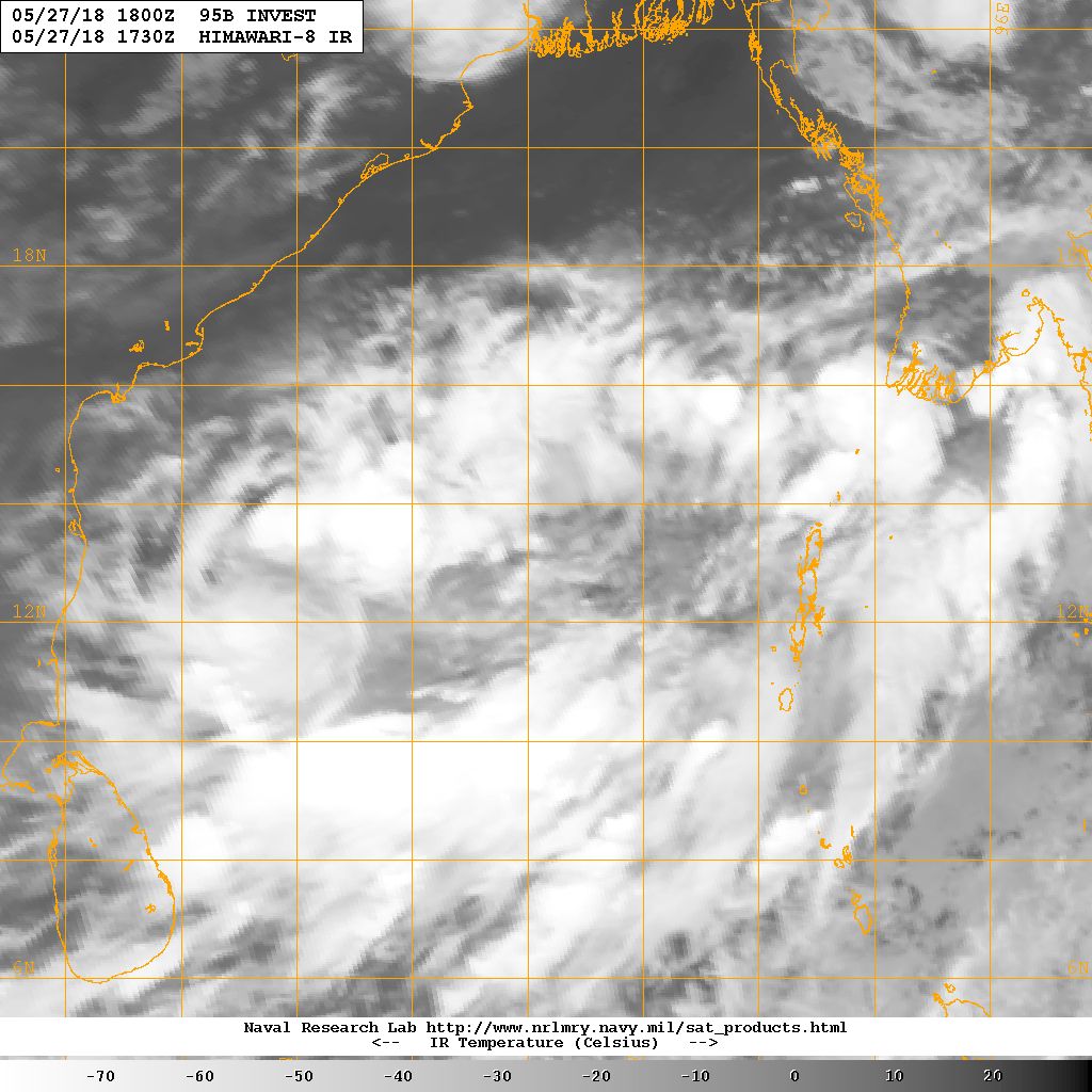
(2) THE AREA OF CONVECTION (INVEST 95B) PREVIOUSLY LOCATED
NEAR 14.2N 89.2E, IS NOW LOCATED NEAR 15.7N 90.9E, APPROXIMATELY 430
NM SOUTH-SOUTHEAST OF KOLKATA, INDIA. ANIMATED MULTISPECTRAL
SATELLITE IMAGERY AND A 281204Z SSMIS 91GHZ MICROWAVE IMAGE DEPICT A
BROAD CIRCULATION WITH A BAND OF FLARING CONVECTION LOCATED TO THE
SOUTH, BUT NOT WRAPPING INTO THE CENTER. A 280319Z OSCAT PASS SHOWS
MOSTLY STRAIGHT LINE FLOW WITH A WEAK CIRCULATION WITH PRIMARILY 15
20 KNOT WINDS AND STRONGER (35 KNOT WINDS) TO THE SOUTH. THE SYSTEM
IS CURRENTLY LOCATED IN A FAVORABLE ENVIRONMENT WITH EXCELLENT
POLEWARD AND EQUATORWARD UPPER LEVEL DIVERGENCE, LOW (5-15 KNOT)
VERTICAL WIND SHEAR, AND VERY WARM (30-32 CELSIUS) SEA SURFACE
TEMPERATURES. GLOBAL MODELS DEPICT THE DISTURBANCE TRACKING TO THE
NORTHEAST OVER THE NEXT FEW DAYS BUT ARE IN DISAGREEMENT AS TO IF IT
WILL CONSOLIDATE BEFORE MAKING LANDFALL SOUTH OF CHITTAGONG. MAXIMUM
SUSTAINED SURFACE WINDS ARE ESTIMATED AT 15 TO 20 KNOTS. MINIMUM SEA
LEVEL PRESSURE IS ESTIMATED TO BE NEAR 1003 MB. THE POTENTIAL FOR
THE DEVELOPMENT OF A SIGNIFICANT TROPICAL CYCLONE WITHIN THE NEXT 24
HOURS IS UPGRADED TO MEDIUM.