簽到天數: 868 天 [LV.10]以壇為家III
|
 jrchang5|2020-2-23 12:03
|
顯示全部樓層
本帖最後由 jrchang5 於 2020-2-23 12:20 編輯
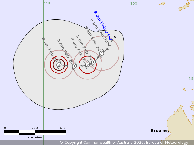
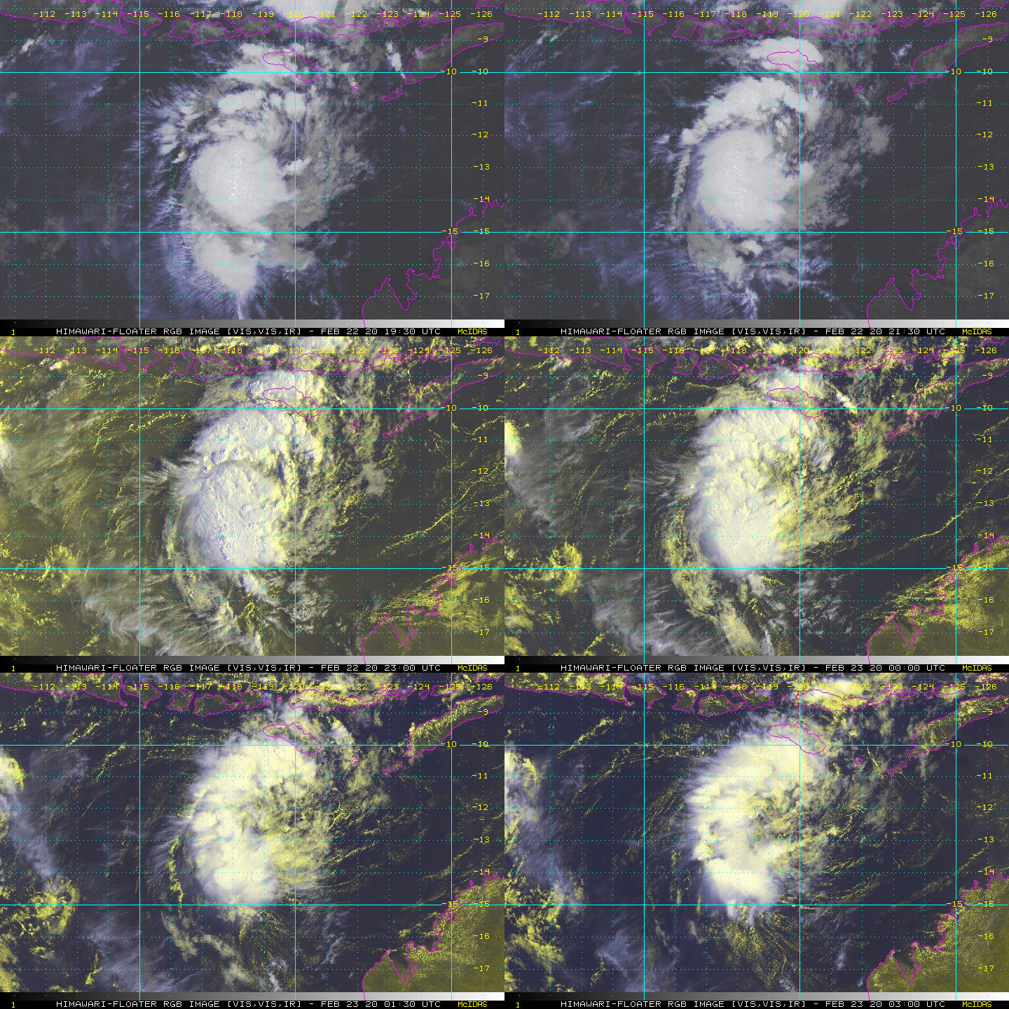
BoM已升格為熱帶低壓並編號08U,看好未來發展。
IDW27600
TROPICAL CYCLONE TECHNICAL BULLETIN: AUSTRALIA - WESTERN REGION
Issued by PERTH TROPICAL CYCLONE WARNING CENTRE
at: 0219 UTC 23/02/2020
Name: Tropical Low
Identifier: 08U
Data At: 0000 UTC
Latitude: 12.5S
Longitude: 118.9E
Location Accuracy: within 30 nm [55 km]
Movement Towards: west southwest [256 deg]
Speed of Movement: 1 knots [2 km/h]
Maximum 10-Minute Wind: 25 knots [45 km/h]
Maximum 3-Second Wind Gust: 45 knots [80 km/h]
Central Pressure: 1002 hPa
Radius of 34-knot winds NE quadrant:
Radius of 34-knot winds SE quadrant:
Radius of 34-knot winds SW quadrant:
Radius of 34-knot winds NW quadrant:
Radius of 48-knot winds NE quadrant:
Radius of 48-knot winds SE quadrant:
Radius of 48-knot winds SW quadrant:
Radius of 48-knot winds NW quadrant:
Radius of 64-knot winds:
Radius of Maximum Winds:
Dvorak Intensity Code: T1.5/1.5/D1.5/24HRS STT:D0.5/06HRS
Pressure of outermost isobar: 1008 hPa
Radius of outermost closed isobar: 120 nm [220 km]
FORECAST DATA
Date/Time : Location : Loc. Accuracy: Max Wind : Central Pressure
[UTC] : degrees : nm [km]: knots[km/h]: hPa
+06: 23/0600: 12.8S 118.9E: 040 [080]: 030 [055]: 1002
+12: 23/1200: 12.9S 118.8E: 055 [100]: 030 [055]: 1001
+18: 23/1800: 13.2S 118.7E: 065 [125]: 030 [055]: 1000
+24: 24/0000: 13.4S 118.4E: 080 [145]: 035 [065]: 1000
+36: 24/1200: 13.9S 117.9E: 100 [185]: 040 [075]: 996
+48: 25/0000: 14.1S 117.6E: 120 [220]: 055 [100]: 986
+60: 25/1200: 14.1S 116.8E: 140 [255]: 060 [110]: 983
+72: 26/0000: 14.1S 115.9E: 155 [290]: 070 [130]: 976
+96: 27/0000: 14.5S 114.6E: 200 [370]: 060 [110]: 983
+120: 28/0000: 14.7S 113.8E: 290 [535]: 040 [075]: 996
REMARKS:
Tropical low 08U has shown signs of development over the past 12 hours, with
convection consolidating closer to LLCC.
Location has been determined by microwave and visual imagery.
System has been analysed with a CI/FT of 1.5, and combined with recent
scatterometer passes the max winds are estimated to be 25 knots [10 min].
The environmental conditions in the short term are favourable for development.
SSTs are above 30C, and TPW shows the system in a pocket of moisture though
there is peripheral dry air. Shear is low [less than 20kts] in the vicinity of
the system and an upper trough to the west is enabling good outflow.
Due to it's small size, rapid intensification is possible if it remains pouched
in low shear and sheltered from dry air. Forecast track has intensification to
Wednesday, then an expected weakening trend due to the effects of increasing
shear, dry air as moves west, and the potential interaction with 07U.
Copyright Commonwealth of Australia
==
The next bulletin for this system will be issued by: 23/0730 UTC by Perth TCWC.


|
|