簽到天數: 3291 天 [LV.Master]伴壇終老
|
 t02436|2016-6-3 01:09
|
顯示全部樓層
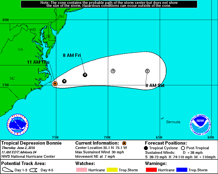
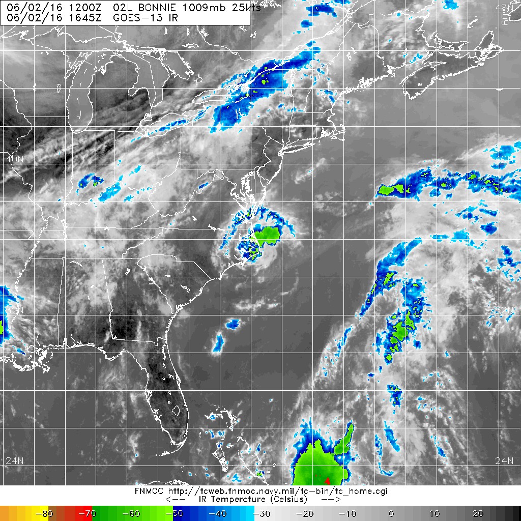
NHC 15Z直接將92L再度升格為02L,故原帖與Bonnie合併。
000
WTNT42 KNHC 021434
TCDAT2
TROPICAL DEPRESSION BONNIE DISCUSSION NUMBER 24
NWS NATIONAL HURRICANE CENTER MIAMI FL AL022016
1100 AM EDT THU JUN 02 2016
Satellite imagery and coastal radar data indicate that the low
pressure area that was formerly Bonnie has developed persistent
organized convection near the center. Based on this, the system is
again being designated as a tropical depression. The initial
intensity of 25 kt and central pressure of 1009 mb are based on
surface data near the center, along with a satellite intensity
estimate of 25 kt from TAFB.
The initial motion estimate is 055/5. Bonnie is moving along the
southern edge of the mid-latitude westerlies, and the cyclone
should move generally east-northeastward to eastward with a gradual
increase in forward speed during the next couple of days. The
track forecast follows that of the various consensus models, which
are tightly clustered.
The center of Bonnie will be moving over warm Gulf Stream waters
for the next 12-24 hours while the vertical wind shear is light.
Thus, the intensity forecast calls for modest strengthening during
that time. After that, increasing shear and sea surface
temperatures below 24C should cause Bonnie to again degenerate to a
remnant low, with the system dissipating by 72 hours.
FORECAST POSITIONS AND MAX WINDS
INIT 02/1500Z 35.1N 75.1W 25 KT 30 MPH
12H 03/0000Z 35.3N 74.2W 30 KT 35 MPH
24H 03/1200Z 35.8N 72.2W 30 KT 35 MPH
36H 04/0000Z 36.1N 69.5W 25 KT 30 MPH...POST-TROP/REMNT LOW
48H 04/1200Z 36.1N 66.2W 25 KT 30 MPH...POST-TROP/REMNT LOW
72H 05/1200Z...DISSIPATED
$$
Forecaster Beven


|
|