簽到天數: 3291 天 [LV.Master]伴壇終老
|
 t02436|2016-9-3 23:45
|
顯示全部樓層
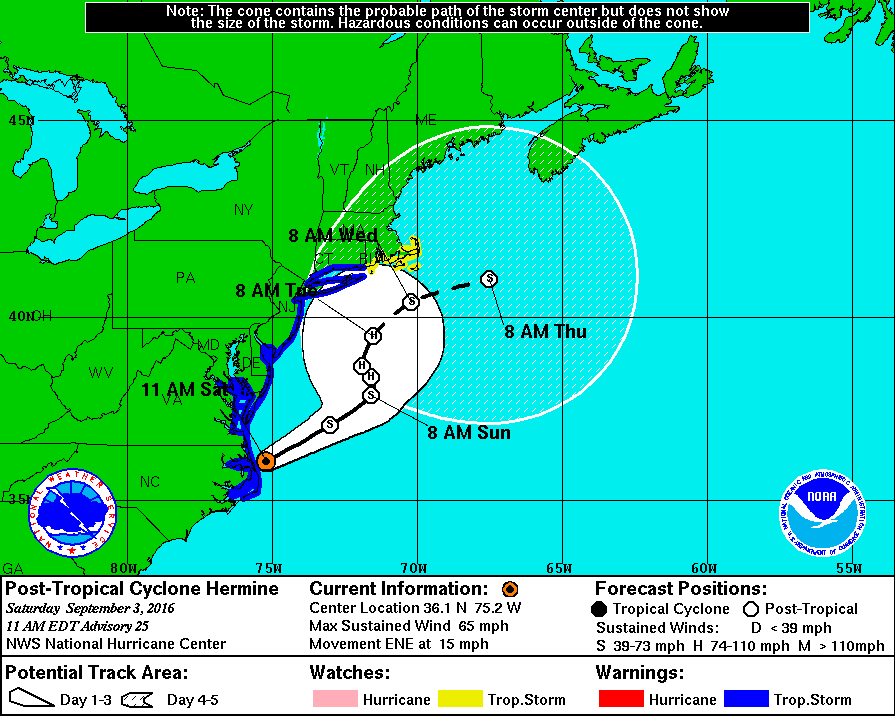
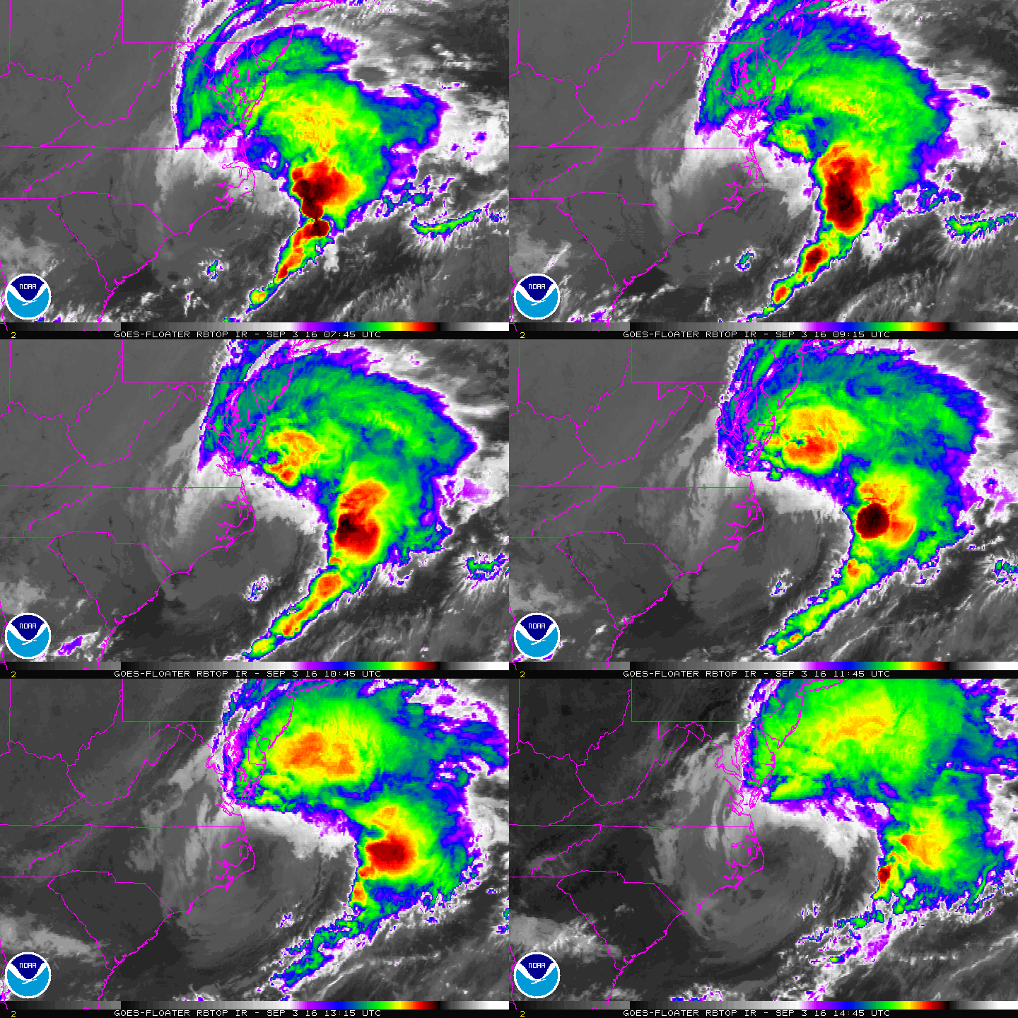
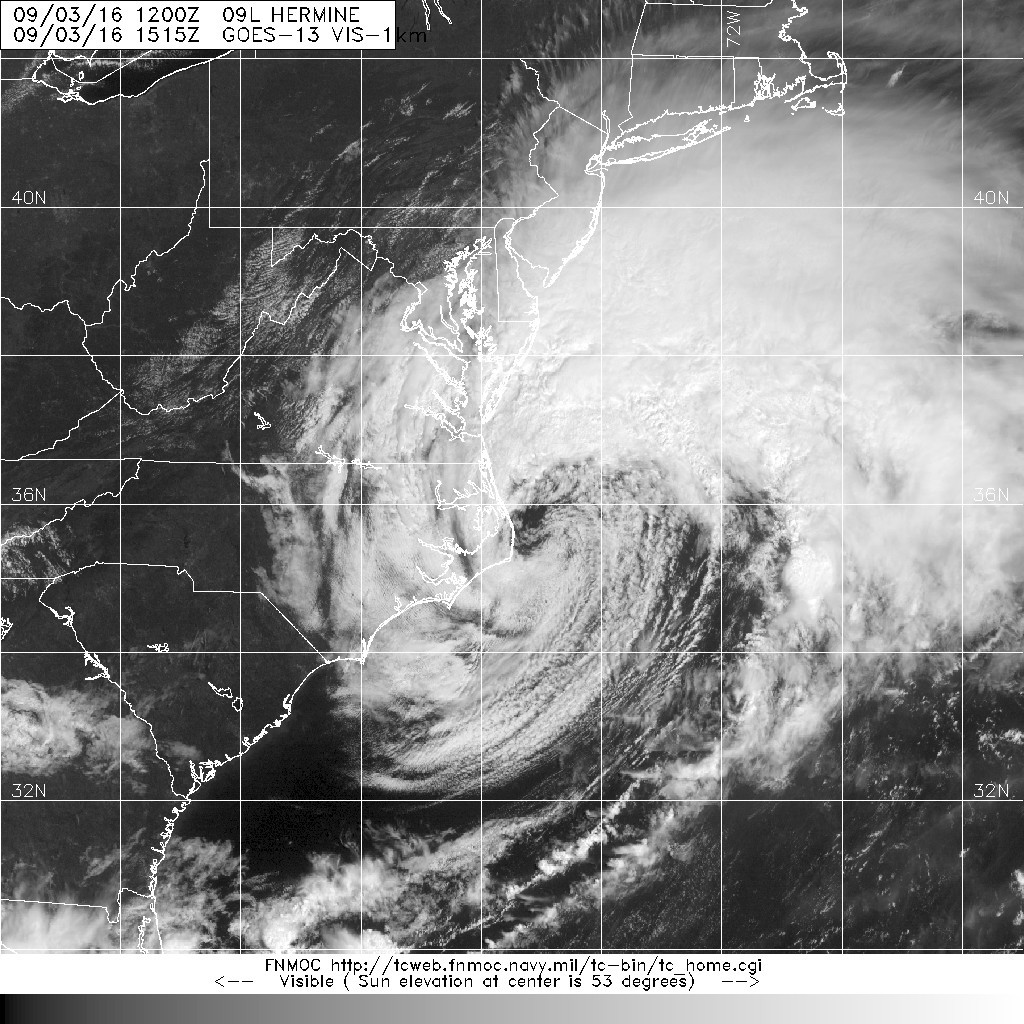
中心已經進入北大西洋,NHC 15Z評價55節,但判定為後熱帶氣旋。
000
WTNT44 KNHC 031457
TCDAT4
POST-TROPICAL CYCLONE HERMINE DISCUSSION NUMBER 25
NWS NATIONAL HURRICANE CENTER MIAMI FL AL092016
1100 AM EDT SAT SEP 03 2016
Satellite imagery indicates that Hermine has become a post-tropical
cyclone, with the coldest convective tops now located more than 200
n mi northeast of the exposed center. Despite this change in
structure, surface data from the Outer Banks indicate that some
strong winds persist near the center, and the initial intensity is
set to 55 kt for this advisory. During the next 48 to 72 hours,
Hermine will interact with a strong mid-latitude shortwave trough
and all of the global models show the system re-intensifying during
that time and a redevelopment of a stronger inner core, albeit one
situated underneath an upper-level low. Regardless of its final
structure, Hermine is expected to remain a dangerous cyclone through
the 5 day period.
The initial motion estimate is a somewhat uncertain 060/14. Hermine
should continue moving northeastward in deep-layer southwesterly
flow through 24 hours and then meander generally northward from 36
to 72 hours while the cyclone deepens beneath the upper-level low.
Late in the period, the guidance is in generally good agreement
showing a steadier motion toward the northeast, although there is
significant spread. The new NHC forecast is generally close to the
previous one and is near a consensus of the GFS and ECMWF through 3
days, and then favors the guidance that is a bit faster and farther
north at days 4 and 5.
KEY MESSAGES:
1. The slow motion and large wind field associated with Hermine will
result in a long duration of hazardous conditions along much of the
mid-Atlantic coast extending into southern New England through the
holiday weekend.
2. Although Hermine has become a post-tropical cyclone, NHC will
continue to issue its full suite of advisory and warning products as
long as the system remains a significant threat to land areas.
3. P-surge, the model that drives the Potential Storm Surge Flooding
Graphic, is designed for a wind field typical of a tropical
cyclone. The wind field of Hermine is very poorly represented by
the P-surge model and as a result, recent Flooding Graphics have
understated the inundation risk from the Carolinas northward. NHC
will be discontinuing runs of the P-surge model for Hermine with
this advisory. The NWS is attempting to substitute the GFS ensemble
system for P-surge for the next issuance of the Potential Storm
Surge Flooding Graphic, to provide a more realistic depiction of the
threat. If this effort is unsuccessful, issuance of the Potential
Storm Surge Flooding Graphic for Hermine will also be discontinued.
4. The Prototype Storm Surge Watch/Warning Graphic does account for
the current wind structure of Hermine, and therefore accurately
identifies those areas at risk for life-threatening storm surge.
This graphic will continue to be produced for Hermine.
FORECAST POSITIONS AND MAX WINDS
INIT 03/1500Z 36.1N 75.2W 55 KT 65 MPH...POST-TROPICAL
12H 04/0000Z 37.1N 73.0W 60 KT 70 MPH...POST-TROPICAL
24H 04/1200Z 37.9N 71.6W 60 KT 70 MPH...POST-TROPICAL
36H 05/0000Z 38.4N 71.6W 65 KT 75 MPH...POST-TROPICAL
48H 05/1200Z 38.7N 71.9W 65 KT 75 MPH...POST-TROPICAL
72H 06/1200Z 39.5N 71.5W 65 KT 75 MPH...POST-TROPICAL
96H 07/1200Z 40.4N 70.2W 60 KT 70 MPH...POST-TROPICAL
120H 08/1200Z 41.0N 67.5W 50 KT 60 MPH...POST-TROPICAL
$$
Forecaster Brennan


|
|