簽到天數: 3291 天 [LV.Master]伴壇終老
|
 t02436|2017-2-21 09:27
|
顯示全部樓層
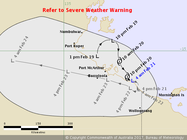
BoM 18Z降TD,但還沒登陸。
IDD20020
TROPICAL CYCLONE TECHNICAL BULLETIN: AUSTRALIA - NORTHERN REGION
Issued by DARWIN TROPICAL CYCLONE WARNING CENTRE
at: 2010 UTC 20/02/2017
Name: Ex-Tropical Cyclone Alfred
Identifier: 19U
Data At: 1800 UTC
Latitude: 16.1S
Longitude: 137.7E
Location Accuracy: within 30 nm [55 km]
Movement Towards: southeast [130 deg]
Speed of Movement: 2 knots [4 km/h]
Maximum 10-Minute Wind: 30 knots [55 km/h]
Maximum 3-Second Wind Gust: 45 knots [85 km/h]
Central Pressure: 999 hPa
Radius of 34-knot winds NE quadrant:
Radius of 34-knot winds SE quadrant:
Radius of 34-knot winds SW quadrant:
Radius of 34-knot winds NW quadrant:
Radius of 48-knot winds NE quadrant:
Radius of 48-knot winds SE quadrant:
Radius of 48-knot winds SW quadrant:
Radius of 48-knot winds NW quadrant:
Radius of 64-knot winds:
Radius of Maximum Winds:
Dvorak Intensity Code: T1.5/2.5/W1.5/24HRS
Pressure of outermost isobar: 1006 hPa
Radius of outermost closed isobar: 120 nm [220 km]
FORECAST DATA
Date/Time : Location : Loc. Accuracy: Max Wind : Central Pressure
[UTC] : degrees : nm [km]: knots[km/h]: hPa
+06: 21/0000: 16.3S 137.9E: 030 [055]: 030 [055]: 1000
+12: 21/0600: 16.4S 137.9E: 030 [055]: 030 [055]: 1000
+18: 21/1200: 16.5S 137.9E: 030 [055]: 030 [050]: 1000
+24: 21/1800: 16.5S 137.9E: 040 [075]: 025 [045]: 1000
+36: 22/0600: 16.4S 137.6E: 060 [110]: 025 [045]: 1000
+48: 22/1800: 16.1S 136.7E: 080 [150]: 025 [045]: 1001
+60: 23/0600: 15.8S 135.2E: 100 [185]: 025 [045]: 1003
+72: 23/1800: 15.4S 133.0E: 110 [205]: 020 [040]: 1004
+96: 24/1800: 14.9S 127.9E: 150 [280]: 020 [035]: 1004
+120: 25/1800: 14.6S 124.5E: 190 [350]: 020 [035]: 1004
REMARKS:
The centre was located using a combination of a 1300UTC ASCAT pass, surface
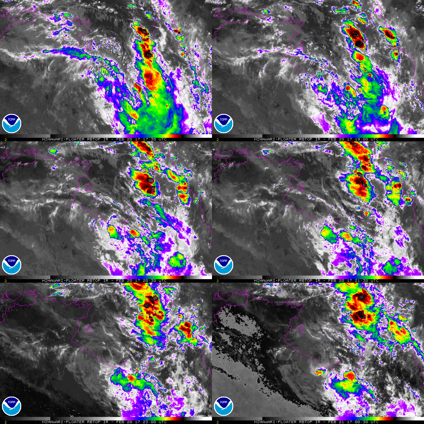
observations and satellite imagery. Animated near-infrared shows that a well
defined circulation still persists over the far southern Gulf of Carpentaria.
Winds at Centre Island and Morninton Island during the last 6 hours have
reported winds of 15-20 knots and easing. The ASCAT pass 1300UTC showed broad
area of 25-30 knots and marginally 35 knots around the system. Recent satellite
imagery has shown dry air dominating the environment and an absence of deep
convection near the LLCC for more than 6 hours. FT=1.5, based on MET, while CI
is maintained at 2.5.
As such, Tropical Cyclone Alfred was downgraded to a tropical low at 1800UTC.
The tropical cyclone has moved slowly southeast under the influence of a
mid-level ridge to the NE and a mid-latitude trough to the southeast. A ridge
building to the south is expected to slow the southeast movement today, causing
the system to stall close to the coast.
Vertical wind shear is around 10-15 knots and is forecast to remain at this
amount during the next day or two. Outflow is good in the southern semicircle
due to an upper trough to the west. So there is the potential for renewed bursts
of convection to develop near the LLCC while it remains over water. However
significant dry air in the western and northern sectors of the circulation,
together with land interaction means there is now only a low chance the system
could redevelop into a tropical cyclone.
From later Tuesday and on Wednesday the remnant tropical low is forecast to
track towards the west over land south of the Top End as southeasterly steering
winds establish.
Copyright Commonwealth of Australia
==
There will be no further bulletins for this system unless it reintensifies.


|
|