簽到天數: 3291 天 [LV.Master]伴壇終老
|
 t02436|2017-6-19 09:49
|
顯示全部樓層
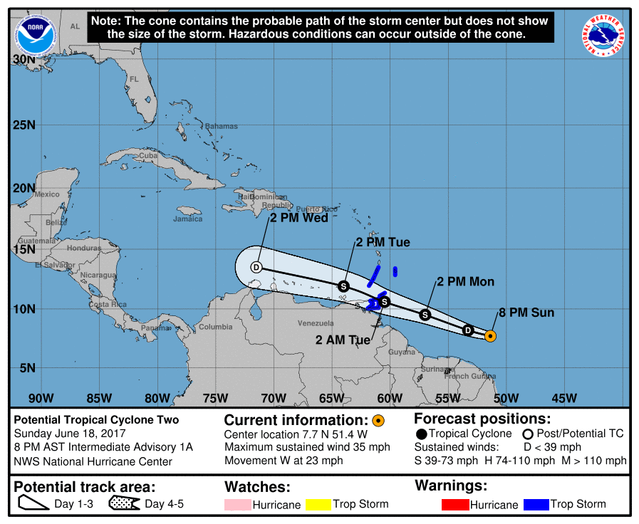
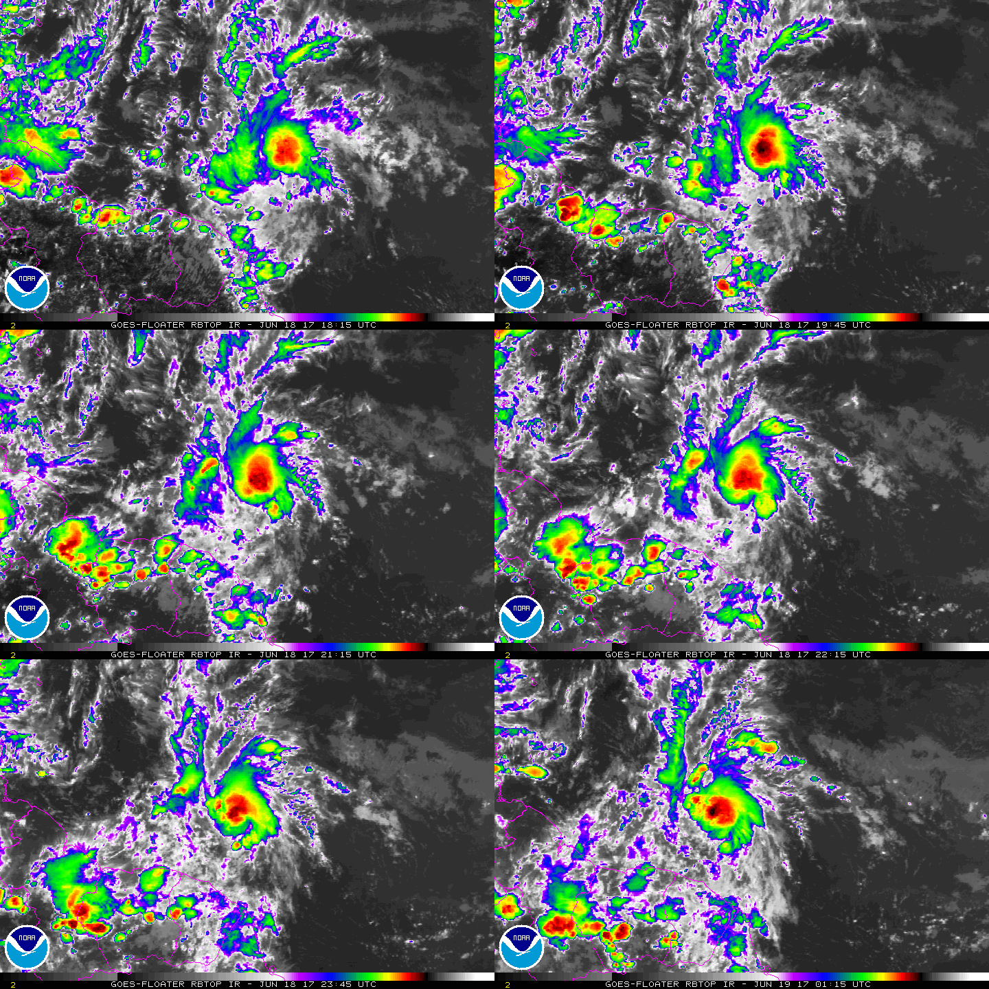
NHC 21Z升格02L,看來是首次使用"潛在熱帶氣旋"這個前綴?!
000
WTNT42 KNHC 182056
TCDAT2
Potential Tropical Cyclone Two Discussion Number 1
NWS National Hurricane Center Miami FL AL022017
500 PM AST Sun Jun 18 2017
The disturbance over the deep tropical Atlantic has become better
organized today, although a pair of ASCAT-A and B passes this
morning indicated that the system does not have a closed low-level
circulation, which isn't surprising given the fast translational
speed of the system. The ASCAT passes showed peak winds of near
30 kt well north of the center, and given that the environment is
expected to be conducive for some additional development before the
shear increases in the eastern Caribbean Sea, strengthening is
forecast, and the disturbance is expected to become a tropical storm
before reaching the Windward Islands in 36 to 48 hours.
The National Hurricane Center now has the option to issue advisories
on disturbances that are not yet tropical cyclones, but which pose
the threat of bringing tropical storm or hurricane conditions to
land areas within 48 hours. Under previous policy this was not
possible. These systems are known as Potential Tropical Cyclones in
advisory products and are numbered from the same list as
depressions. Because of the threat to the Windward Islands,
advisories have been initiated on Potential Tropical Cyclone Two and
the appropriate warnings have been issued by the respective
governments in the Windward Islands. Advisory packages will continue
until the threat of tropical-storm-force winds for land areas
sufficiently diminishes, although if the system becomes a tropical
cyclone, the normal rules for discontinuing advisories would apply.
Users should be aware that forecast uncertainty for disturbances is
generally larger than for tropical cyclones, especially beyond 48-72
hours.
The disturbance will be steered quickly westward to west-
northwestward over the next several days to the south of a mid-level
subtropical ridge over the central Atlantic. The NHC track
forecast is close to a blend of the latest GFS and ECMWF tracks.
There is a fair bit of across-track spread in the model guidance,
which isn't surprising given the lack of a well-defined center.
However, given that tropical storm conditions are expected to extend
well north of the center, users should not focus on the exact track
of the center, and the track forecast is of lower certainty than
usual.
Most of the intensity guidance shows mostly modest strengthening
during the next 36 hours, with the system moving over SSTs of 27-28C
and the deep-layer shear at 10 kt or less. The NHC forecast shows
the system peaking at 45 kt, in agreement with the intensity model
consensus. Quick weakening is expected after that time as southerly
shear increases dramatically while the system moves into the eastern
Caribbean Sea. The system is forecast to become a remnant low by 72
hours and dissipate by day 4.
FORECAST POSITIONS AND MAX WINDS
INIT 18/2100Z 7.5N 50.4W 30 KT 35 MPH...POTENTIAL TROP CYCLONE
12H 19/0600Z 8.2N 53.3W 30 KT 35 MPH
24H 19/1800Z 9.5N 57.0W 35 KT 40 MPH...TROPICAL CYCLONE
36H 20/0600Z 10.6N 60.5W 45 KT 50 MPH
48H 20/1800Z 11.9N 64.0W 40 KT 45 MPH
72H 21/1800Z 13.5N 71.5W 30 KT 35 MPH...POST-TROP/REMNT LOW
96H 22/1800Z...DISSIPATED
$$
Forecaster Brennan


|
|