簽到天數: 3291 天 [LV.Master]伴壇終老
|
 t02436|2017-6-22 17:11
|
顯示全部樓層
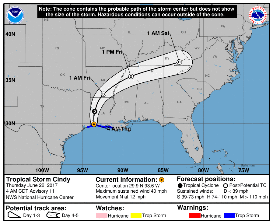
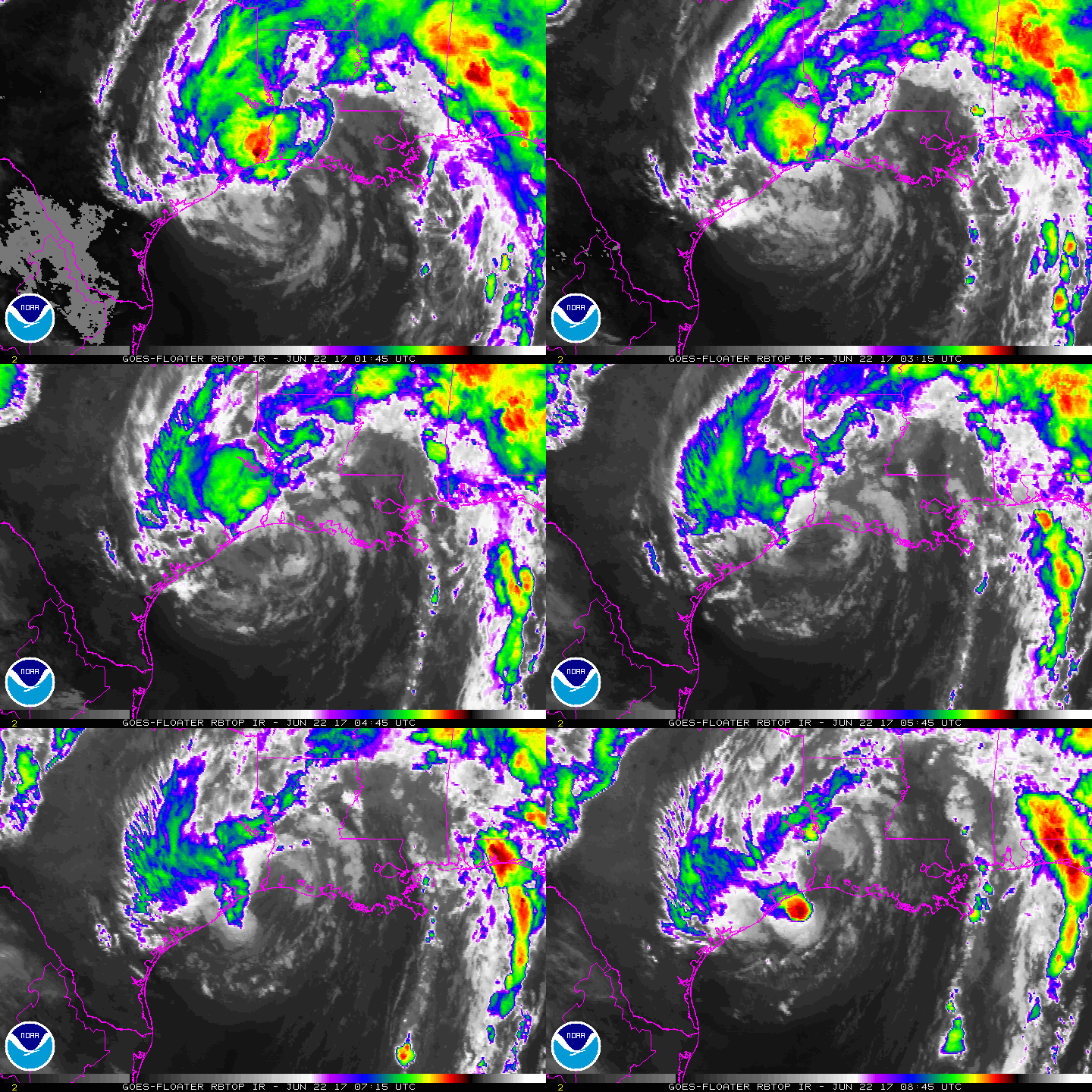
中心已經在稍早登陸
000
WTNT43 KNHC 220852
TCDAT3
Tropical Storm Cindy Discussion Number 11
NWS National Hurricane Center Miami FL AL032017
400 AM CDT Thu Jun 22 2017
Radar imagery from Slidell and Lake Charles, Louisiana along with
surface synoptic data, particularly those from Calcasieu Pass
Louisiana, indicate that the center of Cindy crossed the coast
between Cameron Louisiana and Port Arthur Texas an hour or two ago.
The observations from Calcasieu indicate that the intensity is now
around 35 kt. Now that the center is inland, steady weakening will
occur and the system should become a depression later today, and be
reduced to a post-tropical remnant low tonight. In 2-3 days, or
sooner, the remnant low of Cindy should become absorbed into a
frontal zone over the eastern United States.
The initial motion is a little faster, and is about 360/10 kt.
Cindy should continue to move through a break in the subtropical
ridge today, and gradually turn toward the northeast and
east-northeast as it encounters mid-level westerly flow over the
next couple of days. The official track forecast lies between the
GFS and ECMWF predictions.
Although Cindy is weakening, it will continue to produce heavy
rainfall over portions of the northern Gulf Coast and the
southeastern and eastern United States, along with the potential
for life-threatening flash flooding in some locations. For
more information on the flooding hazard, see products from your
local National Weather Service office and the NOAA Weather
Prediction Center.
FORECAST POSITIONS AND MAX WINDS
INIT 22/0900Z 29.9N 93.6W 35 KT 40 MPH...INLAND
12H 22/1800Z 31.4N 93.5W 30 KT 35 MPH...INLAND
24H 23/0600Z 33.4N 92.4W 25 KT 30 MPH...POST-TROP/REMNT LOW
36H 23/1800Z 35.4N 89.0W 20 KT 25 MPH...POST-TROP/REMNT LOW
48H 24/0600Z 37.0N 83.0W 20 KT 25 MPH...POST-TROP/REMNT LOW
72H 25/0600Z...DISSIPATED
$$
Forecaster Pasch


|
|