|
|
 霧峰追風者|2017-10-29 08:59
|
顯示全部樓層
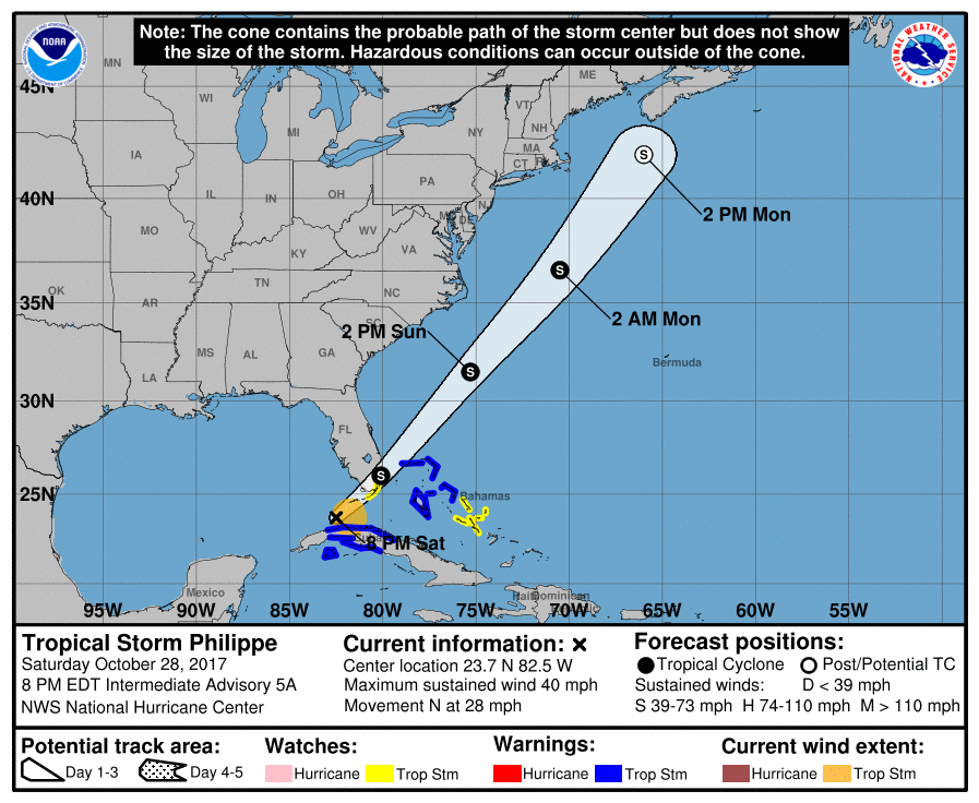
NHC 命名"Philippe",逐漸增強,即將登陸佛州。
000
WTNT43 KNHC 282052
TCDAT3
Tropical Storm Philippe Discussion Number 5
NWS National Hurricane Center Miami FL AL182017
500 PM EDT Sat Oct 28 2017
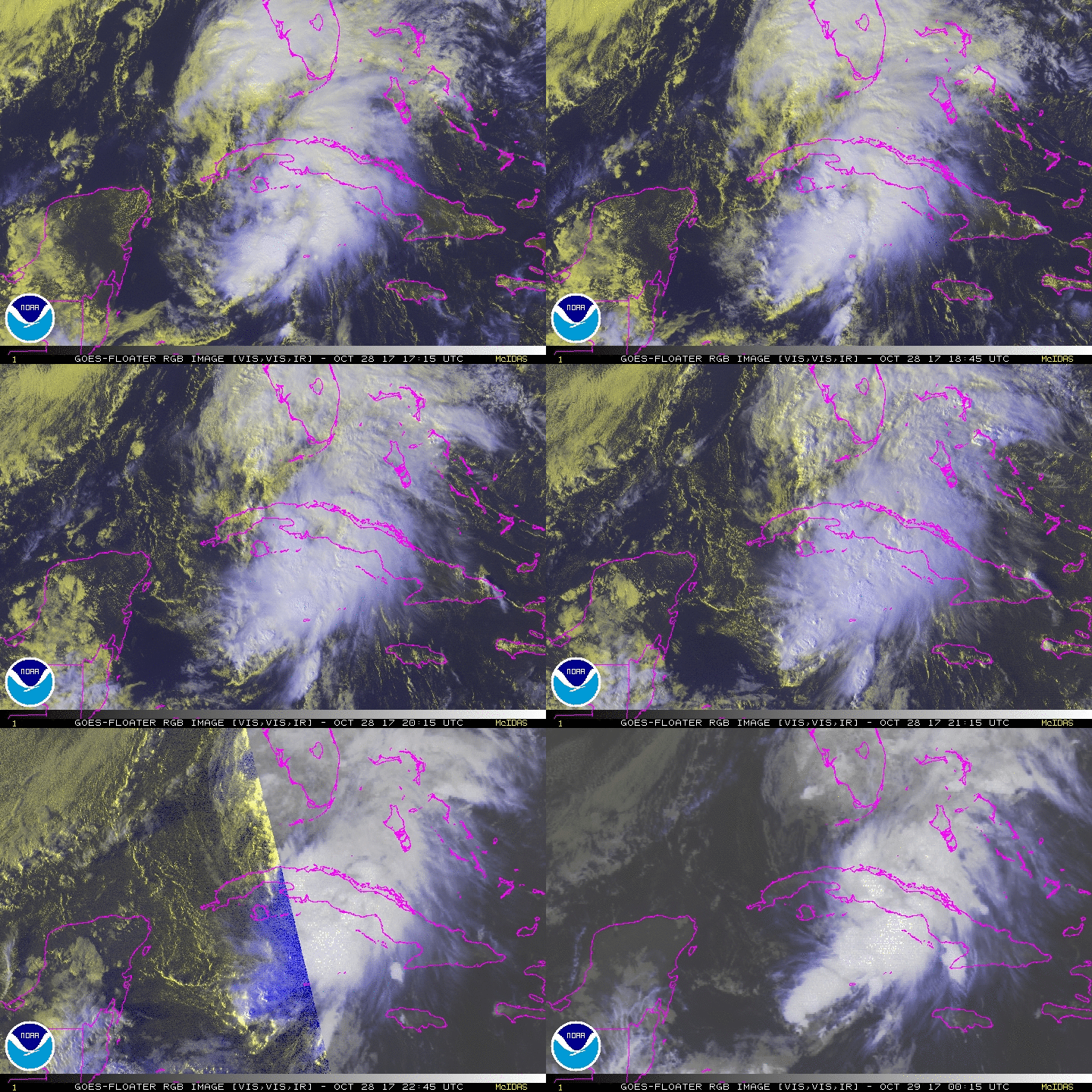
Satellite images, radar data from Cuba and Key West, and surface
observations indicate the depression has turned northward over the
past few hours, and has also strengthened into a tropical storm.
The initial intensity of 35 kt is based on a surface observation of
35 kt in a brief squall from Grand Cayman at 1444Z, a recent AMSU
estimate of 37 kt, and average Key West Doppler radar velocities of
40 kt between 10,000-12,000 ft just north of the Cuban coast; the
latter data equates to an approximate surface wind speed of 36 kt.
The initial motion estimate is now 355/25 kt based on radar data and
high-resolution GOES-16 visible satellite imagery over the past 2-3
hours. The low-level wind flow pattern for the next 6 hours or so is
forecast to be complex, with a new non-tropical surface low having
recently formed about 100 nmi west of Key West, Florida. This
feature appears to have developed beneath an upper-level jet
entrance region ahead of an approaching cold front. The global,
regional, and even the convective-scale models are now showing the
center of Philippe moving general northward across the Straits of
Florida this evening and merging with the non-tropical low around
0000Z. After the merger over Florida Bay, the various models are in
good agreement on Philippe moving northeastward to
east-northeastward across extreme southern Florida or the Florida
Keys overnight as the cyclone is accelerated ahead of the
aforementioned frontal system and strong mid-/upper-level trough.
After reaching the northwestern Bahamas by 1200Z Sunday morning,
Philippe is forecast to accelerate further towards the northeast at
forward speeds of 30-35 kt, by Sunday afternoon and evening,
remaining well offshore of the Carolinas. By 36 hours, Philippe is
expected to pass about midway between Bermuda and the southeastern
United States, and gradually getting pulled north-northeastward up
the east side of a powerful baroclinic low that is forecast to
develop near Cape Hatteras and move northward near the U.S. east
coast. The NHC track guidance is in reasonable agreement on this
developing track scenario, and lies between the GFS model, which
takes Philippe across the Florida Keys, and the ECMWF model, which
moves the cyclone farther north over South Florida.
The vertical wind shear affecting Philippe is expected to remain
favorable for strengthening to occur for the next 24 hours, along
with an additional baroclinic boost from the aforementioned
upper-level jet maximum. By 36 hours, strong baroclinic forcing
associated with the approaching frontal system are forecast to
induce additional strengthening before the cyclone merges with
the frontal system and becomes an extratropical low by 48 hours.
Dissipation or absorption by a larger extratropical low is expected
by 72 hours when the system is located over the cold waters of the
North Atlantic.
KEY MESSAGES:
1. Although the center of Philippe is now forecast to move across
the Florida Keys or extreme south Florida, most of the strongest
winds are expected to remain east and southeast of the center.
However, tropical-storm-force winds, mainly in gusts, could occur
in brief heavy squalls across the upper Florida Keys and southeast
Florida overnight. For that reason, a tropical storm watch remains
in effect for these areas.
2. Regardless of the exact track of Philippe, the primary threat
from this system will be heavy rainfall that can cause localized
flooding across portions of Cuba, the Florida Keys, and South
Florida.
FORECAST POSITIONS AND MAX WINDS
INIT 28/2100Z 23.0N 82.6W 35 KT 40 MPH
12H 29/0600Z 26.0N 80.1W 45 KT 50 MPH
24H 29/1800Z 31.5N 75.3W 50 KT 60 MPH
36H 30/0600Z 36.6N 70.5W 55 KT 65 MPH
48H 30/1800Z 42.0N 66.0W 50 KT 60 MPH...POST-TROP/EXTRATROP
72H 31/1800Z...DISSIPATED
$$
Forecaster Stewart 

|
|