簽到天數: 3291 天 [LV.Master]伴壇終老
|
 t02436|2018-6-15 12:18
|
顯示全部樓層
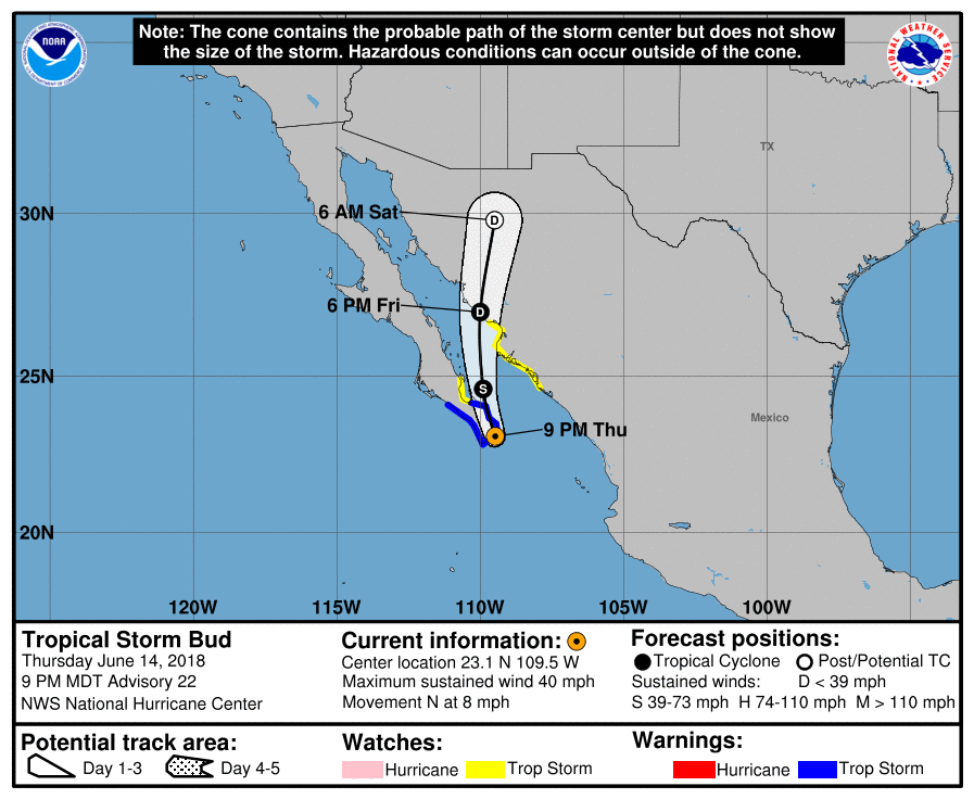
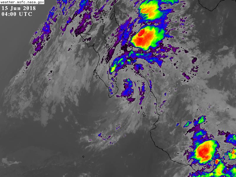
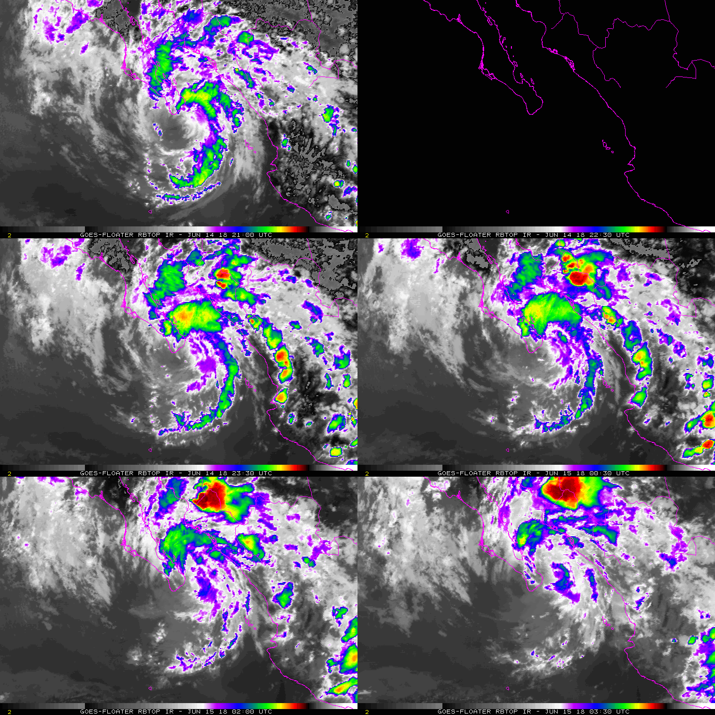
以35節強度擦過下加利福尼亞半島最南邊000
WTPZ43 KNHC 150240
TCDEP3
Tropical Storm Bud Discussion Number 22
NWS National Hurricane Center Miami FL EP032018
900 PM MDT Thu Jun 14 2018
Bud is skirting the southern coast of the Baja California
Peninsula. There have been a few observations of tropical-storm-
force winds near Cabo San Lucas earlier this evening. Since that
time, the increasing interaction with the terrain of southern Baja
California Sur has likely decreased its intensity slightly. In
addition, convection is limited to a curved band that is about 100 n
mi north of the center. Thus the initial intensity is lowered to 35
kt, in agreement with the Dvorak CI-number from TAFB.
After moving just west of due north for much of the day, Bud has
made a jog to the north-northeast over the past few hours. This has
delayed landfall over southern Baja California Sur this evening.
Track guidance remains in excellent agreement on Bud resuming a
north-northwestward track over the next 12 hours, taking the center
across the southern Baja California Sur overnight. Bud is then
expected to gradually accelerate as it turns northward and then
north-northeastward on Friday over the central Gulf of California
as it moves around the western periphery of a mid-level ridge. Bud
is then expected to make a second landfall over the Mexican state of
Sonora by Friday evening.
The storm should maintain its intensity overnight as the interaction
with Baja California Sur is offset by the warmer waters of the Gulf
of California, with these warmer waters likely supporting convective
bands in the northeast quadrant. In addition, funneling in the
Gulf of California could cause Bud to maintain tropical storm
status for a little longer. By 24 hours, interaction with the
terrain of mainland Mexico should cause Bud to weaken to a tropical
depression before landfall over Sonora. Thereafter, the high
terrain of mainland Mexico should cause Bud to become a remnant low
by 36 hours, and dissipate by 48 hours, if not sooner.
Although Bud is expected to weaken, the associated remnant moisture
plume is expected to spread northward and northeastward into
northwestern Mexico and the U.S. Desert Southwest on Friday and
Saturday, resulting in significant rainfall and possible flash
flooding across those areas. For further information on the heavy
rainfall threat, please see products issued by your local weather
service office.
FORECAST POSITIONS AND MAX WINDS
INIT 15/0300Z 23.1N 109.5W 35 KT 40 MPH
12H 15/1200Z 24.6N 109.9W 35 KT 40 MPH
24H 16/0000Z 27.0N 110.0W 30 KT 35 MPH
36H 16/1200Z 29.8N 109.5W 20 KT 25 MPH...POST-TROP/INLAND
48H 17/0000Z...DISSIPATED
$$
Forecaster Cangialosi/Latto


|
|