開啟輔助訪問
 找回密碼
 立即加入

08E.Gilma

簽到天數: 2414 天

[LV.Master]伴壇終老

2018-7-26 09:11 | 顯示全部樓層
  基本資料  
編號    :08 E
擾動編號日期:2018 07 26 08
撤編日期  :2018 07 00 00
91E.INVEST.25kts.1011mb.12N.118.5W

20180725.0300.goes-15.ir.91E.INVEST.25kts.1011mb.12N.118.5W.100pc.jpg

  NHC:40%  
1. An elongated area of low pressure continues to produce disorganized
showers and thunderstorms around 1000 miles south-southwest of the
southern tip of the Baja California peninsula. However,
environmental conditions are expected to support gradual development
and a tropical depression could form during the next few days while
the system moves toward the west or west-northwest.
* Formation chance through 48 hours...medium...40 percent.
* Formation chance through 5 days...medium...60 percent.

two_pac_2d1.png

評分

參與人數 1水氣能量 +15 +1 收起 理由
t02436 + 15 + 1

查看全部評分

回復

使用道具 舉報

簽到天數: 601 天

[LV.9]以壇為家II

霧峰追風者|2018-7-27 08:54 | 顯示全部樓層
NHC 21Z升格熱帶低壓08E,巔峰暫時上望45KT。
805
WTPZ43 KNHC 262045
TCDEP3

Tropical Depression Eight-E Discussion Number   1
NWS National Hurricane Center Miami FL       EP082018
200 PM PDT Thu Jul 26 2018

A recent ASCAT pass indicated that a very small 30-kt circulation
has developed in association with the disturbance that the NHC has
been tracking southwest of Baja California Sur during the past
several days. On this basis, advisories are initiated on Tropical
Depression Eight.  However, the satellite presentation is not very
well organized at this time, and Dvorak T-numbers are still low.
Given the current environment of low shear and warm ocean, gradual
strengthening is anticipated. However, global models indicate that
the shear will markedly increase beyond 48 hours, and this wind
pattern should result in weakening. The NHC forecast is a blend of
HCCA and the simple intensity consensus.

The depression is moving toward the west or west-northwest at 14 kt
around the periphery of the strong subtropical ridge. Since the
ridge is forecast to persist, no significant change in the steering
flow is anticipated. The cyclone should then continue on the same
track for the next several days, although by the end of the
forecast period, the cyclone is forecast to become a westward
moving remnant low. The NHC forecast is very close to the
multi-model consensus.


FORECAST POSITIONS AND MAX WINDS

INIT  26/2100Z 13.2N 123.4W   30 KT  35 MPH
12H  27/0600Z 13.7N 125.6W   35 KT  40 MPH
24H  27/1800Z 14.0N 128.3W   40 KT  45 MPH
36H  28/0600Z 14.5N 130.5W   45 KT  50 MPH
48H  28/1800Z 15.0N 132.0W   45 KT  50 MPH
72H  29/1800Z 16.5N 135.5W   35 KT  40 MPH
96H  30/1800Z 17.0N 139.5W   25 KT  30 MPH...POST-TROP/REMNT LOW
120H  31/1800Z 17.0N 144.0W   25 KT  30 MPH...POST-TROP/REMNT LOW

$$
Forecaster Avila
204712_5day_cone_no_line_and_wind.png 20180727.0030.goes15.x.vis1km_high.08EEIGHT.30kts-1008mb-132N-1227W.100pc.jpg avn-animated.gif


回復

使用道具 舉報

簽到天數: 3279 天

[LV.Master]伴壇終老

t02436|2018-7-27 17:41 | 顯示全部樓層
09Z命名Gilma
926
WTPZ43 KNHC 270831
TCDEP3

Tropical Storm Gilma Discussion Number   3
NWS National Hurricane Center Miami FL       EP082018
200 AM PDT Fri Jul 27 2018

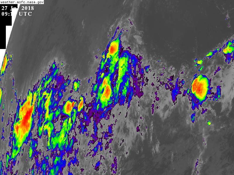
The cloud pattern associated with the cyclone has lost organization
during the past several hours, with the low-level center now located
at the northern edge of a smaller area of convection.  Despite the
ragged appearance in satellite imagery, recent ASCAT-A data showed
an area of 35 kt winds to the northeast of the center.  Based on
this, the cyclone has been upgraded to Tropical Storm Gilma.

The initial motion is 285/14.  Gilma should be steered westward to
west-northwestward along the southwestern flank of a large mid-level
ridge extending westward from the southwestern United States.  As
the cyclone decays to a shallow remnant low late in the period, a
more westward motion is expected.  The new track forecast is
similar to, but a little faster than the previous forecast, and it
is a blend of the previous forecast and the multi-model consensus
aids.

Gilma is located just to the east of an upper-level trough, which
the large-scale models forecast to move or re-form westward just
ahead of the storm for the next couple of days.  This evolution is
expected to keep the cyclone in an area of moderate vertical wind
shear, but with some upper-level divergence to maintain convection.
Based on this, the intensity forecast shows a little more
strengthening in agreement with the overall trend of the intensity
guidance.  After 36-48 h, Gilma is likely to move into strong and
dry northwesterly upper-level flow west of the upper-level trough
axis, which should lead to weakening and eventual dissipation.  The
new intensity forecast now shows dissipation by 120 h in agreement
with the dynamical models.


FORECAST POSITIONS AND MAX WINDS

INIT  27/0900Z 14.4N 126.7W   35 KT  40 MPH
12H  27/1800Z 14.6N 128.7W   40 KT  45 MPH
24H  28/0600Z 15.0N 130.9W   40 KT  45 MPH
36H  28/1800Z 15.5N 132.6W   40 KT  45 MPH
48H  29/0600Z 16.1N 134.5W   35 KT  40 MPH
72H  30/0600Z 17.5N 138.5W   30 KT  35 MPH
96H  31/0600Z 17.5N 143.0W   20 KT  25 MPH...POST-TROP/REMNT LOW
120H  01/0600Z...DISSIPATED

$$
Forecaster Beven
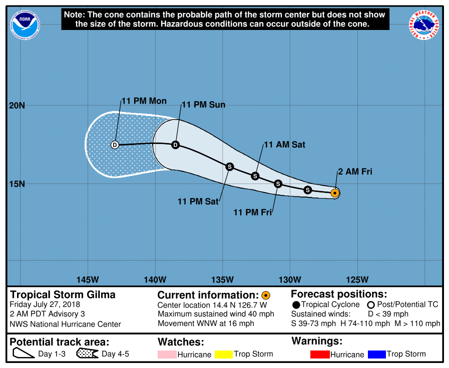
083311_5day_cone_with_line.png

GOES09152018208SMKhDd.jpg
回復

使用道具 舉報

簽到天數: 601 天

[LV.9]以壇為家II

霧峰追風者|2018-7-30 09:46 | 顯示全部樓層
稍早殘餘低壓,進入中太。
205147_5day_cone_no_line_and_wind.png avn_lalo-animated (1).gif

回復

使用道具 舉報

快速回覆
您需要登錄後才可以回帖 登錄 | 立即加入

本版積分規則

本平台僅供學術討論之用,預報應以氣象局為準

威普網站虛擬主機贊助公司

臺灣第一個天氣類型社群平台 即時天氣資訊、精準颱風動態

線上客服
FB傳送訊息
廣告行銷
精準行銷 物超所值
官方粉專
發佈 快速回復 返回頂部 返回列表