開啟輔助訪問
 找回密碼
 立即加入

17E.Olivia 二度上MH 直襲夏威夷 殘餘雲系進西太

簽到天數: 601 天

[LV.9]以壇為家II

霧峰追風者|2018-9-9 11:45 | 顯示全部樓層
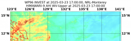
70節強度正式進入中太,CPHC 開始發報。
WTPA45 PHFO 090302
TCDCP5

Hurricane Olivia Discussion Number  34
NWS Central Pacific Hurricane Center Honolulu HI   EP172018
500 PM HST Sat Sep 08 2018

Olivia lost its well-defined center feature in conventional
satellite imagery late this afternoon and now appears as a rather
messy asymmetric blob of deep convection. However, SSMI and GMI
overpasses at 2349 and 2336 UTC, respectively, showed an eyewall
remained, except for a break on the west side, along with a very
well organized low level circulation. The satellite intensity
estimates showed some spread, with 4.5 from PHFO and UW-CIMSS ADT,
4.0 from TAFB and SAB, 3.5 from JTWC. The current intensity was
lowered to 70 kt based on a blend of these estimates, and
considering the degradation seen in the satellite imagery over the
last few hours.

The initial motion estimate is 280/14. Olivia is moving just north
of due west, to the south of strong deep layer ridging to the west
through north of the tropical cyclone. Little change is
anticipitated for the first 48 hours or so as this ridging builds
westward in tandem with Olivia. After 48 hours, the portion of the
ridge to the west of Olivia is forecast to strengthen, shunting the
tropical cyclone on a more west-southwest motion. The track
guidance remains fairly tightly clustered, and this forecast is very
similar to the previous forecast track, which brings the center of
Olivia over the main Hawaiian Islands between 72 and 96 hours. A
more westward motion is expected to resume after Olivia's passage
through the islands, as the upper ridge retreats westward and the
circulation center becomes increasingly steered by the lower level
trades.

Olivia is in a very weak shear environment, but moving over
marginal sea surface temperatures of 25.5C. The hurricane has
already traversed the coolest water it was going to encounter, but
SSTs stay sub-27C until Olivia gets close to the islands. This
should allow Olivia to only very slowly weaken or maintain intensity
through the next 24 to 48 hours. Shear should begin to gradually
increase over Olivia after 48 hours, leading to a slow weakening
trend, but likely not soon enough to prevent some significant
impacts to the main Hawaiian Islands.


KEY MESSAGES:

1.  It is important to recognize that errors in both forecast track
and intensity, particularly at longer time ranges, can be large.
While it is too soon to determine the location and magnitude of the
worst impacts, all interests in Hawaii should continue to monitor
the progress of Olivia, and use this time to prepare for the
increasing liklihood of direct impacts from this system.

2.  Regardless of the exact track and intensity that Olivia takes
as it approaches the islands, significant effects often do extend
far from the center. In particular, the mountainous terrain of
Hawaii can produce localized areas of strongly enhanced winds and
rainfall, even well away from the tropical cyclone center.


FORECAST POSITIONS AND MAX WINDS

INIT  09/0300Z 21.8N 140.8W   70 KT  80 MPH
12H  09/1200Z 22.0N 142.9W   70 KT  80 MPH
24H  10/0000Z 22.1N 145.3W   70 KT  80 MPH
36H  10/1200Z 22.1N 147.5W   65 KT  75 MPH
48H  11/0000Z 22.0N 149.4W   65 KT  75 MPH
72H  12/0000Z 21.2N 153.5W   55 KT  65 MPH
96H  13/0000Z 20.1N 158.4W   50 KT  60 MPH
120H  14/0000Z 19.5N 163.5W   40 KT  45 MPH

$$
Forecaster R Ballard
EP172018_3day_cone_no_line_34.png rgb_lalo-animated.gif rbtop_lalo-animated.gif

回復

使用道具 舉報

簽到天數: 3279 天

[LV.Master]伴壇終老

t02436|2018-9-11 00:17 | 顯示全部樓層
即將在兩天之後正面襲擊夏威夷,飛機實測現正進行中。
五天之後以40節越過西經170度,至於是否能以熱帶風暴強度進入西太本周末再觀察。
Hurricane Olivia Discussion Number  40
NWS Central Pacific Hurricane Center Honolulu HI   EP172018
500 AM HST Mon Sep 10 2018

Olivia's eye has been appearing at times this morning. The outflow
pattern remains impressive, so it does not appear to be negatively
impacted by vertical wind shear of around 10 kt. The satellite fix
agencies (JTWC, SAB, and PHFO) provided unanimous subjective Dvorak
current intensity estimates of 4.5/77 kt. The UW-CIMSS ADT estimate
was 4.2/70 kt. Based on all of this information, we are maintaining
the initial intensity at 75 kt for this advisory. Note that an
aircraft flown by the U.S. Air Force Reserves 53rd Weather
Reconnaissance Squadron is scheduled to sample the inner core and
outer wind field of Olivia starting in a few hours. This will
give us a much better idea of the latest intensity of Olivia once
they arrive.

Olivia continues to move nearly due west with a current motion of
270/9 kt. This motion is being induced by a deep layer ridge to the
north and northwest of the tropical cyclone. During the next 12
hours or so, the ridge is expected to strengthen and build southward
ahead of Olivia, forcing the tropical cyclone to shift toward a
west-southwest track. This motion is expected to continue through
day 3. The track guidance appears have slightly more spread through
72 hours, especially from 36 to 72 hours. The spread is even greater
during days 4 and 5. The current forecast track is very close to the
previous, except it has been nudged to the right and is slightly
slower during the first 72 hours. Little change has been made in the
day 4 and 5 positions. This closely follows the latest TVCE, FSSE,
GFEX and HCCA guidance. Again, since the is a wider spread in the
track guidance, we want to emphasize the uncertainty in our track
forecast. It is important to NOT focus on the exact forecast track
of Olivia's center across the islands. A slight deviation to the
right or left can bring vastly different weather hazards to any
islands that are directly impacted by this potentially damaging
tropical cyclone.

Vertical wind shear remains relatively weak in the vicinity of
Olivia. Water temperatures, as well as ocean heat content values,
are expected to increase along the forecast track. Therefore, Olivia
will likely remain a hurricane through 36 hours. After that,
increasing vertical wind shear is forecast to take its toll on
Olivia, so that it may be a strong tropical storm within 48 hours.
Additional slow weakening is expected to persist during days 3
through 5. The latest forecast is close to the IVCN and CTCI. Note
that based on the latest track and intensity along with the wind
speed probabilities, Tropical Storm Warnings have been issued for
the Big Island of Hawaii and the islands of Maui County.

KEY MESSAGES:

1.  It is important to not focus on the exact forecast track and
intensity when planning for Olivia. Persons on the main Hawaiian
Islands east of Kauai should continue preparing for the likelihood
of direct impacts from this system today and early Tuesday. Those
impacts could include intense flooding rainfall, damaging winds,
large and dangerous surf, and storm surge.

2.  Regardless of the exact track and intensity that Olivia takes
as it approaches the islands, significant effects often extend far
from the center. In particular, the mountainous terrain of Hawaii
can produce localized areas of strongly enhanced winds and
rainfall, even well away from the tropical cyclone center.


FORECAST POSITIONS AND MAX WINDS

INIT  10/1500Z 21.7N 148.0W   75 KT  85 MPH
12H  11/0000Z 21.7N 149.3W   75 KT  85 MPH
24H  11/1200Z 21.4N 151.3W   75 KT  85 MPH
36H  12/0000Z 21.1N 153.4W   65 KT  75 MPH
48H  12/1200Z 20.7N 155.7W   60 KT  70 MPH
72H  13/1200Z 19.9N 160.7W   45 KT  50 MPH
96H  14/1200Z 20.0N 166.0W   40 KT  45 MPH
120H  15/1200Z 21.0N 171.0W   40 KT  45 MPH

$$
Forecaster Houston

EP172018_5day_cone_with_line_40.png

17E_intensity_latest.png

rbtop-animated.gif

2.track.png
回復

使用道具 舉報

簽到天數: 601 天

[LV.9]以壇為家II

霧峰追風者|2018-9-13 03:42 | 顯示全部樓層
正在侵襲夏威夷,出國旅遊需留意。
WTPA45 PHFO 121502
TCDCP5

Tropical Storm Olivia Discussion Number  48
NWS Central Pacific Hurricane Center Honolulu HI   EP172018
500 AM HST Wed Sep 12 2018

An explosive overnight development of thunderstorms in Olivia's
eastern semicircle have since moved over the low level circulation
center (LLCC), despite westerly vertical wind shear near 25 kt.
Subjective Dvorak current intensity estimates ranged from 2.0/30 kt
to 2.5/35 kt this time around, but velocity data from the WSR-88D
on Molokai indicate 50 kt winds at 5000 feet, and 45 kt at 10000
feet. Using reduction factors typically applied to aircraft data,
this supports a surface wind estimate of 40 kt.

Olivia's motion over the past 18 hours has been erratic, and
strongly modulated by the amount of associated deep convection. A
faster motion toward the west-southwest was observed when
convection dissipated yesterday, with a slower forward speed toward
the west-northwest observed with the deeper convection. This
is due to the vertical wind shear, with the exposed low cloud swirl
steered by low-level trade winds, while the deep convection allows
Olivia's motion to be increasingly affected by the westerly flow
aloft. With the persistent overnight convective burst, the initial
motion estimate for this advisory is estimated to be 280/10 kt.

In the short term, Olivia is expected to move toward the west.
However, the expectation is that the deep convection will wane
later this morning, and Olivia will make a turn toward the
west-southwest by this afternoon. After emerging to the west of Maui
County this evening, the expectation is that terrain interaction and
increasing vertical wind shear will prevent deep convection from
persisting over the center. A motion toward the west-southwest is
then expected through 36 hours, with the assumption that the LLCC
will be intact after emerging to the southwest of Maui County. GFS
guidance indicates dissipation within 48 hours, while the ECMWF
carries a surface low through day 5. The official forecast splits
the difference, with Olivia devolving to a post-tropical remnant low
by day 3 before dissipation on day 5.


Key Messages:

1. Flooding rainfall, high surf, and damaging winds are expected in
the warning area. Significant impacts can occur well away from the
center, especially when considering that the mountainous terrain of
Hawaii can produce localized areas of strongly enhanced wind gusts
and rainfall.


FORECAST POSITIONS AND MAX WINDS

INIT  12/1500Z 21.2N 155.7W   40 KT  45 MPH
12H  13/0000Z 20.6N 157.6W   40 KT  45 MPH
24H  13/1200Z 20.0N 160.4W   35 KT  40 MPH
36H  14/0000Z 19.6N 163.1W   30 KT  35 MPH
48H  14/1200Z 19.6N 166.0W   30 KT  35 MPH
72H  15/1200Z 20.5N 171.5W   30 KT  35 MPH...POST-TROP/REMNT LOW
96H  16/1200Z 21.0N 177.0W   30 KT  35 MPH...POST-TROP/REMNT LOW
120H  17/1200Z...DISSIPATED

$$
Forecaster Birchard
EP172018_5day_cone_no_line_48.png rgb-animated (6).gif avn-animated (5).gif

回復

使用道具 舉報

簽到天數: 1337 天

[LV.10]以壇為家III

吉野|2018-9-14 22:52 | 顯示全部樓層
茂宜島與周邊的島兩天前遭到正面直擊,不過還好奧利維亞那時只剩下C2

現在剩C1,話說這颶風死灰復燃的機率好像還不低
回復

使用道具 舉報

簽到天數: 3279 天

[LV.Master]伴壇終老

t02436|2018-9-18 00:33 | 顯示全部樓層
默默地,Olivia殘餘即將跨過國際換日線進到西太,只不過目前中心裸露,數值也不看好發展。
rgb_lalo-animated.gif

17E_gefs_latest.png

17E_intensity_latest.png

20180917.1600.goes-15.ircolor.17E.OLIVIA.25kts.1008mb.23.1N.176.5W.100pc.jpg
回復

使用道具 舉報

簽到天數: 1765 天

[LV.Master]伴壇終老

zjk369|2018-9-19 10:58 | 顯示全部樓層
JMA準備接手
2018091909.png

回復

使用道具 舉報

簽到天數: 601 天

[LV.9]以壇為家II

霧峰追風者|2018-9-19 12:19 | 顯示全部樓層
JTWC 01Z評級LOW
(2) AN AREA OF CONVECTION (17E REMNANTS) HAS PERSISTED NEAR
21.9N 179.9E, APPROXIMATELY 405 NM SOUTH-SOUTHWEST OF MIDWAY.
ANIMATED MULTISPECTRAL SATELLITE IMAGERY DEPICTS AN INCREASINGLY
DISORGANIZED LOW LEVEL CIRCULATION CENTER (LLCC). A 182216Z PARTIAL
ASCAT PASS DEPICTS A CIRCULATION WITH THE STRONGEST FLOW OVER THE
NORTHWESTERN QUADRANT. UPPER LEVEL ANALYSIS SHOWS AN UNFAVORABLE
ENVIRONMENT WITH STRONG (25-30 KNOT) VERTICAL WIND SHEAR AND POOR
UPPER LEVEL DIVERGENCE. SEA SURFACE TEMPERATURES REMAIN FAVORABLE
(28-30 CELSIUS) FOR FUTURE DEVELOPMENT. DYNAMIC MODELS MAINTAIN A
WAVE WITH STRONGER WINDS TO THE NORTH FOR THE NEXT SEVERAL DAYS,
THEN DIFFER ON POTENTIAL DEVELOPMENT AFTERWARDS AS THE SYSTEM TRACKS
WEST. MAXIMUM SUSTAINED SURFACE WINDS ARE ESTIMATED AT 15 TO 20
KNOTS. MINIMUM SEA LEVEL PRESSURE IS ESTIMATED TO BE NEAR 1007 MB.
THE POTENTIAL FOR THE DEVELOPMENT OF A SIGNIFICANT TROPICAL CYCLONE
WITHIN THE NEXT 24 HOURS IS LOW.
abpwsair (3).jpg 20180919.0331.goes-15.vis.1km.17E.OLIVIA.15kts.1010mb.21.7N.179.4W.100pc.jpg

點評

05Z取消評級  發表於 2018-9-19 19:25
數值轉趨不看好接下來發展  發表於 2018-9-19 15:00
回復

使用道具 舉報

簽到天數: 2096 天

[LV.Master]伴壇終老

周子堯@FB|2018-9-19 20:40 | 顯示全部樓層
本帖最後由 周子堯@FB 於 2018-9-19 20:42 編輯

JTWC 05Z取消評級,NRL也已撤編~
(2) THE AREA OF CONVECTION PREVIOUSLY LOCATED NEAR 21.9N
179.9E, HAS DISSIPATED AND IS NO LONGER SUSPECT FOR THE DEVELOPMENT
OF A SIGNIFICANT TROPICAL CYCLONE IN THE NEXT 24 HOURS.
abpwsair-E.jpg
回復

使用道具 舉報

12
快速回覆
您需要登錄後才可以回帖 登錄 | 立即加入

本版積分規則

本平台僅供學術討論之用,預報應以氣象局為準

威普網站虛擬主機贊助公司

臺灣第一個天氣類型社群平台 即時天氣資訊、精準颱風動態

線上客服
FB傳送訊息
廣告行銷
精準行銷 物超所值
官方粉專
發佈 快速回復 返回頂部 返回列表