|
|
 霧峰追風者|2018-9-22 12:12
|
顯示全部樓層
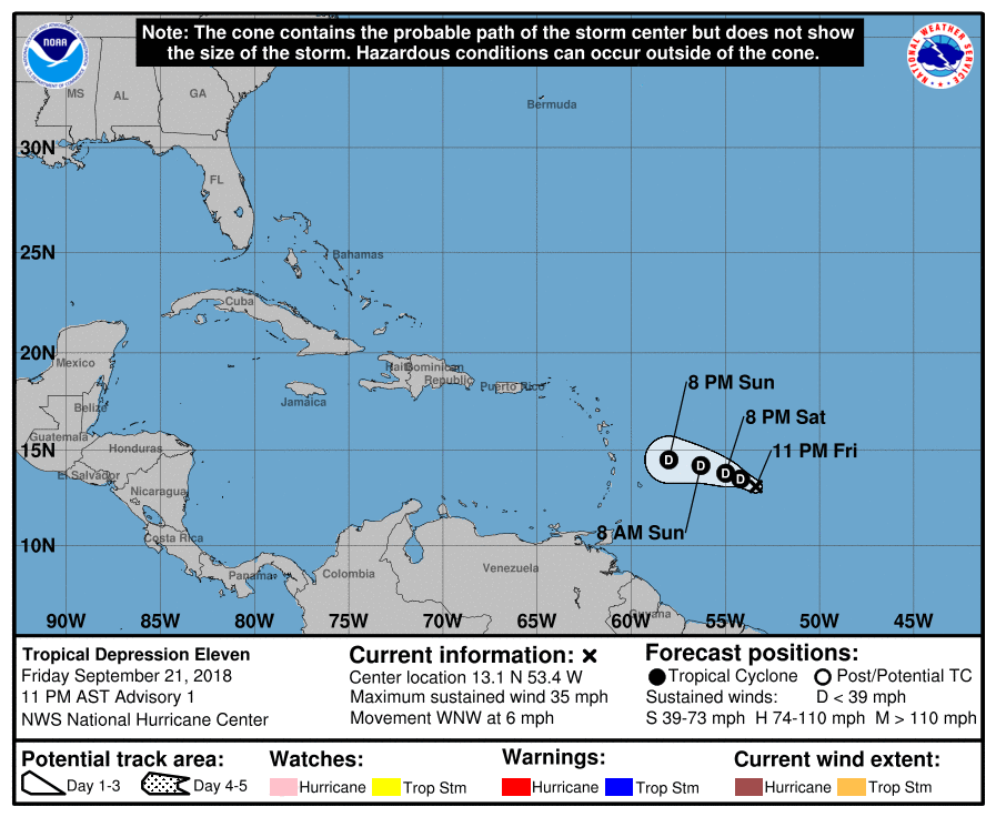
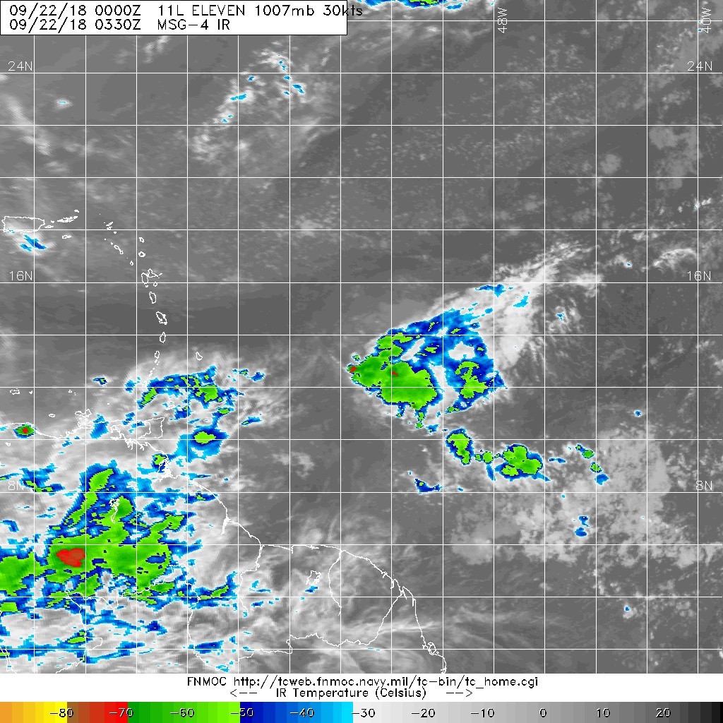
NHC 升格熱帶低壓11L,首報暫時不看好命名。
562
WTNT41 KNHC 220249
TCDAT1
Tropical Depression Eleven Discussion Number 1
NWS National Hurricane Center Miami FL AL112018
1100 PM AST Fri Sep 21 2018
The small, but well-defined, low pressure system located about 500
miles east of the Lesser Antilles has been producing steady
convection for the past several hours. Although this convection is
displaced to the south and east of the exposed low-level center due
to strong westerly wind shear, it has persisted long enough to meet
the NHC definition of a tropical cyclone. On this basis, advisories
are being initiated on Tropical Depression Eleven.
The initial intensity is set at 30 kt based on ASCAT data from
earlier today which showed a couple of 25-30 kt wind vectors in the
northeast quadrant of the circulation. The intensity guidance is in
extremely good agreement that the depression is unlikely to
strengthen. All of the global models forecast an increase in
upper-level winds over the small cyclone during the next 24 h. In
fact, SHIPS diagnostics indicate that the 850-200 mb shear could
exceed 30 kt by tomorrow morning, and will be near 40 kt within 48
h. As a result of this shear and some dry air also in the vicinity,
the dynamical models unanimously forecast dissipation within 72 h,
and most show that the depression will open into a trough of low
pressure sooner than that. The NHC forecast conservatively maintains
the tropical cyclone for 48 h, but it could weaken and dissipate
sooner than currently indicated.
The depression has recently been moving almost due west, but a
longer-term motion yields an initial motion of 290/5 kt. A break in
the subtropical ridge to the north of the depression should result
in fairly weak steering flow for the next day or two, and only a
slow west-northwestward to westward motion is anticipated. All of
the typically-reliable track models are in fairly good agreement on
this scenario. The NHC forecast is very close to HCCA at all
forecast hours, and lies near the south edge of the tight guidance
envelope.
FORECAST POSITIONS AND MAX WINDS
INIT 22/0300Z 13.1N 53.4W 30 KT 35 MPH
12H 22/1200Z 13.5N 54.2W 30 KT 35 MPH
24H 23/0000Z 13.8N 55.0W 30 KT 35 MPH
36H 23/1200Z 14.2N 56.3W 30 KT 35 MPH
48H 24/0000Z 14.5N 58.0W 25 KT 30 MPH
72H 25/0000Z...DISSIPATED
$$
Forecaster Zelinsky 

|
|