|
|
 霧峰追風者|2018-9-26 19:23
|
顯示全部樓層
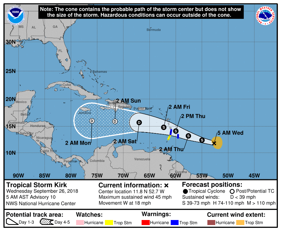
09Z 再次升格熱帶風暴,將西行進入加勒比海。
961
WTNT42 KNHC 260844
TCDAT2
Tropical Storm Kirk Discussion Number 10
NWS National Hurricane Center Miami FL AL122018
500 AM AST Wed Sep 26 2018
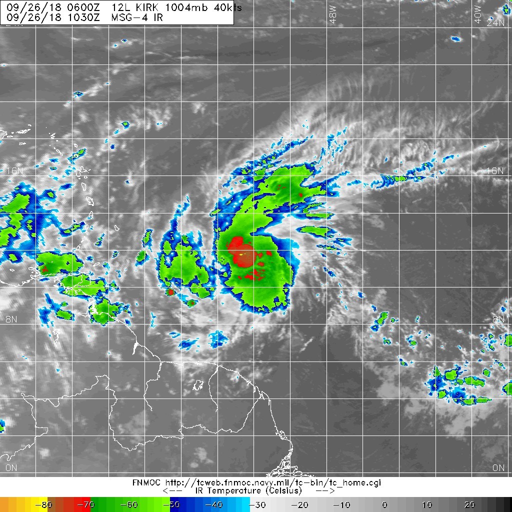
Infrared satellite imagery during the past several hours indicates
that deep convection has increased and become better organized near
the center of the remnants of Kirk. In addition, two earlier ASCAT
scatterometer passes between 0000-0100Z indicated that the low-level
center had become a little better defined, and that the inner-core
wind field had contracted, now with a radius of maximum winds (RMW)
of about 40 nmi. Given the continued increase in the amount and
organization of the deep convection, advisories have be re-initiated
on Tropical Storm Kirk. The two ASCAT passes showed peak winds of 38
and 44 kt, so the initial intensity will be a blend of these two
values or 40 kt. An Air Force Reserve reconnaissance aircraft will
be investigating Kirk later this morning to provide more detailed
information on the location and intensity of the tropical storm.
The initial motion estimates is an uncertain 280/16 kt, due to the
lack of a well-defined center to track for the past two days. The
global and regional models, excluding the HWRF model, are in very
good agreement on Kirk moving between west and west-northwest for
the next 72 hours along the south side of a strong Bermuda-Azores
high pressure system anchored across most of the subtropical
Atlantic. After that time, strong shear is forecast to weaken Kirk
into a remnant low, resulting in a more westward motion as the
shallow cyclone will be steered by the low-level easterly trade wind
flow. The official forecast track closely follows the HCCA
corrected-consensus model, and is a little south of the simple
consensus model TVCA due to an apparent northward bias in the HWRF
member.
The current modest west to southwesterly vertical wind shear is
forecast to decrease to less than 10 kt during the next 24 hours,
which should allow for some slight strengthening to occur. After 48
hours when Kirk is forecast to emerge over the eastern Caribbean
Sea, the shear is expected to increase to more then 30 kt, which
should act to displace the deep convection to the east of the
low-level center, resulting in rapid weakening. Kirk is forecast to
degenerate into a remnant low pressure system after 72 hours, but
this could occur a little sooner than indicated in the official
forecast if Kirk moves farther north and into even stronger shear
conditions. The NHC intensity forecast closely follows a blend of
the HCCA, FSSE, and IVCN consensus models.
FORECAST POSITIONS AND MAX WINDS
INIT 26/0900Z 11.8N 52.7W 40 KT 45 MPH
12H 26/1800Z 12.4N 55.0W 45 KT 50 MPH
24H 27/0600Z 13.2N 57.6W 45 KT 50 MPH
36H 27/1800Z 14.1N 60.0W 45 KT 50 MPH
48H 28/0600Z 14.8N 62.3W 40 KT 45 MPH
72H 29/0600Z 15.7N 67.0W 30 KT 35 MPH
96H 30/0600Z 15.9N 71.6W 25 KT 30 MPH...POST-TROP/REMNT LOW
120H 01/0600Z 16.0N 76.0W 25 KT 30 MPH...POST-TROP/REMNT LOW
$$
Forecaster Stewart 

|
|