開啟輔助訪問
 找回密碼
 立即加入

13E.Kiko 持續西行

簽到天數: 1650 天

[LV.Master]伴壇終老

老農民版夜神月|2019-9-15 23:16 | 顯示全部樓層
本帖最後由 老農民版夜神月 於 2019-9-16 00:48 編輯

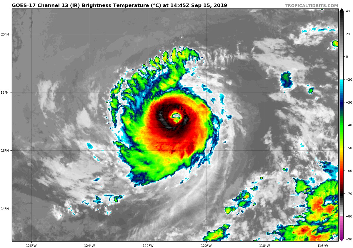
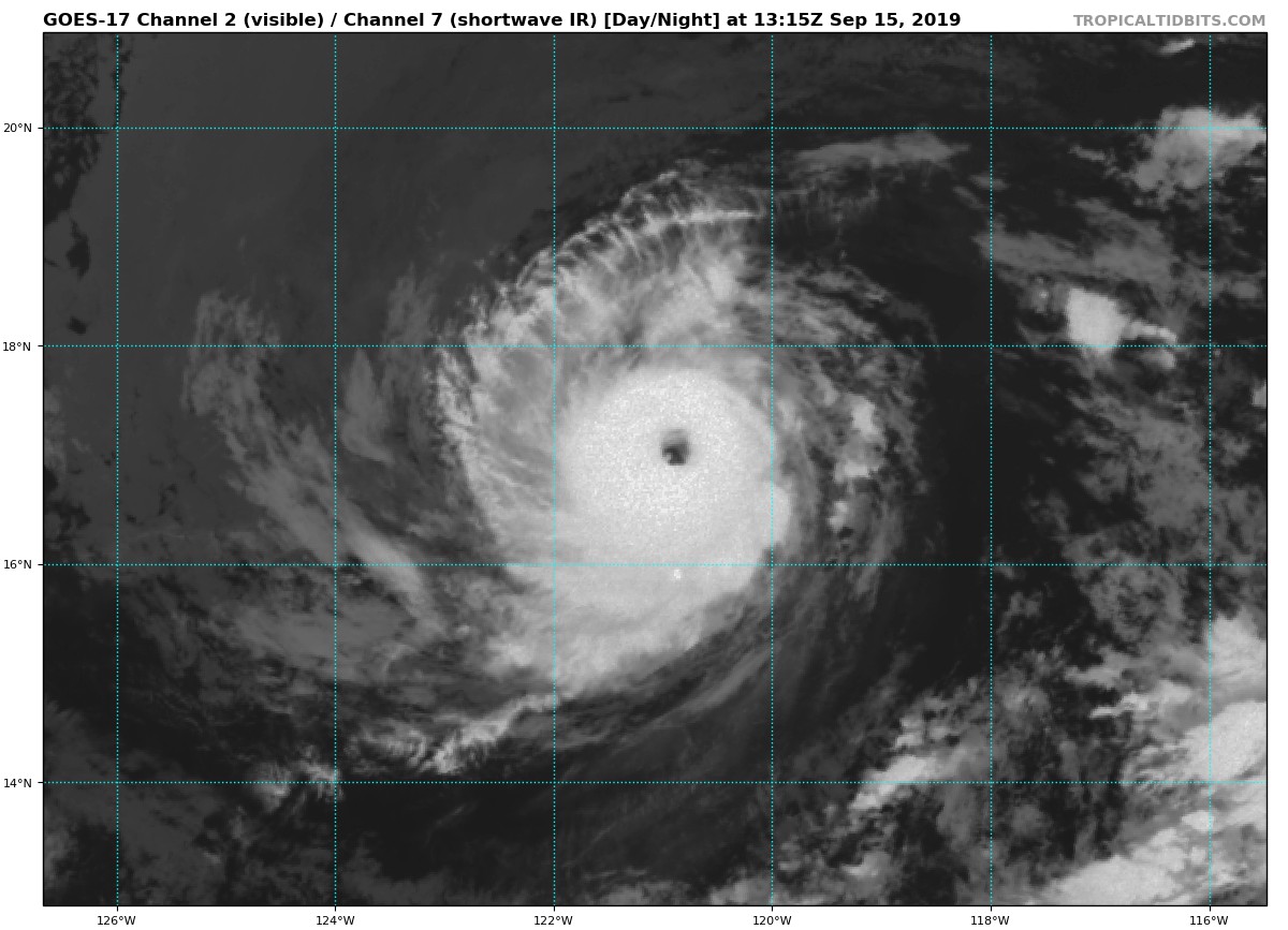
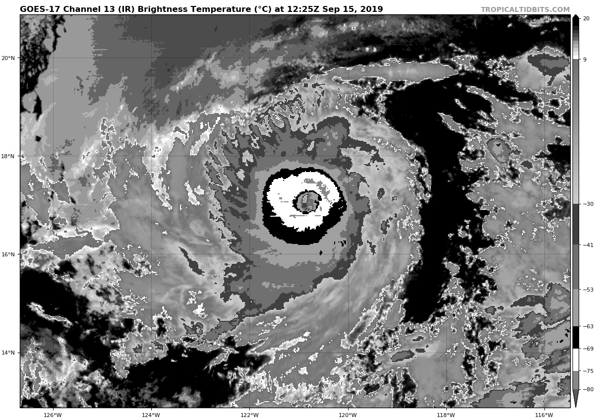
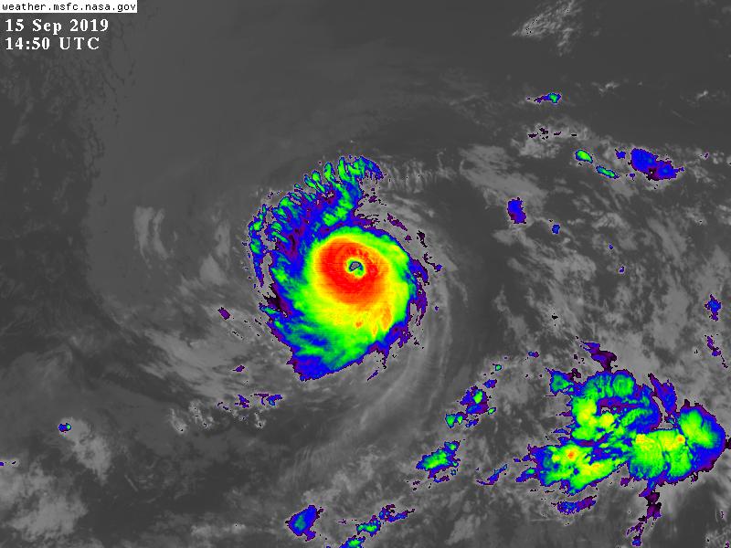
15/15ZNHC定強115節,13E.Kiko正式成為2019年中東太和北大颶風季中第5個MH(C3以上),第4個C4以上的颶風
000
WTPZ43 KNHC 151454
TCDEP3

Hurricane Kiko Discussion Number  13
NWS National Hurricane Center Miami FL       EP132019
800 AM PDT Sun Sep 15 2019

Kiko has become a very powerful hurricane overnight, with a warm eye
and strong eyewall convection. The cloud pattern is also fairly
symmetric, except favoring the western semicircle slightly due to
some easterly shear.  The initial wind speed is set to 115 kt, which
matches the latest ADT and TAFB estimates.

The hurricane should be near its peak intensity today while it in is
a low-shear, marginal warm-water environment. While those conditions
don't change that much during the next few days, Kiko is forecast
to be moving fairly slowly over that time, which will likely stir up
some cooler waters and help weaken the convection.  A steadier
weakening is expected at long-range due to an increase in shear. The
new forecast is somewhat lower than the last one, but higher than
the model consensus.  It isn't out of the realm of possibility that
Kiko could transition into an annular hurricane, which tend to
maintain their intensities higher than average, so I'm hesitant to
reduce the forecast too much for now.

Kiko is moving westward at about 6 kt.  A mid-level ridge to the
north of the cyclone is forecast to remain in place for about the
next two days, keeping the hurricane on a slow westward track.  A
weakness or even a break in the ridge is then forecast by all of the
models due to a mid-latitude trough, with perhaps a restrengthening
of the ridge at long range.  There's been a subtle model trend
toward supporting the ridge remaining weak but intact, which would
favor Kiko moving very slowly westward instead of any significant
rightward turn.  The latest NHC prediction places a greater weight
on the UKMET and ECMWF models and their ensembles, which generally
favor the weak ridge scenario.  No significant changes were made to
the previous forecast track, but the long-range track confidence is
low due to the large model spread at that time.

FORECAST POSITIONS AND MAX WINDS

INIT  15/1500Z 17.0N 121.1W  115 KT 130 MPH
12H  16/0000Z 17.1N 122.0W  110 KT 125 MPH
24H  16/1200Z 17.3N 123.2W  105 KT 120 MPH
36H  17/0000Z 17.4N 124.1W   95 KT 110 MPH
48H  17/1200Z 17.5N 125.0W   85 KT 100 MPH
72H  18/1200Z 17.5N 126.7W   70 KT  80 MPH
96H  19/1200Z 18.0N 129.0W   65 KT  75 MPH
120H  20/1200Z 18.5N 131.5W   50 KT  60 MPH

$$
Forecaster Blake
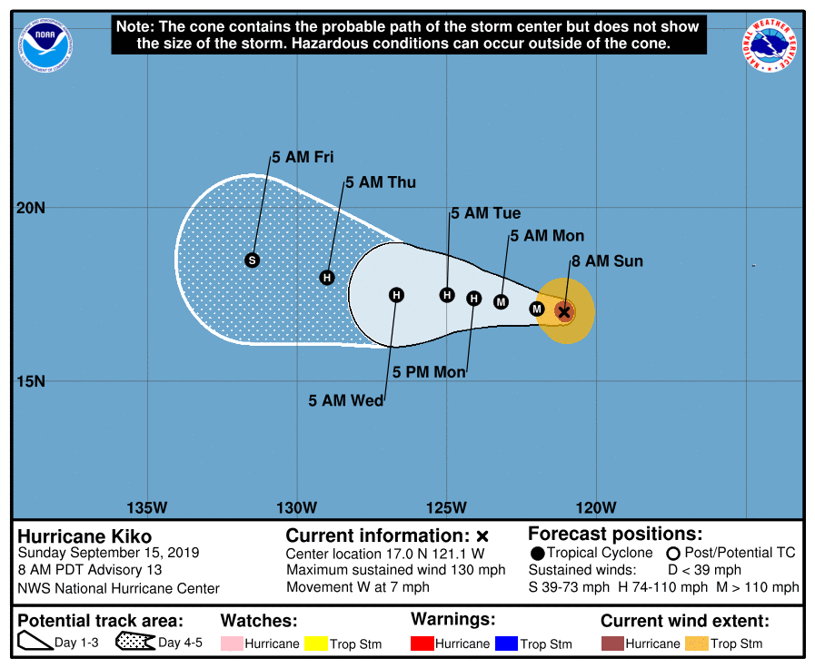
145355_5day_cone_no_line_and_wind.png goes17_ir_13E_201909151445.jpg
goes17_vis-swir_13E_201909151315.jpg goes17_ir-dvorak_13E_201909151225.jpg
GOES14502019258BPYjev.jpg


回復

使用道具 舉報

簽到天數: 3279 天

[LV.Master]伴壇終老

t02436|2019-9-20 10:12 | 顯示全部樓層
拋物線的走法,預期進入中太前還會再次重返C1
437
WTPZ43 KNHC 192045
TCDEP3

Tropical Storm Kiko Discussion Number  30
NWS National Hurricane Center Miami FL       EP132019
200 PM PDT Thu Sep 19 2019

In terms of organization (and latitude) Kiko appears to have hit
rock bottom and may now be on its way back up (and north). After the
last advisory, Kiko briefly lost all of its central deep convection
and consisted of a low-level swirl of clouds.  Since then,
convective activity has increased substantially and now a rain band
appears to be trying to wrap around the northern semicircle of the
tropical storm.  ASCAT data around 1800 UTC showed max winds of only
35-40 kt, but given the improvement in the structure of Kiko since
that time, the initial intensity is conservatively lowered to 45 kt.

Aside from small adjustments due to the lower initial intensity,
little change was made to the intensity forecast. Most of the
guidance calls for at least slight strengthening, and the dynamical
models are still calling for Kiko to become a hurricane again. Dry
air is still the primary limiting factor, and if Kiko can ever
reform a well-defined inner-core, it could strengthen more quickly
than forecast. By the end of the forecast period, Kiko could
encounter an even drier environment and most of the guidance calls
for weakening.

Kiko is beginning to turn west-northwestward, and a turn toward the
northwest is expected soon. The tropical storm is still forecast to
move slowly westward on a wave-like path due to fluctuations in the
strength of a mid-level ridge to the north. The track guidance is in
particularly poor agreement on the speed Kiko will move west and by
day 5 the ECMWF and GFS are 750 mi apart. Although only minor
changes were made to the NHC forecast, which remains near the model
consensus, confidence in the track forecast is much lower than
usual.

FORECAST POSITIONS AND MAX WINDS

INIT  19/2100Z 16.3N 129.3W   45 KT  50 MPH
12H  20/0600Z 16.8N 130.0W   50 KT  60 MPH
24H  20/1800Z 17.5N 130.6W   55 KT  65 MPH
36H  21/0600Z 17.9N 131.4W   55 KT  65 MPH
48H  21/1800Z 17.8N 132.2W   55 KT  65 MPH
72H  22/1800Z 17.0N 134.5W   60 KT  70 MPH
96H  23/1800Z 17.0N 136.5W   70 KT  80 MPH
120H  24/1800Z 18.0N 138.5W   55 KT  65 MPH

$$
Forecaster Zelinsky

ep132019.20190919220701.gif

205154_5day_cone_with_line.png

GOES01502019263qrb5hl.jpg

13e.gif
回復

使用道具 舉報

12
快速回覆
您需要登錄後才可以回帖 登錄 | 立即加入

本版積分規則

本平台僅供學術討論之用,預報應以氣象局為準

威普網站虛擬主機贊助公司

臺灣第一個天氣類型社群平台 即時天氣資訊、精準颱風動態

線上客服
FB傳送訊息
廣告行銷
精準行銷 物超所值
官方粉專
發佈 快速回復 返回頂部 返回列表