|
|
 霧峰追風者|2020-8-13 23:02
|
顯示全部樓層
本帖最後由 霧峰追風者 於 2020-8-13 23:04 編輯
000
WTNT41 KNHC 131453
TCDAT1
Tropical Storm Josephine Discussion Number 8
NWS National Hurricane Center Miami FL AL112020
1100 AM AST Thu Aug 13 2020
A just-received ASCAT overpass showed an area of 35-40 kt winds
about 70 n mi north of the center of Tropical Depression Eleven,
and based on this the cyclone is being upgraded to Tropical Storm
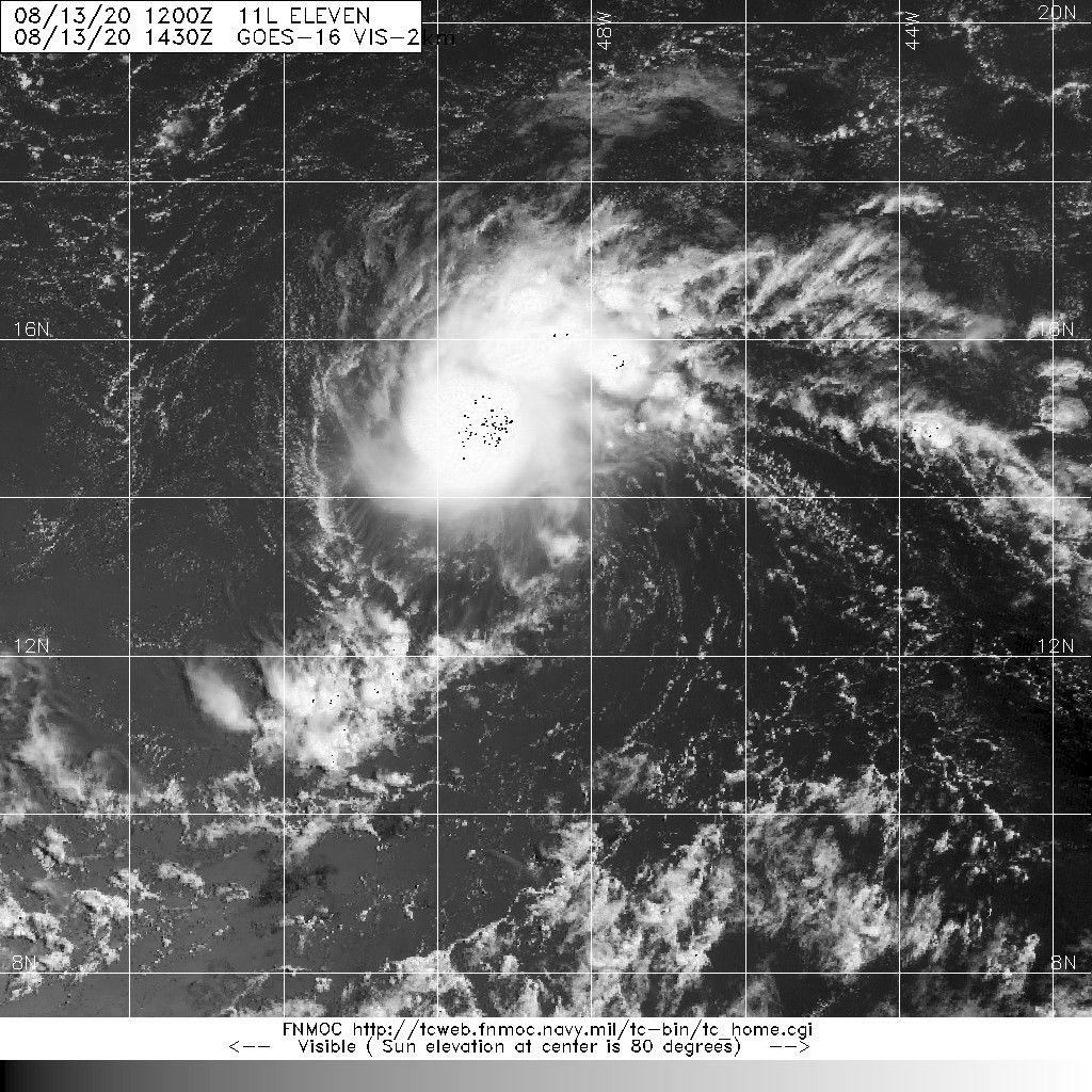
Josephine with an initial intensity of 40 kt. Satellite imagery
shows that the convective pattern associated with Josephine has
become a little better organized since the last advisory, with a
ragged central convective feature and a weak band in the northern
semicircle.
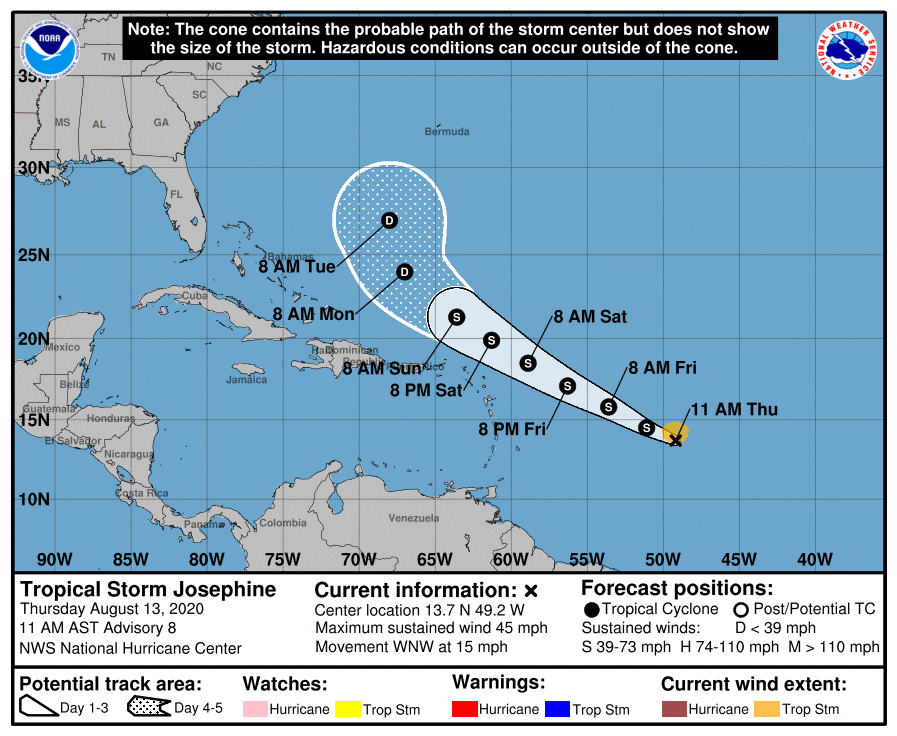
The initial motion is now west-northwestward or 295/13 kt.
Josephine should continue this motion for the next several days as
it moves toward a weakness in the western portion of the Atlantic
subtropical ridge. The global models forecast the western end of
the ridge to weaken even more after 72-96 h, which should cause
the cyclone, or what is left of it by that time, to turn
northwestward. The track guidance is tightly clustered, and the
new forecast track lies a little to the right of the previous track
and a little to the left of the consensus models.
Some additional strengthening appears likely during the next 24-
36 h as Josephine moves through an environment of light vertical
wind shear. After that, the cyclone is expected to encounter
moderate to strong southwesterly shear as it approaches an
upper-level trough over the southwestern Atlantic, which should
cause at least some weakening. The new intensity forecast is
adjusted upward for the first 72 h based on the current intensity.
After 72 h, it shows weakening similar to the previous forecast, but
not as drastic as the global models that show the storm degenerating
to a tropical wave before 120 h.
Josephine is the earliest tenth tropical storm of record in the
Atlantic, with the next earliest tenth storm being Tropical Storm
Jose on August 22, 2005.
FORECAST POSITIONS AND MAX WINDS
INIT 13/1500Z 13.7N 49.2W 40 KT 45 MPH
12H 14/0000Z 14.5N 51.1W 45 KT 50 MPH
24H 14/1200Z 15.8N 53.6W 50 KT 60 MPH
36H 15/0000Z 17.1N 56.3W 50 KT 60 MPH
48H 15/1200Z 18.5N 58.9W 50 KT 60 MPH
60H 16/0000Z 19.9N 61.3W 45 KT 50 MPH
72H 16/1200Z 21.3N 63.6W 40 KT 45 MPH
96H 17/1200Z 24.0N 67.0W 30 KT 35 MPH
120H 18/1200Z 27.0N 68.0W 25 KT 30 MPH
$$ 

|
|