簽到天數: 1650 天 [LV.Master]伴壇終老
|
 老農民版夜神月|2021-8-28 18:37
|
顯示全部樓層
NHC升格TD10L
000
WTNT45 KNHC 280855
TCDAT5
Tropical Depression Ten Discussion Number 1
NWS National Hurricane Center Miami FL AL102021
500 AM AST Sat Aug 28 2021
The tropical wave and associated low pressure system that the NHC
has been tracking for the past several days has finally acquired a
well-defined surface circulation and enough organized deep
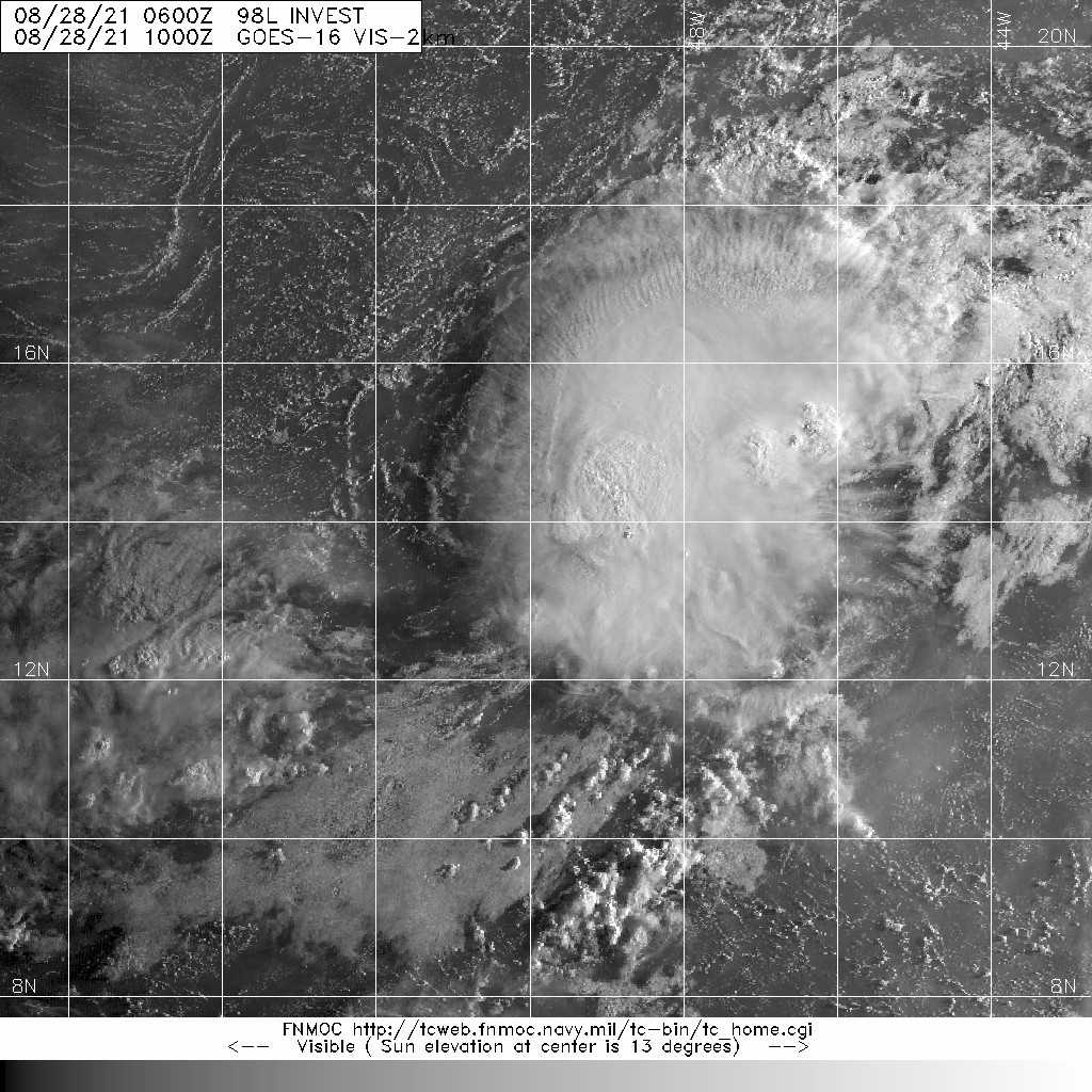
convection to be classified as a tropical depression. The last few
visible satellite images yesterday evening indicated a tight swirl
in the low-cloud field and a 27/2325Z partial ASCAT-A pass showed
the circulation was also well-defined, albeit with only 23-kt
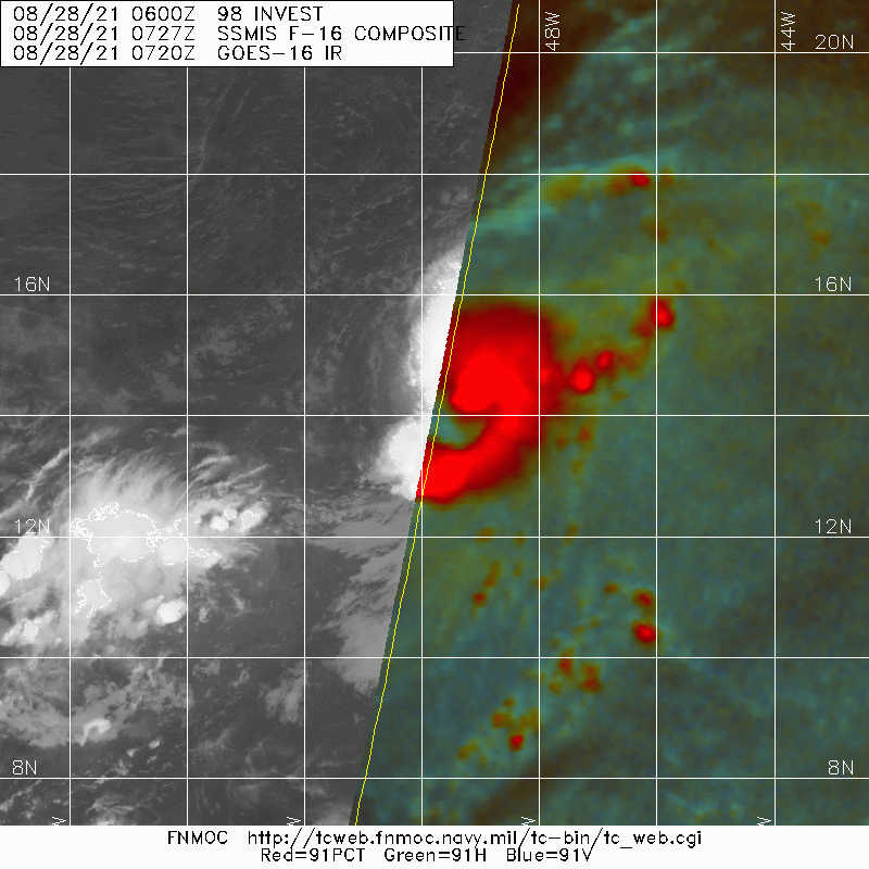
surface winds. Since the time of that scatterometer pass, however, a
significant increase in deep convection with cloud tops colder than
-80 deg C has developed very near and to the northeast of he center,
with a few cells also now having developed just to the southwest of
the center. Based on the structure noted in the ASCAT data and the
pronounced increase in the amount and organization of the
convection, the advisory intensity is estimated to be 30 kt.
The initial motion estimate is 340/06 kt. The system has slowed down
markedly during the past several hours, likely due to the sharp
increase in the associated convection. A turn toward the north is
forecast to begin later this afternoon as the system moves into a
break in the Atlantic subtropical ridge pattern, with a general
northward motion continuing through the remainder of the forecast
period. The latest NHC model guidance is surprisingly in good
agreement on this track scenario, with only minor forward speed
differences noted between the models.
The 18-20 kt of westerly vertical wind shear affecting the
depression is expected to abate somewhat during the next 12-24
hours, which should allow for some slight strengthening to occur
while the system moves over 27.5 deg C sea-surface temperatures. By
48 hours, however, the shear is forecast to increase again in excess
of 25 kt, which should act to weaken the cyclone, possibly even
causing it to degenerate into a remnant low. For now, however, the
official intensity forecast calls for the system to remain a
tropical depression at days 3 and 4 in the event the cyclone
regenerates at day 5 when the shear is forecast to decrease below
10 kt, which may allow for convection to redevelop. The
official intensity forecast closely follows a blend of the
intensity consensus models IVCN and NOAA-HCCA.
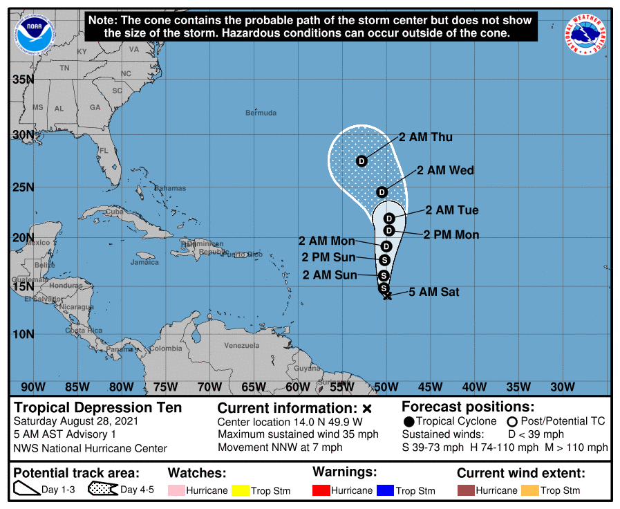
FORECAST POSITIONS AND MAX WINDS
INIT 28/0900Z 14.0N 49.9W 30 KT 35 MPH
12H 28/1800Z 14.8N 50.3W 35 KT 40 MPH
24H 29/0600Z 16.1N 50.3W 35 KT 40 MPH
36H 29/1800Z 17.7N 50.2W 35 KT 40 MPH
48H 30/0600Z 19.1N 50.0W 30 KT 35 MPH
60H 30/1800Z 20.7N 49.7W 30 KT 35 MPH
72H 31/0600Z 21.9N 49.7W 30 KT 35 MPH
96H 01/0600Z 24.5N 50.5W 30 KT 35 MPH
120H 02/0600Z 27.5N 52.8W 30 KT 35 MPH
$$
Forecaster Stewart 


|
|