簽到天數: 3294 天 [LV.Master]伴壇終老
|
 t02436|2015-7-23 16:56
|
顯示全部樓層
t02436|2015-7-23 16:56
|
顯示全部樓層
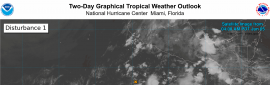
在數日的High評級過後
NHC 09Z升格07E
但不看好系統能夠獲得命名
000
WTPZ42 KNHC 230834
TCDEP2
TROPICAL DEPRESSION SEVEN-E DISCUSSION NUMBER 1
NWS NATIONAL HURRICANE CENTER MIAMI FL EP072015
300 AM MDT THU JUL 23 2015
Deep convection associated with the area of low pressure several
hundred miles southwest of the southern tip of the Baja California
peninsula has become better organized tonight, with a curved
band wrapping around the southern semicircle of the circulation.
Based on the increased convective organization, the system is now
classified as a tropical cyclone. The initial intensity is set to
30 kt based on the latest Dvorak estimate from SAB.
There is not much of an opportunity for the depression to
strengthen, with moderate northerly shear expected to persist until
the system crosses the 26C isotherm in about a day. As a result,
the intensity guidance shows little strengthening and the NHC
forecast follows this trend. However, it is possible that the
cyclone could briefly reach tropical storm status even though that
isn't explicitly forecast here. The cyclone should weaken to a
remnant low by 48 hours due to cold waters and a dry, stable
airmass. The low is forecast to dissipate by day 5.
The initial motion estimate is 330/08. The depression should
move northwestward around the southwestern periphery of the
subtropical ridge for the next 24 hours and then turn westward under
the influence of the low-level ridge as it becomes a shallow system.
The NHC track forecast is close to a blend of the GFS and ECMWF
models through dissipation.
FORECAST POSITIONS AND MAX WINDS
INIT 23/0900Z 18.0N 114.0W 30 KT 35 MPH
12H 23/1800Z 19.0N 115.0W 30 KT 35 MPH
24H 24/0600Z 20.2N 116.3W 30 KT 35 MPH
36H 24/1800Z 21.3N 117.6W 30 KT 35 MPH
48H 25/0600Z 22.1N 119.2W 25 KT 30 MPH...POST-TROP/REMNT LOW
72H 26/0600Z 22.5N 122.0W 20 KT 25 MPH...POST-TROP/REMNT LOW
96H 27/0600Z 22.0N 125.0W 20 KT 25 MPH...POST-TROP/REMNT LOW
120H 28/0600Z...DISSIPATED
$$
Forecaster Brennan
|
本帖子中包含更多資源
您需要 登錄 才可以下載或查看,沒有賬號?立即加入
x
|

 提升卡
提升卡 千斤頂
千斤頂 照妖鏡
照妖鏡